Minnesota Prairie Roots

Writing and photography by Audrey Kletscher Helbling

Land eroding around Faribault Woolen Mill Dam July 3, 2024

Filed under: Uncategorized — Audrey Kletscher Helbling @ 10:21 PM
Tags: , , , , , , , ,
In this cellphone photo from the Second Avenue bridge, you can see the boulders piled across the north edge of the dam, excavator to the right. That’s the Faribault Mill to the left on the Cannon River. (Minnesota Prairie Roots copyrighted photo July 3, 2024)

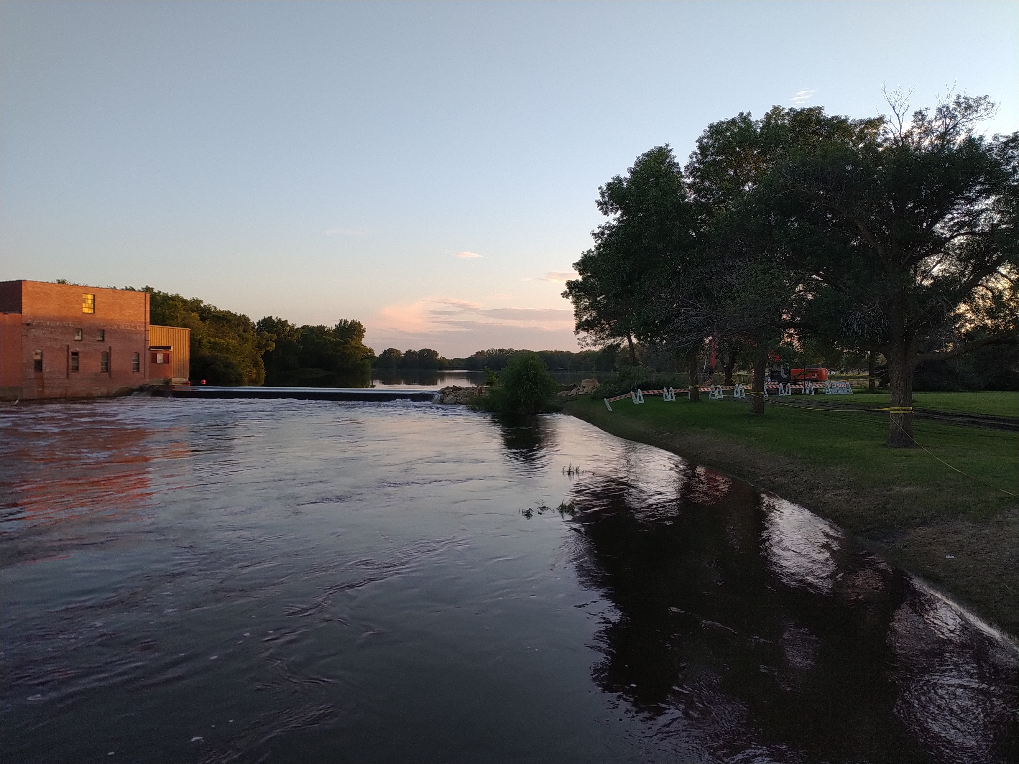
WHEN I LEARNED late Wednesday afternoon of serious river bank erosion by the Faribault Woolen Mill Dam following recent flooding, one word crossed my mind—Rapidan. Last week the Blue Earth River skirted the Rapidan Dam, eroding the earth and creating a new river channel that eventually claimed buildings, trees and more.

Barricades block access to the area along the river where crews worked to stabilize the bank on Wednesday. The Faribault Mill is across the river. (Minnesota Prairie Roots copyrighted photo July 3, 2024)

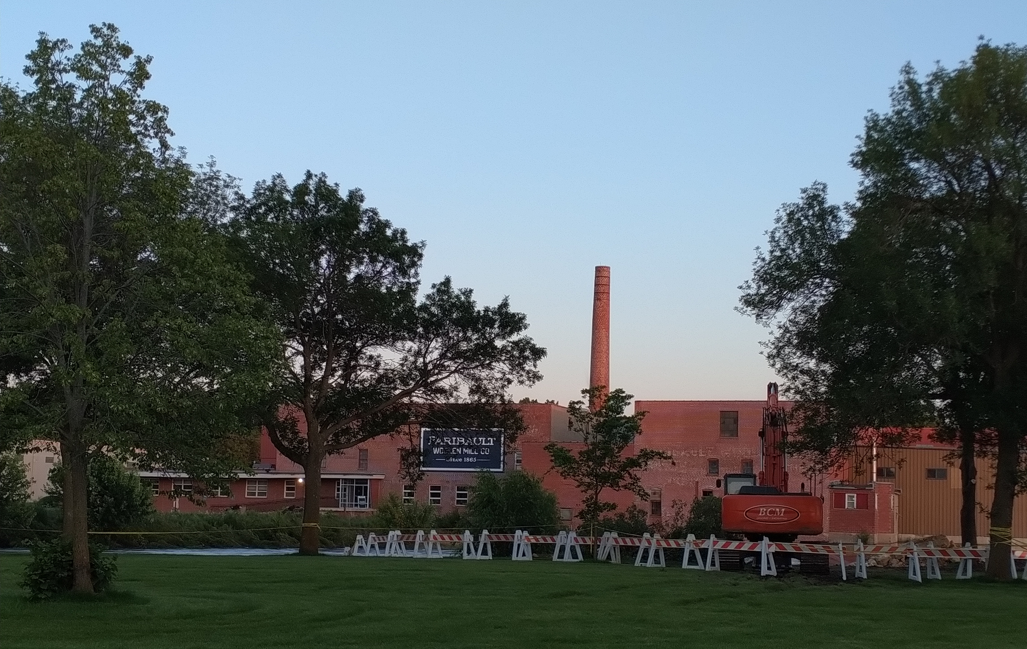
Right now I don’t see that happening in my community. The dam, the river, the landscape differ. In Faribault, crews worked to mitigate further erosion by piling boulders on the north side of the mill dam. That’s a temporary fix until water levels drop and officials can check for damage to the dam.

The second dam next to Father Slevin Park is not showing serious erosion, although water is flowing over the bank on the south side. (Minnesota Prairie Roots copyrighted photo July 3, 2024)

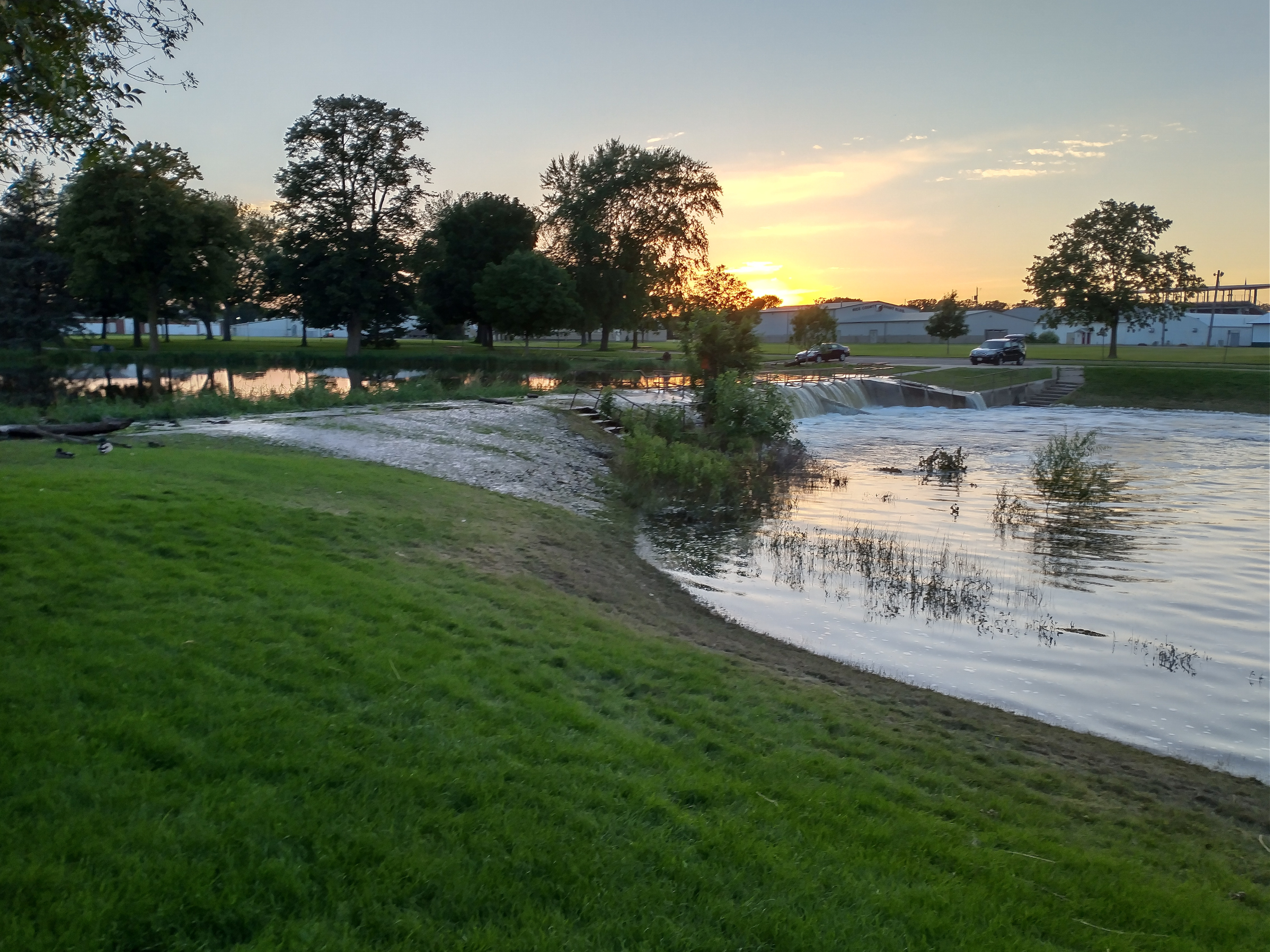
I stopped briefly Wednesday evening to see firsthand what is happening at the two dams on the Cannon River. Water levels remain high, although lower than they have been. But more rain is predicted in the next several days. Exactly what we don’t need.

#

NOTE: I did not have my 35 mm Canon camera with me so I had to use my cellphone to shoot these photos, thus I could not zoom in to take better, clearer images.

© Copyright 2024 Audrey Kletscher Helbling


A mostly snowless Minnesota landscape March 2, 2015

Filed under: Uncategorized — Audrey Kletscher Helbling @ 5:00 AM
Tags: , , , , ,

MILE AFTER MILE, westbound across Minnesota, the snow cover diminished.

Near Madison Lake, Minnesota.

Near Madison Lake, Minnesota.

Except for pockets of snow in the shade of trees or buildings, most yards lay bare, dormant grass exposed.

Road and drainage ditches, typically drifted full, gaped crevices in the land.

Farm fields lie exposed in this shot along U.S. Highway 14 west of Mankato.

Farm fields lie exposed in this shot along U.S. Highway 14 west of Mankato.

Fields normally layered white in February rolled out like a stubbled black carpet. Mile after endless mile the snow cover decreased as my husband and I journeyed from Rice County through Le Sueur, Blue Earth, Nicollet and Brown counties before reaching our destination in Redwood County.

Another rural scene between Mankato and Courtland.

Another rural scene between Mankato and Courtland.

Nearly all 120 miles, the wind shoved against the van, creeping inside, chilling my feet and legs, even snugged under a patchwork throw.

The farther west we drove, the more we felt the wind in the wide open spaces, the prairie, the place of my youth. There is no wind like a prairie wind. Ceaseless. Relentless. Fearsome.

On the drive back east later that day, we spotted a column of black in the distance and considered the source of the fire.

Except, as we drew nearer, we saw dust, not smoke. Rising like a super-sized dust devil, a wind-fueled dust storm swept across bare earth. It was almost frightening to witness this storm growing in size, eroding the soil as it raced across acres of farm land.

The landscape appears more like it does in early spring rather than in the heart of a Minnesota winter. This farm place lies between Mankato and Courtland.

The landscape appears more like it does in early spring rather than in the heart of a Minnesota winter. This farm place lies between Mankato and Courtland.

In that moment, I considered how beneficial snow is in curbing erosion, in supplying moisture to the land, in maintaining balance in the landscape.

FYI: These images were shot on the morning of February 21. Shortly thereafter, my camera stopped working. Therefore I have no photos of the dust storm or the landscape beyond Courtland to the west.

My community of Faribault is deep in snow. No exposed earth here.

© Copyright 2015 Audrey Kletscher Helbling