Minnesota Prairie Roots

Writing and photography by Audrey Kletscher Helbling

When a rock riffle replaces a traditional dam February 5, 2025

This rock riffle in Pine River replaced a traditional dam built in 1910 to hold back water flowing from Norway Lake into the Pine River. The old dam was designated as “high hazard,” thus in need of replacement. (Minnesota Prairie Roots copyrighted photo July 2024)

WIND AND WATER. Both prove soothing and calming elements of nature. Except when destructive.

Sandbagging along the flooding Cannon River in downtown Northfield last June. The traditional dam in Northfield was not compromised, unlike in some Minnesota locations. (Minnesota Prairie Roots copyrighted file photo June 2024)

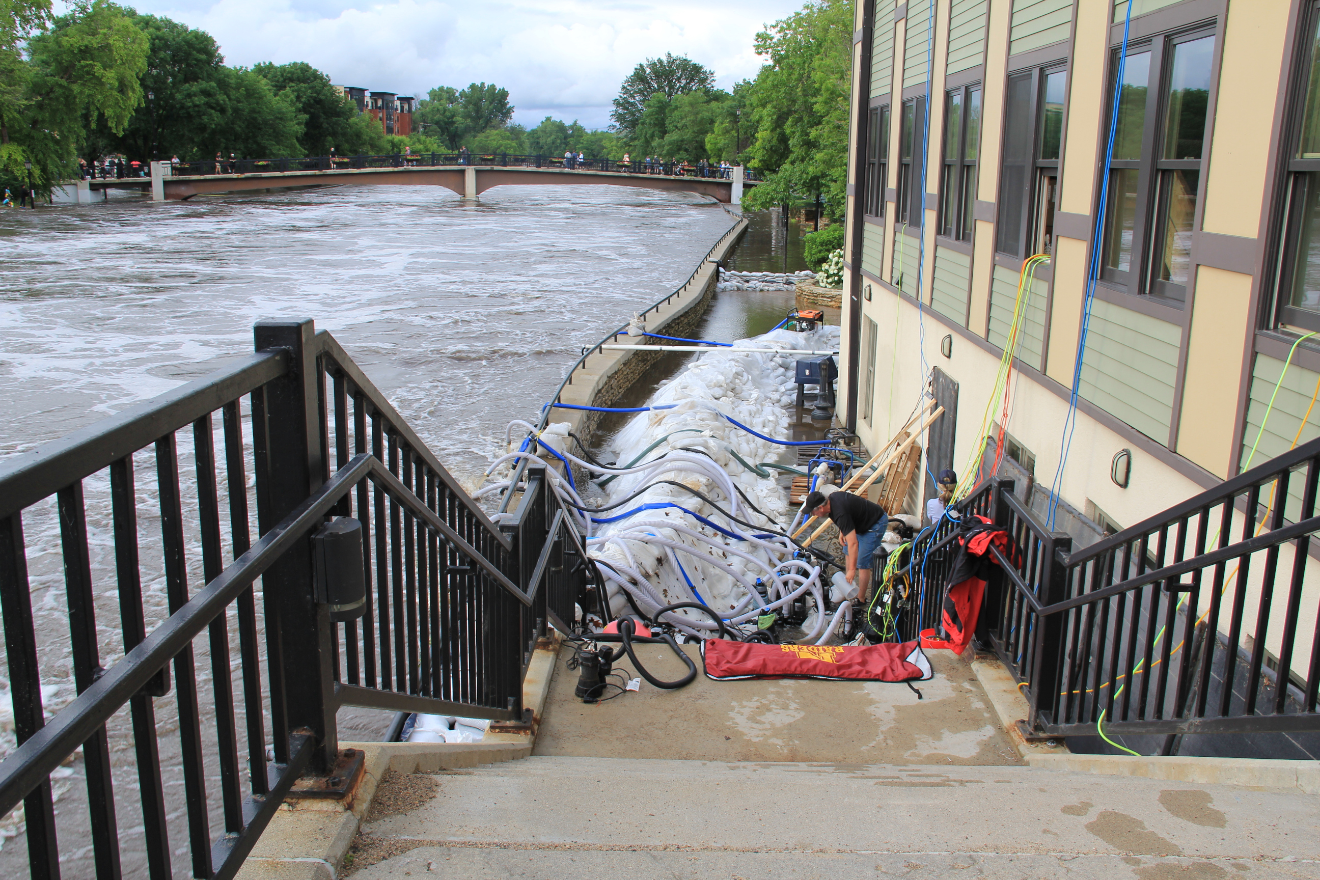
Last June, excessive rainfall led to devastating floods in parts of southern Minnesota, especially in Waterville, a 20-minute drive southwest of Faribault. Farther to the west in Rapidan, the Blue Earth River raged, causing a partial dam collapse and erosion of the land. That led to loss of a house and of the much beloved The Dam Store. In Northfield, 20 minutes from Faribault, the Cannon River flooded the Riverwalk and threatened riverside businesses. In Faribault, the Cannon and Straight Rivers spilled from their banks, flooding parks and several city streets. The powerful river also eroded the shoreline near the Faribault Mill Dam. Boulders were hauled in and placed beside the dam to contain the river and prevent additional erosion.

The Dam Park, with a pavilion, is to the left of the tree-edged Pine River in this photo, private homes to the right. (Minnesota Prairie Roots copyrighted photo July 2024)

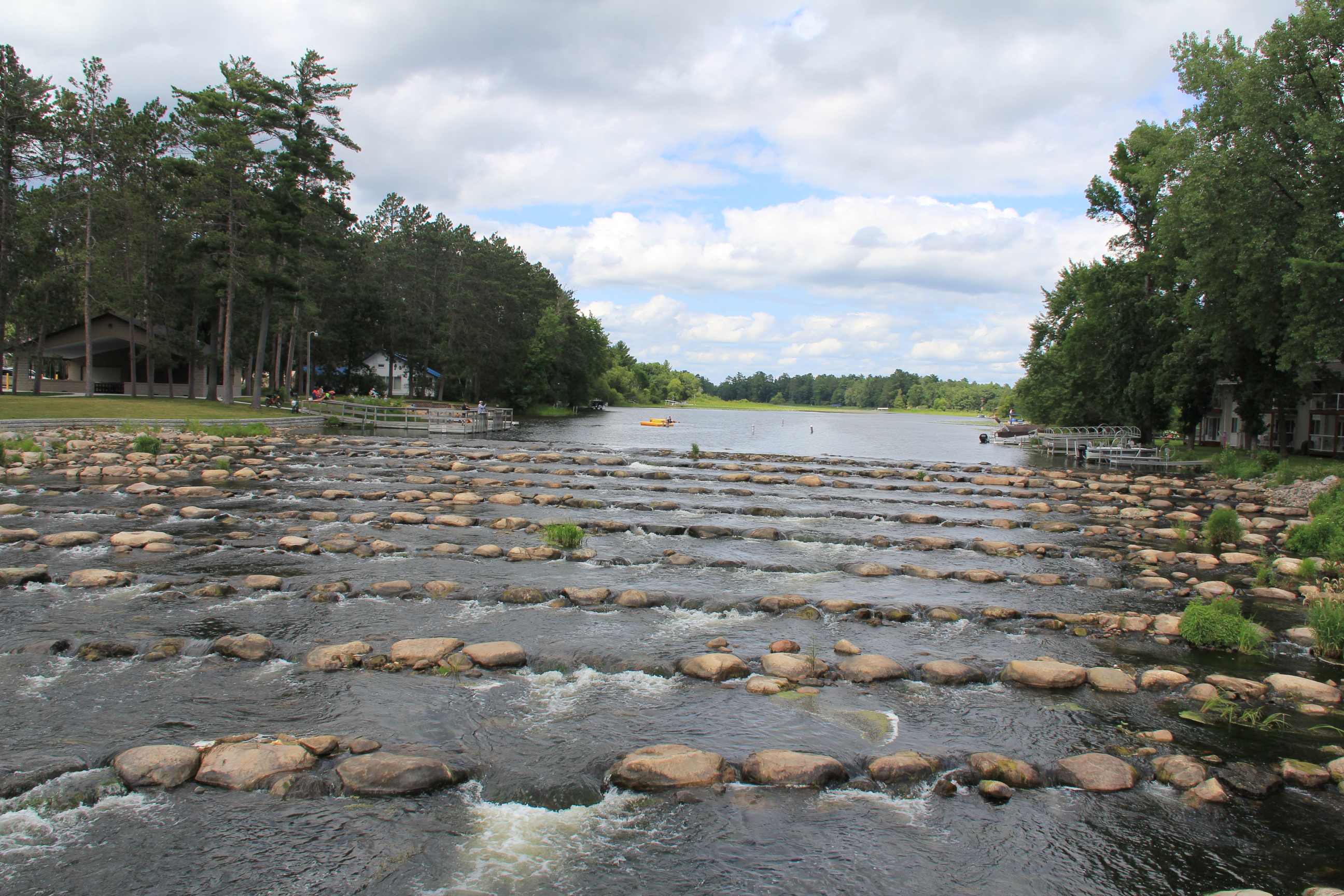
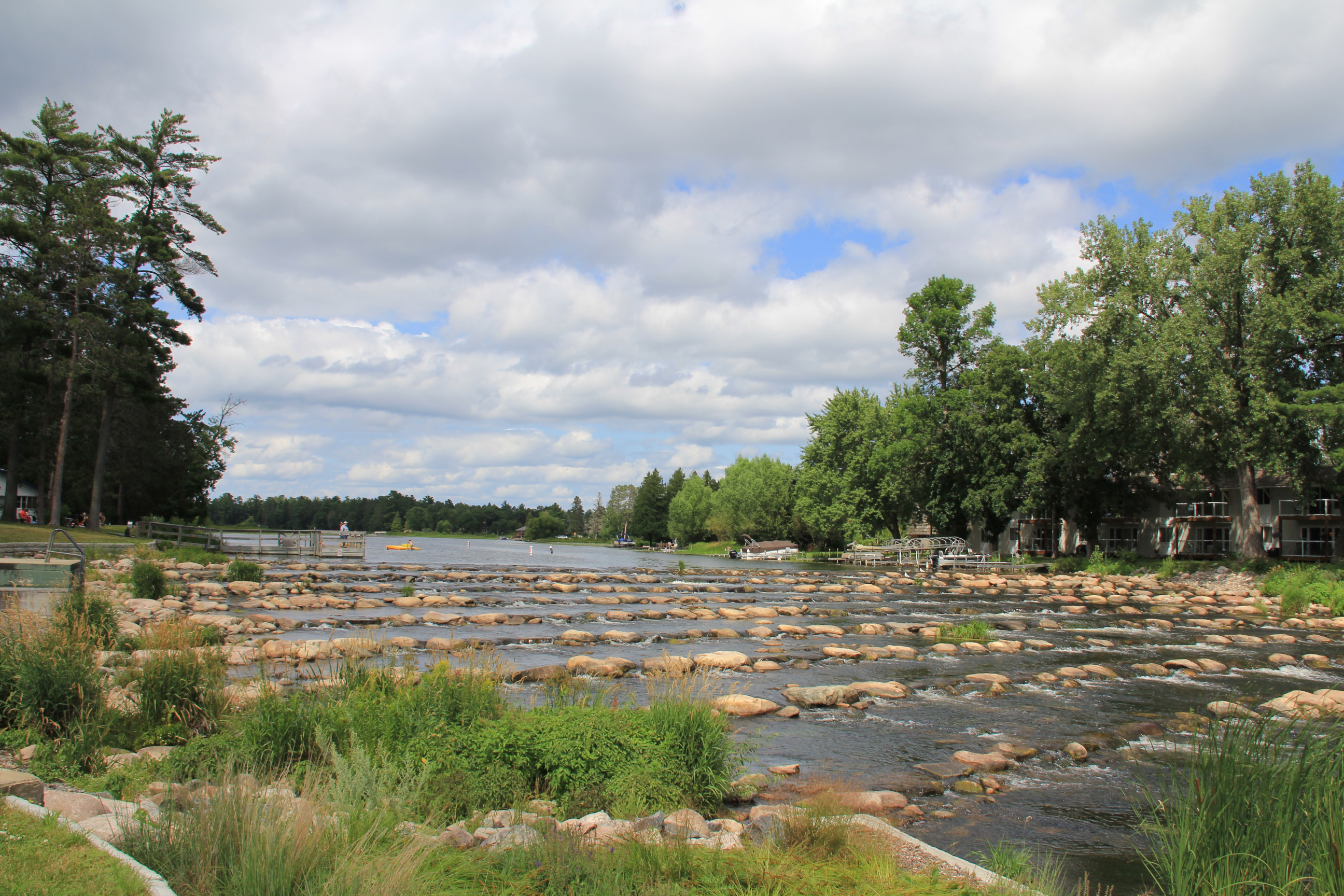
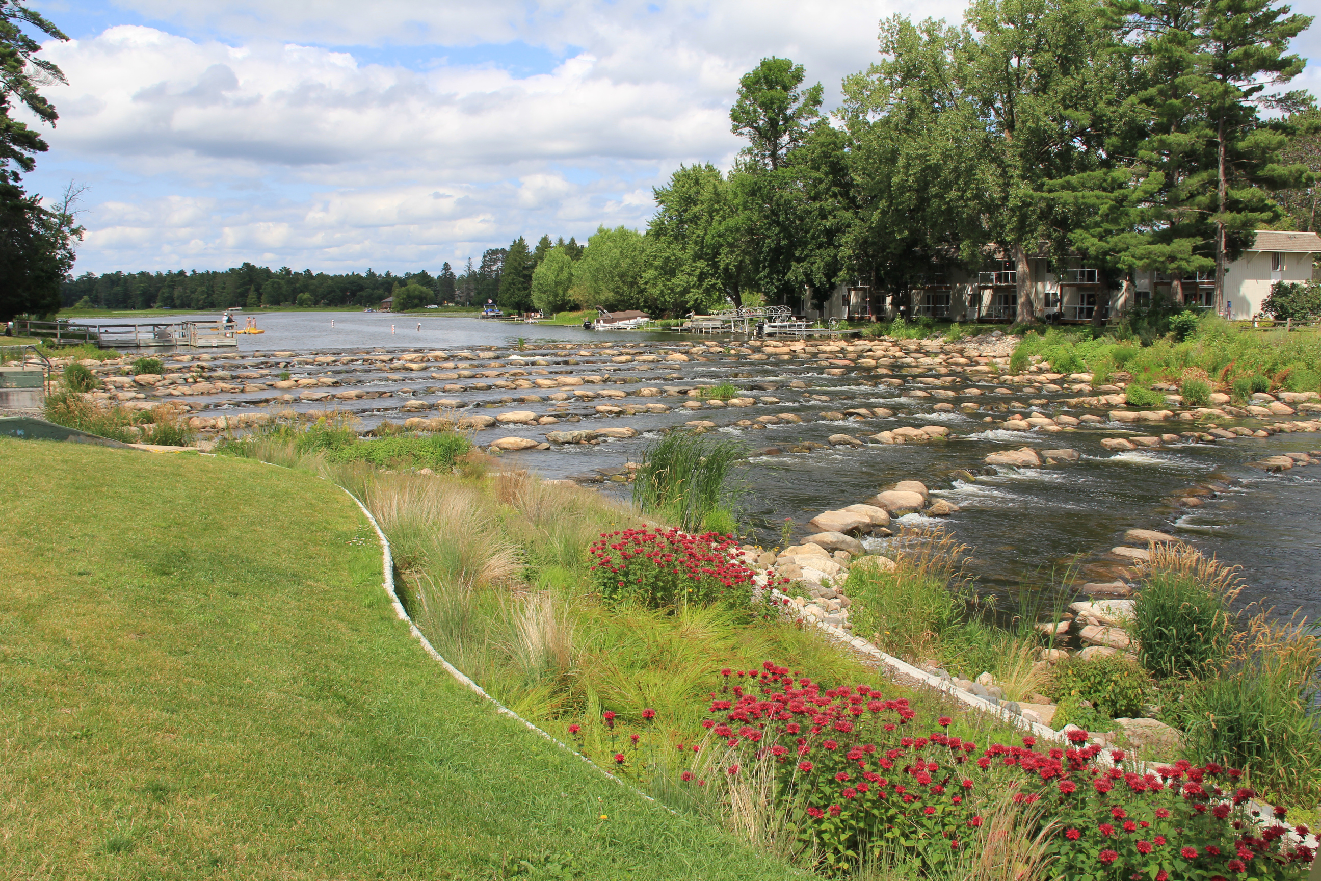
Now, many months later, Faribault city officials are considering options for the Faribault Mill Dam. And that got me thinking about Pine River. In this north central Minnesota community, a rock riffle/rock arch rapids replaces a 200-foot long by 13-foot high traditional dam built in 1910. The result is nothing short of stunning.

The concrete steps and platform remain from the original dam construction project. This image shows a view of the rock riffle looking downstream. (Minnesota Prairie Roots copyrighted photo July 2024)

Let me explain. Smaller rip-rap rocks, larger rocks and boulders were placed in sloping rows across the Pine River to replace the dam. Water spills over the rocks as the rows descend for several hundred feet. Except for the precise placement of the rock rows, the rapids appear almost natural. And that is much more visually pleasing than a wall of concrete.

It’s mesmerizing to watch and listen to the river spill over the man-made rock riffle in Pine River. (Minnesota Prairie Roots copyrighted photo July 2024)

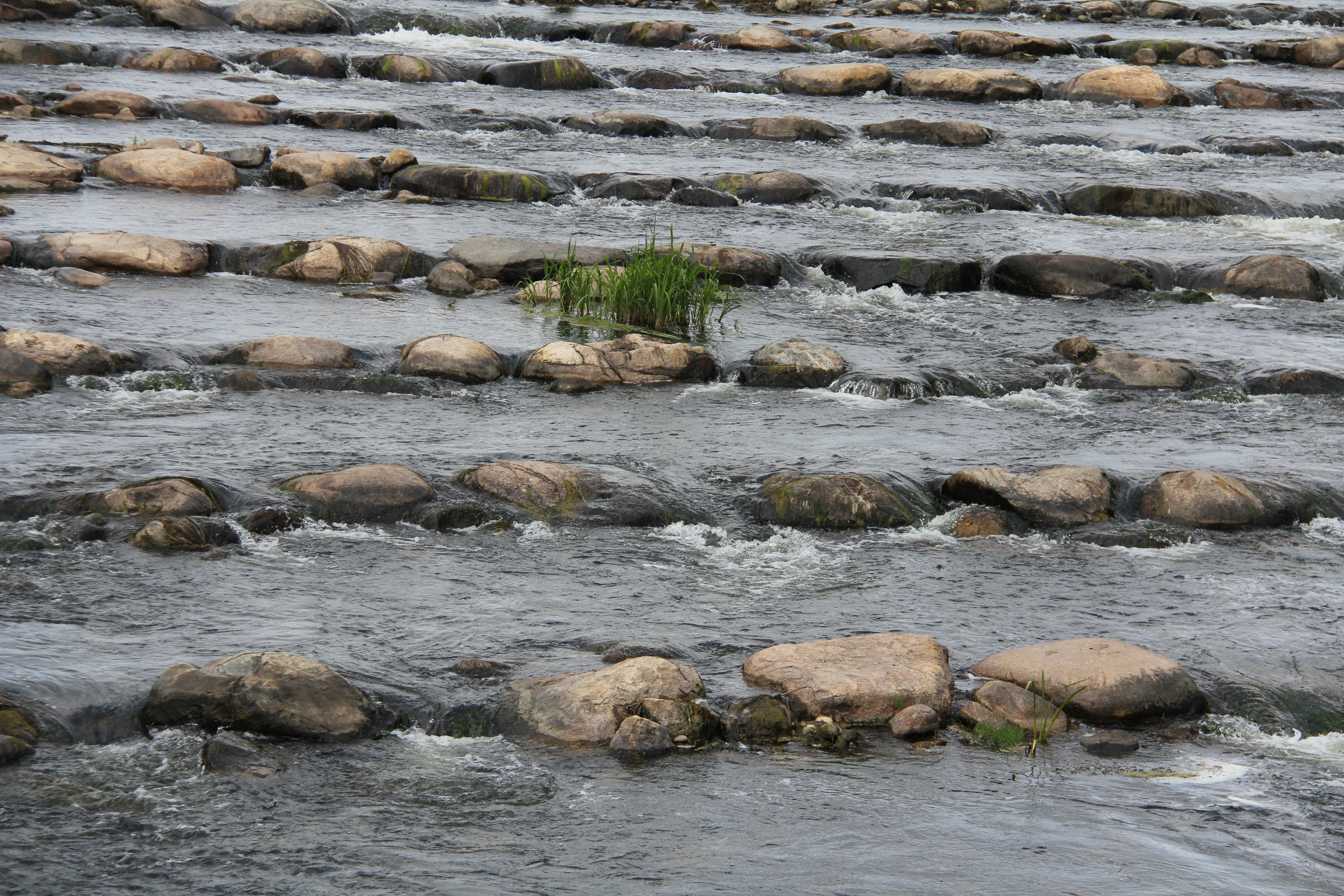
The sound, too, is pleasing. I have always loved the sound of water rushing over rocks. It’s calming, soothing, mesmerizing. As is watching the water pour over and around rocks.

The traditional dam proved a significant fish barrier. Installation of the rock riffle has improved fish habitat in the river, which feeds into the Whitefish Chain of Lakes in north central Minnesota. (Minnesota Prairie Roots copyrighted photo July 2024)

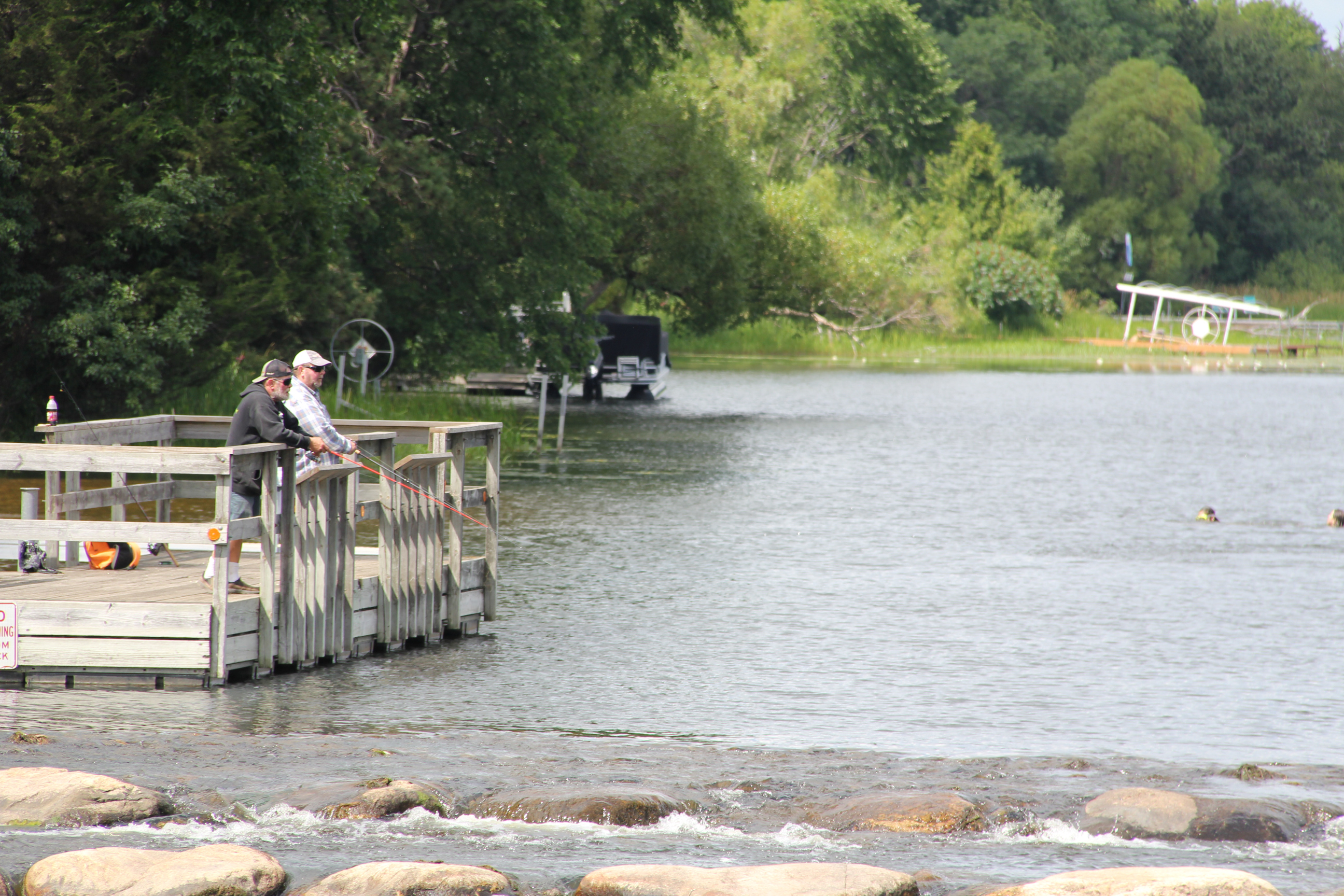
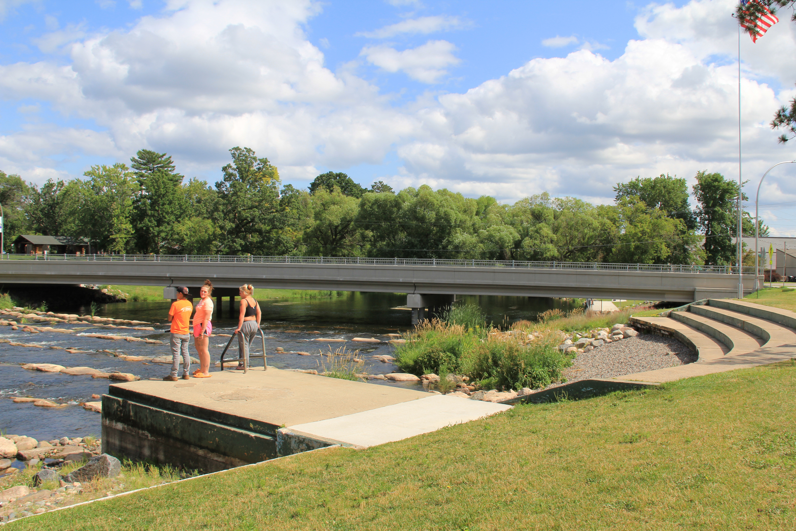
But this award-winning rock riffle dam in Pine River offers much more than a place to sit riverside and relax. It’s also a popular recreational area. During my mid-week July 2024 visit, anglers fished the river from a pier and from shore downstream. Swimmers jumped from floating platforms into the water above the rock riffle. There’s a sandy beach, too. And although I didn’t see any, kayakers can also navigate the rapids. And anyone can cross the river on the rocks, but at their own risk.

On a summer day, swimmers jump off a swimming platform above the rock riffle into the river. Dam Park includes a sandy beach. (Minnesota Prairie Roots copyrighted photo July 2024)

This revamped area, as I viewed it, draws people outside to the river. To recreate. To gather. To enjoy nature. There’s even a playground and a pavilion with a kitchen in Dam Park. What Pine River has created with this rock riffle is a community centerpiece that is beautiful in every way.

Plantings of flowers and grasses protect the river shoreline by the rock riffle. (Minnesota Prairie Roots copyrighted photo July 2024)

Now, whether this will work at the Faribault Mill Dam, I don’t know. I’m no engineer. But rock riffles have been placed in some 75 rivers and lakes across Minnesota. The one in Pine River is the first I’ve seen. I’d like local city officials to consider a rock arch rapids, maybe take a field trip to Pine River or elsewhere and see (and hear) just how inviting and lovely, calming, soothing and mesmerizing a rock riffle is compared to a traditional dam. See how this dam removal and rock riffle replacement in Pine River creates a recreational oasis, a beautiful gathering spot that grows community.

© Copyright 2025 Audrey Kletscher Helbling


The Cannon River today and six months ago March 25, 2011

A view of the Cannon River from Father Slevin Park, looking toward the former Faribault Woolen Mill factory on the right and Faribault Foods on the left.

SIX MONTHS AGO I would not have been standing on this wedge of park land photographing the rising Cannon River by the Faribault Woolen Mill dam.

Here, by this dam, most locals judge the river level. And Wednesday evening, only the slightest hint of the dam showed beneath the roiling river. I kept a safe distance as I photographed scenes I had shot in September when a flash flood sent the Cannon spilling over its banks.

A statue in Father Slevin Park (I believe she is the Virgin Mary) next to the Cannon River.

Back then, this park, Father Slevin Park, was engulfed in water that had risen all the way to the roadway into the Rice County Fairgrounds and North Alexander Park in Faribault.

Father Slevin Park splits the Cannon. This is the other side of the river, looking toward the fairgrounds. The river was nearly out of its banks Wednesday evening.

The situation was not the crisis of six months ago, not at all. Just being here, beside the river, eased my fears about flooding in my community.

My husband, who travels by the Cannon daily on his way to and from work in nearby Northfield, tells me the river level dropped since I took these photos. That is good news for my town, for residents like me who had wondered and worried as the Cannon and Straight Rivers rose.

The former Faribault Woolen Mill building along the banks of the Cannon River.

A view of the Cannon River and the Faribault Woolen Mill from Father Slevin Park.

CLICK HERE to see images of the Cannon taken during the late September 2010 flash flood.

© Copyright 2011 Audrey Kletscher Helbling