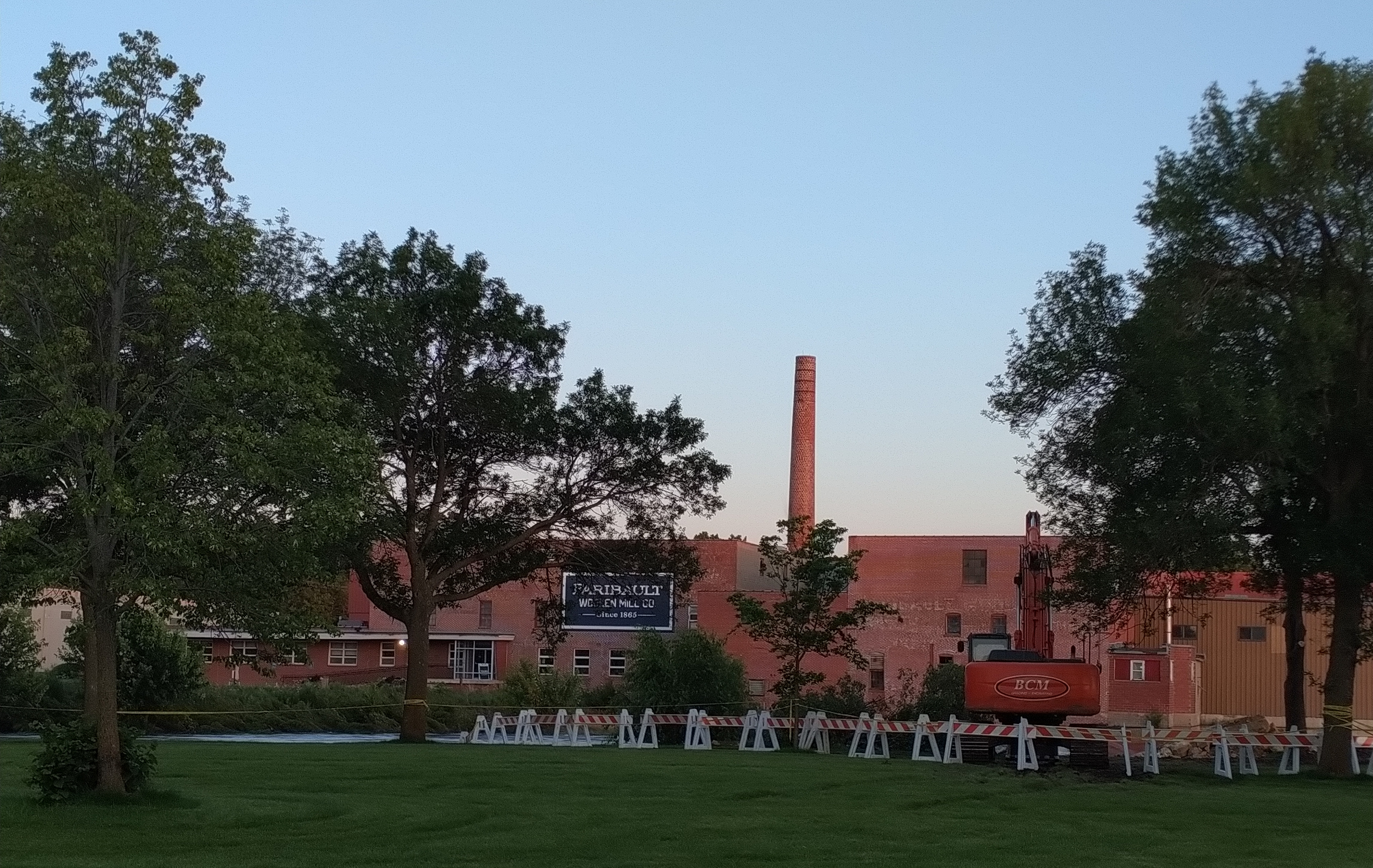
In this cellphone photo from the Second Avenue bridge, you can see the boulders piled across the north edge of the dam, excavator to the right. That’s the Faribault Mill to the left on the Cannon River. (Minnesota Prairie Roots copyrighted photo July 3, 2024)
WHEN I LEARNED late Wednesday afternoon of serious river bank erosion by the Faribault Woolen Mill Dam following recent flooding, one word crossed my mind—Rapidan. Last week the Blue Earth River skirted the Rapidan Dam, eroding the earth and creating a new river channel that eventually claimed buildings, trees and more.
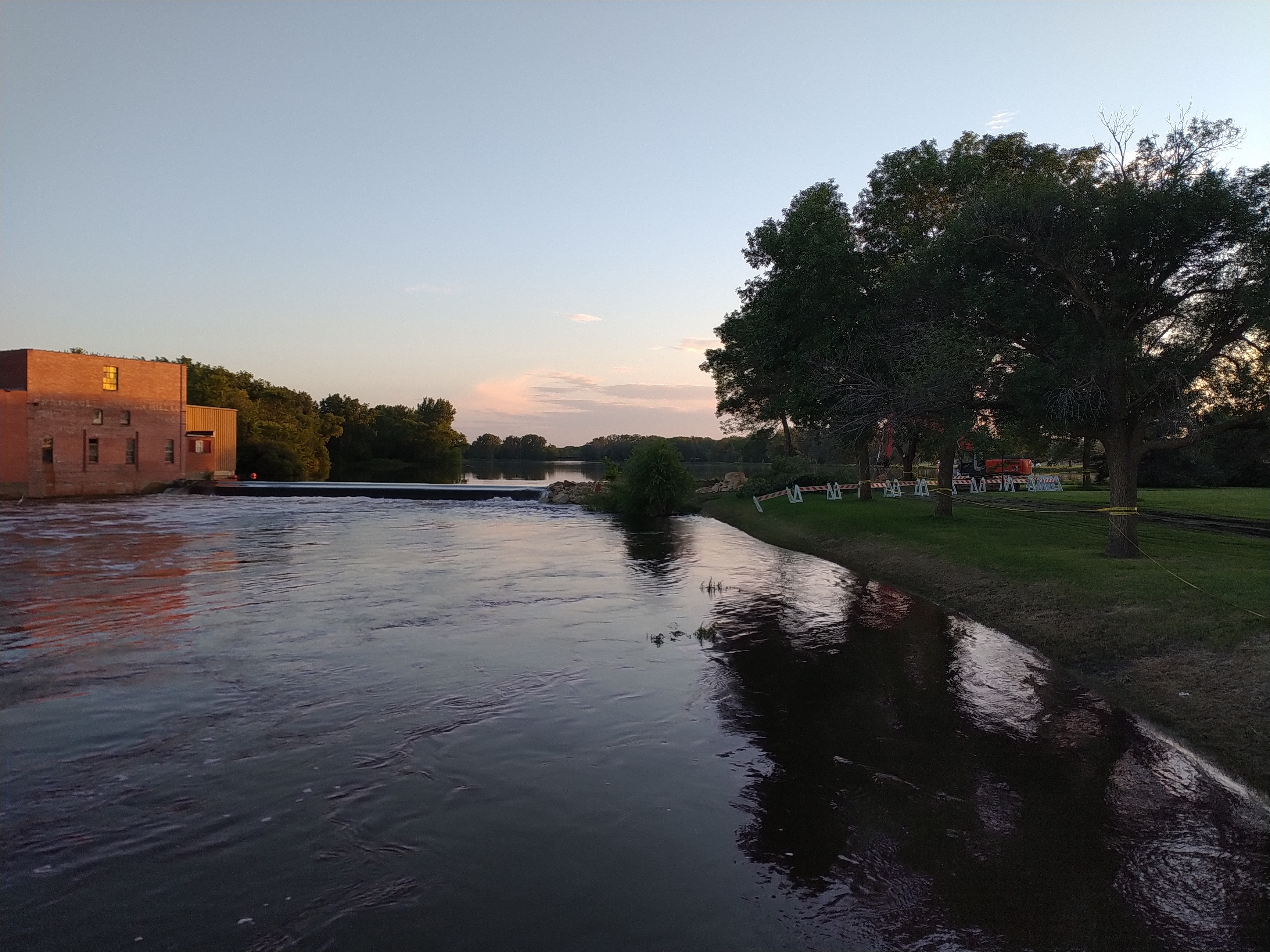
Barricades block access to the area along the river where crews worked to stabilize the bank on Wednesday. The Faribault Mill is across the river. (Minnesota Prairie Roots copyrighted photo July 3, 2024)
Right now I don’t see that happening in my community. The dam, the river, the landscape differ. In Faribault, crews worked to mitigate further erosion by piling boulders on the north side of the mill dam. That’s a temporary fix until water levels drop and officials can check for damage to the dam.
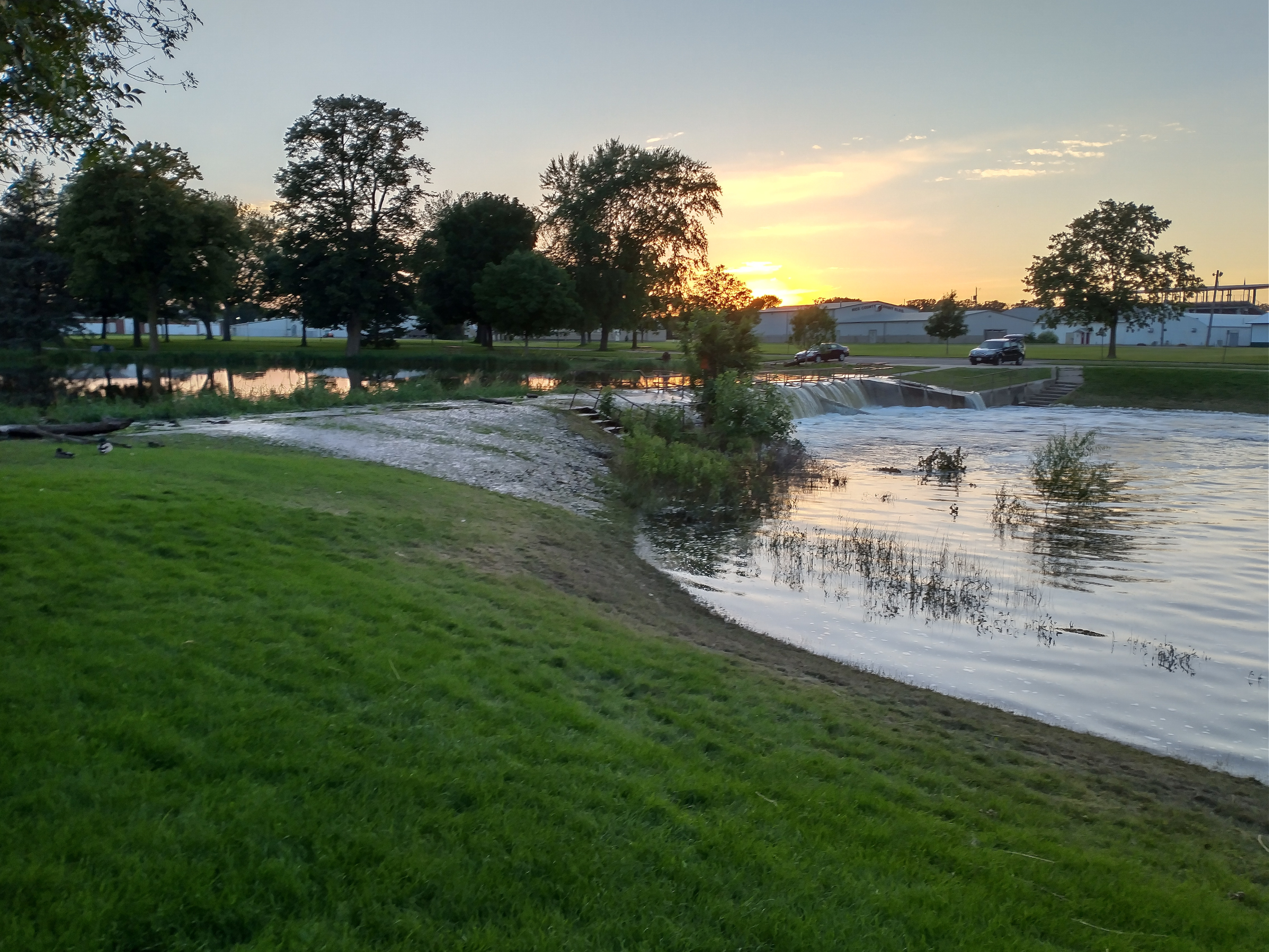
The second dam next to Father Slevin Park is not showing serious erosion, although water is flowing over the bank on the south side. (Minnesota Prairie Roots copyrighted photo July 3, 2024)
I stopped briefly Wednesday evening to see firsthand what is happening at the two dams on the Cannon River. Water levels remain high, although lower than they have been. But more rain is predicted in the next several days. Exactly what we don’t need.
#
NOTE: I did not have my 35 mm Canon camera with me so I had to use my cellphone to shoot these photos, thus I could not zoom in to take better, clearer images.
Friday evening the Cannon River was well above flood stage at the dam by the entrance to North Alexander Park. More rain overnight into Saturday raised the river level even higher. (Minnesota Prairie Roots copyrighted photo June 21, 2024)
NEARLY 10 INCHES OF RAIN fell in the past eight days at my Faribault home, half of that in the last three days. The significant rainfall not only in my community, but throughout southern Minnesota, has resulted in flooding as rivers swell and overflow their banks.
The same dam scene Saturday morning. (Minnesota Prairie Roots copyrighted photo June 22, 2024)
By Saturday morning, the Cannon encroached on even more land and the river rose higher under the Second Avenue bridge by the entrance to North Alexander Park. (Minnesota Prairie Roots copyrighted photo June 22, 2024)
This churning water at the dam shows the power of the river. (Minnesota Prairie Roots copyrighted photo June 21, 2024)
Minnesota Governor Tim Walz declared a peacetime emergency authorizing the National Guard to assist and support with emergency flood operations as needed. Faribault Mayor Kevin Voracek has declared a local emergency as my city deals with flooding. In nearby hard-hit Waterville, some residents have been evacuated. Mankato has also experienced significant flooding.
A police cruiser is parked Saturday morning under the historic viaduct near Teepee Tonka Park, an area prone to flooding. By Saturday evening, the Straight River had flooded even more of the park and surrounding land. (Minnesota Prairie Roots copyrighted photo June 22, 2024)
A chunk of south central Minnesota, including Faribault and other areas of Rice County, plus portions of Le Sueur, Steele and Waseca counties, remain in a flood warning until 10 a.m. Monday.
Teepee Tonka Park in Faribault, along the Straight River, was completely flooded Saturday morning. By evening, floodwaters crept onto the bridge. (Minnesota Prairie Roots copyrighted photo June 22, 2024)
Saturday morning the bridge at Teepee Tonka Park was open to pedestrians with a police officer stationed there. By evening, the bridge was cordoned off. (Minnesota Prairie Roots copyrighted photo June 22, 2024)
A Faribault police officer chats with the public and monitors the Straight River on the bridge into Teepee Tonka Park Saturday morning. (Minnesota Prairie Roots copyrighted photo June 22, 2024)
It’s a lot—this flooding of homes and businesses, city parks and railroad tracks, parking lots and roadways, cropland… A few blocks from my home, Xcel Energy crews are monitoring an electrical substation surrounded by water from the overflowing Straight River.
Floodwaters surround this warning sign by the Woolen Mill Dam. (Minnesota Prairie Roots copyrighted photo June 21, 2024)
A fire department truck stops on the Second Avenue bridge over the Cannon River on Friday evening as emergency personnel keep an eye on the rising river. (Minnesota Prairie Roots copyrighted photo June 21, 2024)
Police tape along the Cannon River by North Alexander Park is in place to keep people away from the roiling river. Friday evening the river nearly touched the bottom of the bridge. (Minnesota Prairie Roots copyrighted photo June 21, 2024)
I arrived home from church late this morning to automated messages from the 911 emergency system. One issued a cautionary warning from public safety officials to honor barricades by not walking or driving around them. Ignoring such signage in flooded areas will result in a citation from law enforcement.
Watching the swift-moving Cannon River from behind police tape Friday evening near the historic Faribault Mill. (Minnesota Prairie Roots copyrighted photo June 21, 2024)
Tree debris floats down the Cannon on Friday evening. (Minnesota Prairie Roots copyrighted photo June 21, 2024)
There’s a dam here, unseen as the Cannon River floods. (Minnesota Prairie Roots copyrighted photo June 21, 2024)
For the most part, I observed people being careful around floodwaters in Faribault while I was out on Friday evening and then again Saturday morning. The areas I accessed and photographed in that time frame have since been closed to the public, a smart move given the power of the river and the sheer volume of people checking things out. We are all naturally drawn to see for ourselves that which is unfolding in our backyard.
A car sits submerged in the parking lot of Two Rivers Health Center by Two Rivers Park on Saturday morning. (Minnesota Prairie Roots copyrighted file photo June 22, 2024)
Two rivers—the Cannon and the Straight—run through Faribault, converging at Two Rivers Park. Near that park, a car sat submerged Saturday morning in a parking lot. I’ve seen other vehicles sitting in floodwaters at the new riverside Straight River Apartments.
Along the Straight River on Third Avenue Northeast, floodwaters fill a backyard which, ironically, includes a boat. (Minnesota Prairie Roots copyrighted photo June 22, 2024)
Yet, as difficult as this flood event has been, it does not match the Faribault floods of 2010, 2014 and 2016, at least not from my recollection. Still, any flood is challenging.
Along the Straight River, a section of railroad tracks flooded. The Depot Bar & Grill patio is on the left. (Minnesota Prairie Roots copyrighted photo June 22, 2024)
For those affected, there’s clean-up and paperwork and unexpected expenses. Emergencies like this often bring out the best in people, as a community comes together. At the local government level, I expect emergency personnel have been working overtime. The Rice County Landfill, rural Dundas, opens at 7:30 a.m. Monday to begin accepting flood-contaminated materials.
Below the historic viaduct, the Straight River overflows its banks Saturday morning. By evening, it had risen even more. (Minnesota Prairie Roots copyrighted photo June 22, 2024)
I am fortunate. There’s no flooding in my home or yard. But I know others are struggling. I hope that in Sunday’s sunshine—finally, a day without rain—they feel a sense of hope. Floodwaters will recede. And life will, eventually, return to normal.
Walking along the Cannon River by the dam Friday evening, before the river flooded even more. (Minnesota Prairie Roots copyrighted photo June 21, 2024)
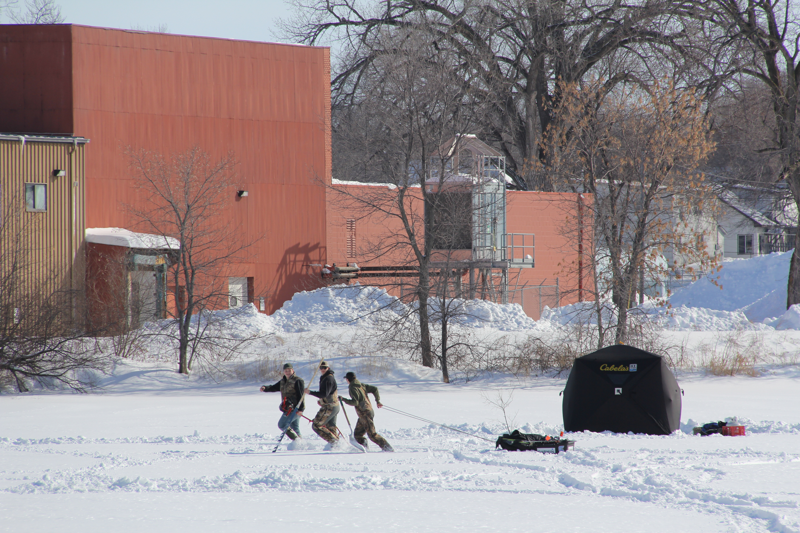
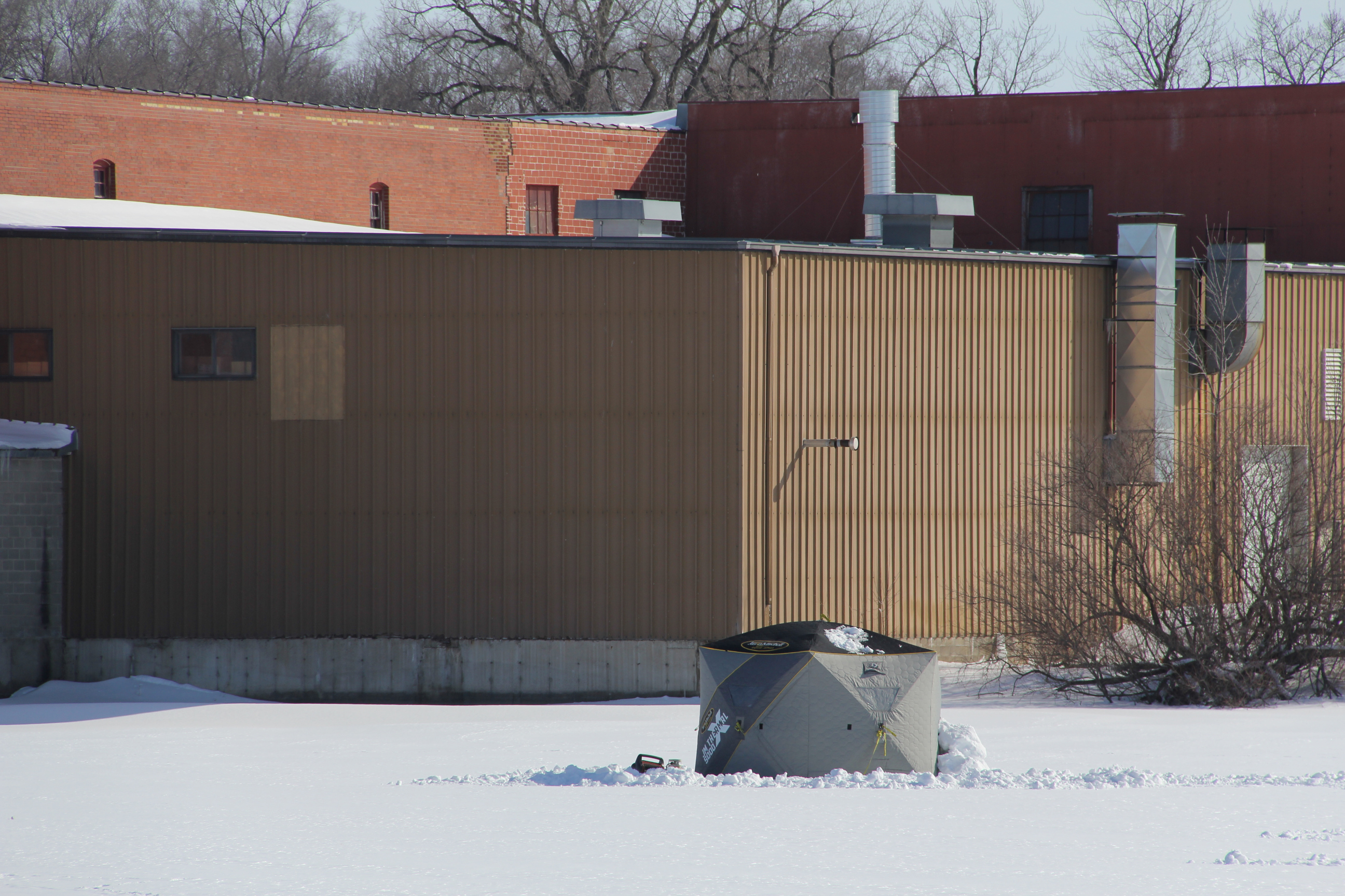
Carting ice fishing gear across the snow-covered Cannon River by the Faribault Mill. (Minnesota Prairie Roots copyrighted photo February 2023)
ICE FISHING RATES AS A SPORT that must seem absurd to anyone living in a warm weather climate.
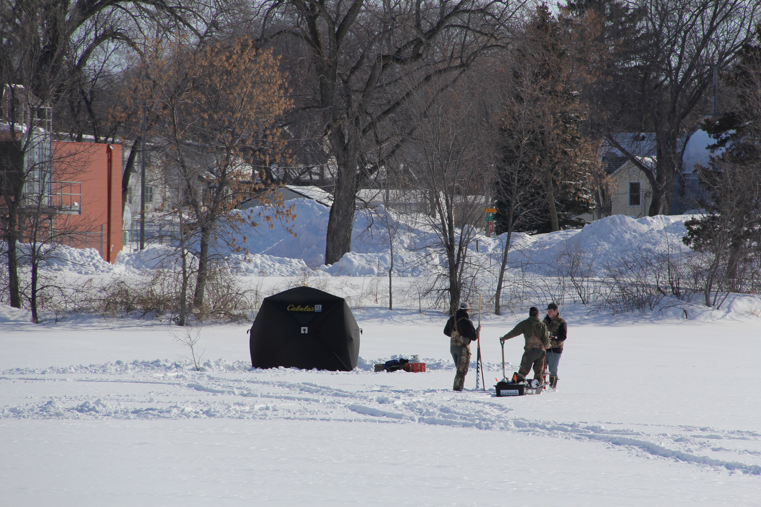
The second portable fish house the anglers set up on the Cannon River near the mill. (Minnesota Prairie Roots copyrighted photo February 2023)
I mean, if you aren’t from a place like Minnesota or Wisconsin, how would you react to anglers driving their vehicles onto a frozen lake, fish houses in tow? That seems reckless and unsafe and dangerous, and it can be. No ice is ever considered 100 percent safe. But, take precautions like knowing your lake (or river) and its ice thickness, driving with windows rolled down and carrying safety equipment, and the sport can be relatively safe.
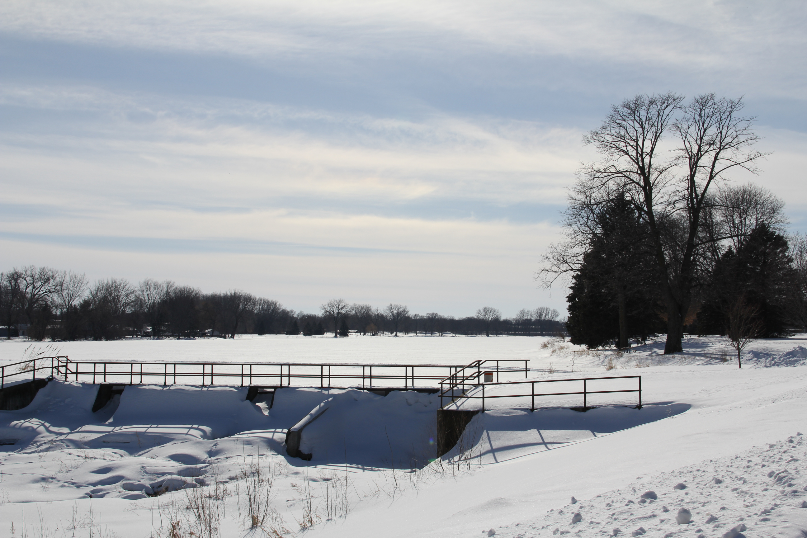
A view of the dam and frozen Cannon River from the recreational trail in North Alexander Park. There are two dams in this location, one next to the woolen mill and then this one. (Minnesota Prairie Roots copyrighted photo February 2023)
Still, this time of year and with the particularly snowy winter we’ve had in Minnesota, ice fishing right now doesn’t seem all that safe to me. Snow acts like a blanket, insulating the ice, resulting in thinner, inconsistent and weaker ice. Decades have passed since I engaged in the sport so I am not writing from current day experience, only from basic knowledge.
Drilling a hole in the frozen river near the top of the Woolen Mill Dam. (Minnesota Prairie Roots copyrighted photo February 2023)
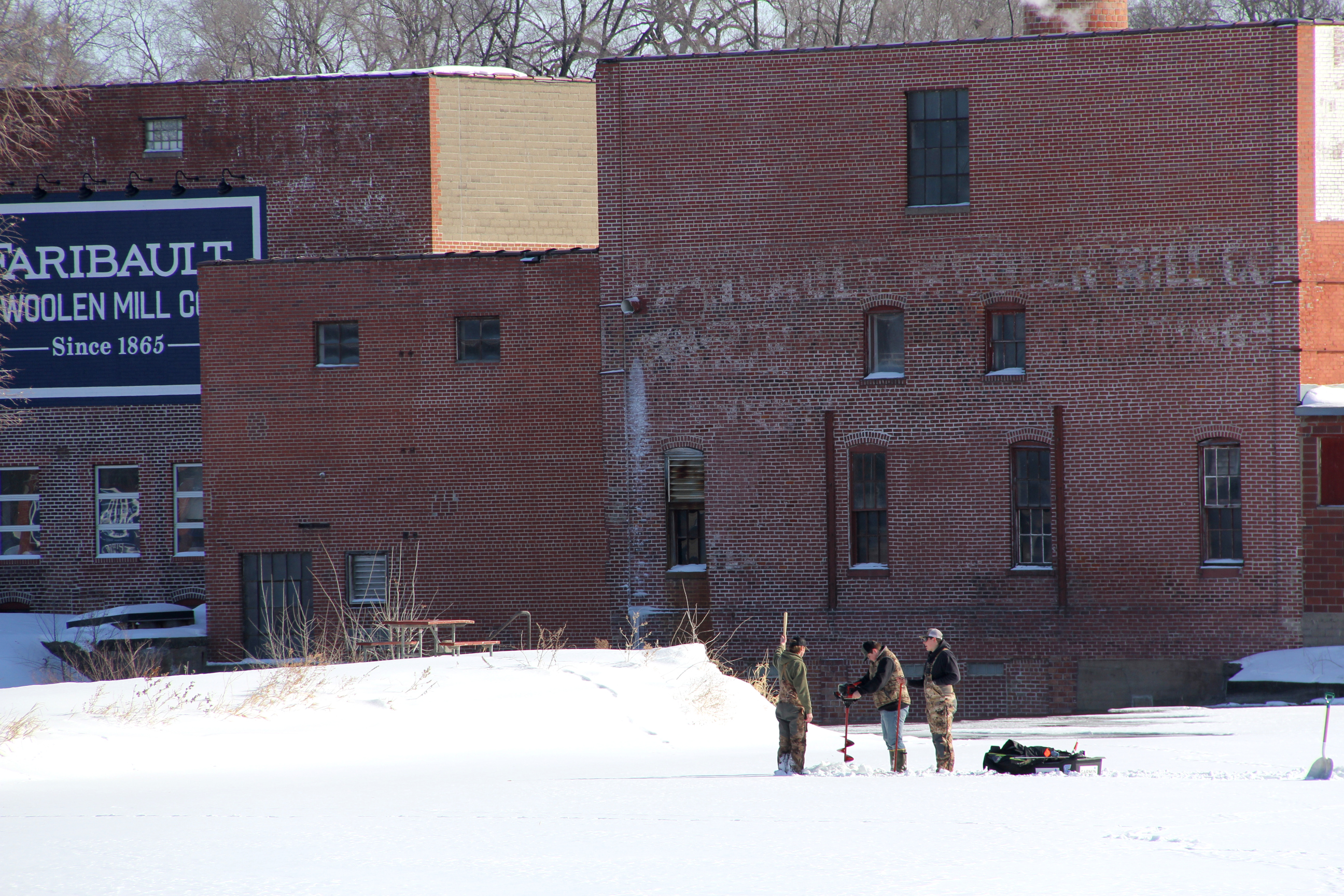
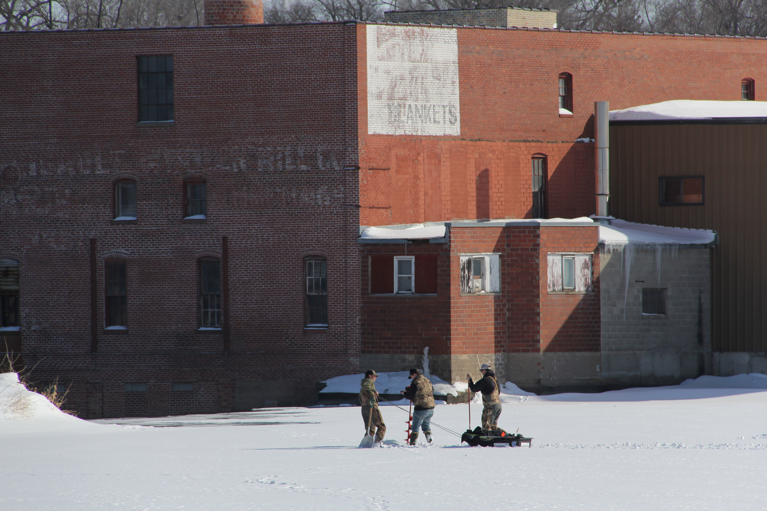
Sunday afternoon while out and about in Faribault, I came upon three guys with ice fishing equipment on the frozen Cannon River Reservoir by the Woolen Mill Dam. As I watched, I hoped they knew what they were doing because I didn’t feel all that confident in the strength of the river ice with water flowing below.
I can almost hear the discussion about where to drill holes in the ice. (Minnesota Prairie Roots copyrighted photo February 2023)
But I appreciated that they were out enjoying the 30-degree sunny afternoon, warm enough even to shed their gloves and heavy coats. They’d already set up two portable fish houses by the time I arrived at North Alexander Park. I stood there and observed as the trio carried ice auger, ice saw, and scoop shovel and towed a sled with fishing gear across the snow-covered river. I was uncertain whether they were spearing for or simply angling for fish. Turns out neither.
Local avid outdoorsman and columnist Larry Gavin clarified: Those guys were actually netting carp. The net is stretched from one tent to the other using a hook and a series of holes. They were checking to see if the location was a good one. Every year they net Wells Lake and get a semi tanker full of carp that are shipped overnight to Chicago. There is a high demand for carp as a food source in some ethnic dining.
Turning the ice auger into the ice to create a hole. (Minnesota Prairie Roots copyrighted photo February 2023)
It was such an iconic Minnesota winter scene, the fishermen in their camouflage attire, a visual clue that they are year-round sportsmen. I can only imagine the camaraderie, the BS, the anticipation of these friends as they searched for fish.
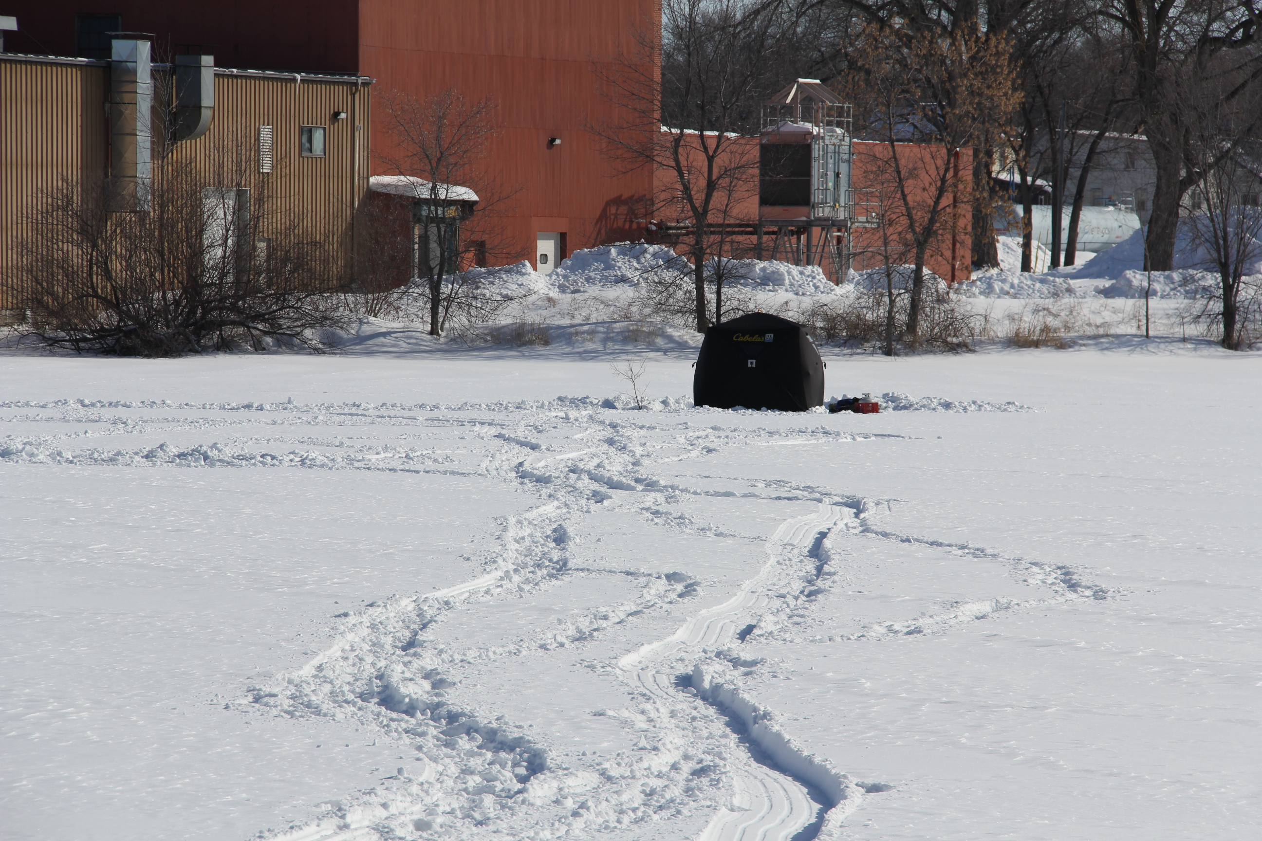
A sled trail across the river to the portable fish house. (Minnesota Prairie Roots copyrighted photo February 2023)
I loved the way their sled left a snaking trail across the Cannon, almost like a line of poetry winding through the snow, writing of winter outdoors, of fish tales, of ice fishing in Minnesota.
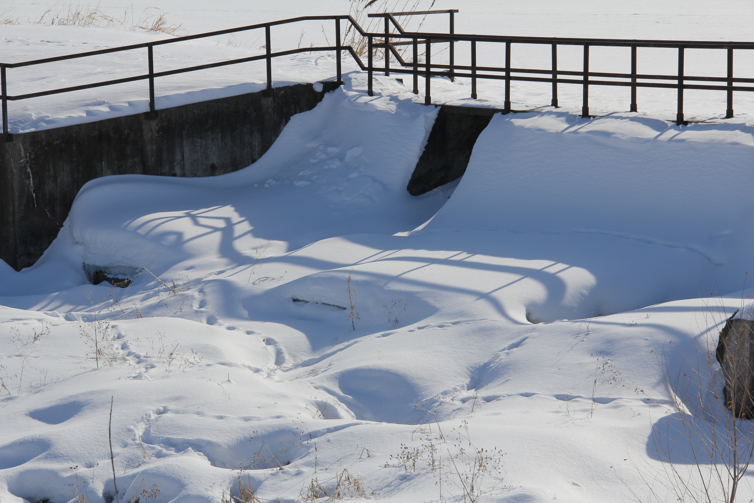
Animal tracks through the snow below the Cannon River dam nearest the recreational trail. (Minnesota Prairie Roots copyrighted photo February 2023)
FYI:The ice fishing season is winding down in Minnesota. All dark houses, fish houses and portables must be off inland lakes by the end of the day beginning on March 6 in the southern two-thirds of the state and by March 20 in the northern third. You can still ice fish, just can’t leave houses unattended. Local officials can set different restrictions if unsafe conditions call for such action.
I shot this scene of the rising Cannon River near the iconic Faribault Woolen Mill shortly before sunset Monday.
WITH TWO RIVERS RUNNING through Faribault, a flooding concern always exists. We’ve had property-damaging floods here in the past. And now, with spring snow melt well underway, we’re all on alert.
The Faribault Woolen Mill dam is barely visible in this photo.
A close-up of the dam.
Likewise, a second dam by the entrance to North Alexander Park and the Rice County Fairgounds is also almost invisible.
Although the Cannon and Straight Rivers are high and have spilled from their banks in some areas, they aren’t threatening. Yet. Who knows what this week’s expected 50 to near 60-degree temps will bring?
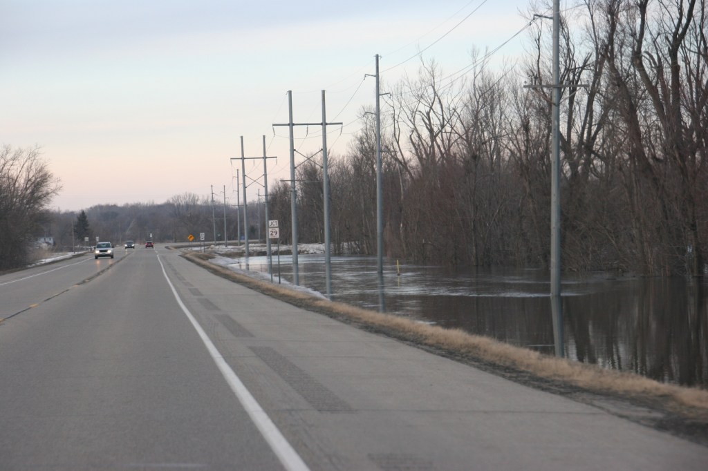
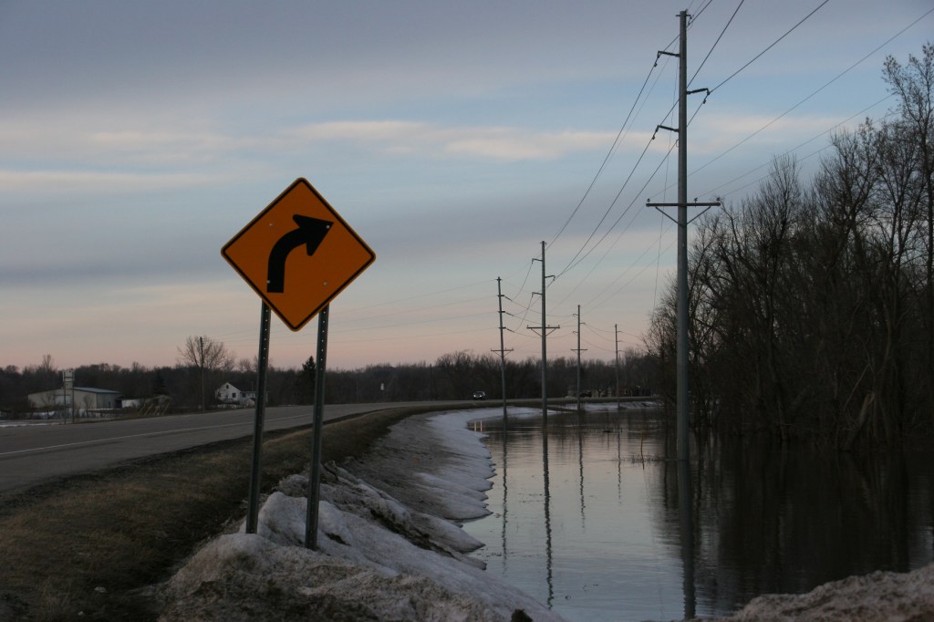
The overflowing Cannon River edges Minnesota State Highway 3 at its intersection with Rice County Road 29 just north of Faribault.
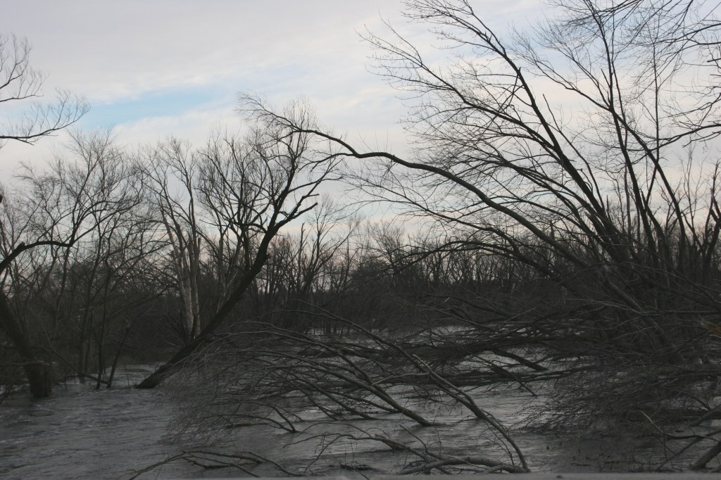
Trees felled by a September 2018 tornado clog the rising Cannon River as seen in this view from the Rice County Road 29 bridge.
The Cannon River spills out of its banks at the intersection of Minnesota State Highway 3 and Rice County Road 29 on Monday evening. This is the main connecting highway between Faribault and Northfield.
I feel for the folks in Nebraska with the devastating floods there. I feel for the folks in the Fargo-Moorhead area now preparing for likely flooding. I feel for the folks in Jordan, Minnesota, some of whom already had to evacuate homes. I feel for the river communities of Northfield, Hastings, Stillwater, Red Wing, New Ulm… The list is lengthy of Minnesota cities that could face serious flooding. Some, including Northfield along the Cannon River and just to the north of Faribault, are in a flood warning issued by the National Weather Service. My home county of Redwood, through which the Redwood River runs, is also included in this warning for specific rivers (the Redwood, Cottonwood, Minnesota and Cannon rivers) in Minnesota.
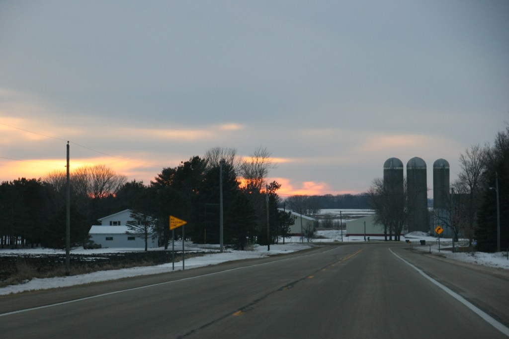
While the snow pack has diminished significantly, snow remains to melt. I shot this photo west of Dundas around sunset Monday along Rice County Road 1.
For now, in Faribault, the issue is primarily flooded basements. I’ve talked to friends who’ve never had water in their basements. Until this year. We’re not talking just water seepage either. We’re also talking backed up septic systems. We’ve had minor issues in our house, too.
Water floods a low lying area along Interstate 35 somewhere between the south metro and Faribault. Photo taken late Saturday afternoon.
But we’ll get through this. We always do.
TELL ME: Have you experienced any flooding or water-related issues in your community or home? Or are you prepping for such a possibility?


Recent Comments