Minnesota Prairie Roots

Writing and photography by Audrey Kletscher Helbling

Escaping the heavy wildfire smoke in north central Minnesota July 16, 2026

Signage on an escape room business in downtown Brainerd, photo taken Monday afternoon before wildfire smoke rolled in. (Minnesota Prairie Roots copyrighted photo July 2026)

IN THE EXTREME HEAT and humidity of Monday afternoon, my husband and I and our eldest daughter and her family escaped to Copper Cat Escape Games in Brainerd to sleuth for Granny’s hidden secret recipe. It was great fun finding and solving clues, unlocking boxes and finally solving the mystery with five minutes to spare.
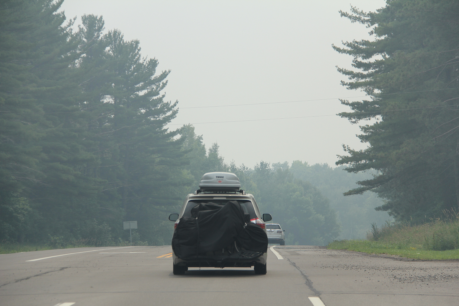
Driving into and through wildfire smoke early Wednesday afternoon near Garrison. I took these photos as a passenger. (Minnesota Prairie Roots copyrighted photo July 2026)

On Wednesday afternoon, we escaped, too, but this time from intense wildfire smoke which blew in from the north, enveloping the Brainerd Lakes area cabin where we were vacationing. We’ve experienced smoke on previous visits. This time, though, the smoke was especially thick, intense and oppressive.
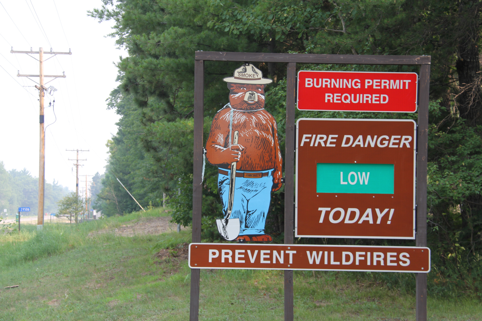
After leaving Mission Park and before reaching the cabin, I photographed this sign by the Mission Town Hall. Fire danger was low here Wednesday with the smoke (seen to the left) coming from wildfires up north. (Minnesota Prairie Roots copyrighted photo July 2026)

The smoke rolled in as Randy and I were hiking at Mission Park only a short drive from the Horseshoe Lake cabin south of Crosslake. We emerged from the woods to see dense smoke. Initially, we thought someone was burning, but soon realized the source—wildfires to the north in Canada and northern Minnesota.
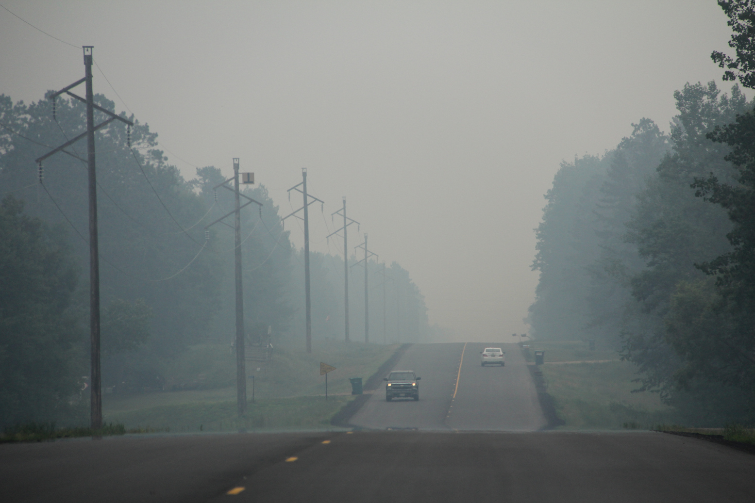
Driving through dense smoke along Crow Wing County Road 11 south of Crosslake early Wednesday afternoon. (Minnesota Prairie Roots copyrighted photo July 2026)

Wildfires are raging in areas in and around the Boundary Waters Canoe Area with campers there evacuated earlier in the week and the BWCA closed. Evacuation orders have been issued in parts of St. Louis, Cook and Lake counties in the northeastern part of Minnesota. Camps are closing, kids sent home. And on and on. Resorts, outfitters and other businesses that rely on seasonal income are suffering.

And across nearly all of Minnesota, we are breathing in smoke at levels classified as hazardous, very unhealthy, unhealthy and more by the Minnesota Pollution Control Agency. That includes right here in my county of Rice in the southern part of the state far from the wildfires.

But the level here in Faribault is nothing compared to what we saw and breathed in yesterday in the Brainerd Lakes area. That smoke smelled of infinite campfires, stung our eyes, made it hard to breathe, reduced visibility.

Our plans to spend the day exploring and enjoying the small towns near the cabin quickly pivoted to packing and heading home a day earlier than intended. Our daughter and her family left a day prior, as scheduled.

Looking across Horseshoe Lake in the thick smoke late Wednesday morning. (Minnesota Prairie Roots copyrighted photo July 2026)

It was the right decision to leave on Wednesday. Already visibility across Horseshoe Lake was so limited that the opposite shore appeared only an outline of trees. Smoke and the stench of smoke hung in the air. The toxic air felt suffocating.
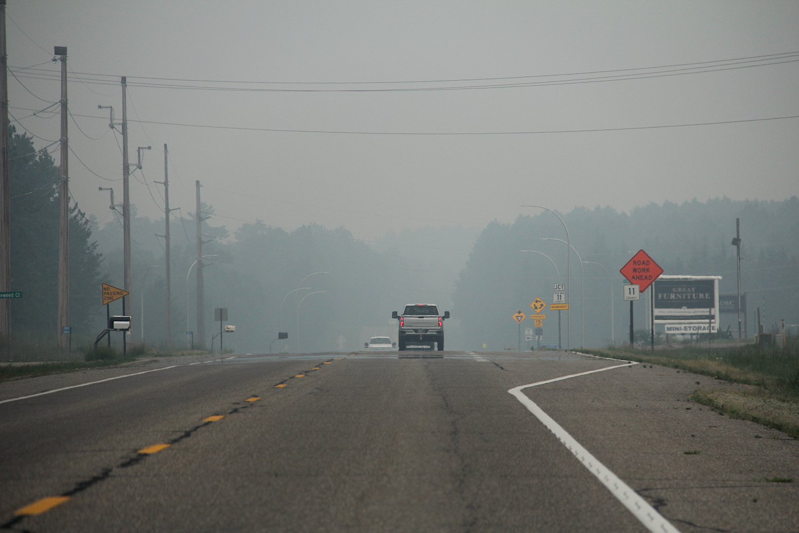
Northbound toward Crosslake, this shows the heavy smoke in the area at the intersection of Crow Wing County roads 3 and 11 early Wednesday afternoon. (Minnesota Prairie Roots copyrighted photo July 2026)

Once on Crow Wing County Road 3, Randy and I could see the scope of the smoke spreading far and wide, blanketing the landscape.
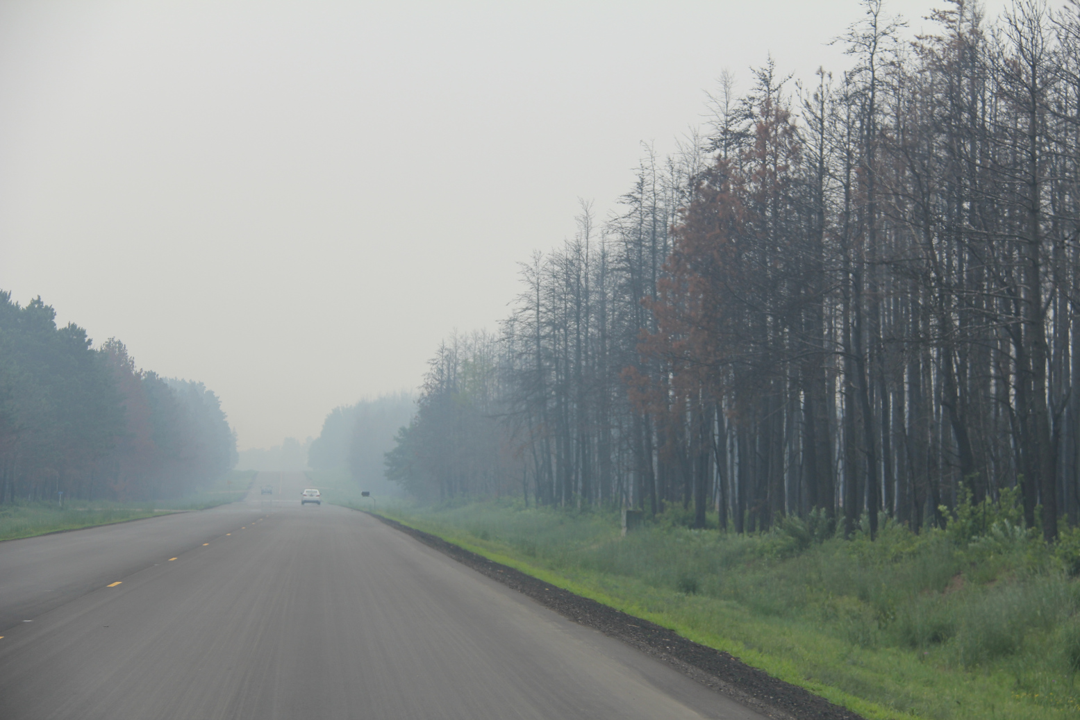
Driving through the smoke, past charred trees, right, burned in the Flanders Fire in May south of Crosslake. (Minnesota Prairie Roots copyrighted photo July 2026)

Onward we drove, turning onto county road 11, passing stands of charred trees and cleared land from a mid-May wildfire in Mission Township. The irony was not lost on me.

Mile after mile, we traveled in smoky conditions. In Crosby, life appeared business as usual with a packed downtown, despite the smoke. Shoppers walking in and out of shops. Bikers biking.
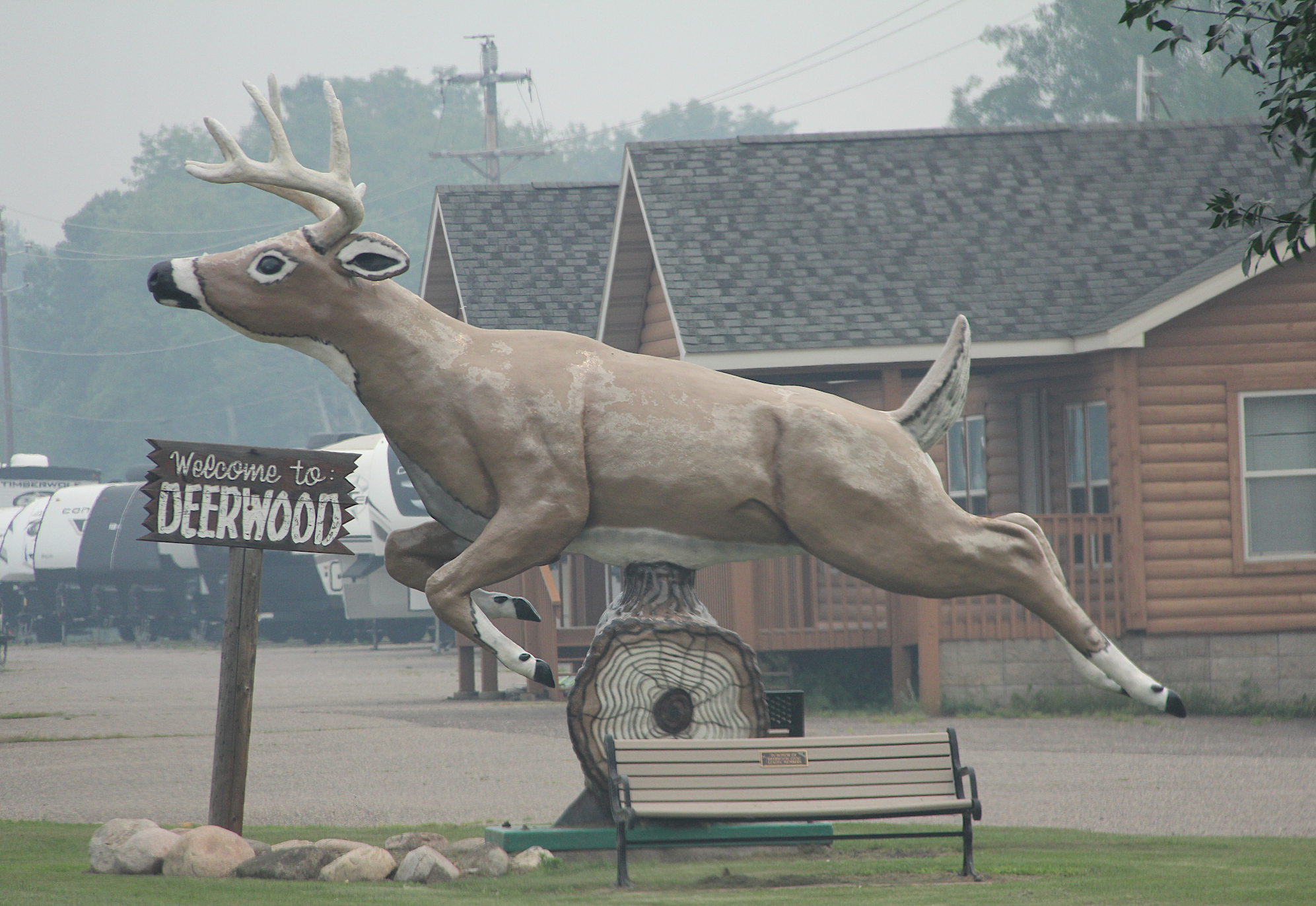
Smoke surrounds the roadside deer statue in Deerwood. (Minnesota Prairie Roots copyrighted photo July 2026)

In Deerwood, a roadside deer statue appeared to leap through the smoke in an attempt to escape.
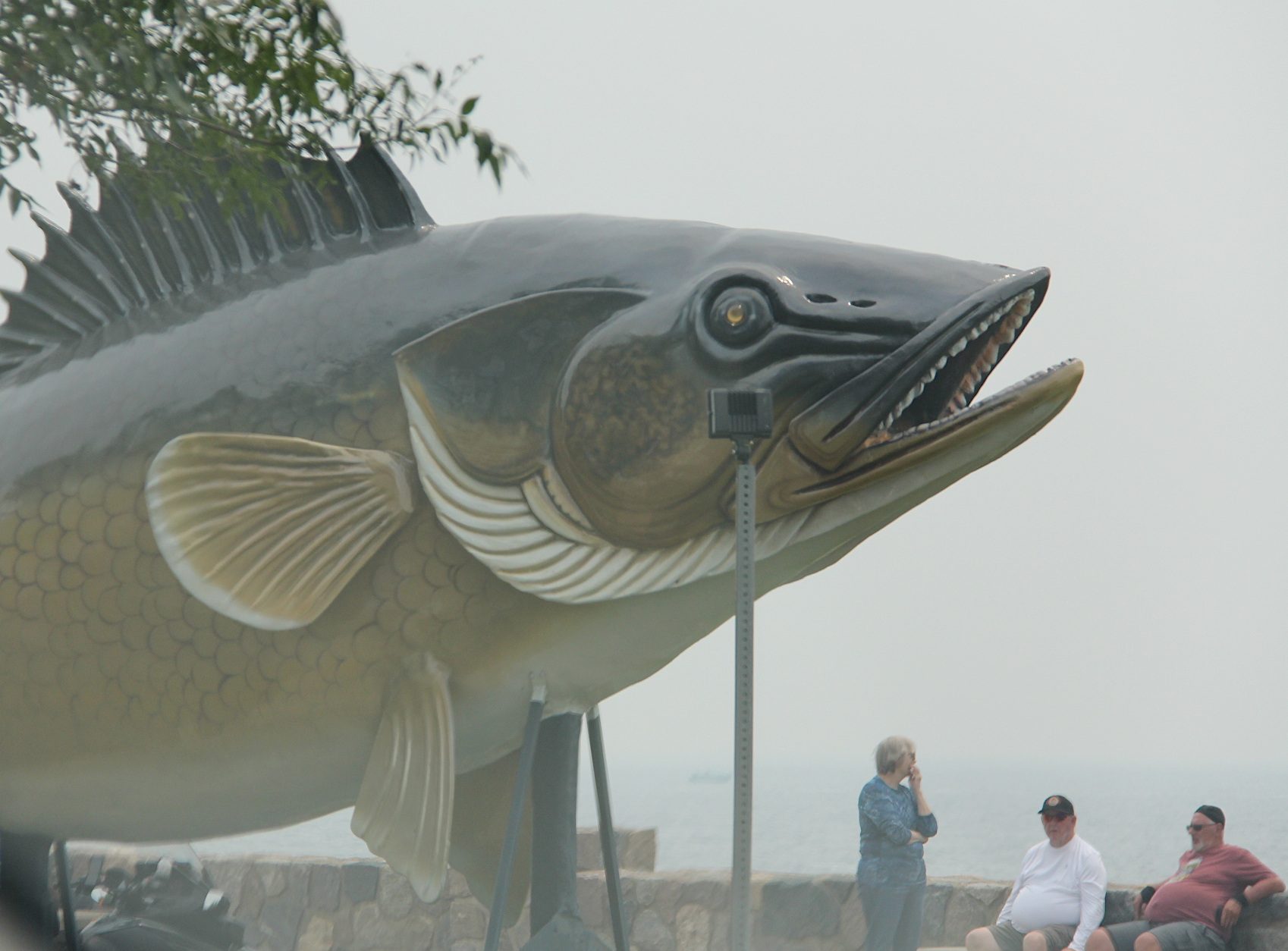
Wildfire smoke screens the view of Mille Lacs Lake by the roadside walleye statue. (Minnesota Prairie Roots copyrighted photo July 2026)

In Garrison, visitors at the Mille Lacs Lake overlook could see the roadside statue, but not much of the lake.
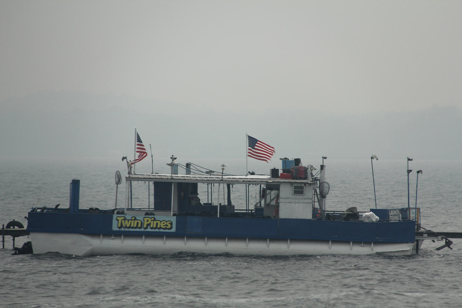
Wildfire smoke backdrops a docked boat on Mille Lacs Lake Wednesday afternoon. (Minnesota Prairie Roots copyrighted photo July 2026)

Down the road a bit, a guy jogged alongside U.S. Highway 169. Smoke still hung thick. I wondered how his body could tolerate the polluted air. Mine can’t.
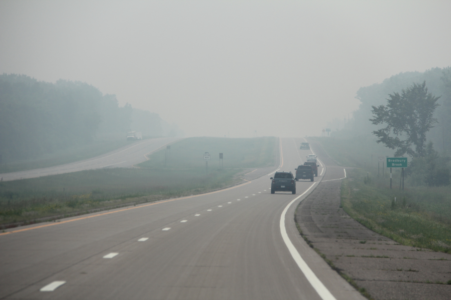
Motorists travel through thick wildfire smoke along US Highway 169 south of Mille Lacs Lake early Wednesday afternoon. (Minnesota Prairie Roots copyrighted photo July 2026)

We thought we would soon drive out of the wildfire smoke. But we drove past endless towns along highway 169—Onamia, Milaca, Princeton, Zimmerman… Not until we reached Elk River in the northwest metro two hours later did the smoke dissipate and open to blue skies. Then and only then did I feel like I could breathe easier.

I hope Minnesotans living near the 17 uncontrolled wildfires, and firefighters, plus our Canadian neighbors, can soon breathe easier, too. Rain is needed.
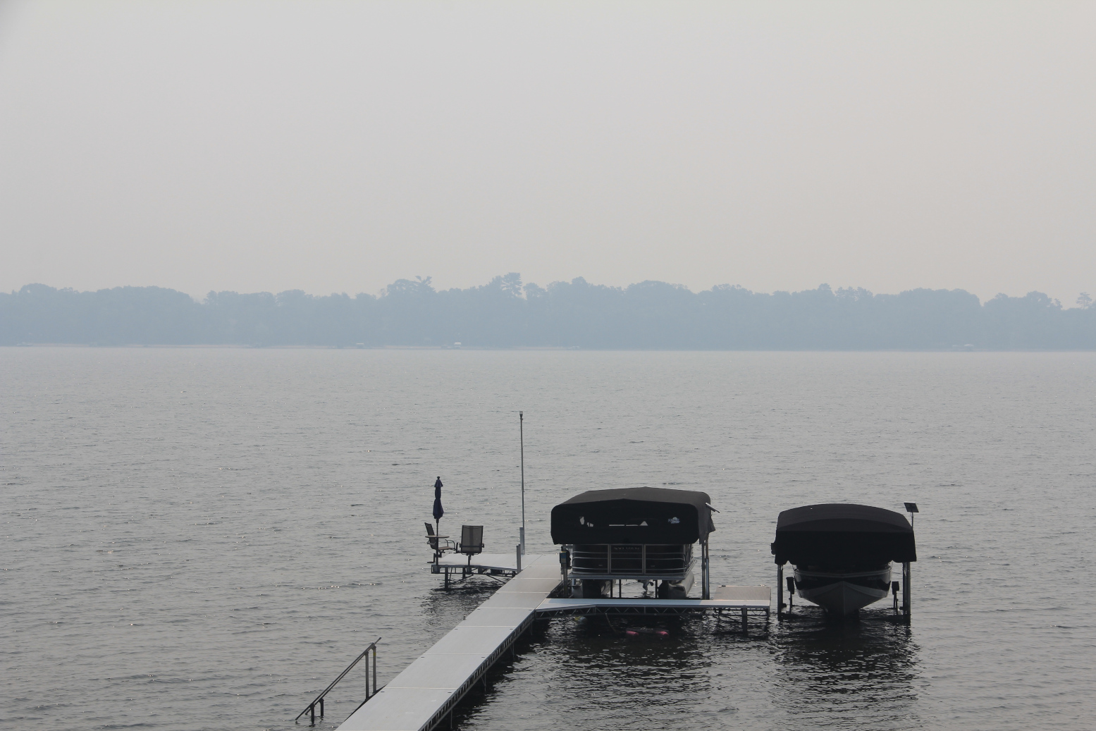
Looking across Horseshoe Lake late Wednesday morning, the opposite shoreline is obscured by wildfire smoke. (Minnesota Prairie Roots copyrighted photo July 2026)

Yet, I know these fires can burn for weeks, ravaging the landscape, polluting the air, impacting businesses and sometimes changing vacation plans. But leaving the lake cabin a day early to escape the smoke is nothing, truly nothing, in the story of wildfires.

TELL ME: Are you being affected by wildfires? If yes, I’d like to hear your story.

© Copyright 2026 Audrey Kletscher Helbling


Commentary: Floods, alligators & an email July 7, 2025

Minnesota Prairie Roots copyrighted file photo used for illustration only)

I HAVE SEVERAL THINGS on my mind today which are roiling my emotions. Not on a personal level. But on a broader, national scale.

First, I feel heartbroken over the loss of lives in Texas following flash flooding. The latest death count I’ve read is eighty-five, 27 of those children. Dozens remain missing. Most heart-rending are the deaths of the young campers at a summer camp. I think many parents, myself included, can relate to dropping a child off at camp with the full expectation that they will be there when we come to pick them up at camp’s end. For too many, a parent’s absolute worst nightmare—that of losing a child—is now reality. I feel for anyone who has lost a loved one in these floods, no matter their age. I am thankful for the 850 rescued thus far.

Titles of two photos in the “Testify” exhibit I saw. (Minnesota Prairie Roots copyrighted file photo April 2025)

ALLIGATORS

Secondly, I’m deeply-troubled by the gloating and hype about “Alligator Alcatraz,” a deportation detention facility in Florida. Those in power have been flaunting the name, stating quite clearly what will happen to anyone who tries to escape. There’s nothing remotely “funny” about alligators attacking and devouring human beings. There’s nothing “funny” either about placing people in cages. But neither seems to bother those who are vocally promoting this facility in such a vile way.

As soon as I heard the words “Alligator Alcatraz,” I was reminded of a traveling exhibit, “Testify—Americana Slavery to Today,” that I saw at my local library in April. Within that exhibit was a studio portrait of nine unclothed Black babies and toddlers sitting or standing in one long line. The circa 1897 image by a photography studio was simply titled “ALLIGATOR BAIT.” I remember standing there, my jaw dropping in disbelief. The photo was right above another image, that one of the African-American 9th Calvary Regiment, ca. 1939.

Then I read the text below the two photos: The juxtaposition of photos heightens the irony of being hawked as unwanted, or “alligator bait,” while at the same time being drafted into a calvary regiment to serve in the name of the United States’ highest ideals. Historians have actually investigated to determine if African-American children were indeed used by hunters to lure alligators. The results were somewhat inconclusive, but the fact that research was needed is telling.

I wondered when I saw the “ALLIGATOR BAIT” photo how humans can be so cruel? I wonder the same today.

Hands of an octogenarian used for illustration only. (Minnesota Prairie Roots copyrighted file photo)

A TROUBLING EMAIL

Lastly, a few days ago I received an email from the Social Security Administration, which I initially thought to be phishing given the title, “Social Security Applauds Passage of Legislation Providing Historic Tax Relief for Seniors.” Turns out this was legit. I’m sure many of you got the same email.

As I read on, I couldn’t quite believe what I was reading—a clearly partisan piece of propaganda from an agency I thought was non-partisan. Not only that, the content was not complete or accurate.

Whoever crafted this email and thought it was OK to mass-send, it is not OK.

LET’S DO BETTER

There you go. This is what’s on my mind today, just days after celebrating the Fourth of July in a country I love, even with all its faults, atrocities, injustices and troubles. But we can, and must, do better. I believe we can.

© Copyright 2025 Audrey Kletscher Helbling
 

Revisiting The Dam Store in Rapidan, now threatened by a raging river June 26, 2024

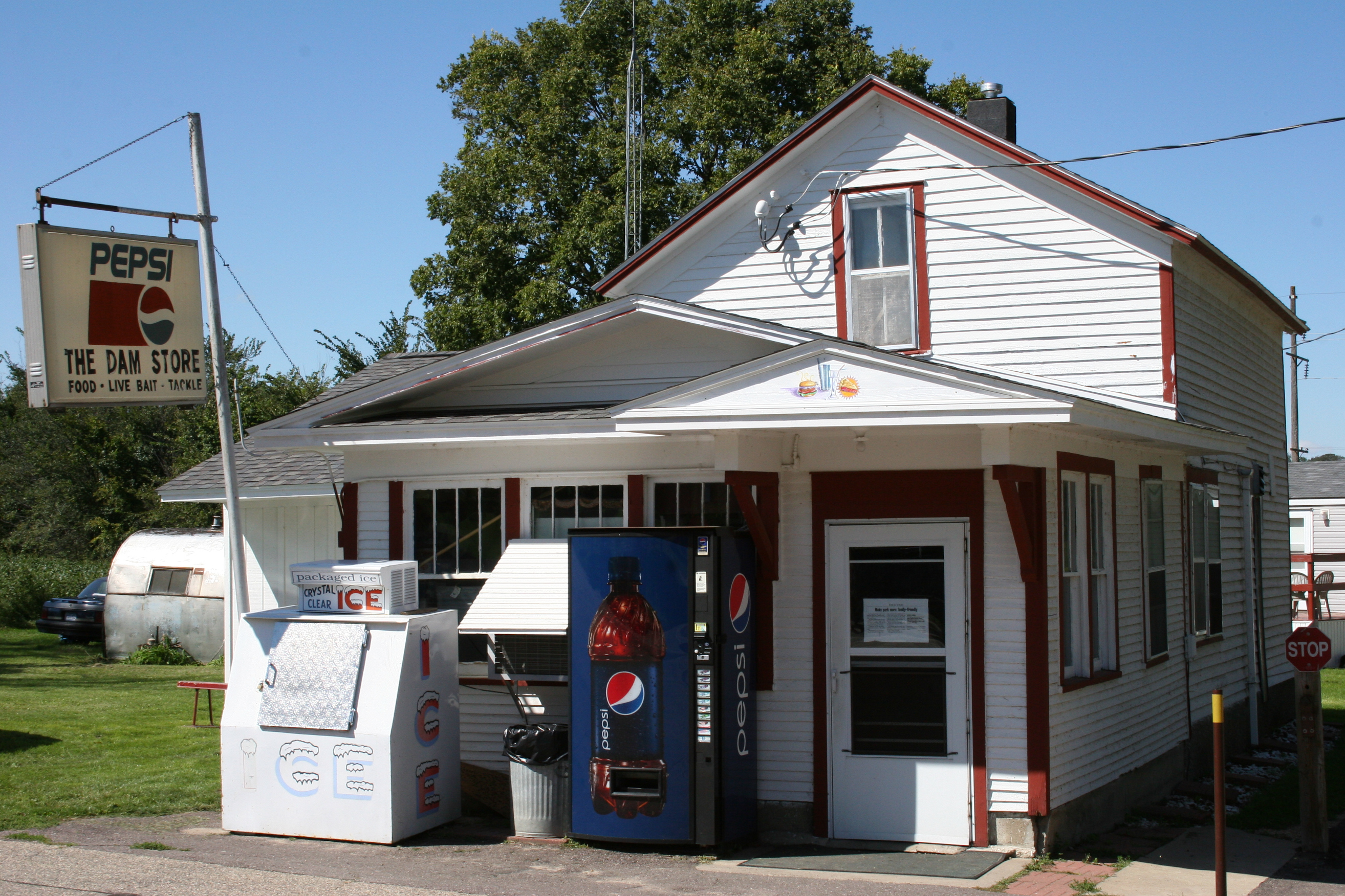
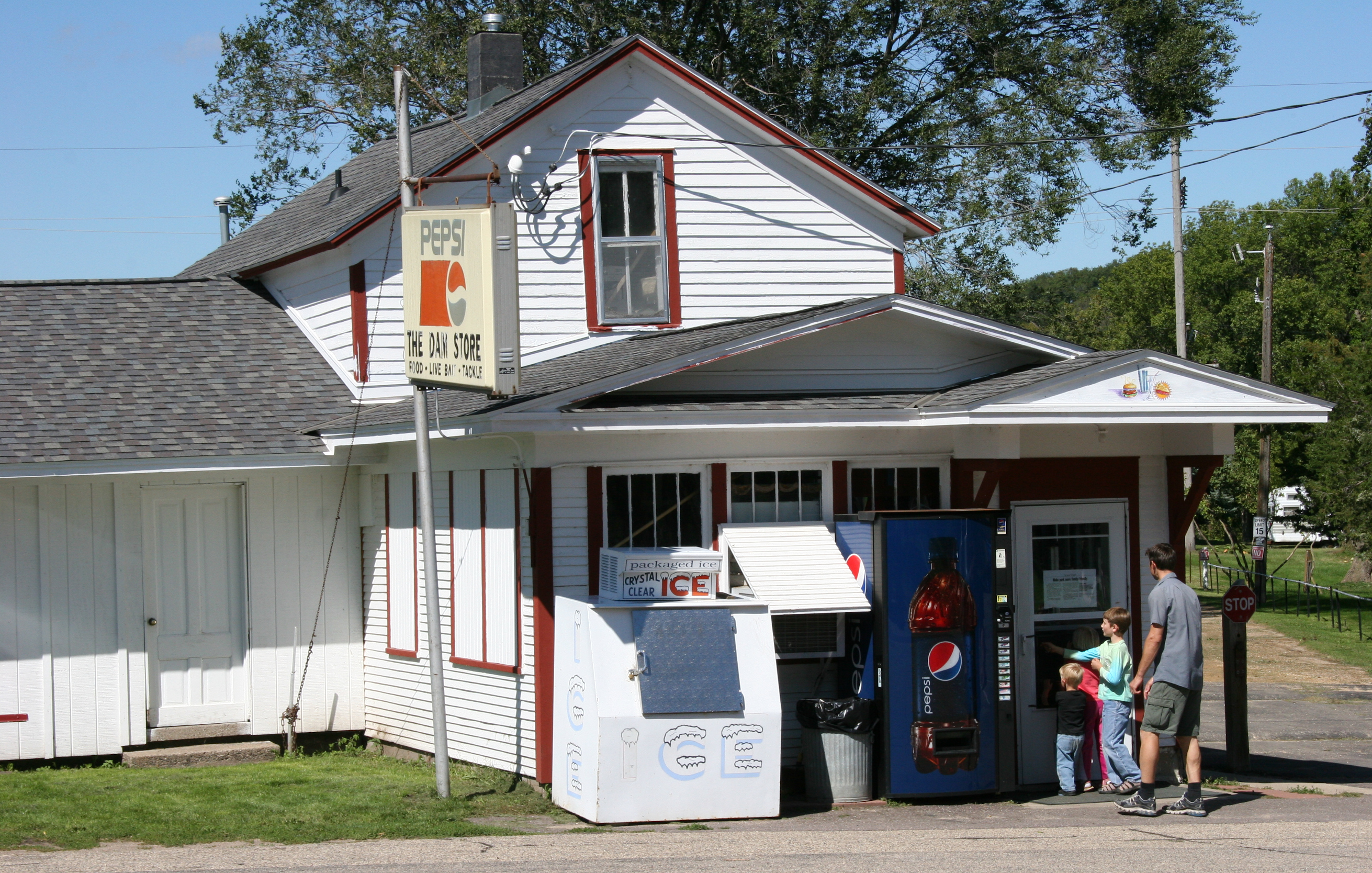
The Dam Store in Rapidan, photographed in 2010. (Minnesota Prairie Roots copyrighted photo 2010)

FOURTEEN YEARS AGO, I wrote a magazine feature story on The Dam Store, a rural southern Minnesota business serving up food, bait and tackle. People travel for miles to buy a burger and a slice of homemade pie here. It’s the kind of place that appeals to me—unpretentious and welcoming. Cozy, homey and comfortable, with great food.

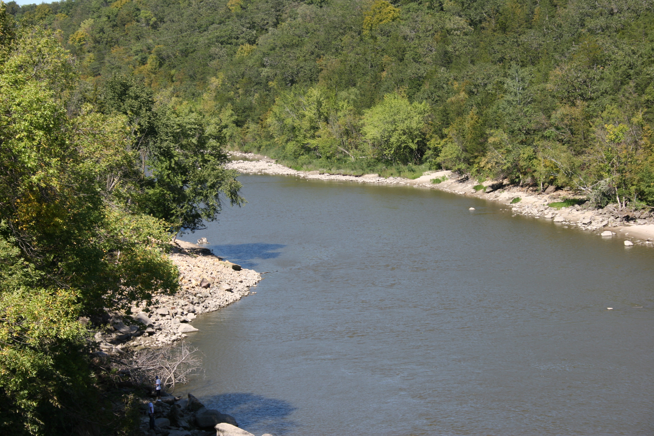
The calm Blue Earth River, photographed in 2010, looks nothing like this today. The raging river has taken out trees, a house, a county shed, and electrical substation as it cut a new path around the Rapidan Dam. (Minnesota Prairie Roots copyrighted photo 2010)

The small eatery is located by the Rapidan Dam, a dam which has been in the news all week due to its possible imminent failure. Thus far, the dam has held. But the roaring, overflowing Blue Earth River carved a path around the dam to the west, eventually claiming the Hruska family’s riverside home. They run the nearby cafe.

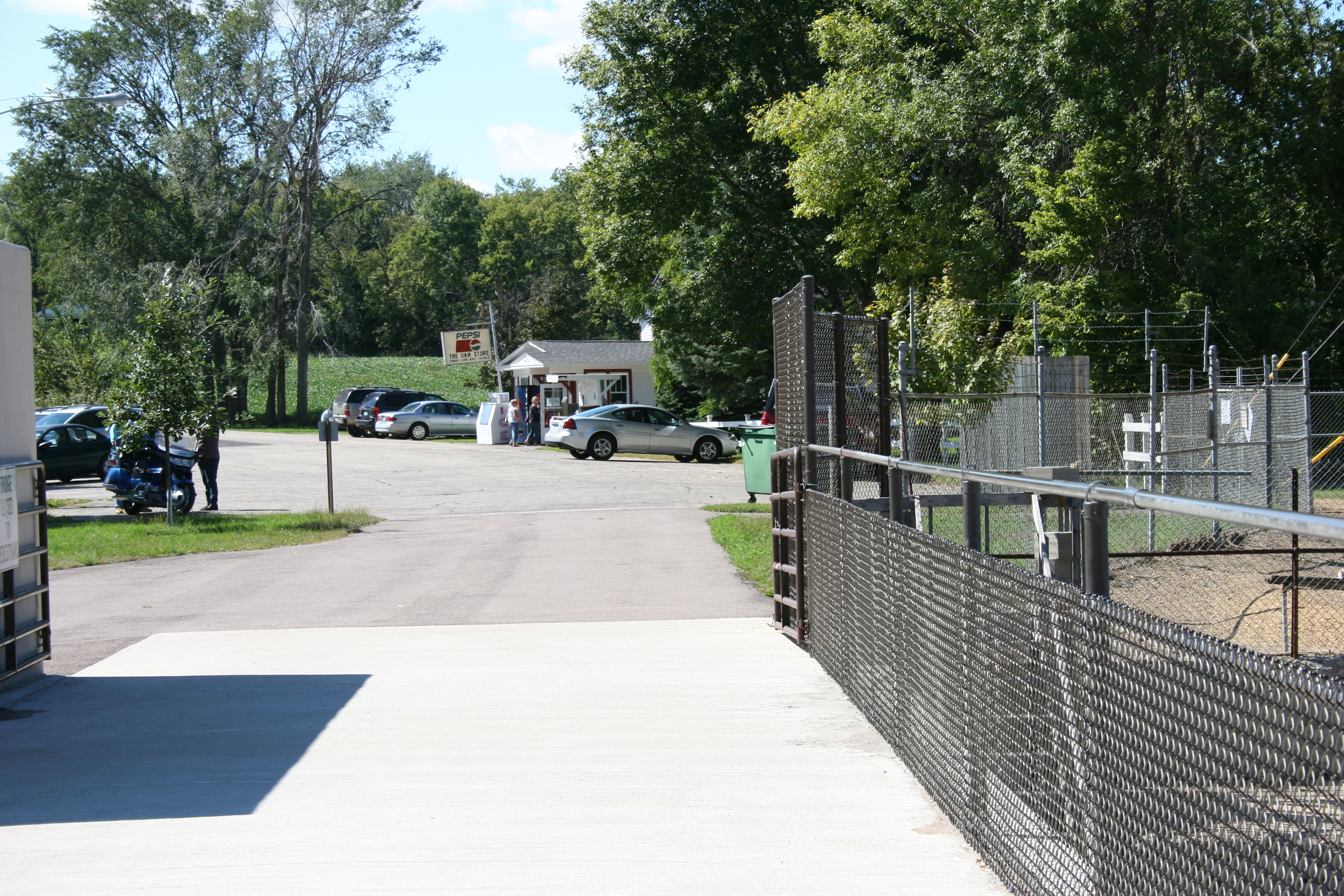
This shows the short distance from the dam walkway to The Dam Store. (Minnesota Prairie Roots copyrighted photo 2010)
The Hruska family, including Jenny Barnes, has run The Dam Store for some 50 years. Her nearby childhood home fell into the raging river Tuesday evening. (Minnesota Prairie Roots copyrighted photo 2010)
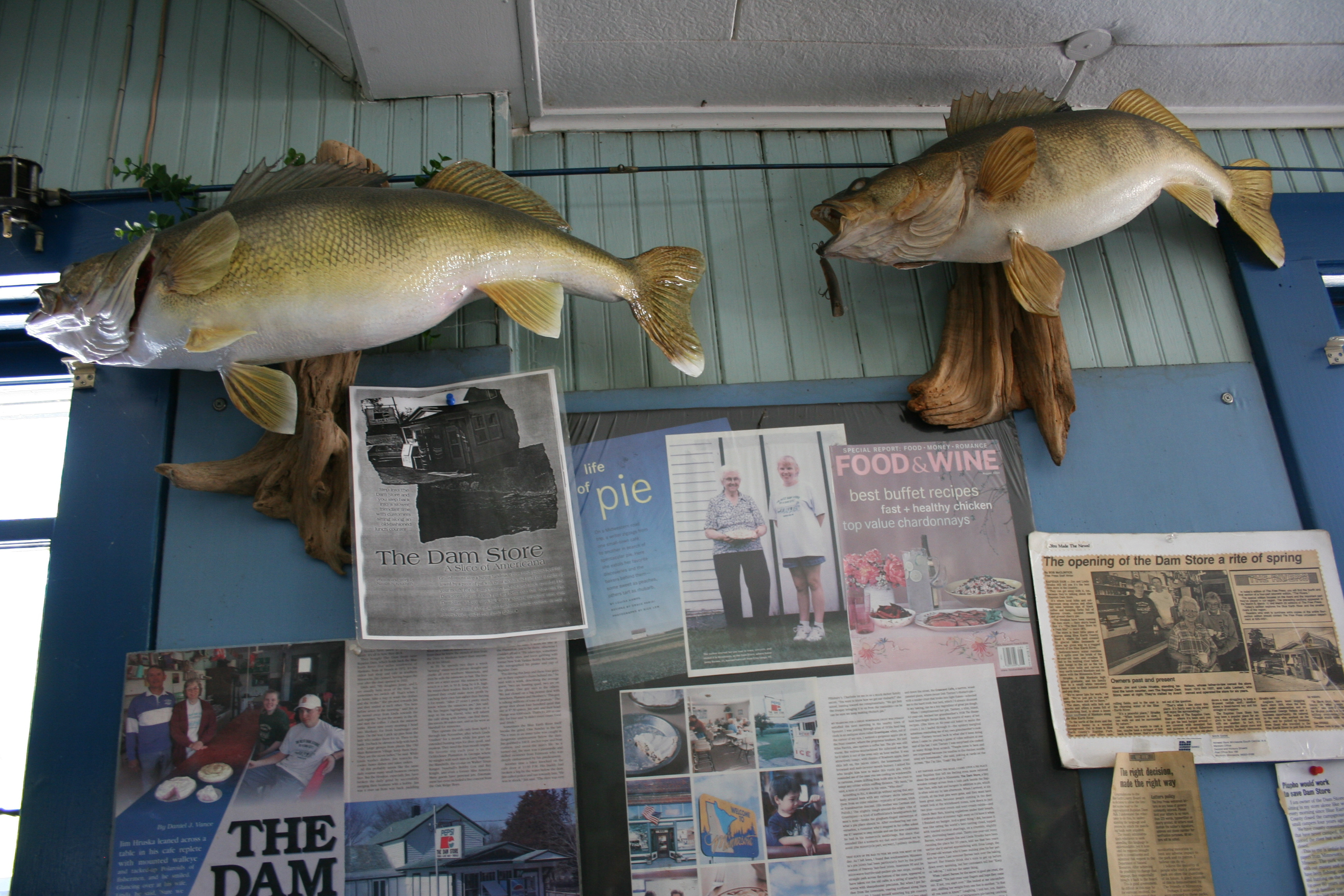
The Dam Store has been written about often as shown in this wall of feature stories. (Minnesota Prairie Roots copyrighted photo 2010)

The Dam Store sits a short distance away, close enough that it could possibly be overcome by floodwaters. At least that’s my non-professional opinion. And if that worries me, I can only imagine how the family feels.

Delicious burger and fries. (Minnesota Prairie Roots copyrighted photo 2010)
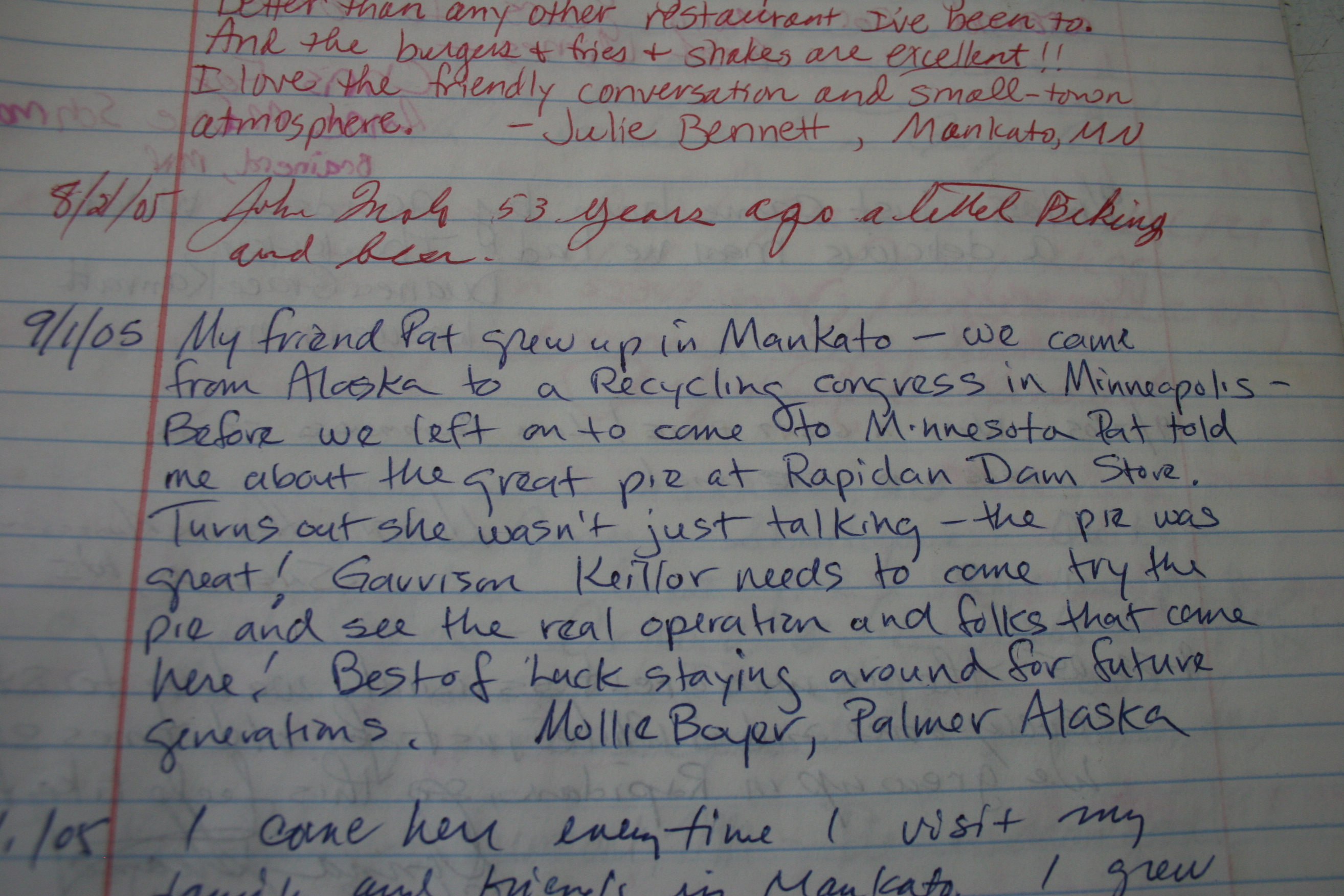
Notebooks full of praise for The Dam Store. (Minnesota Prairie Roots copyrighted photo 2010)
Homemade rhubarb pie. The Dam Store is known for its fruit and cream pies. (Minnesota Prairie Roots copyrighted photo 2010)

This place is a treasure. A destination. A slice of Americana run by folks who care deeply about their customers. People rave about The Dam Store. I read that in comments filling a notebook when I was there back in 2010. I feel the same. To dine here is an experience, a step back in time to days when life seemed simpler.

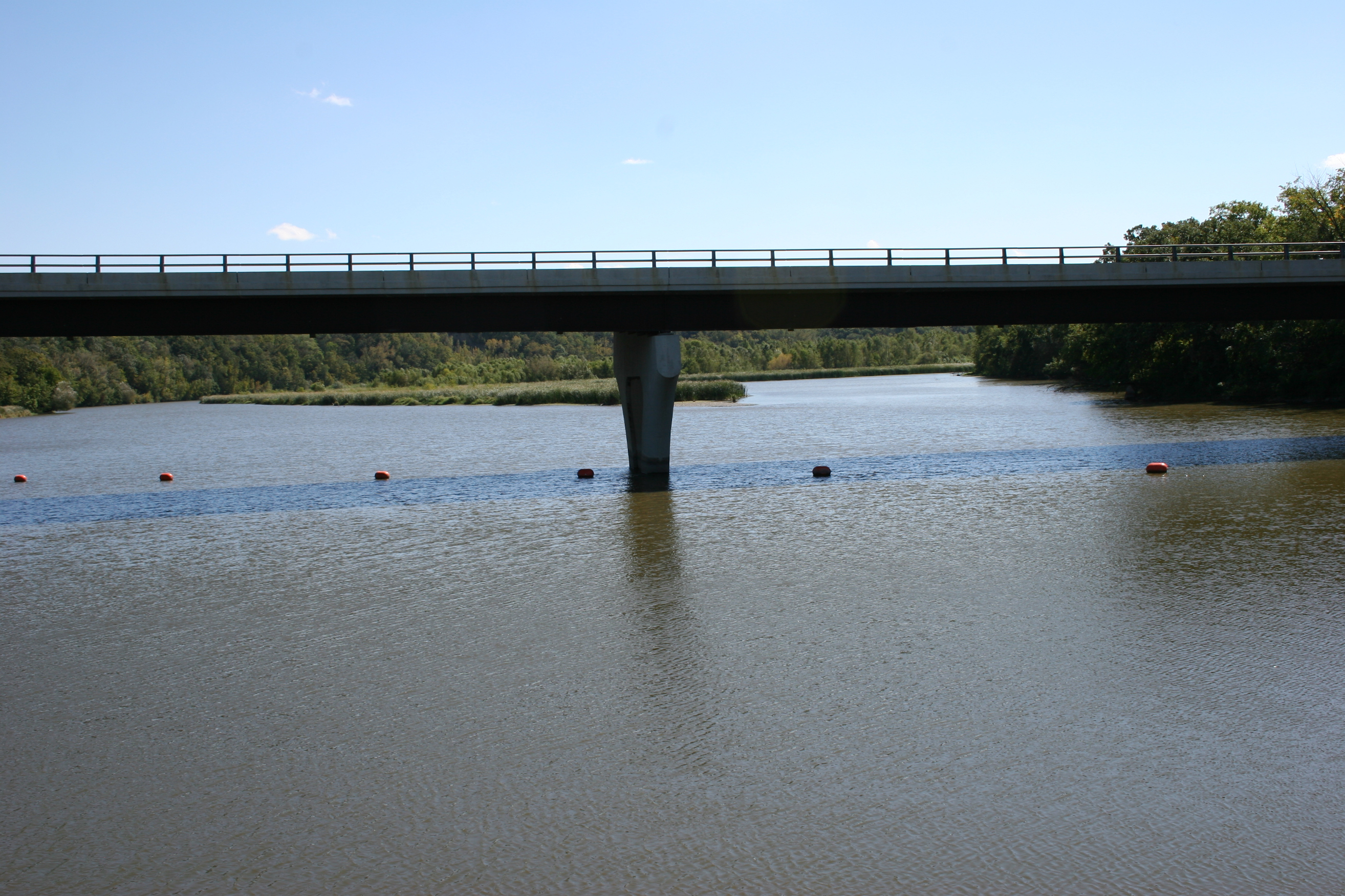
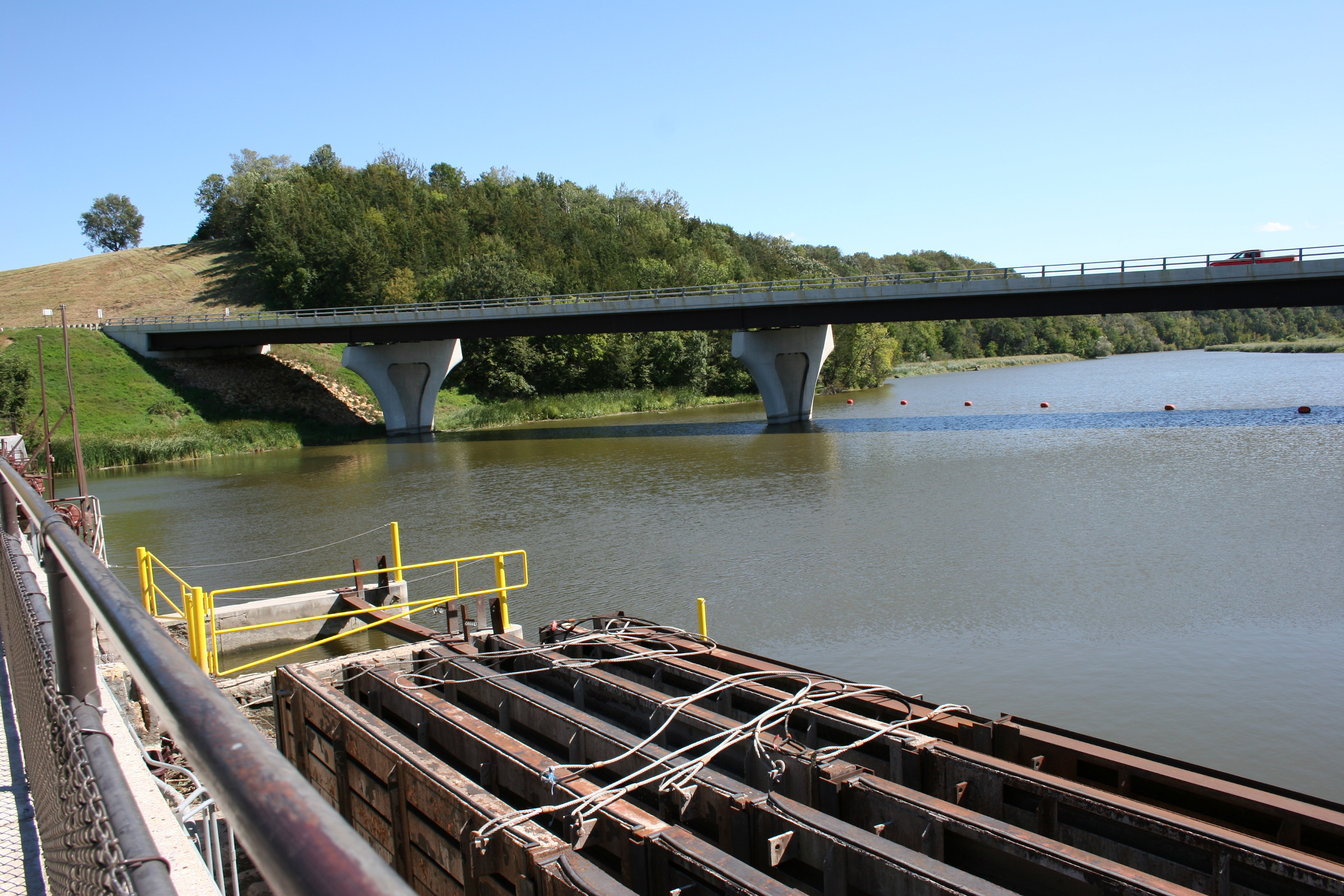
Public officials are now concerned about the integrity of this bridge as the river is no longer flowing over the Rapidan Dam but cutting a path to the west. This 2010 photo shows a low, calm river. (Minnesota Prairie Roots copyrighted photo 2010)
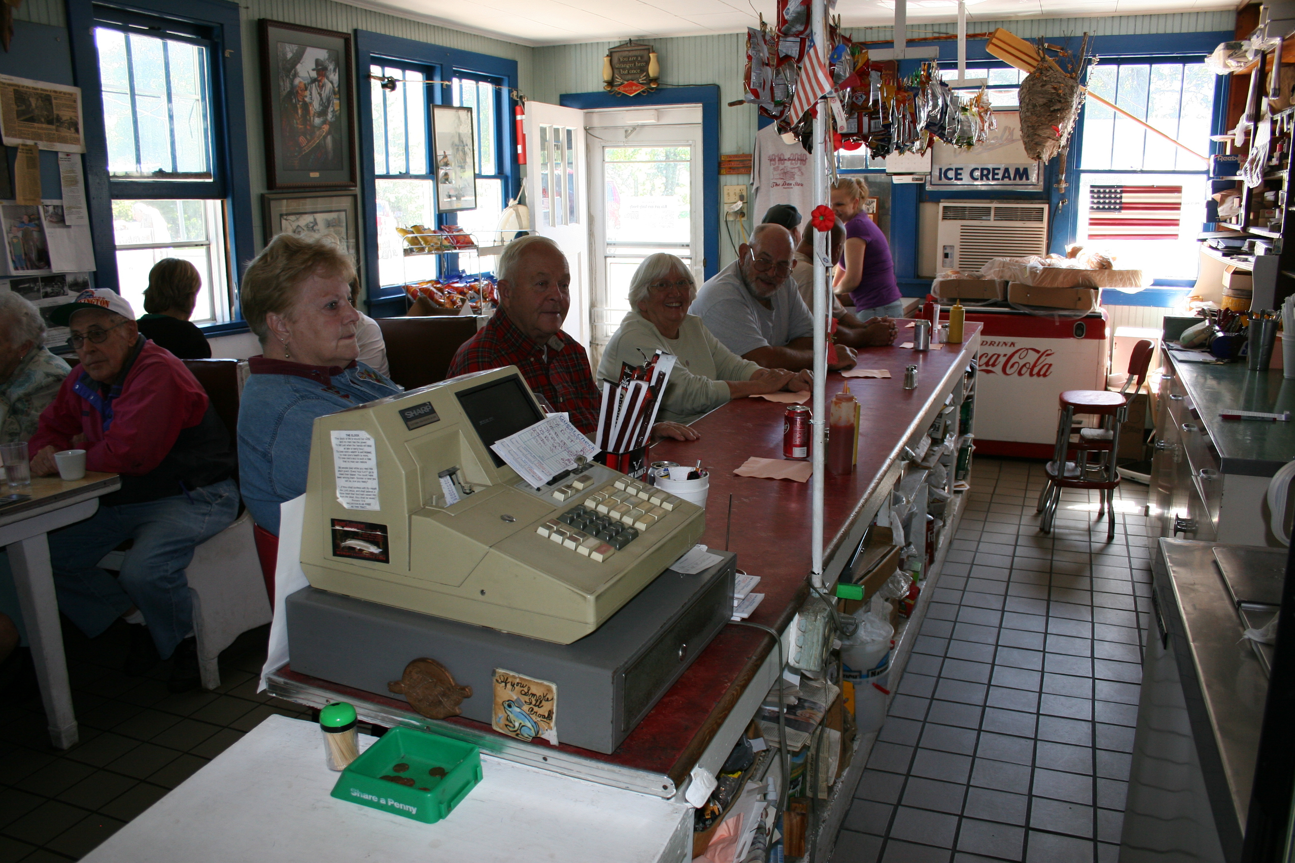
The Dam Store was packed with diners during my 2010 stop. (Minnesota Prairie Roots copyrighted photo 2010)
The dam, built in 1908-1910, is 475 feet wide and measures 87 feet from the top to the streambed. This 2010 image shows a section of the dam and the nearby bridge, now in jeopardy due to river bank erosion by floodwaters. (Minnesota Prairie Roots copyrighted photo 2010)

The scene unfolding today in Rapidan is decidedly one of concern and watchfulness. And for many, one of hope. Hope that The Dam Store will remain standing, untouched by floodwaters. The building has been there since 1910, the eatery in the Hruska family for more than 50 years. This is their history, their life, their livelihood. Their home. Their place.

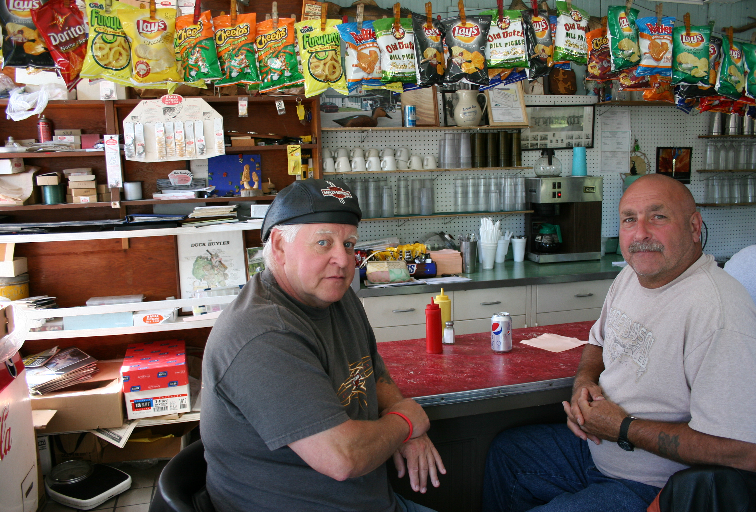
The main dining area of The Dam Store with booths and lunch counter. (Minnesota Prairie Roots copyrighted photo 2010)

The Rapidan Heritage Society has established a relief fund for the Hruska family with donations accepted at MinnStar Bank offices in Mankato and Lake Crystal. Click here for more information.

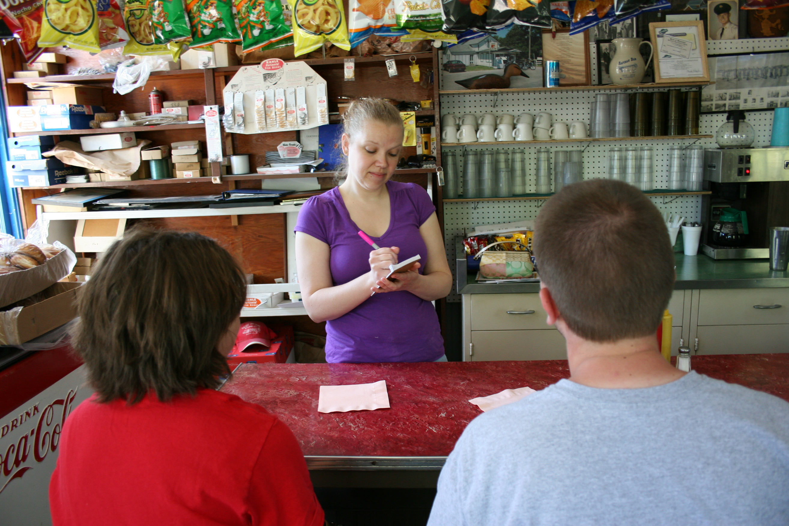
These guys ordered burgers at the lunch counter. (Minnesota Prairie Roots copyrighted photo 2010)

Now, until The Dam Store reopens—and I’m being optimistic that this will all turn out OK—enjoy these photos taken in 2010. I think you’ll understand why this place is so popular, so loved.

© Copyright 2024 Audrey Kletscher Helbling

 

From city to countryside, flooding continues to affect Faribault area & beyond June 24, 2024

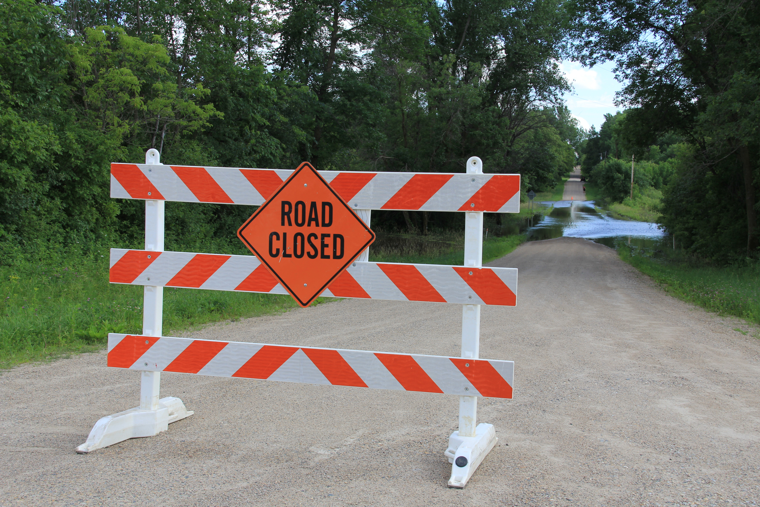
Roads are closed throughout the area due to flooding. Here a barricade blocks Dahle Avenue at its intersection with 220th Street East along the Straight River east of Faribault late Sunday afternoon. (Minnesota Prairie Roots copyrighted photo June 23, 2024)

NEARLY TWO DOZEN city streets, county highways and township roads remain closed throughout Rice County due to floodwaters. The number seems unprecedented. Closures include several streets in Faribault along the Cannon and Straight Rivers. More rain is possible later today. Exactly what we don’t need. However, Faribault city officials noted both rivers began to drop Monday morning.

A couple checks out flooded Dahle Avenue. (Minnesota Prairie Roots copyrighted photo June 23, 2024)

As inconvenient as these road closures may be, especially to locals, it’s nothing compared to the flooding of businesses, homes, campgrounds and more, especially in neighboring Waterville. The small town draws lake-lovers to summer cabins and campgrounds with tourism an important part of the local economy.

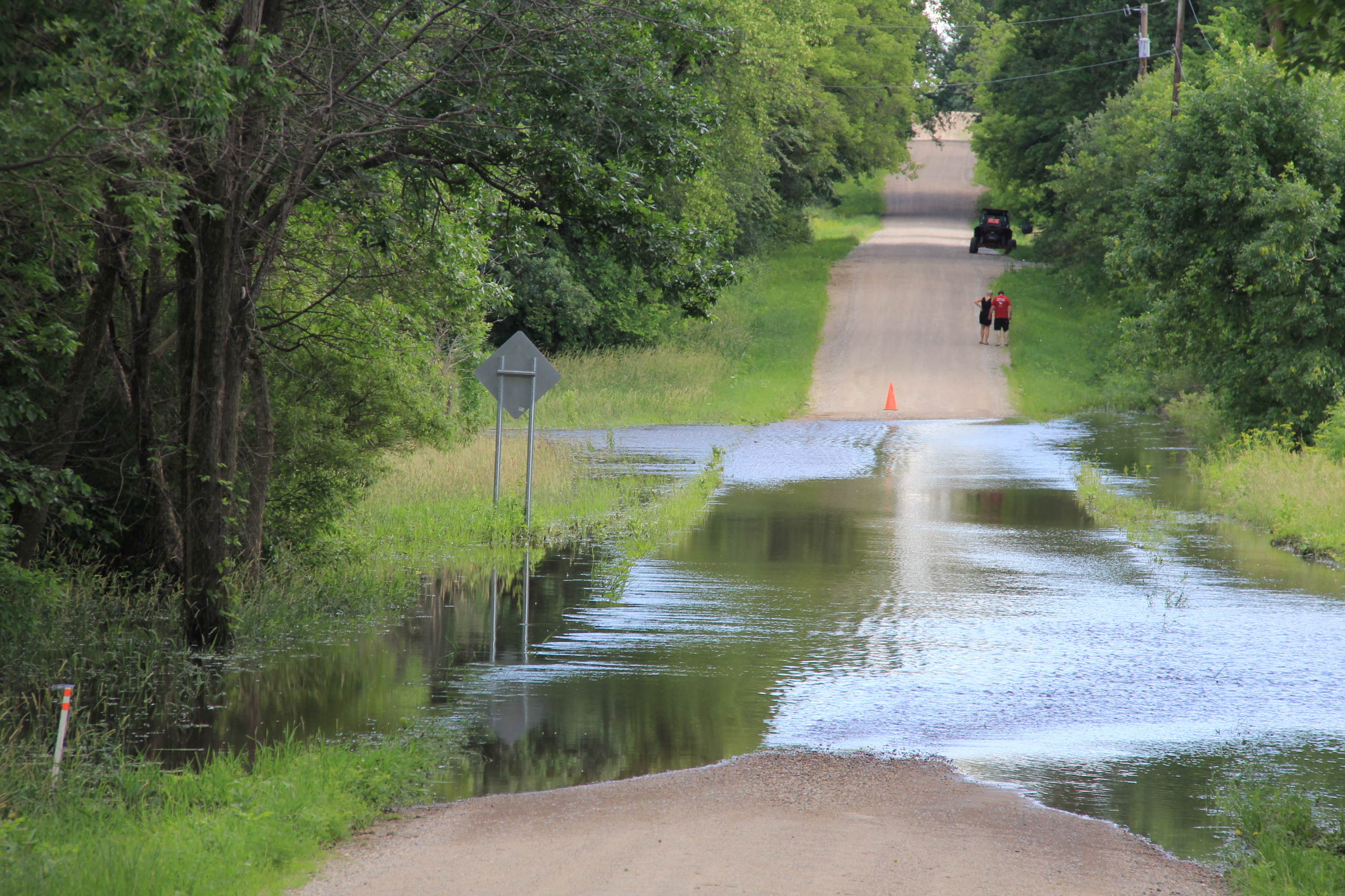
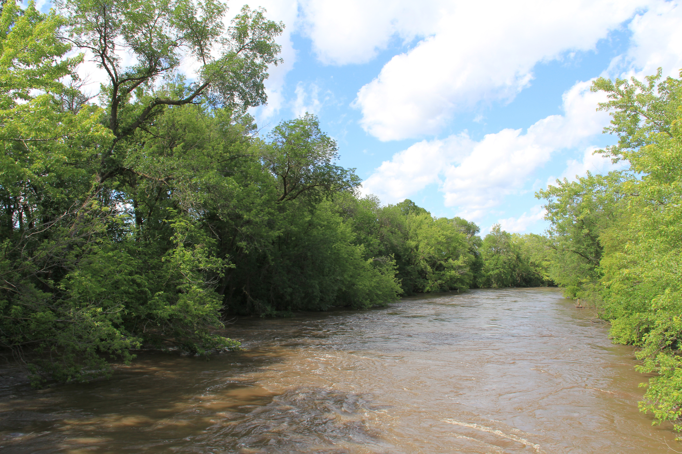
The muddy, fast-moving Straight River, photographed late Sunday afternoon from a bridge on 220th Street East, east of Faribault. (Minnesota Prairie Roots copyrighted photo June 23, 2024)

Other small towns, like Morristown and Warsaw, have also been impacted by the rising Cannon River. That water (and water from the Straight River) eventually ends up in Faribault and then Northfield and other places along the river and its watershed. In Faribault, public safety officials are keeping a close eye on the King Mill Dam, over which the Cannon flows. I’ve not seen that area, which is now barricaded to motor vehicle and foot traffic, and wisely so. The dam is a popular fishing spot. The road past the dam is also a busy traffic route, a connection to Minnesota State Highway 60.

Rounding 195th Street West, a flooded cornfield, photographed northwest of Faribault late Friday morning. (Minnesota Prairie Roots copyrighted photo June 21, 2024)

Out in the countryside, too much rain has drowned corn and soybean crops, turning fields into lakes. I feel for the farmers, who depend on a good crop for their livelihood. It’s too late in Minnesota’s short growing season to replant. Crop insurance will cover some of their losses.

Excessive rain flooded this cornfield, transforming it from farmland to lake. Photographed late Friday morning along 195th Street West. (Minnesota Prairie Roots copyrighted photo June 21, 2024)

Rice County has a diverse topography of flat lands and rolling hills, plus differing soil types and drainage systems. Those, and rainfall amounts, affect whether a farm field floods. The entire county has experienced substantial rains. Just last Friday afternoon and into Saturday morning, we measured 3.1 inches of rain in our gauge. The day prior, 1.75 inches. Ten inches of rain fell here in eight days. Too much.

A flooded cornfield along 195th Street West, photographed Friday morning. (Minnesota Prairie Roots copyrighted photo June 21, 2024)
Ducks swim in the cornfield turned lake late Friday morning along 195th Street West. (Minnesota Prairie Roots copyrighted photo June 21, 2024)

Ask any farmer, and he/she can likely give you rainfall totals. I saw some of that rainwater on Friday morning while on a short drive along backroads northwest of Faribault. And that was before Friday’s three-inch rainfall.

A bit down the road, more flooding in the rolling terrain along Fairbanks Avenue northwest of Faribault, photographed late Friday morning. (Minnesota Prairie Roots copyrighted photo June 21, 2024)

On Sunday afternoon, most fields in the area I traveled were not flooded, but at least one township gravel road along the Straight River was flooded and barricaded. I expect if I expanded my tour, I’d see a whole lot more road closures and flooded fields. (Click here for a list of roadways that are closed in Rice County.)

Public officials are warning people to heed warning signs (like this one on Dahle Avenue) and stay out of flooded areas due to the dangers of swift-moving, high water. (Minnesota Prairie Roots copyrighted photo June 23, 2024)

In the all of this, there’s nothing we can do to control the weather. We can only prepare and then deal with whatever comes. Those, of course, are just words, not really helpful to anyone dealing with flooded fields, flooded roads, flooded homes, flooded businesses, flooded campers, flooded parks, flooded…

© Copyright 2024 Audrey Kletscher Helbling
 

Flooding in Faribault: A photo essay June 23, 2024

Friday evening the Cannon River was well above flood stage at the dam by the entrance to North Alexander Park. More rain overnight into Saturday raised the river level even higher. (Minnesota Prairie Roots copyrighted photo June 21, 2024)

NEARLY 10 INCHES OF RAIN fell in the past eight days at my Faribault home, half of that in the last three days. The significant rainfall not only in my community, but throughout southern Minnesota, has resulted in flooding as rivers swell and overflow their banks.

The same dam scene Saturday morning. (Minnesota Prairie Roots copyrighted photo June 22, 2024)
By Saturday morning, the Cannon encroached on even more land and the river rose higher under the Second Avenue bridge by the entrance to North Alexander Park. (Minnesota Prairie Roots copyrighted photo June 22, 2024)
This churning water at the dam shows the power of the river. (Minnesota Prairie Roots copyrighted photo June 21, 2024)

Minnesota Governor Tim Walz declared a peacetime emergency authorizing the National Guard to assist and support with emergency flood operations as needed. Faribault Mayor Kevin Voracek has declared a local emergency as my city deals with flooding. In nearby hard-hit Waterville, some residents have been evacuated. Mankato has also experienced significant flooding.

A police cruiser is parked Saturday morning under the historic viaduct near Teepee Tonka Park, an area prone to flooding. By Saturday evening, the Straight River had flooded even more of the park and surrounding land. (Minnesota Prairie Roots copyrighted photo June 22, 2024)

A chunk of south central Minnesota, including Faribault and other areas of Rice County, plus portions of Le Sueur, Steele and Waseca counties, remain in a flood warning until 10 a.m. Monday.

Teepee Tonka Park in Faribault, along the Straight River, was completely flooded Saturday morning. By evening, floodwaters crept onto the bridge. (Minnesota Prairie Roots copyrighted photo June 22, 2024)
Saturday morning the bridge at Teepee Tonka Park was open to pedestrians with a police officer stationed there. By evening, the bridge was cordoned off. (Minnesota Prairie Roots copyrighted photo June 22, 2024)
A Faribault police officer chats with the public and monitors the Straight River on the bridge into Teepee Tonka Park Saturday morning. (Minnesota Prairie Roots copyrighted photo June 22, 2024)

It’s a lot—this flooding of homes and businesses, city parks and railroad tracks, parking lots and roadways, cropland… A few blocks from my home, Xcel Energy crews are monitoring an electrical substation surrounded by water from the overflowing Straight River.

Floodwaters surround this warning sign by the Woolen Mill Dam. (Minnesota Prairie Roots copyrighted photo June 21, 2024)
A fire department truck stops on the Second Avenue bridge over the Cannon River on Friday evening as emergency personnel keep an eye on the rising river. (Minnesota Prairie Roots copyrighted photo June 21, 2024)
Police tape along the Cannon River by North Alexander Park is in place to keep people away from the roiling river. Friday evening the river nearly touched the bottom of the bridge. (Minnesota Prairie Roots copyrighted photo June 21, 2024)

I arrived home from church late this morning to automated messages from the 911 emergency system. One issued a cautionary warning from public safety officials to honor barricades by not walking or driving around them. Ignoring such signage in flooded areas will result in a citation from law enforcement.

Watching the swift-moving Cannon River from behind police tape Friday evening near the historic Faribault Mill. (Minnesota Prairie Roots copyrighted photo June 21, 2024)
Tree debris floats down the Cannon on Friday evening. (Minnesota Prairie Roots copyrighted photo June 21, 2024)
There’s a dam here, unseen as the Cannon River floods. (Minnesota Prairie Roots copyrighted photo June 21, 2024)

For the most part, I observed people being careful around floodwaters in Faribault while I was out on Friday evening and then again Saturday morning. The areas I accessed and photographed in that time frame have since been closed to the public, a smart move given the power of the river and the sheer volume of people checking things out. We are all naturally drawn to see for ourselves that which is unfolding in our backyard.

A car sits submerged in the parking lot of Two Rivers Health Center by Two Rivers Park on Saturday morning. (Minnesota Prairie Roots copyrighted file photo June 22, 2024)

Two rivers—the Cannon and the Straight—run through Faribault, converging at Two Rivers Park. Near that park, a car sat submerged Saturday morning in a parking lot. I’ve seen other vehicles sitting in floodwaters at the new riverside Straight River Apartments.

Along the Straight River on Third Avenue Northeast, floodwaters fill a backyard which, ironically, includes a boat. (Minnesota Prairie Roots copyrighted photo June 22, 2024)

Yet, as difficult as this flood event has been, it does not match the Faribault floods of 2010, 2014 and 2016, at least not from my recollection. Still, any flood is challenging.

Along the Straight River, a section of railroad tracks flooded. The Depot Bar & Grill patio is on the left. (Minnesota Prairie Roots copyrighted photo June 22, 2024)

For those affected, there’s clean-up and paperwork and unexpected expenses. Emergencies like this often bring out the best in people, as a community comes together. At the local government level, I expect emergency personnel have been working overtime. The Rice County Landfill, rural Dundas, opens at 7:30 a.m. Monday to begin accepting flood-contaminated materials.

Below the historic viaduct, the Straight River overflows its banks Saturday morning. By evening, it had risen even more. (Minnesota Prairie Roots copyrighted photo June 22, 2024)

I am fortunate. There’s no flooding in my home or yard. But I know others are struggling. I hope that in Sunday’s sunshine—finally, a day without rain—they feel a sense of hope. Floodwaters will recede. And life will, eventually, return to normal.

Walking along the Cannon River by the dam Friday evening, before the river flooded even more. (Minnesota Prairie Roots copyrighted photo June 21, 2024)

FYI: Click here to view my photo essay about flooding in neighboring Northfield. And watch for another post from Faribault about my riverside wildlife observations.

All photos in this post were taken Friday evening, June 21, and Saturday morning, June 22.

© Copyright 2024 Audrey Kletscher Helbling
 

Flooding in Northfield: a photo essay June 22, 2024

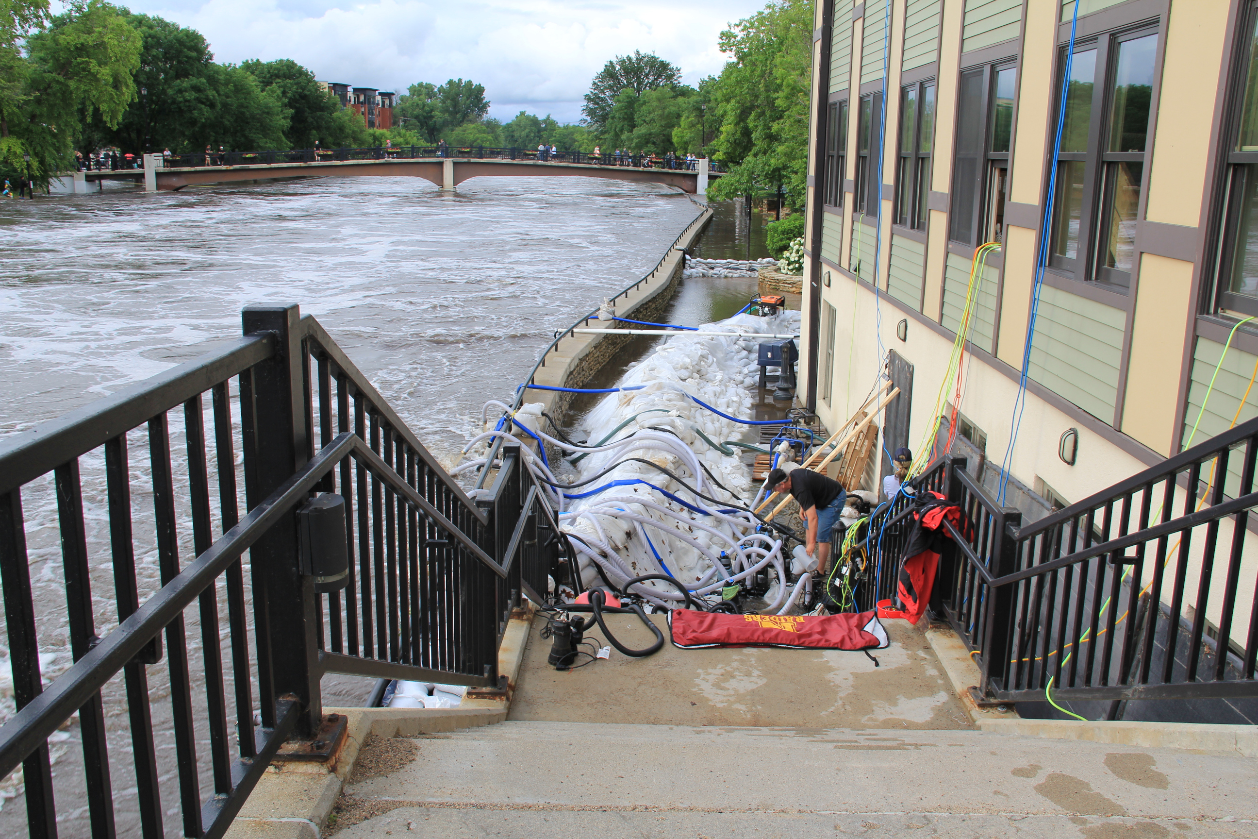
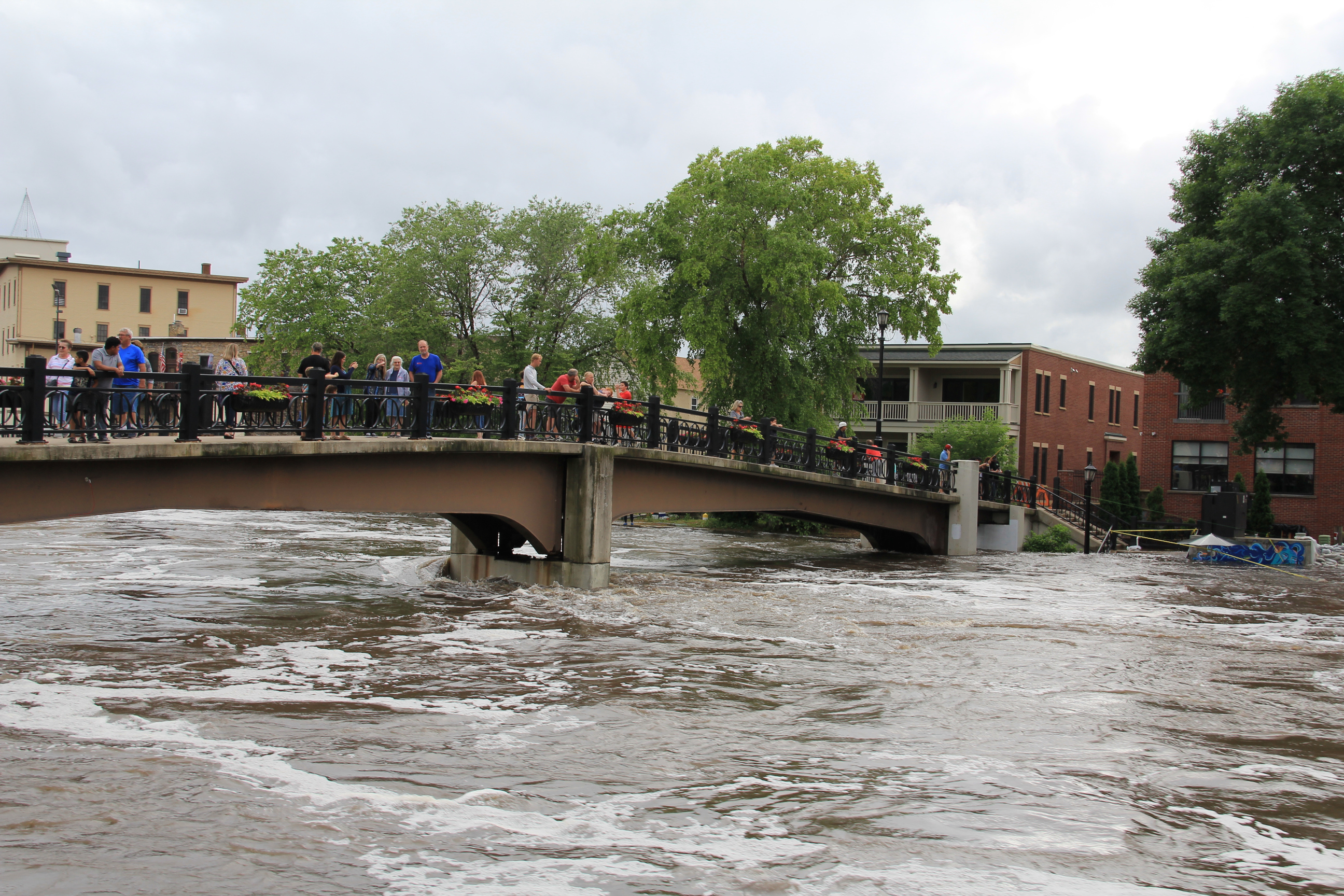
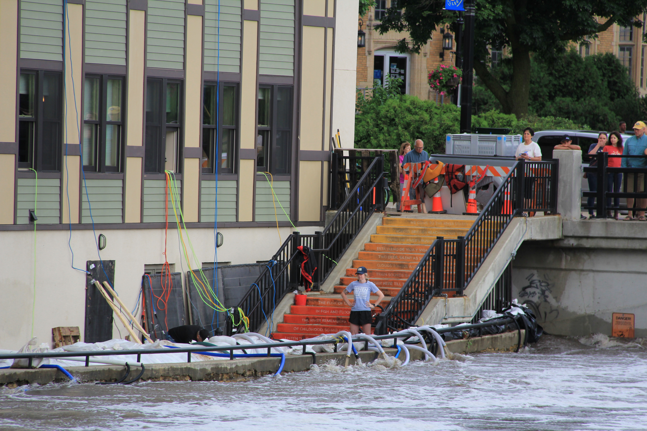
A crew works to protect the Carlson Capital Management building along the east bank of the Cannon River. This is by the “Poem Steps” leading to the Riverwalk, now flooded. (Minnesota Prairie Roots copyrighted photo June 22, 2024)

MANY AREAS OF SOUTHERN MINNESOTA, including my county of Rice, have been inundated with torrential rain during the past week. That’s led to flooding of rivers and property and to road closures. Like so many others, I’ve been out and about observing, taking photos.

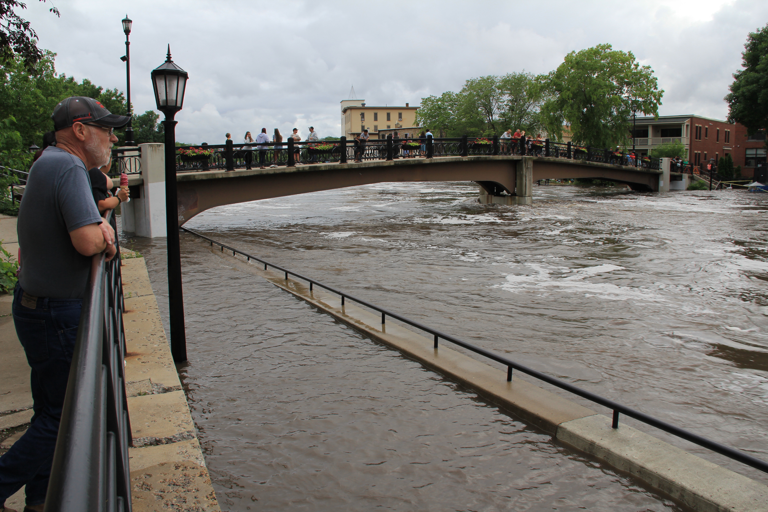
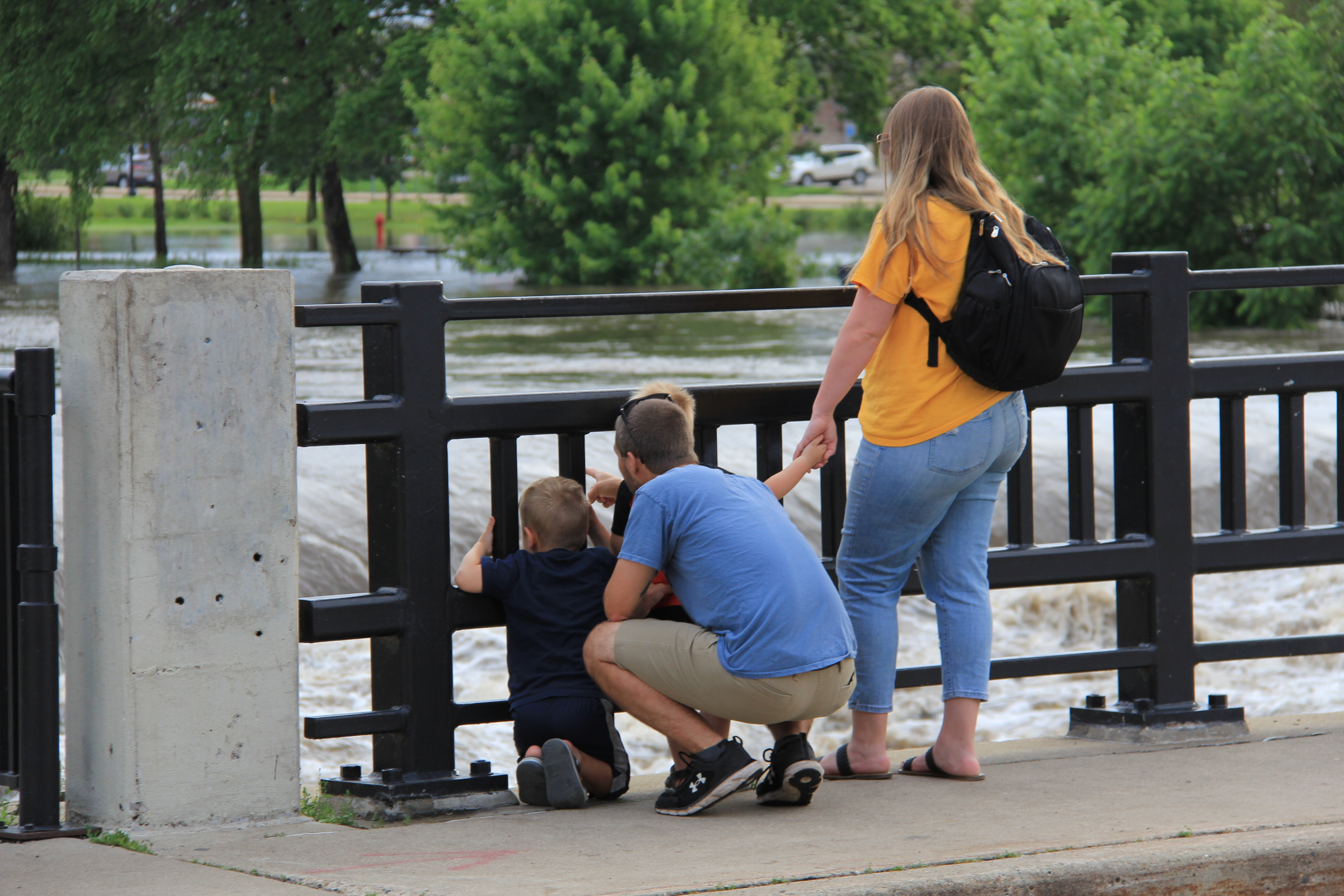
People gather on the pedestrian bridge and along a sidewalk above the Riverwalk to see flooding along the Cannon River. (Minnesota Prairie Roots copyrighted photo June 22, 2024)

Saturday evening, on our way home from visiting family in Lakeville, Randy and I drove through Northfield and stopped to walk along the Cannon River. The river runs through the heart of this historic downtown, which features a waterside river walk.

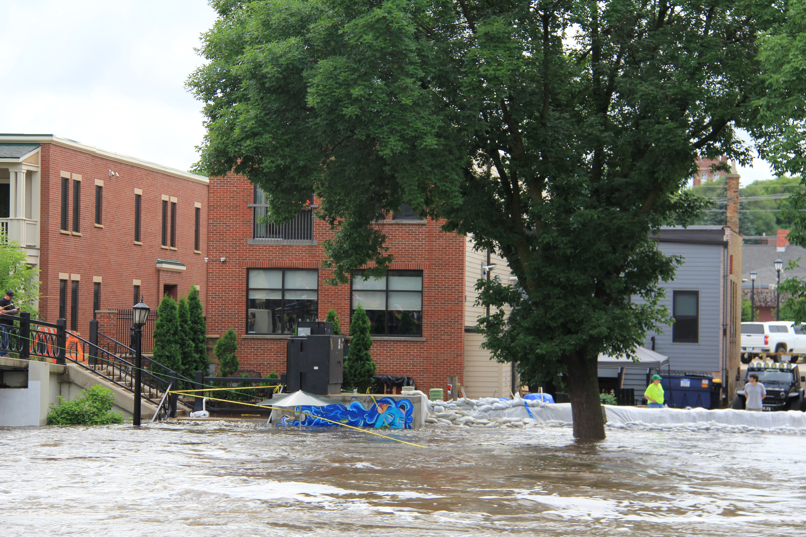
Flooding and sandbagging along the west bank of the Cannon near the Lady Cannon mural.
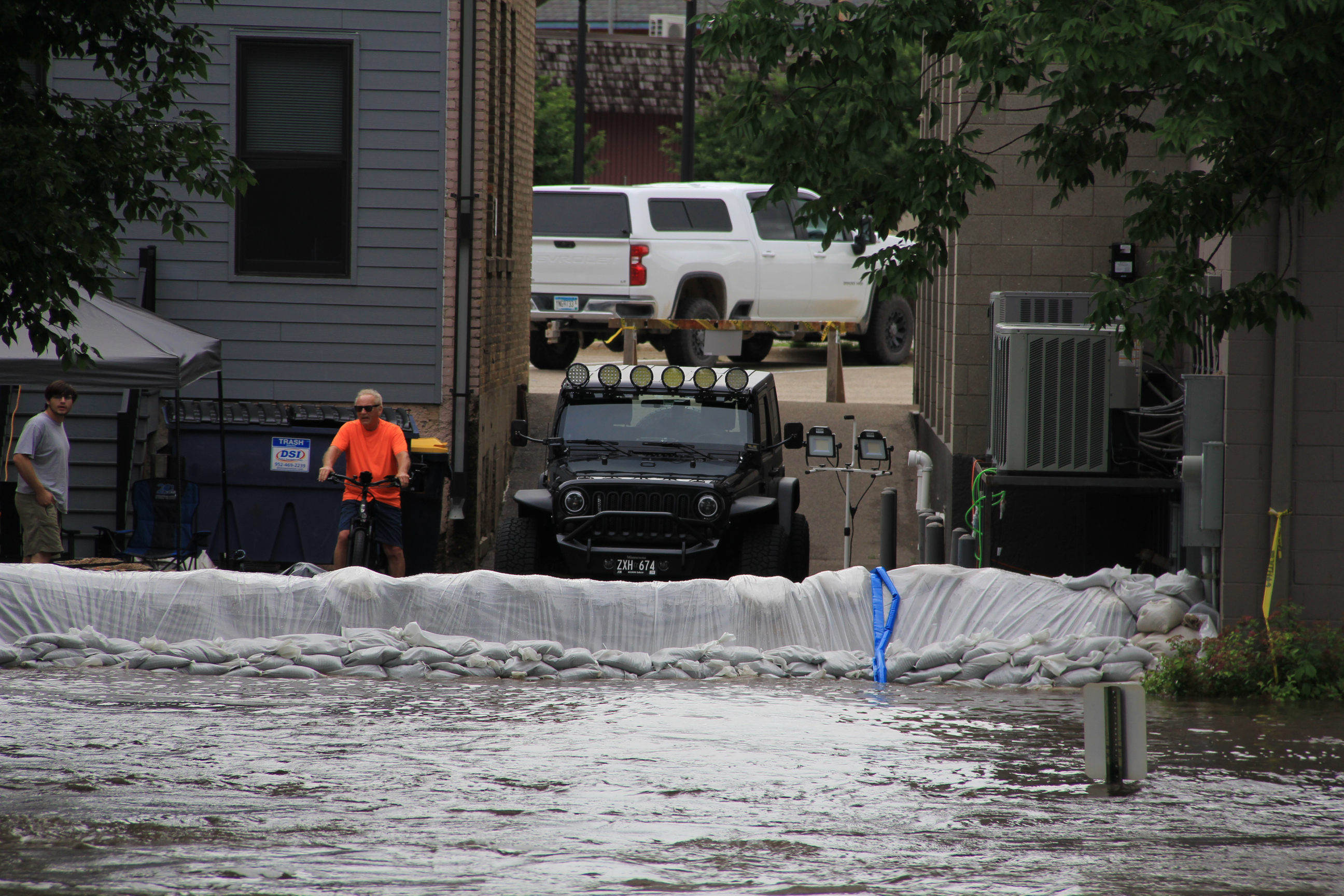
Sandbag wall on the west side of the river. (Minnesota Prairie Roots copyrighted photo June 22, 2024)
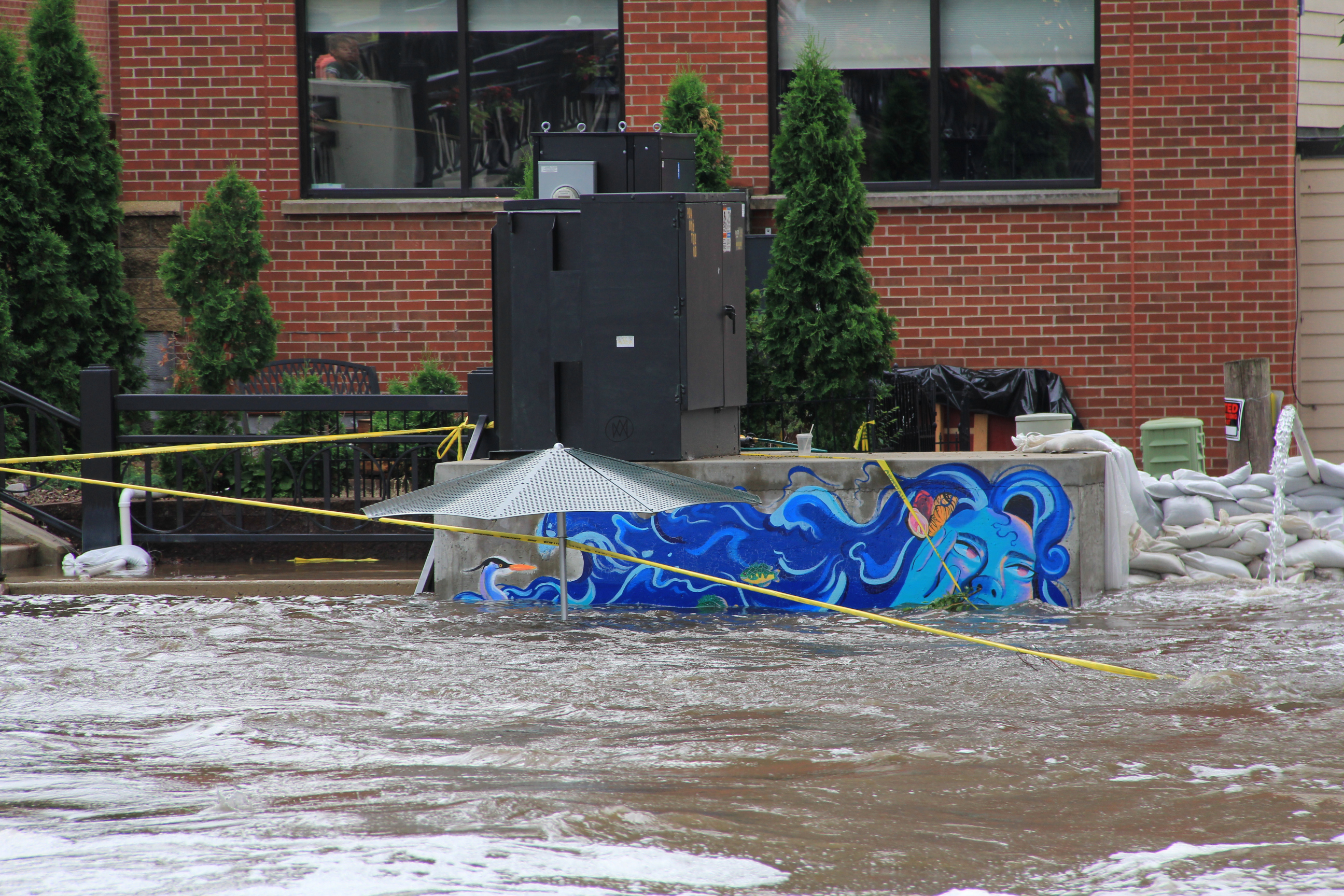
Lady Cannon is nearly swimming in the river. (Minnesota Prairie Roots copyrighted photo June 22, 2024)

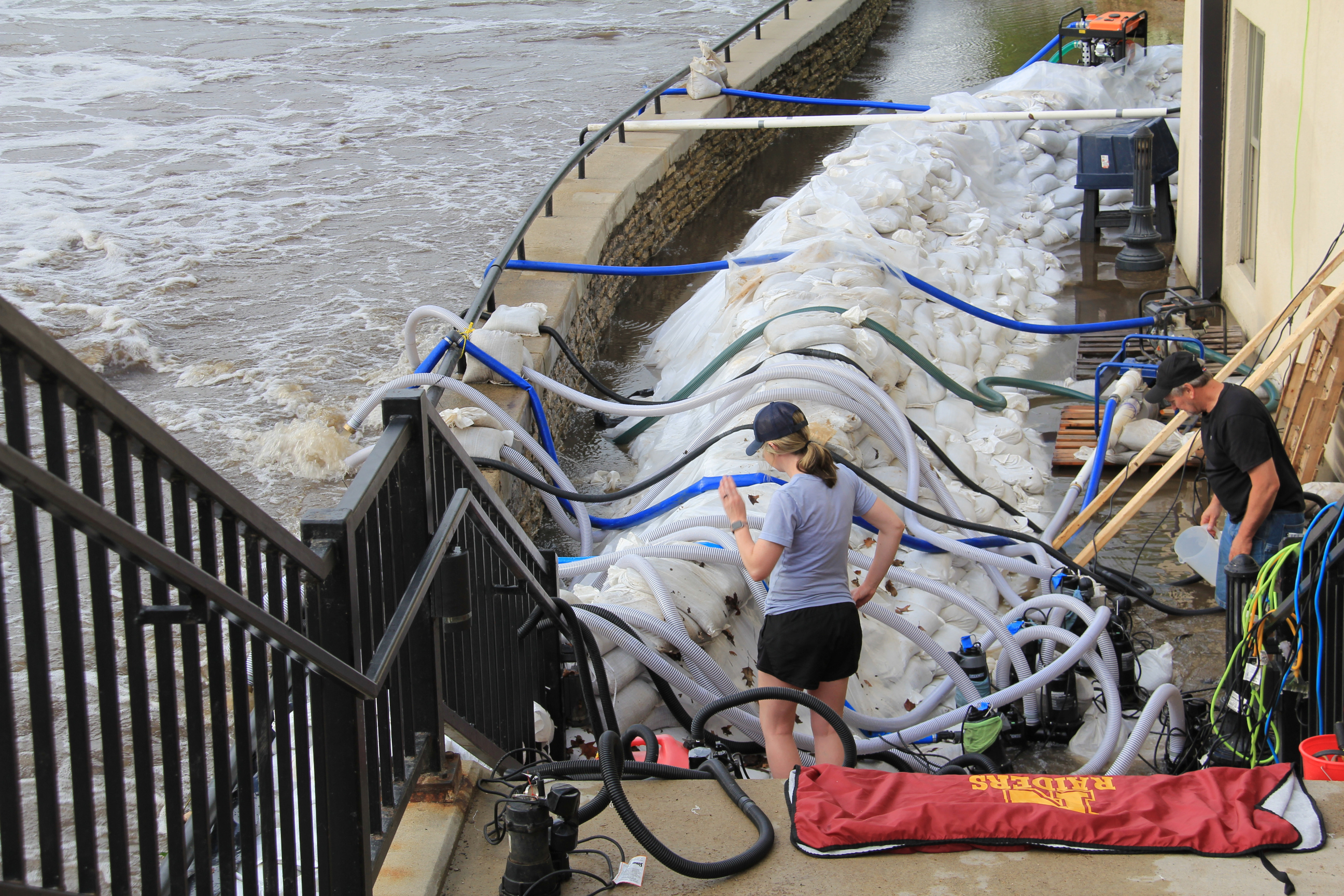
The Cannon has spilled over its banks, flooding the river walk and adjacent land and threatening buildings at water’s edge. Sandbags are in place. Pumping is underway.

People line the pedestrian bridge across the Cannon for a wide perspective of the river and the flooding. (Minnesota Prairie Roots copyrighted photo June 22, 2024)
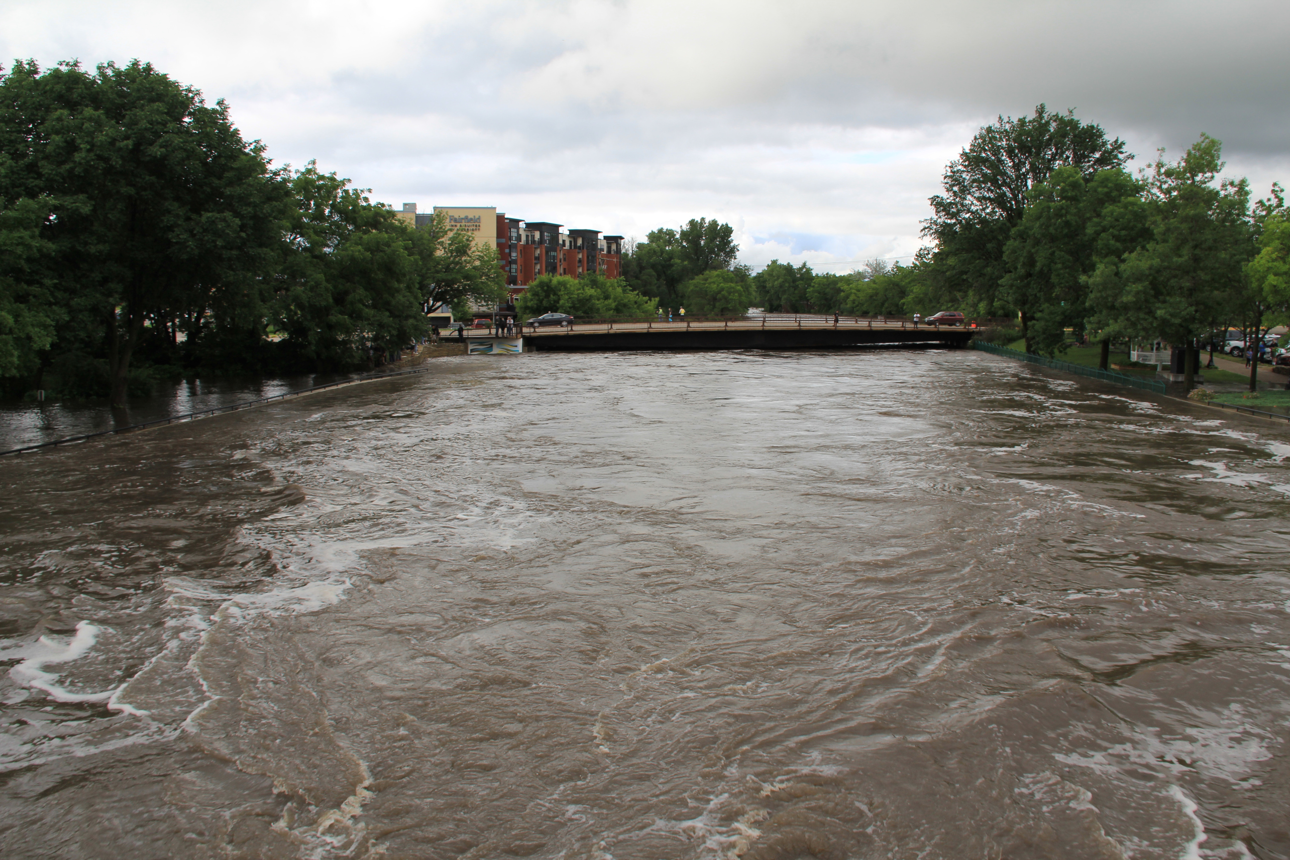
Looking north from the pedestrian bridge to the Second Street/State Highway 19 bridge. (Minnesota Prairie Roots copyrighted photo June 22, 2024)
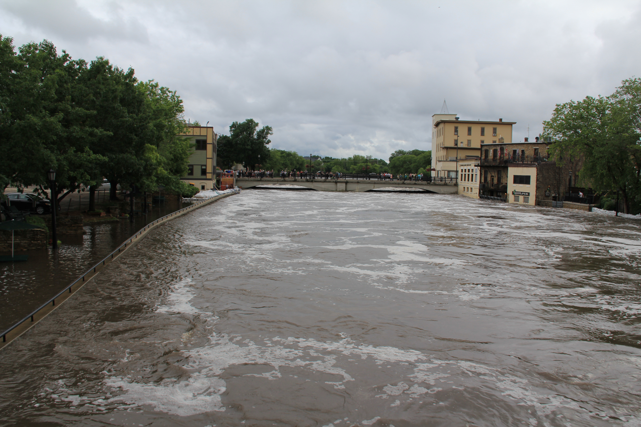
Looking south from the pedestrian bridge toward the Water Street bridge by the Ames Mill Dam. (Minnesota Prairie Roots copyrighted photo June 22, 2024)

And people are coming to the river by the hundreds to view its raging power. A pedestrian bridge high above the water offers a unique perspective.

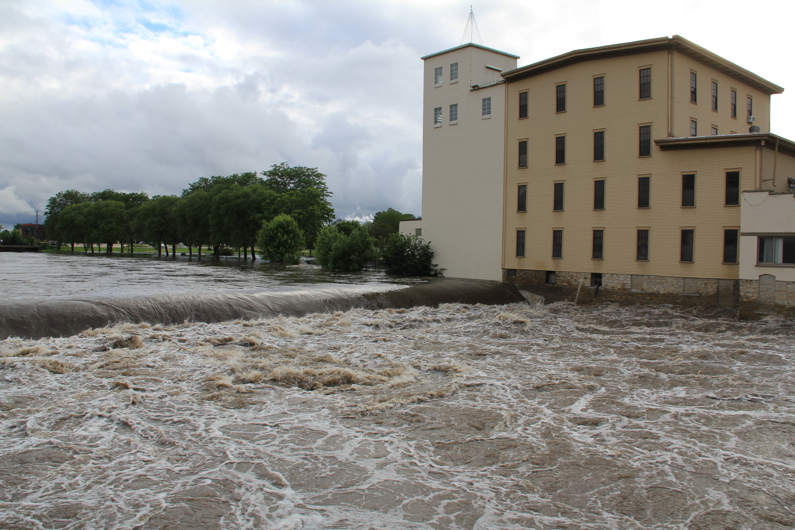
The dam is barely visible by the historic Ames Mill. (Minnesota Prairie Roots copyrighted photo June 22, 2024)
Among the many people viewing the river at the dam site. (Minnesota Prairie Roots copyrighted photo June 22, 2024)

And a bridge across the river by the historic Ames Mill provides a close-up view of the Cannon roaring over the dam.

Protecting Carlson Capital Management. (Minnesota Prairie Roots copyrighted photo June 22, 2024)
A maze of hoses channel water out of the Carlson building while sandbags protect it. (Minnesota Prairie Roots copyrighted photo June 2024)
Froggy Bottoms on the west bank floods whenever the river floods. A neon green poster on the building reads: “This Frog Swims Again.” (Minnesota Prairie Roots copyrighted photo June 22, 2024)

It is impressive, all of it. The nauseating movement of the water. The speed. The danger. The feeling of overwhelming respect and awe in the presence of such power.

Fitting words on the door of the Froggy Bottoms building. (Minnesota Prairie Roots copyrighted photo June 22, 2024)

This I felt as I took in the scene unfolding before me on a Saturday evening in Northfield.

A sandbag wall protects property along the west bank of the Cannon River. (Minnesota Prairie Roots copyrighted photo June 22, 2024)
A sandbagging station. (Minnesota Prairie Roots copyrighted photo June 22, 2024)
A line of sandbags protects property on the west bank of the Cannon. (Minnesota Prairie Roots copyrighted photo June 22, 2024)
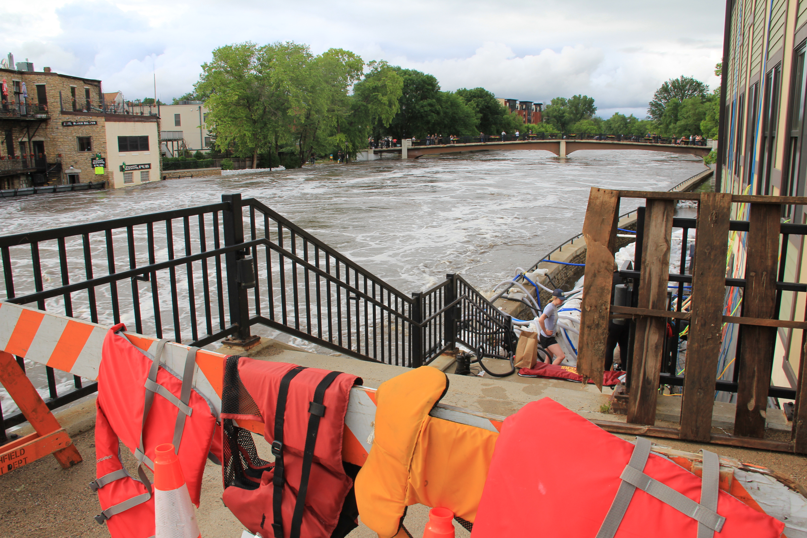
Life jackets drape a barricade blocking access to the flooded east side Riverwalk. Below, workers work to protect the Carlson building from the river. (Minnesota Prairie Roots copyrighted photo June 22, 2024)

NOTE: Check back tomorrow for flood photos from Faribault.

© Copyright 2024 Audrey Kletscher Helbling
 

Back in Redwood County after July flash floods July 9, 2018

Just six weeks ago, spring planting was underway in this same area of rural Minnesota. Minnesota Prairie Roots file photo May 2018.


DURING MY LAST TRIP to southwestern Minnesota in mid May, farmers worked the land. Tilling. Planting crops. Rushing to get seeds into the soil after a late spring start.

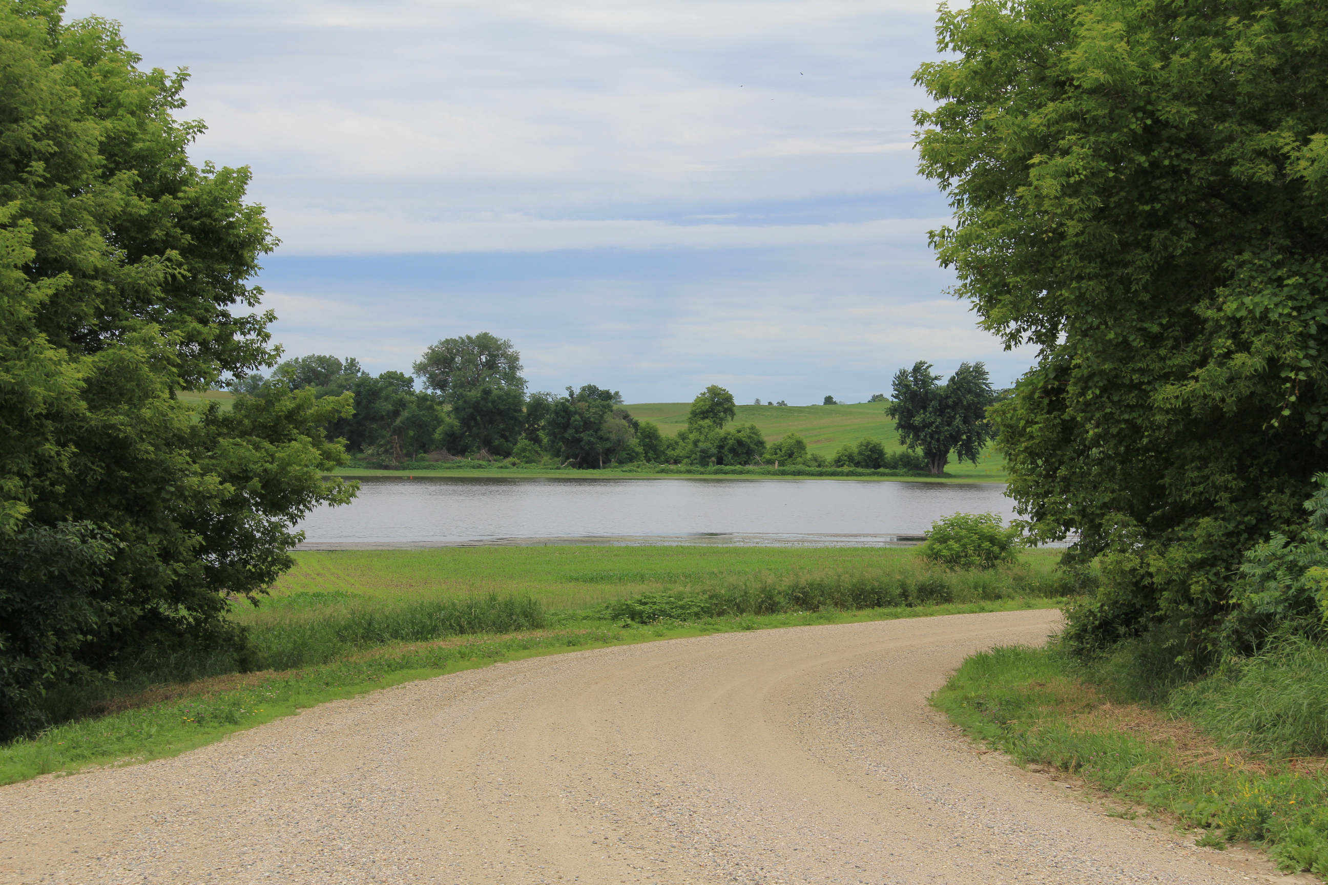
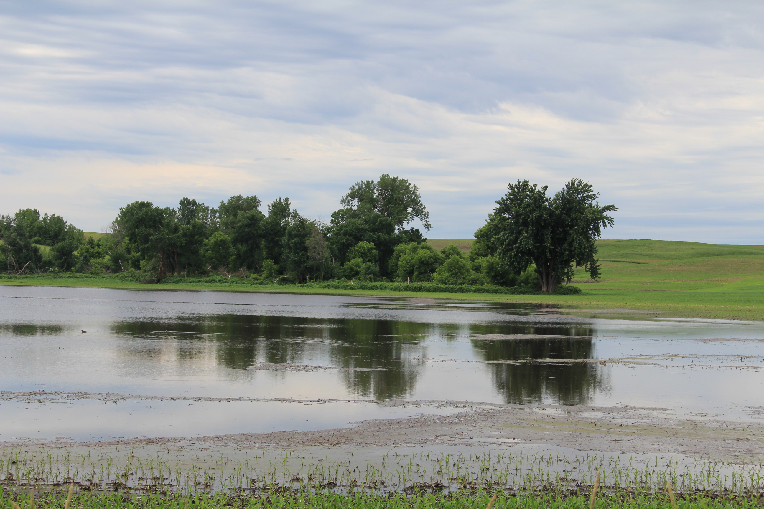
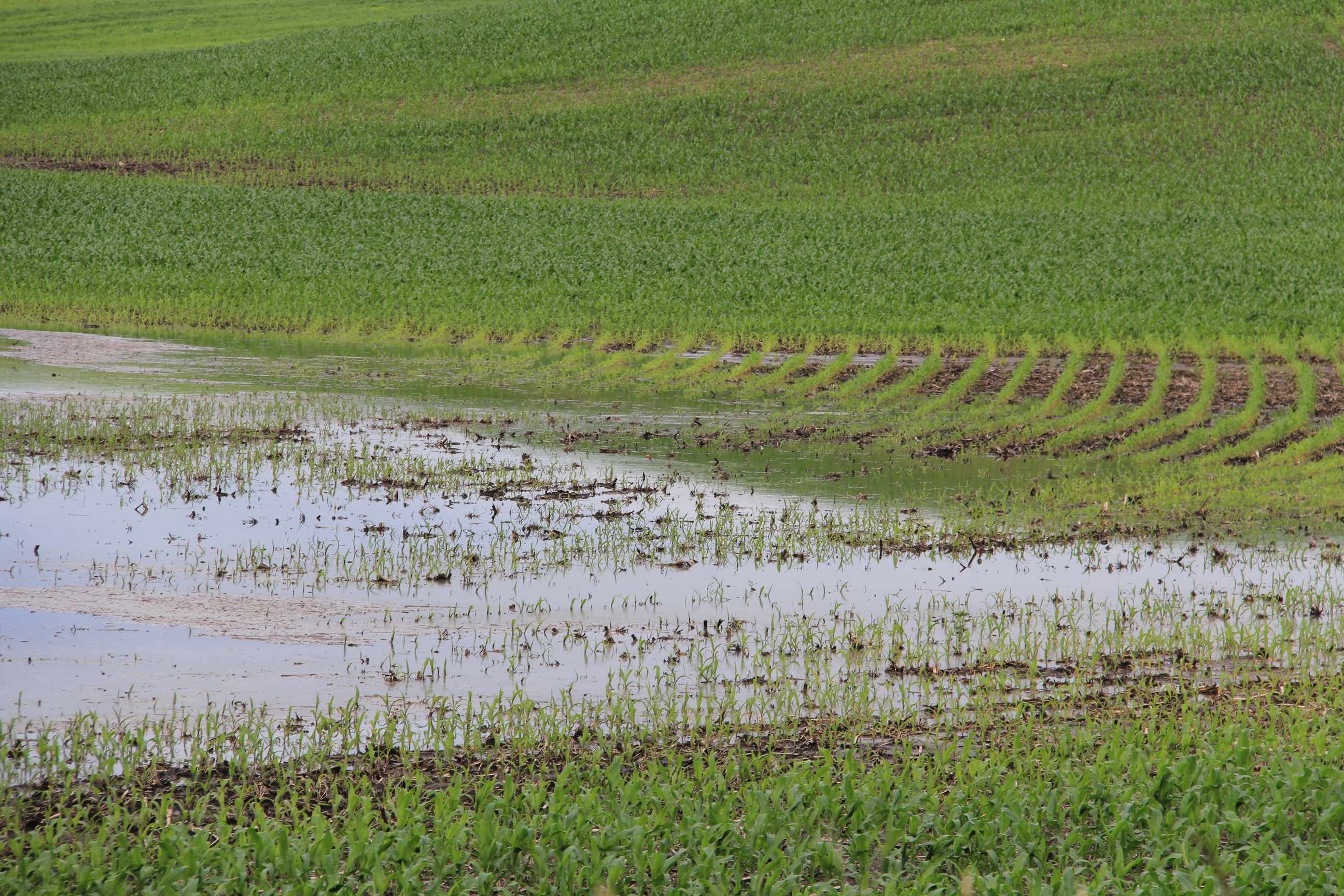
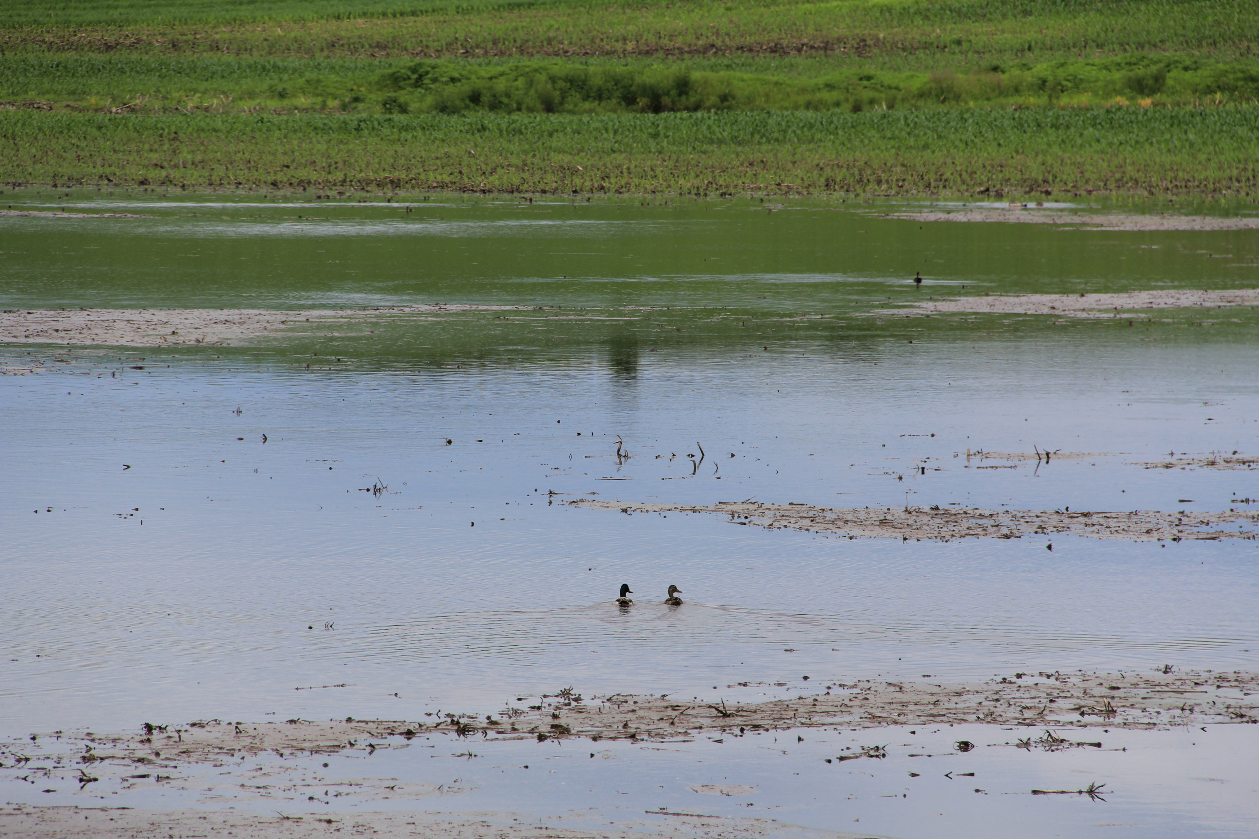
Now, some six weeks later, acres and acres of that same cropland lie under water, corn and soybean fields flooded by torrential rains. Flash floods that turned farm land into lakes early last week.

On our route west of Redwood Falls then north to Belview then later east of Belview along county roads back to Redwood, Randy and I observed lots of standing water. Massive lakes where crops should now thrive. It was disheartening to see the efforts and hopes of so many farmers gone. Flash, just like that. Weather is always the gamble of farming. I would never have the mental fortitude to farm. I admire those who do.

As we drove, I noted the wash of debris along shoulders, evidence that floodwaters overtook the county road. We drove a narrow ribbon of asphalt, water edging both sides of the roadway. Orange cones and orange flags flagged danger. An orange snow fence blocked a gravel road.

I understood that, days after the flash flood, we had not seen the worst of this devastating storm. But it was enough for me to gauge the significant loss to the farmers of my native Redwood County.

#

NOTE: My apologies for the lack of flood images. But I am under strict orders from my ortho surgeon not to use my left hand as I recover from surgery on my broken left wrist. “Use it,” he said, “and you will be back in the OR.” I’ll listen, thank you.

© copyright 2018 Audrey Kletscher Helbling
 

When torrential rains cause major flooding in my home region of southwestern Minnesota July 4, 2018

Minnesota Prairie Roots file photo.


HAPPY FOURTH OF JULY, my friends. I hope this finds you celebrating your freedom in a fun way.


The Redwood River, flooded over its banks, along Redwood County Road 10 heading south out of Vesta earlier this spring. That’s my home farm in the distance. I expect the flooding is much worse now. Minnesota Prairie Roots file photo.


In my home region of southwestern Minnesota, where I was supposed to be yesterday and today with extended family, residents are cleaning up after heavy rainfall flooded the region. Flash flooding resulted in water in basements (and higher), road wash-outs and closures, mudslides, swamped farm fields, overflowing rivers and more. That includes in my home county of Redwood. And the communities of Wabasso (where I graduated from high school) and Vesta (my hometown).

After a flurry of texts between me and my five siblings and lots of online searching yesterday, Randy and I decided not to risk the trip into the flooded region. Although I second-guessed our decision multiple times, it was the right one. This morning floodwaters flowed across a section of US highway 14 east of Lamberton, our route to and from my middle brother’s rural acreage just north of that small town. Likewise I expect the rising Cottonwood River has flooded a county road within a mile of our destination.

Some roads have collapsed in Redwood and Renville counties. I don’t trust the structural integrity of any road covered with water. The Redwood County Sheriff’s Department issued this statement on Facebook early yesterday morning:

We have had numerous (reports) of water covering the roadways. Please DO NOT drive on any roadway that has water running over it. MN DOT and Redwood County highway departments are doing the best they can do get these roads blocked off to warn motorists.


A combine similar to this was moved from a Tracy dealership onto Highway 14. Minnesota Prairie Roots file photo.


One of the most creative road blocks happened in Tracy where crews parked a massive John Deere combine across Highway 14 to keep traffic off the flooded roadway.


This road-side sculpture welcomes travelers to Wabasso. Minnesota Prairie Roots file photo.


In Wabasso, which got 11 inches of rain within 12 hours, a resident noted on social media that the white rabbit was safe from floodwaters. He was referencing an over-sized rabbit sculpture along State Highway 68. Wabasso means “white rabbit” and is the local school mascot.

It’s good to find humor in a difficult situation, in an area where residents endured another round of rain this Fourth of July morning.

To those who live in my native southwestern Minnesota (and that includes many family and friends), I am sorry you are experiencing this major flooding. Please be safe.

© Copyright 2018 Audrey Kletscher Helbling
 

Minnesota Faces: Flood survivor January 30, 2015

Portrait #5: Tracy Yennie, after the flood


Tracey, Zumbro Falls flood 2010


She’s a young woman I will always remember. Tracy Yennie. Strong. Determined. Thankful. A redneck. Her word, not mine.

When I met this mother of four young boys in early October 2010, she was hanging out next to the Salvation Army trailer in downtown Zumbro Falls, a small southeastern Minnesota community ravaged by a September 23/24 flash flood. Tracy’s family lost nearly everything, as did many others, and was camping in a shed on their riverside property.

When I interviewed Tracy, she was waiting on FEMA. She talked strong, invincible. But I could see the weariness in her eyes, edged by dark circles. I saw beneath her tough veneer. I saw a woman concerned about her future.

I wonder sometimes what happened to Tracy and her family. Do they still live in her hometown of Zumbro Falls? Or did the flood force them out?

Of all the portraits I’ve taken, Tracy’s ranks as perhaps my favorite. This photo tells the story of one woman dealing with disaster. And beyond Tracy, if you look at the details, you notice steps leading to the Salvation Army trailer. You notice the flowers behind her, still standing after the flood. You notice a business district seemingly unscathed. But if you were to walk the sidewalks, you would see the damage close-up.

This photo documents disaster in a personal way. It shows disaster as more than a number or an insurance claim. This image puts a face on disaster. And that is powerful.

#

This portrait is part of a new series, Minnesota Faces, featured every Friday on Minnesota Prairie Roots.

© Copyright 2015 Audrey Kletscher Helbling
 

Memories of the June 13, 1968, Tracy tornado: “Pain, anguish and blood…” June 12, 2013

HE DOESN’T RECALL the details like it was yesterday.

Yesterday, after all, was 45 years ago.

Eric Lantz, 16, of Walnut Grove, shot this award-winning photo of the Tracy tornado as it was leaving town. He often took photos for the Walnut Grove Tribune, owned by his uncle, Everett Lantz. This image by Eric was awarded third place in the 1968 National Newspaper Association contest for best news photo.

Eric Lantz, then 16, of Walnut Grove, shot this award-winning photo of the Tracy tornado as it was leaving town on the evening of June 13, 1968. He often took photos for the Walnut Grove Tribune, owned by his uncle, Everett Lantz. This image by Eric was awarded third place in the 1968 National Newspaper Association contest for best news photo. Copyrighted photo courtesy of Scott Thoma with original copyright retained by Eric Lantz.

But for Mankato resident Steve Ulmen, certain memories of the aftermath of the deadly Tracy tornado of June 13, 1968, stick with him.

He was only 22 then, a college student and a senior member of the Mankato Civil Air Patrol squadron dispatched on a search and rescue mission to Tracy 90 miles away in southwestern Minnesota. They were the first responders, handling crisis management until other local and state officials arrived.

A residential street, once covered in branches and debris, had to be plowed to allow vehicles to pass. Photo by The Tracy Headlight Herald and courtesy of Scott Thoma, Tracy native and author of Out of the Blue, a book about the Tracy tornado.

A residential street, once covered in branches and debris, had to be plowed to allow vehicles to pass. Photo by The Tracy Headlight Herald and courtesy of Scott Thoma, Tracy native and author of Out of the Blue, a book about the Tracy tornado.

Ulmen remembers entering Tracy, feeling overcome by the sheer devastation. The F5 tornado, with wind speeds surpassing 300 mph, killed nine and injured 125. Destruction was massive.

“It looked like we were driving into a dump site, or a burned out slum, or what I would imagine a bombed out city would have looked like after World War II,” Ulmen recalls.

With experience as a hospital orderly, he was assigned to the emergency room at the Tracy hospital—removing victims from ambulances and placing them on gurneys and moving others around.

Some of the injured at the Tracy Hospital. Photo by The Tracy Headlight Herald and courtesy of Scott Thoma.

Some of the injured at the Tracy Hospital. Photo by The Tracy Headlight Herald and courtesy of Scott Thoma.

“There were victims coming in and lying on stretchers even in the hallways, as it was a small hospital,” Ulmen remembers. “Some were suffering from fractures, some from cuts and scratches. All were in one degree of shock or another and needed assistance and someone to talk to them and try and calm them down.

“There was pain, anguish, and blood, that I remember. As long as casualties kept coming in, we stayed on duty.”

The CAP squadron, comprised of cadets (high school age, 18 and under) to supervising senior members, volunteered for several days in the ravaged community. Among other duties, the patrol established a communications system based out of “an old military surplus deuce and a half 4-wheel drive vehicle” equipped with “radios of every description.”

Surveying the destruction at Tracy Elementary School, which was destroyed. Photo by The Tracy Headlight Herald and courtesy of Scott Thoma.

Surveying the destruction at Tracy Elementary School, which was destroyed. Photo by The Tracy Headlight Herald and courtesy of Scott Thoma.

Ulmen remembers the satisfaction he felt in helping those in distress.

Among his memories, Ulmen recalls a particular incident, one he still wonders about now 45 years later. “I was driving either my vehicle or an emergency vehicle, I forget which, and I went through an intersection. The stop sign was bent and twisted from the tornado and wasn’t pointing at the street I was on; it looked like it was pointed at another street. Nevertheless, the local cop saw me run the stop sign, pulled me over, and gave me a ticket,” Ulmen says. “Some thanks for coming all the way from Mankato and volunteering my service to a community in distress. My superiors were not impressed with this either, but I ended up having to pay the ticket as I recall.

“It is funny what you remember from 45 years ago.”

FYI: The community of Tracy is marking the 45-year anniversary of the deadly tornado with special events on Thursday, June 13. Click here to learn more in a post published here several days ago.

To learn more about Steve Ulmen, who served with the CAP for 17 years until he was about 27, click here. Ulmen, who is retired after 34 years of working in the corrections field, is also a published writer. He’s written a western screenplay, later rewritten and published as his first western novel, Toby Ryker. He then published a sequel, Deadwood Days. His most recent works include a book of historical fiction, Blood on the Prairie—A Novel of the Sioux Uprising (actually the first book in the Toby Ryker trilogy), and Bad Moon Arising, a fictional story based on his experiences as the first probation officer in LeSueur County beginning in 1969.

Ulmen and his wife of 42 years, Ida Mae, live in Mankato, his hometown.

© Copyright 2013 Audrey Kletscher Helbling