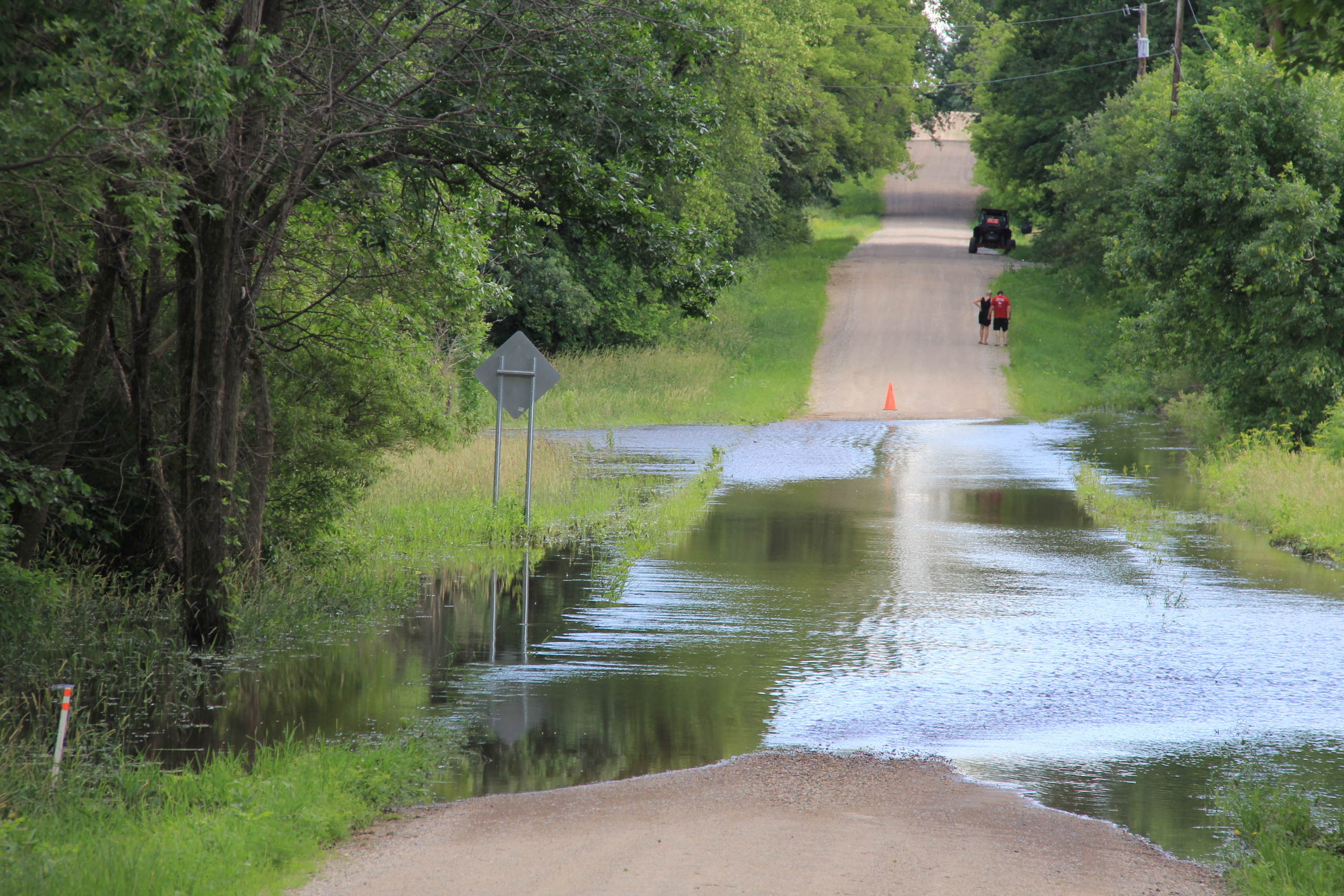
Roads are closed throughout the area due to flooding. Here a barricade blocks Dahle Avenue at its intersection with 220th Street East along the Straight River east of Faribault late Sunday afternoon. (Minnesota Prairie Roots copyrighted photo June 23, 2024)
A couple checks out flooded Dahle Avenue. (Minnesota Prairie Roots copyrighted photo June 23, 2024)
As inconvenient as these road closures may be, especially to locals, it’s nothing compared to the flooding of businesses, homes, campgrounds and more, especially in neighboring Waterville. The small town draws lake-lovers to summer cabins and campgrounds with tourism an important part of the local economy.
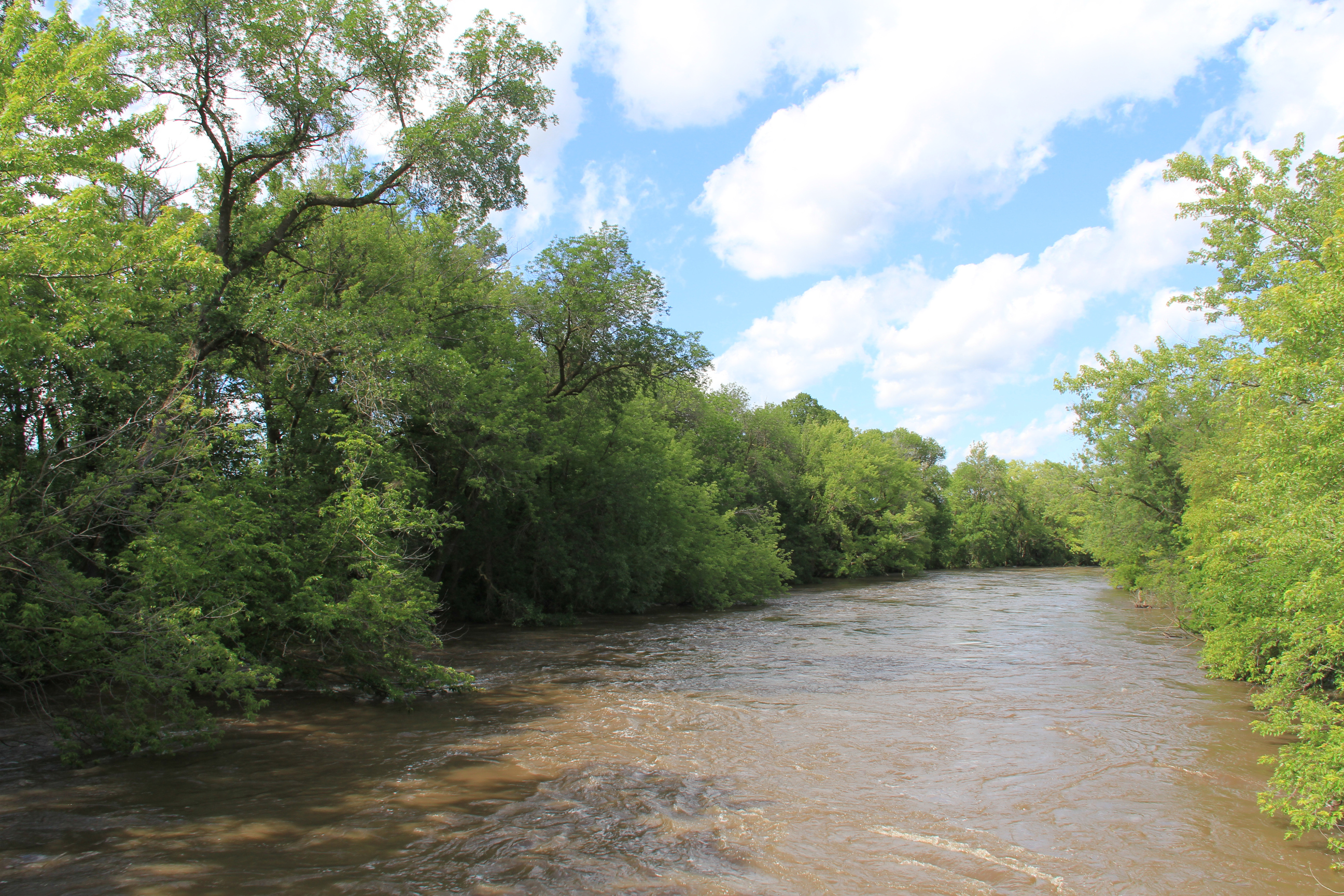
The muddy, fast-moving Straight River, photographed late Sunday afternoon from a bridge on 220th Street East, east of Faribault. (Minnesota Prairie Roots copyrighted photo June 23, 2024)
Other small towns, like Morristown and Warsaw, have also been impacted by the rising Cannon River. That water (and water from the Straight River) eventually ends up in Faribault and then Northfield and other places along the river and its watershed. In Faribault, public safety officials are keeping a close eye on the King Mill Dam, over which the Cannon flows. I’ve not seen that area, which is now barricaded to motor vehicle and foot traffic, and wisely so. The dam is a popular fishing spot. The road past the dam is also a busy traffic route, a connection to Minnesota State Highway 60.
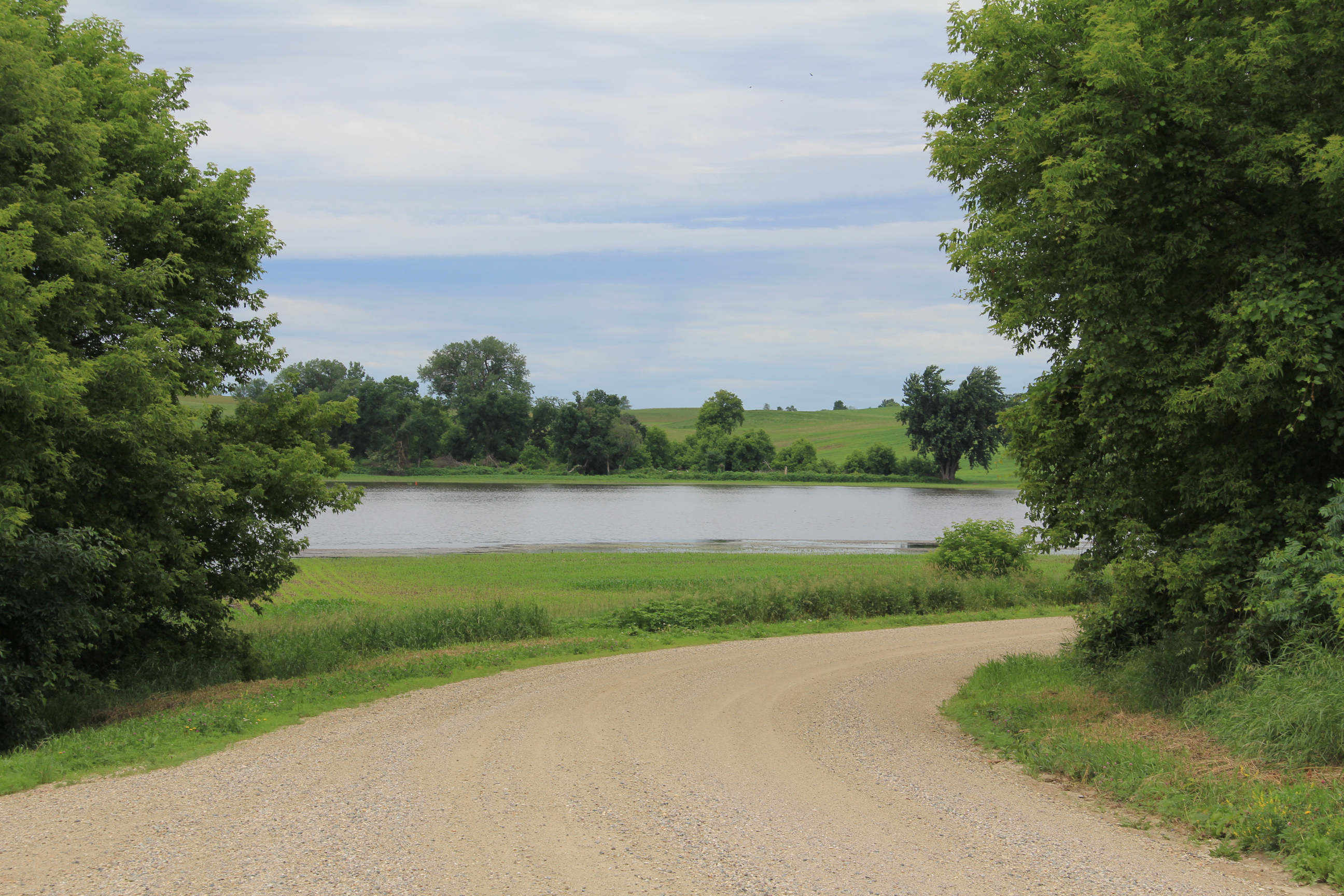
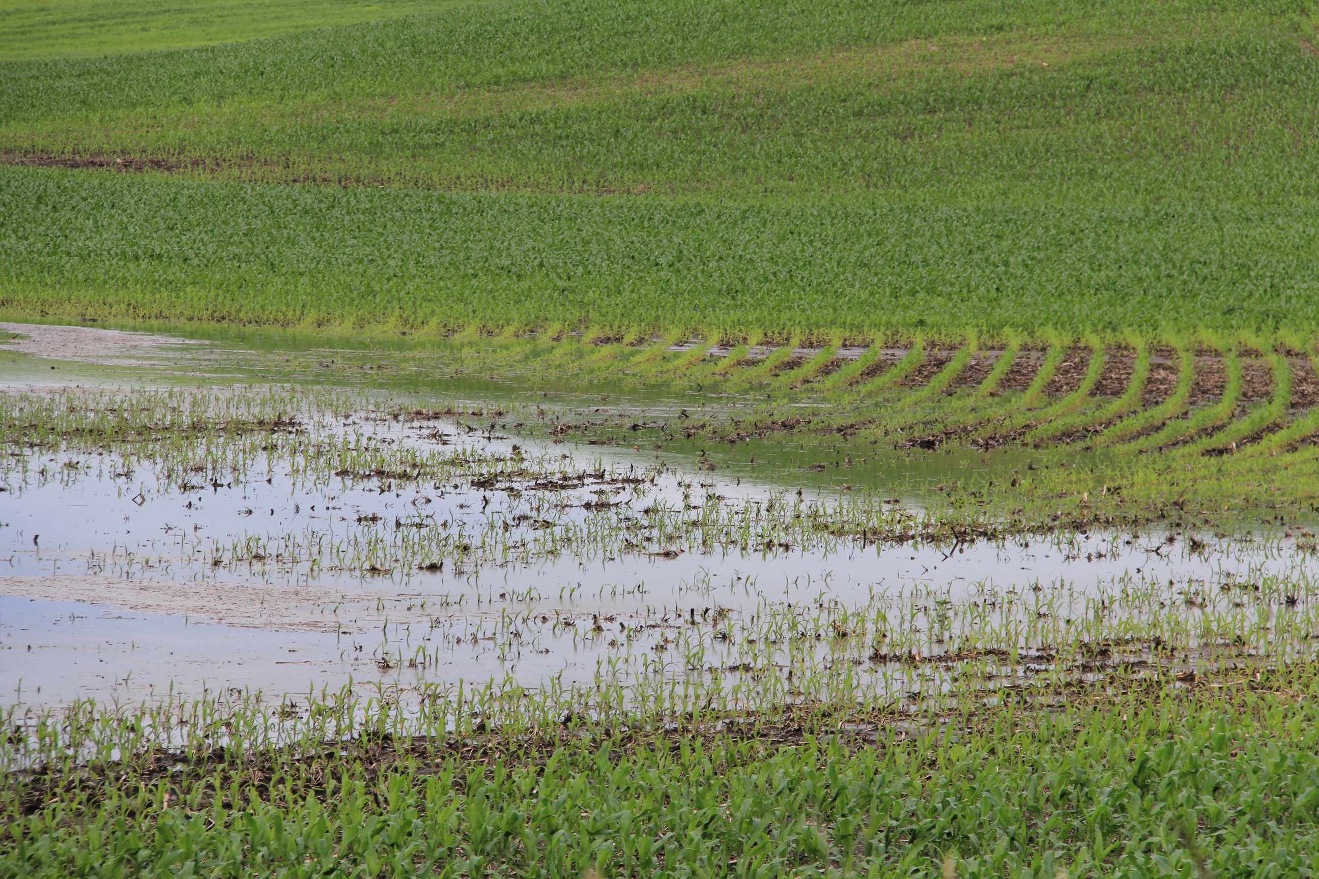
Rounding 195th Street West, a flooded cornfield, photographed northwest of Faribault late Friday morning. (Minnesota Prairie Roots copyrighted photo June 21, 2024)
Out in the countryside, too much rain has drowned corn and soybean crops, turning fields into lakes. I feel for the farmers, who depend on a good crop for their livelihood. It’s too late in Minnesota’s short growing season to replant. Crop insurance will cover some of their losses.
Excessive rain flooded this cornfield, transforming it from farmland to lake. Photographed late Friday morning along 195th Street West. (Minnesota Prairie Roots copyrighted photo June 21, 2024)
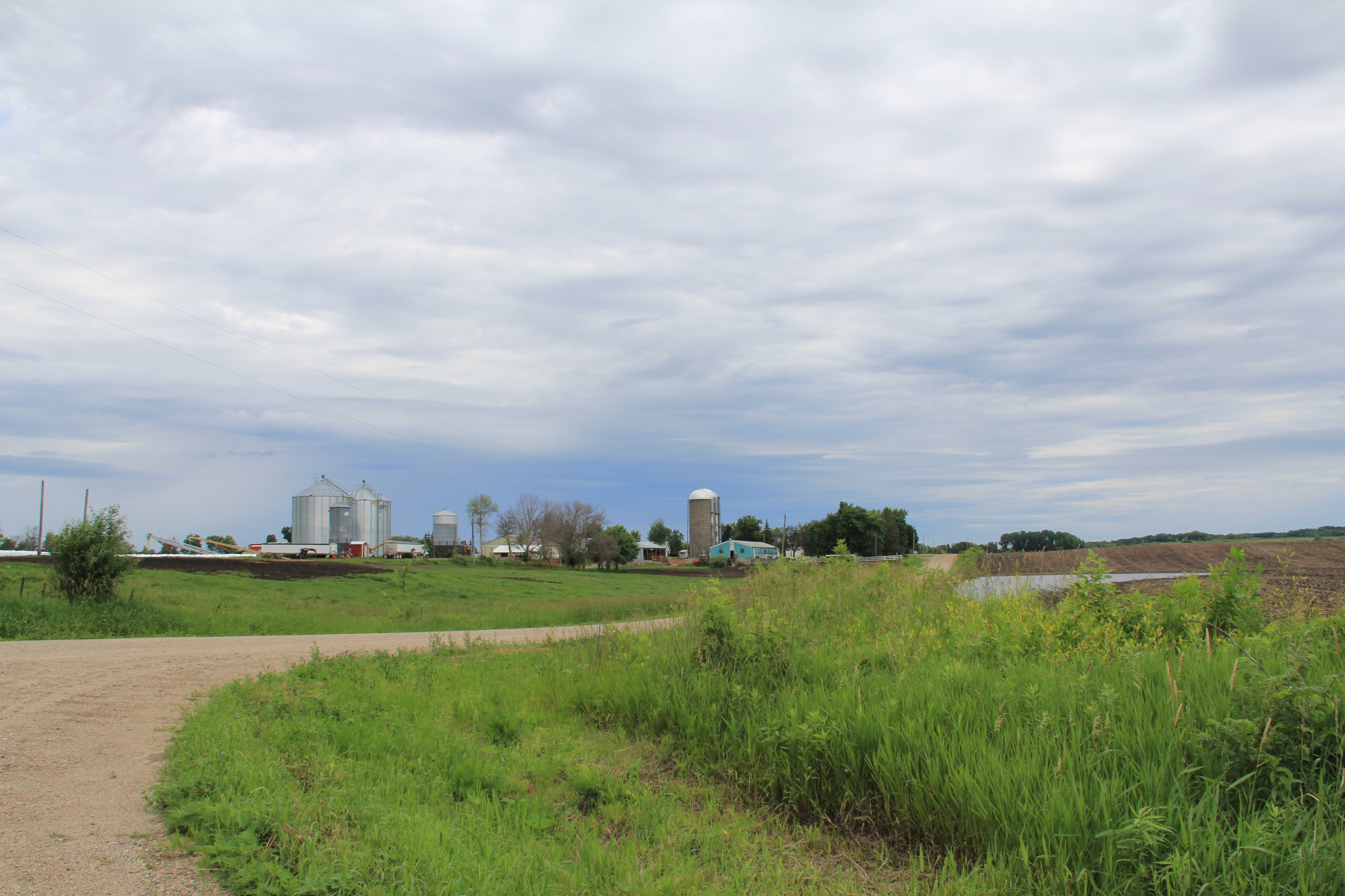
Rice County has a diverse topography of flat lands and rolling hills, plus differing soil types and drainage systems. Those, and rainfall amounts, affect whether a farm field floods. The entire county has experienced substantial rains. Just last Friday afternoon and into Saturday morning, we measured 3.1 inches of rain in our gauge. The day prior, 1.75 inches. Ten inches of rain fell here in eight days. Too much.
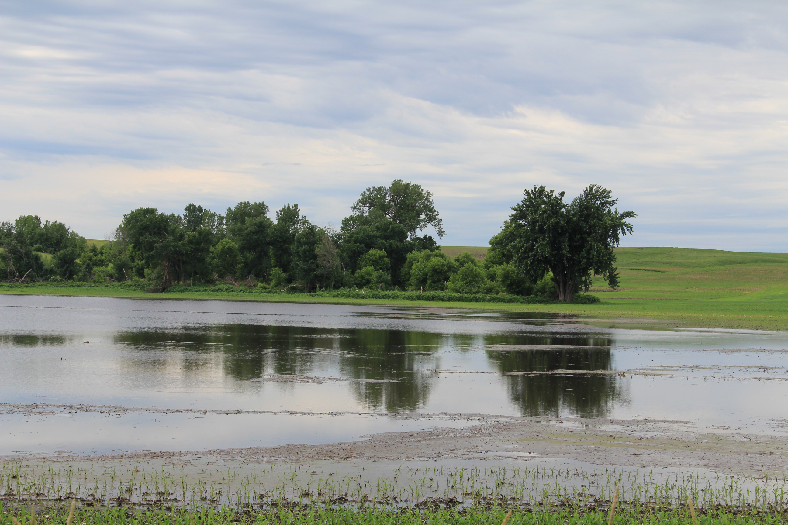
A flooded cornfield along 195th Street West, photographed Friday morning. (Minnesota Prairie Roots copyrighted photo June 21, 2024)
Ducks swim in the cornfield turned lake late Friday morning along 195th Street West. (Minnesota Prairie Roots copyrighted photo June 21, 2024)
Ask any farmer, and he/she can likely give you rainfall totals. I saw some of that rainwater on Friday morning while on a short drive along backroads northwest of Faribault. And that was before Friday’s three-inch rainfall.
A bit down the road, more flooding in the rolling terrain along Fairbanks Avenue northwest of Faribault, photographed late Friday morning. (Minnesota Prairie Roots copyrighted photo June 21, 2024)
On Sunday afternoon, most fields in the area I traveled were not flooded, but at least one township gravel road along the Straight River was flooded and barricaded. I expect if I expanded my tour, I’d see a whole lot more road closures and flooded fields. (Click here for a list of roadways that are closed in Rice County.)
Public officials are warning people to heed warning signs (like this one on Dahle Avenue) and stay out of flooded areas due to the dangers of swift-moving, high water. (Minnesota Prairie Roots copyrighted photo June 23, 2024)
In the all of this, there’s nothing we can do to control the weather. We can only prepare and then deal with whatever comes. Those, of course, are just words, not really helpful to anyone dealing with flooded fields, flooded roads, flooded homes, flooded businesses, flooded campers, flooded parks, flooded…
Friday evening the Cannon River was well above flood stage at the dam by the entrance to North Alexander Park. More rain overnight into Saturday raised the river level even higher. (Minnesota Prairie Roots copyrighted photo June 21, 2024)
NEARLY 10 INCHES OF RAIN fell in the past eight days at my Faribault home, half of that in the last three days. The significant rainfall not only in my community, but throughout southern Minnesota, has resulted in flooding as rivers swell and overflow their banks.
The same dam scene Saturday morning. (Minnesota Prairie Roots copyrighted photo June 22, 2024)
By Saturday morning, the Cannon encroached on even more land and the river rose higher under the Second Avenue bridge by the entrance to North Alexander Park. (Minnesota Prairie Roots copyrighted photo June 22, 2024)
This churning water at the dam shows the power of the river. (Minnesota Prairie Roots copyrighted photo June 21, 2024)
Minnesota Governor Tim Walz declared a peacetime emergency authorizing the National Guard to assist and support with emergency flood operations as needed. Faribault Mayor Kevin Voracek has declared a local emergency as my city deals with flooding. In nearby hard-hit Waterville, some residents have been evacuated. Mankato has also experienced significant flooding.
A police cruiser is parked Saturday morning under the historic viaduct near Teepee Tonka Park, an area prone to flooding. By Saturday evening, the Straight River had flooded even more of the park and surrounding land. (Minnesota Prairie Roots copyrighted photo June 22, 2024)
A chunk of south central Minnesota, including Faribault and other areas of Rice County, plus portions of Le Sueur, Steele and Waseca counties, remain in a flood warning until 10 a.m. Monday.
Teepee Tonka Park in Faribault, along the Straight River, was completely flooded Saturday morning. By evening, floodwaters crept onto the bridge. (Minnesota Prairie Roots copyrighted photo June 22, 2024)
Saturday morning the bridge at Teepee Tonka Park was open to pedestrians with a police officer stationed there. By evening, the bridge was cordoned off. (Minnesota Prairie Roots copyrighted photo June 22, 2024)
A Faribault police officer chats with the public and monitors the Straight River on the bridge into Teepee Tonka Park Saturday morning. (Minnesota Prairie Roots copyrighted photo June 22, 2024)
It’s a lot—this flooding of homes and businesses, city parks and railroad tracks, parking lots and roadways, cropland… A few blocks from my home, Xcel Energy crews are monitoring an electrical substation surrounded by water from the overflowing Straight River.
Floodwaters surround this warning sign by the Woolen Mill Dam. (Minnesota Prairie Roots copyrighted photo June 21, 2024)
A fire department truck stops on the Second Avenue bridge over the Cannon River on Friday evening as emergency personnel keep an eye on the rising river. (Minnesota Prairie Roots copyrighted photo June 21, 2024)
Police tape along the Cannon River by North Alexander Park is in place to keep people away from the roiling river. Friday evening the river nearly touched the bottom of the bridge. (Minnesota Prairie Roots copyrighted photo June 21, 2024)
I arrived home from church late this morning to automated messages from the 911 emergency system. One issued a cautionary warning from public safety officials to honor barricades by not walking or driving around them. Ignoring such signage in flooded areas will result in a citation from law enforcement.
Watching the swift-moving Cannon River from behind police tape Friday evening near the historic Faribault Mill. (Minnesota Prairie Roots copyrighted photo June 21, 2024)
Tree debris floats down the Cannon on Friday evening. (Minnesota Prairie Roots copyrighted photo June 21, 2024)
There’s a dam here, unseen as the Cannon River floods. (Minnesota Prairie Roots copyrighted photo June 21, 2024)
For the most part, I observed people being careful around floodwaters in Faribault while I was out on Friday evening and then again Saturday morning. The areas I accessed and photographed in that time frame have since been closed to the public, a smart move given the power of the river and the sheer volume of people checking things out. We are all naturally drawn to see for ourselves that which is unfolding in our backyard.
A car sits submerged in the parking lot of Two Rivers Health Center by Two Rivers Park on Saturday morning. (Minnesota Prairie Roots copyrighted file photo June 22, 2024)
Two rivers—the Cannon and the Straight—run through Faribault, converging at Two Rivers Park. Near that park, a car sat submerged Saturday morning in a parking lot. I’ve seen other vehicles sitting in floodwaters at the new riverside Straight River Apartments.
Along the Straight River on Third Avenue Northeast, floodwaters fill a backyard which, ironically, includes a boat. (Minnesota Prairie Roots copyrighted photo June 22, 2024)
Yet, as difficult as this flood event has been, it does not match the Faribault floods of 2010, 2014 and 2016, at least not from my recollection. Still, any flood is challenging.
Along the Straight River, a section of railroad tracks flooded. The Depot Bar & Grill patio is on the left. (Minnesota Prairie Roots copyrighted photo June 22, 2024)
For those affected, there’s clean-up and paperwork and unexpected expenses. Emergencies like this often bring out the best in people, as a community comes together. At the local government level, I expect emergency personnel have been working overtime. The Rice County Landfill, rural Dundas, opens at 7:30 a.m. Monday to begin accepting flood-contaminated materials.
Below the historic viaduct, the Straight River overflows its banks Saturday morning. By evening, it had risen even more. (Minnesota Prairie Roots copyrighted photo June 22, 2024)
I am fortunate. There’s no flooding in my home or yard. But I know others are struggling. I hope that in Sunday’s sunshine—finally, a day without rain—they feel a sense of hope. Floodwaters will recede. And life will, eventually, return to normal.
Walking along the Cannon River by the dam Friday evening, before the river flooded even more. (Minnesota Prairie Roots copyrighted photo June 21, 2024)


Recent Comments