Minnesota Prairie Roots

Writing and photography by Audrey Kletscher Helbling

Escaping the heavy wildfire smoke in north central Minnesota July 16, 2026

Signage on an escape room business in downtown Brainerd, photo taken Monday afternoon before wildfire smoke rolled in. (Minnesota Prairie Roots copyrighted photo July 2026)

IN THE EXTREME HEAT and humidity of Monday afternoon, my husband and I and our eldest daughter and her family escaped to Copper Cat Escape Games in Brainerd to sleuth for Granny’s hidden secret recipe. It was great fun finding and solving clues, unlocking boxes and finally solving the mystery with five minutes to spare.
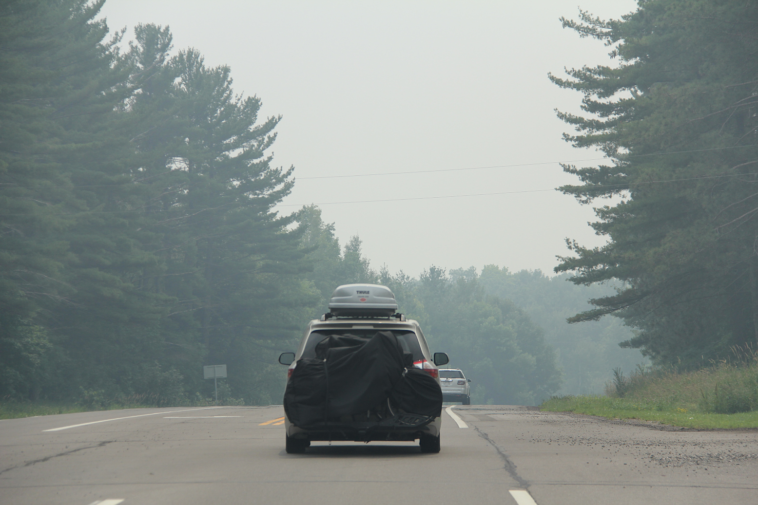
Driving into and through wildfire smoke early Wednesday afternoon near Garrison. I took these photos as a passenger. (Minnesota Prairie Roots copyrighted photo July 2026)

On Wednesday afternoon, we escaped, too, but this time from intense wildfire smoke which blew in from the north, enveloping the Brainerd Lakes area cabin where we were vacationing. We’ve experienced smoke on previous visits. This time, though, the smoke was especially thick, intense and oppressive.
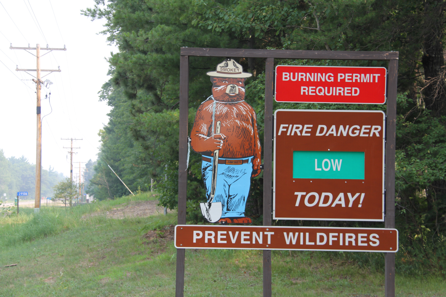
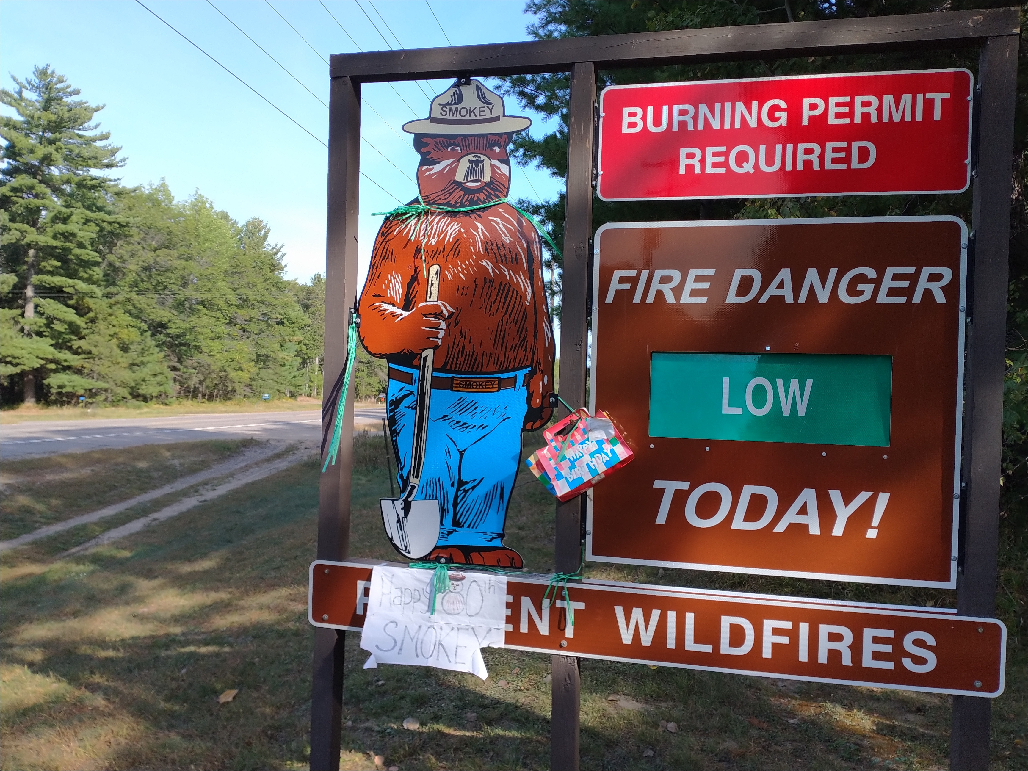
After leaving Mission Park and before reaching the cabin, I photographed this sign by the Mission Town Hall. Fire danger was low here Wednesday with the smoke (seen to the left) coming from wildfires up north. (Minnesota Prairie Roots copyrighted photo July 2026)

The smoke rolled in as Randy and I were hiking at Mission Park only a short drive from the Horseshoe Lake cabin south of Crosslake. We emerged from the woods to see dense smoke. Initially, we thought someone was burning, but soon realized the source—wildfires to the north in Canada and northern Minnesota.
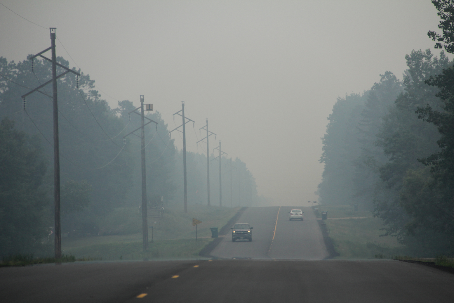
Driving through dense smoke along Crow Wing County Road 11 south of Crosslake early Wednesday afternoon. (Minnesota Prairie Roots copyrighted photo July 2026)

Wildfires are raging in areas in and around the Boundary Waters Canoe Area with campers there evacuated earlier in the week and the BWCA closed. Evacuation orders have been issued in parts of St. Louis, Cook and Lake counties in the northeastern part of Minnesota. Camps are closing, kids sent home. And on and on. Resorts, outfitters and other businesses that rely on seasonal income are suffering.

And across nearly all of Minnesota, we are breathing in smoke at levels classified as hazardous, very unhealthy, unhealthy and more by the Minnesota Pollution Control Agency. That includes right here in my county of Rice in the southern part of the state far from the wildfires.

But the level here in Faribault is nothing compared to what we saw and breathed in yesterday in the Brainerd Lakes area. That smoke smelled of infinite campfires, stung our eyes, made it hard to breathe, reduced visibility.

Our plans to spend the day exploring and enjoying the small towns near the cabin quickly pivoted to packing and heading home a day earlier than intended. Our daughter and her family left a day prior, as scheduled.

Looking across Horseshoe Lake in the thick smoke late Wednesday morning. (Minnesota Prairie Roots copyrighted photo July 2026)

It was the right decision to leave on Wednesday. Already visibility across Horseshoe Lake was so limited that the opposite shore appeared only an outline of trees. Smoke and the stench of smoke hung in the air. The toxic air felt suffocating.
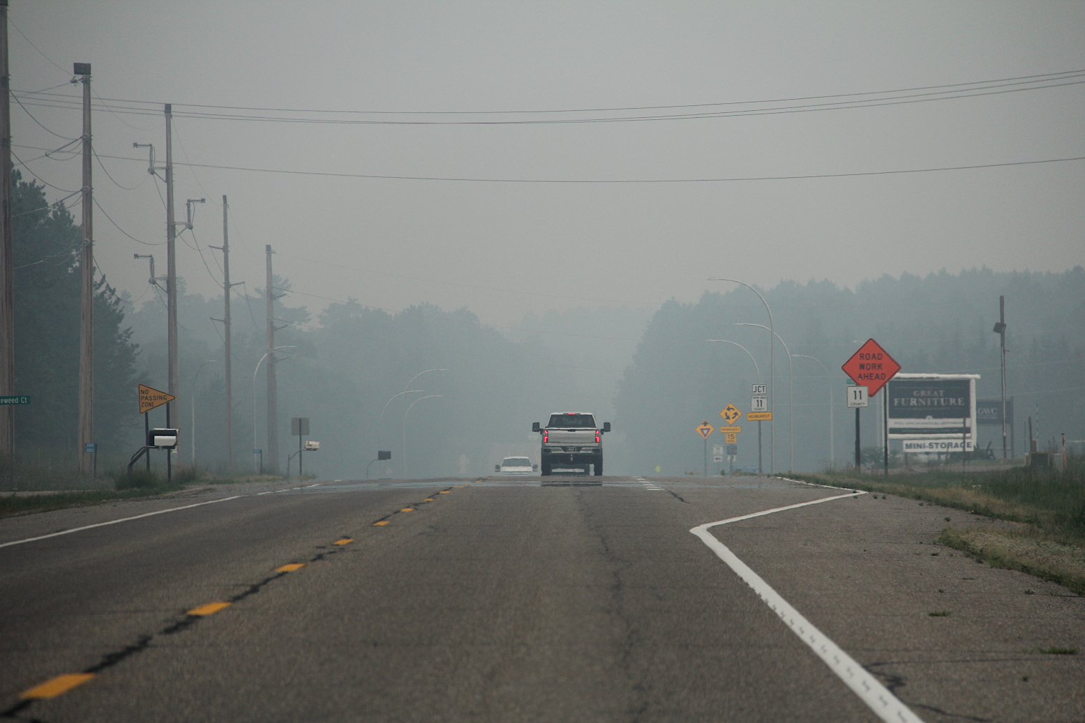
Northbound toward Crosslake, this shows the heavy smoke in the area at the intersection of Crow Wing County roads 3 and 11 early Wednesday afternoon. (Minnesota Prairie Roots copyrighted photo July 2026)

Once on Crow Wing County Road 3, Randy and I could see the scope of the smoke spreading far and wide, blanketing the landscape.
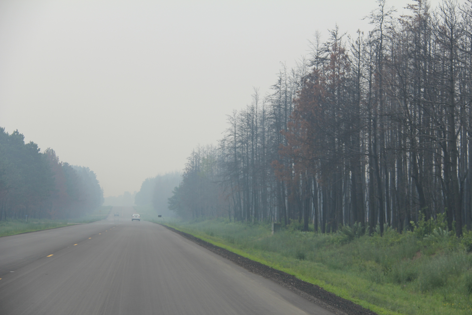
Driving through the smoke, past charred trees, right, burned in the Flanders Fire in May south of Crosslake. (Minnesota Prairie Roots copyrighted photo July 2026)

Onward we drove, turning onto county road 11, passing stands of charred trees and cleared land from a mid-May wildfire in Mission Township. The irony was not lost on me.

Mile after mile, we traveled in smoky conditions. In Crosby, life appeared business as usual with a packed downtown, despite the smoke. Shoppers walking in and out of shops. Bikers biking.
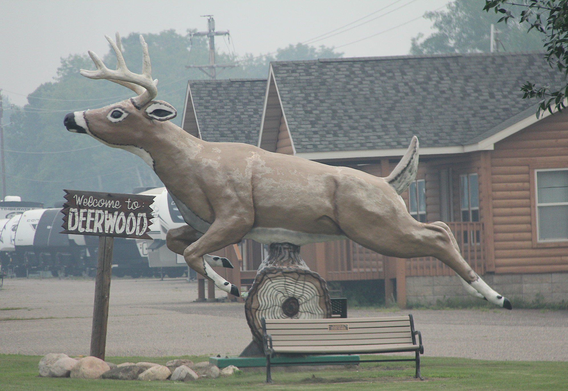
Smoke surrounds the roadside deer statue in Deerwood. (Minnesota Prairie Roots copyrighted photo July 2026)

In Deerwood, a roadside deer statue appeared to leap through the smoke in an attempt to escape.
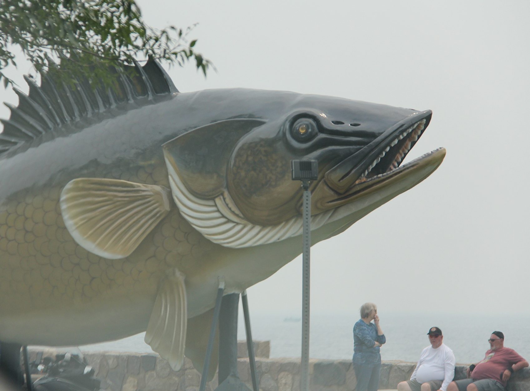
Wildfire smoke screens the view of Mille Lacs Lake by the roadside walleye statue. (Minnesota Prairie Roots copyrighted photo July 2026)

In Garrison, visitors at the Mille Lacs Lake overlook could see the roadside statue, but not much of the lake.
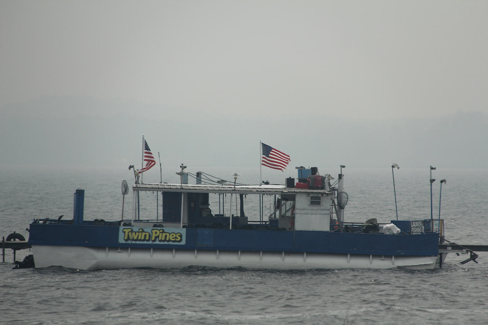
Wildfire smoke backdrops a docked boat on Mille Lacs Lake Wednesday afternoon. (Minnesota Prairie Roots copyrighted photo July 2026)

Down the road a bit, a guy jogged alongside U.S. Highway 169. Smoke still hung thick. I wondered how his body could tolerate the polluted air. Mine can’t.
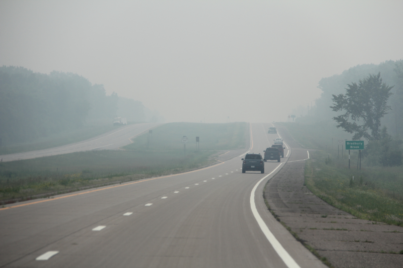
Motorists travel through thick wildfire smoke along US Highway 169 south of Mille Lacs Lake early Wednesday afternoon. (Minnesota Prairie Roots copyrighted photo July 2026)

We thought we would soon drive out of the wildfire smoke. But we drove past endless towns along highway 169—Onamia, Milaca, Princeton, Zimmerman… Not until we reached Elk River in the northwest metro two hours later did the smoke dissipate and open to blue skies. Then and only then did I feel like I could breathe easier.

I hope Minnesotans living near the 17 uncontrolled wildfires, and firefighters, plus our Canadian neighbors, can soon breathe easier, too. Rain is needed.
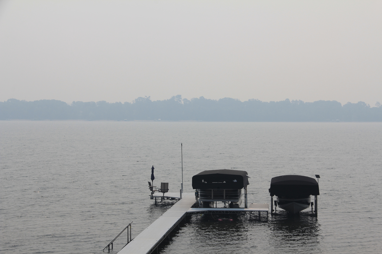
Looking across Horseshoe Lake late Wednesday morning, the opposite shoreline is obscured by wildfire smoke. (Minnesota Prairie Roots copyrighted photo July 2026)

Yet, I know these fires can burn for weeks, ravaging the landscape, polluting the air, impacting businesses and sometimes changing vacation plans. But leaving the lake cabin a day early to escape the smoke is nothing, truly nothing, in the story of wildfires.

TELL ME: Are you being affected by wildfires? If yes, I’d like to hear your story.

© Copyright 2026 Audrey Kletscher Helbling


Smokey the Bear still igniting fire prevention in Minnesota & beyond September 25, 2024

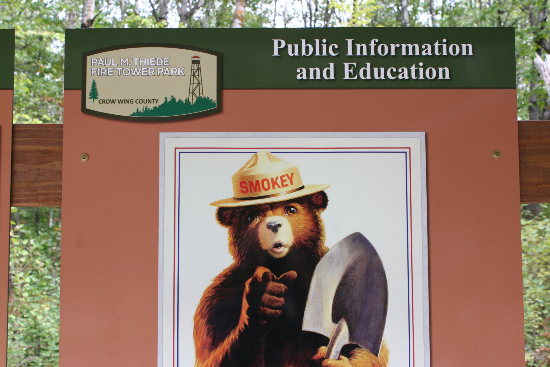
Smokey the Bear is incorporated into interpretive signage at Paul M. Thiede Fire Tower Park by Pequot Lakes. (Minnesota Prairie Roots copyrighted file photo September 2021)

FOR 80 YEARS, Smokey the Bear has delivered the same core message of fire prevention. In 2001, the US Forest Service updated Smokey’s long-running “Remember, only you can prevent forest fires” to “Only you can prevent wildfires.” But YOU has always centered Smokey’s directive to all of us. We, yes, we, hold a responsibility to prevent wildfires.

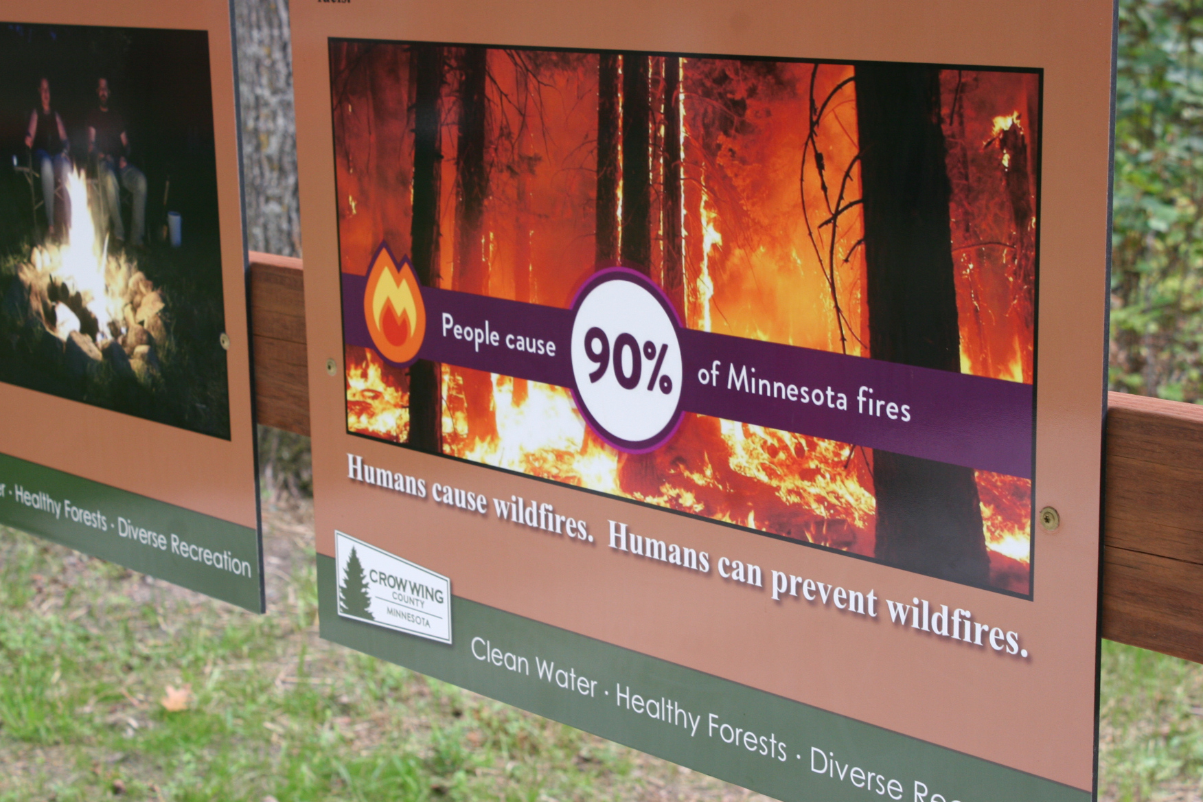
This interpretative sign at the fire tower park reminds visitors of who causes fires and their responsibility to prevent them. (Minnesota Prairie Roots copyrighted file photo September 2021)

That’s important to remember as Smokey celebrates his 80th year of igniting fire prevention efforts on a national scale. He officially turned 80 on August 9, marking the longest running public service campaign in the country. Who doesn’t like, and recognize, Smokey the Bear? And remember his message to us about fire.

Smokey, before he morphed into an anti-fire campaign spokes-bear, was a real bear. A cub injured and orphaned in a 1950 New Mexico wildfire. That’s the story anyway.

I admit I didn’t think all that much about wildfires until recent years, when smoke-hazed skies began occasionally blanketing Minnesota. Even here in southern Minnesota, the smoke from Canadian and western wildfires sometimes affects air quality. When I hear and see media reports about wildfires out West, I wonder how people manage to breathe, how they cope with the ongoing threat of fire, the death and destruction.

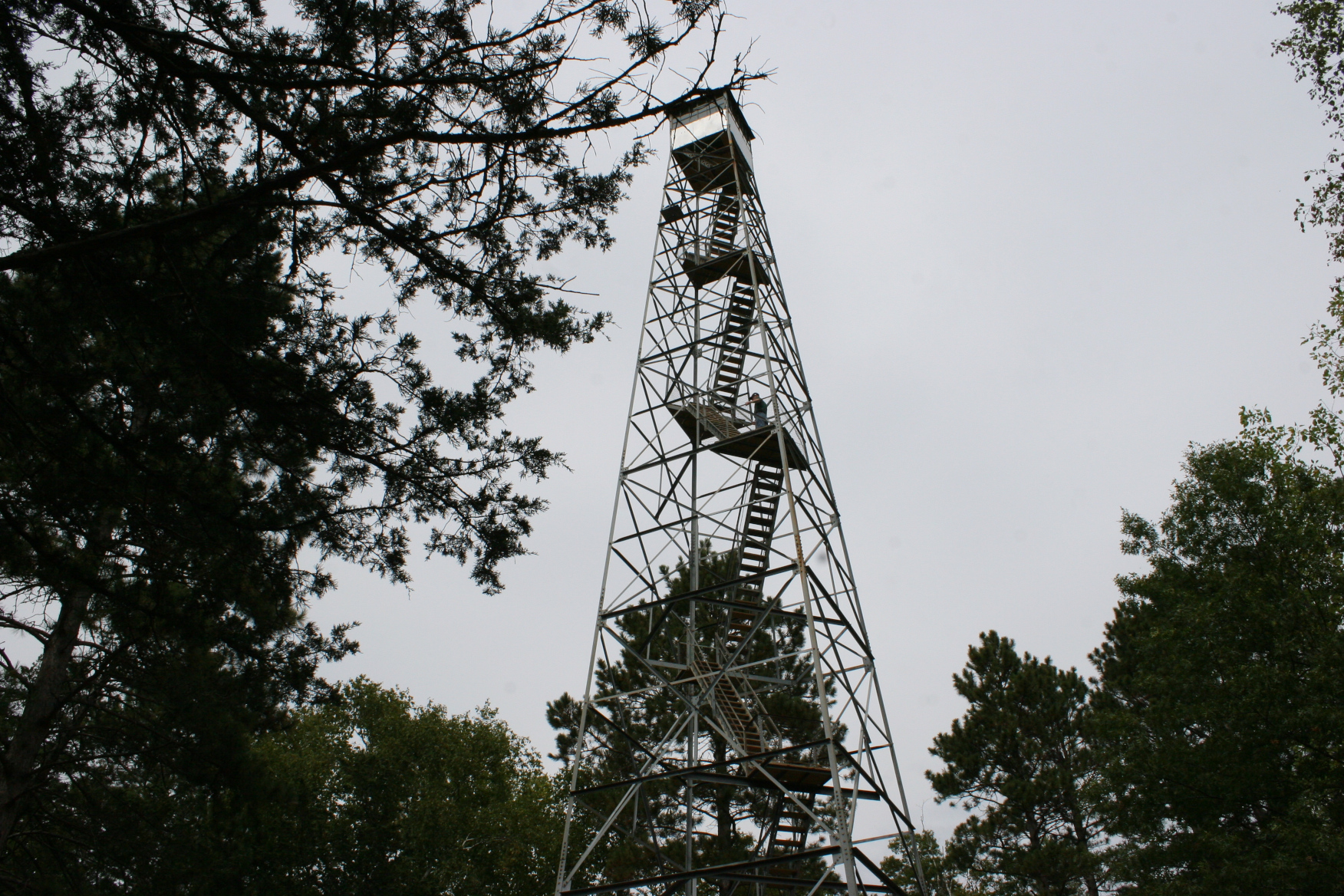
The Paul M. Thiede Fire Tower stretches high among the pines. It is no longer used to spot fires. (Minnesota Prairie Roots copyrighted file photo September 2021)

We’re not immune here in Minnesota, with most wildfires centered in the northern forested regions of our state. But occasionally, the Twin Cities metro and other areas experience out-of-control fires. Early this past March, for example, firefighters battled a massive blaze near Waseca (25 miles southwest of Faribault) that destroyed nearly 2,000 acres and injured three. Smokey’s cautionary words need to be heeded by all of us no matter where we live.

Visitors can climb the 100-foot high Paul M. Thiede Fire Tower and other fire towers in Minnesota. (Minnesota Prairie Roots copyrighted file photo September 2021)

I am most cognizant of fire, though, when staying at a family member’s cabin in the Brainerd Lakes area. Dense pine forests, scrub grass, dried pine needles and more seem sufficient fuel for a wildfire. There are no campfires on windy days. Not for Randy and me.

This sign is posted along Crow Wing County Highway 3 south of Crosslake in Mission Township. (Minnesota Prairie Roots copyrighted photo September 2024)

Then there’s Smokey, or at least a Smokey the Bear sign along Crow Wing County Road 3 south of the cabin by the Mission Township Hall and Fire Station 1. The sign ranks the daily fire danger and also advises that burning permits are required in the area.

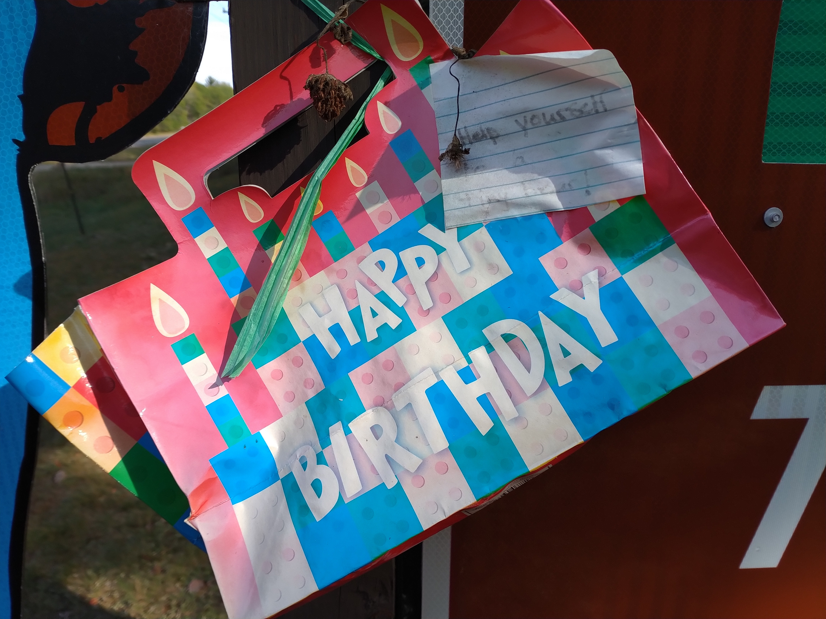
Inside this gift bag are tiny plastic bears for the taking in honor of Smokey’s 80th birthday. (Minnesota Prairie Roots copyrighted photo September 2024)

During a recent visit, I noticed more. Smokey held a HAPPY BIRTHDAY gift bag with an attached note to “Help yourself to a tiny bear!” I reached inside the bag and pulled out a tiny blue plastic bear and a tiny green bear for my grandchildren. Later, I schooled them about Smokey the Bear and wildfires. They loved the mini bears.

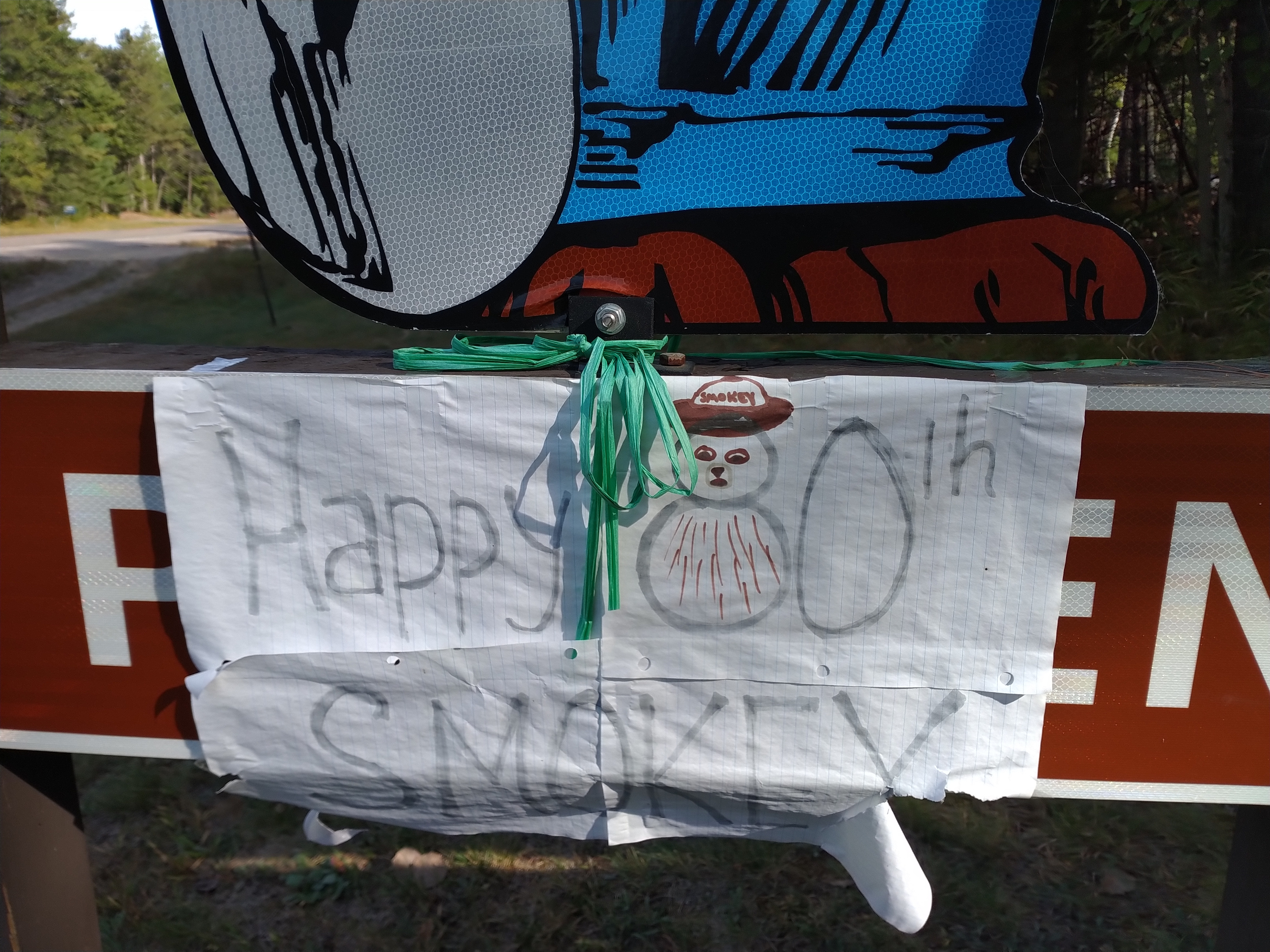
Birthday wishes for Smokey. (Minnesota Prairie Roots copyrighted photo September 2024)

A hand-printed “Happy 80th Smokey” paper sign also hangs below Smokey’s feet, partially covering PREVENT WILDFIRES. Smokey is celebrating his birthday throughout 2024. He’ll be in the Macy’s Thanksgiving Day Parade, at the lighting of the US Capital Christmas Tree…

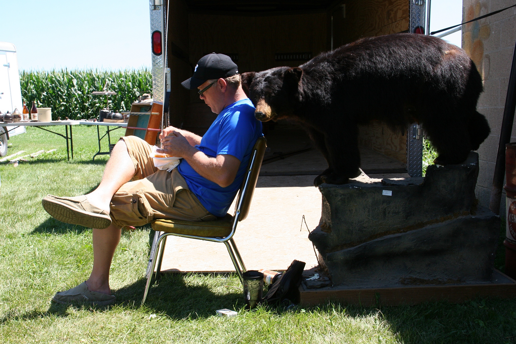
A vendor grabs lunch and settles in next to a bear mount he’s selling at a barn sale in rural Medford several years ago. Live bears were seen near Medford, south of Faribault, this past summer. (Minnesota Prairie Roots copyrighted file photo)

Like the injured cub of the 1950 New Mexico wildfire, bears roam the woods of central and northern Minnesota and sometimes venture south. A bear was spotted at River Bend Nature Center in Faribault and farther south this past summer.

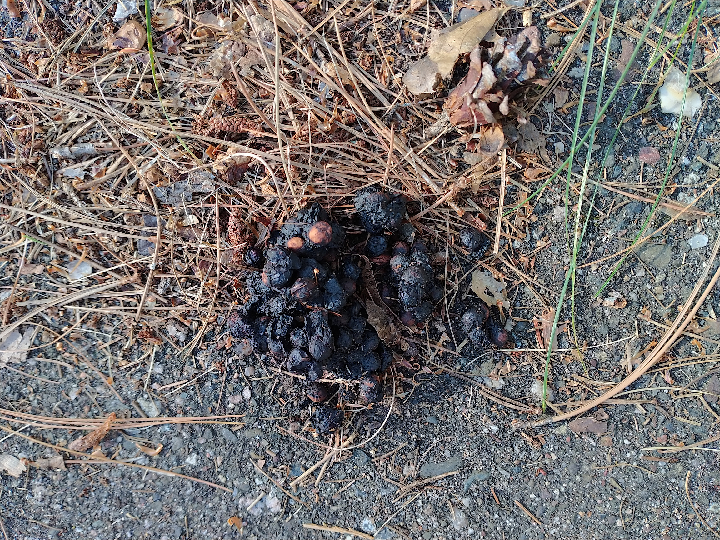
Scat identified as from a bear cub. (Minnesota Prairie Roots copyrighted photo September 2024)

Before leaving the cabin recently, Randy found berry-laced scat along the driveway that looked suspiciously like bear poop. I sent a photo to my brother-in-law. Jon confirmed this was scat from a cub. A mama bear and three cubs were sighted at the cabin in June, certainly not the first bear sightings in the Crosslake area. I wasn’t surprised by Randy’s discovery, although unsettled. I like the imaginary 80-year-old Smokey the Bear. But if I encountered a real Smokey, I doubt I would pause to wish him a HAPPY BIRTHDAY. Nope, I’d pretty much be outta there.

© Copyright 2024 Audrey Kletscher Helbling
 

A Minnesota northwoods experience: Climbing a fire tower (or not) October 6, 2021

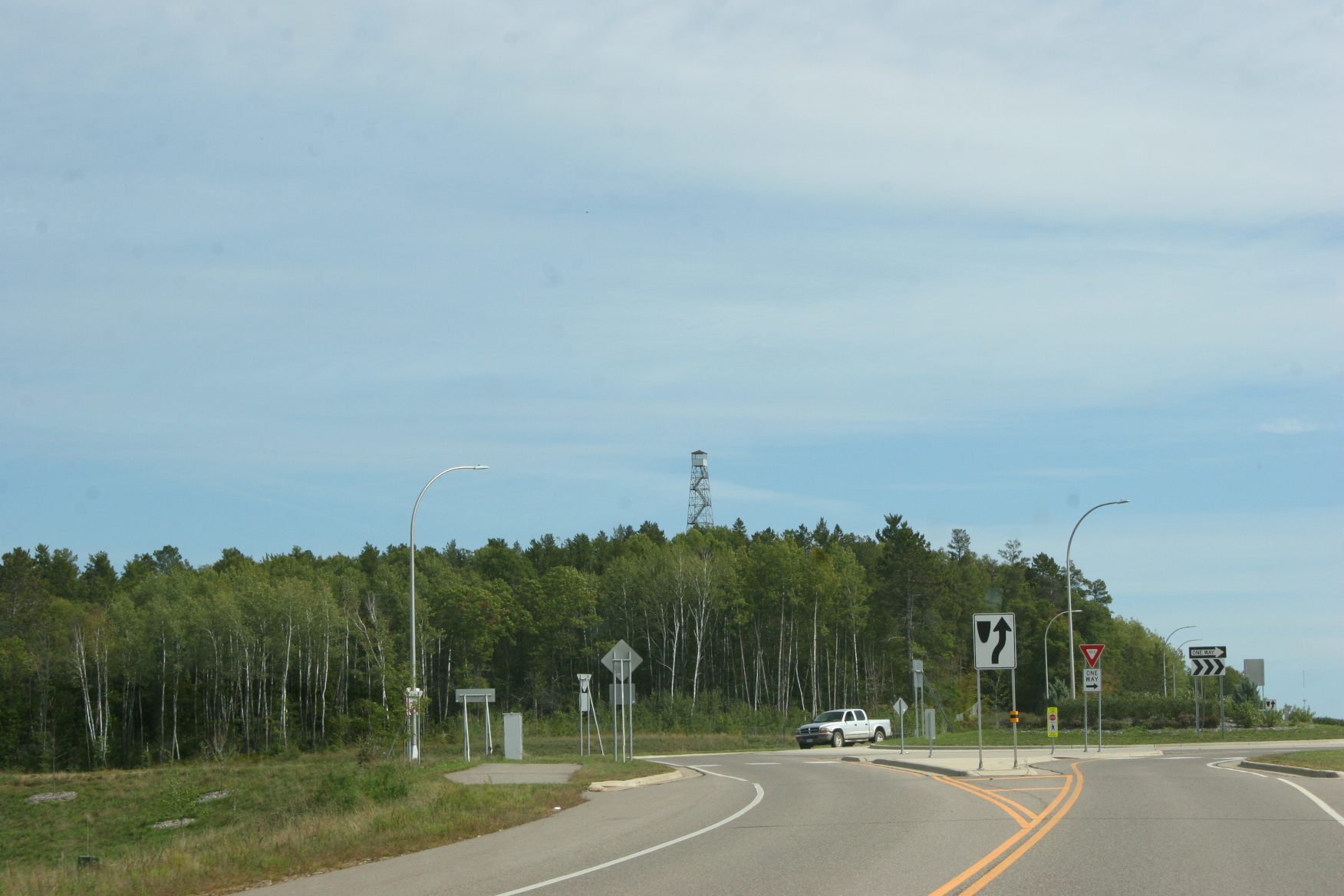
Just a short distance from this roundabout by Pequot Lakes, you can see the Paul M. Thiede Fire Tower peeking through the treetops. Minnesota Prairie Roots copyrighted photo September 2021.

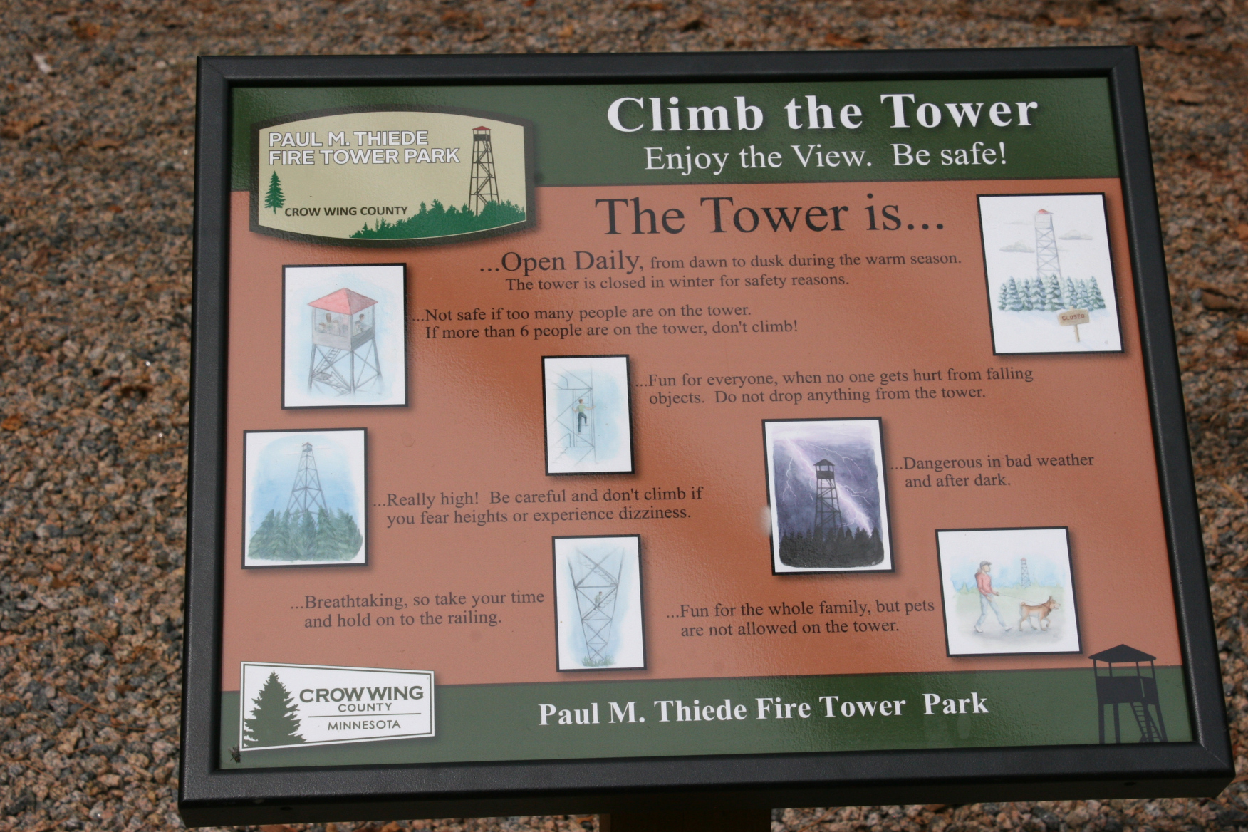
Really high! Be careful and don’t climb if you fear heights or experience dizziness.

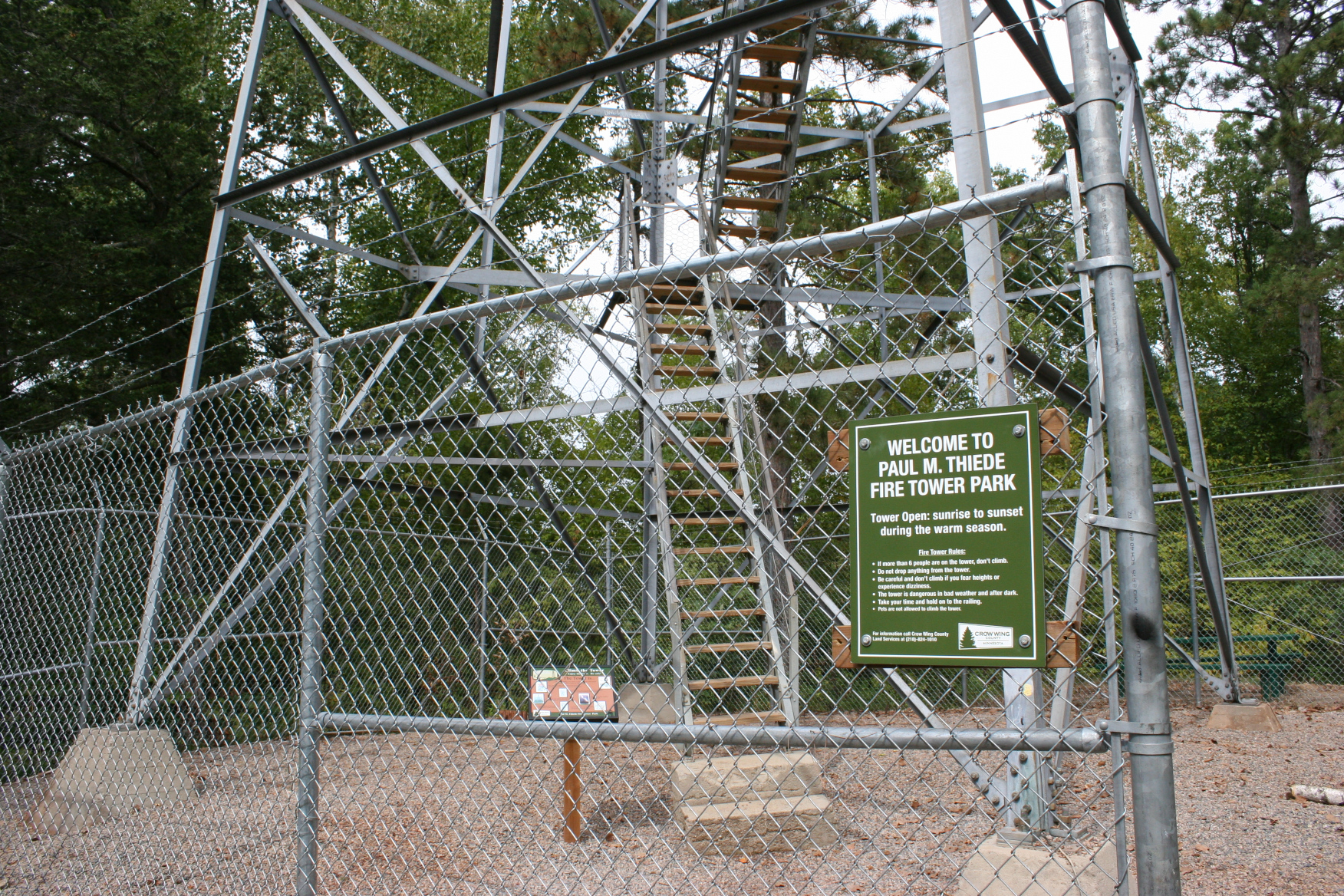
The warning sign and rules posted at the base of the fire tower. Minnesota Prairie Roots copyrighted photo September 2021.

I heeded the warning and stayed put. Feet on the ground. Camera aimed skyward. Toward the 100-foot high Paul M. Thiede Fire Tower just outside Pequot Lakes in the central Minnesota lakes region. The top of the tower pokes through the trees, barely visible from State Highway 371. Turn off that arterial road onto Crow Wing County Road 11, turn left, and you’ve reached the fire tower park.

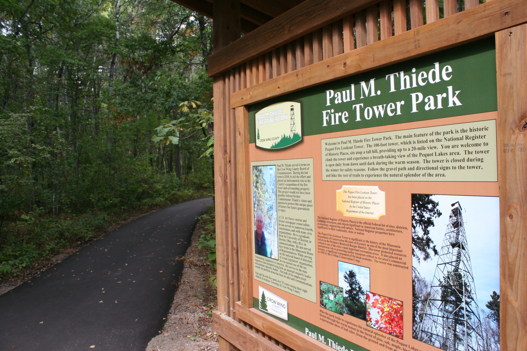
A little background on the park. Minnesota Prairie Roots copyrighted photo September 2021.

The Paul M. Thiede Fire Tower Park (named after the county commissioner instrumental in developing this 40-acre park) offers visitors an opportunity to hike to, and then climb, the historic tower built in 1935 by the Civilian Conservation Corps. As one who prefers low to high, I was up for the 0.3 mile hike, but not the climb.

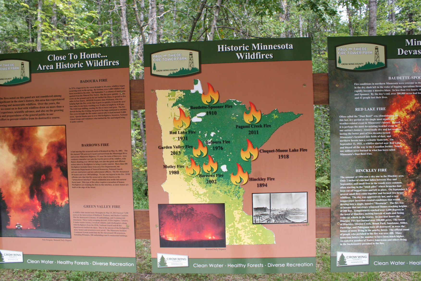
Lots of info packs signs in the outdoor interpretative area. Minnesota Prairie Roots copyrighted photo September 2021.
The iconic Smokey the Bear reminds us that we can prevent forest fires. Minnesota Prairie Roots copyrighted photo September 2021.
We are to blame for nearly all of Minnesota’s wildfires, according to this park sign. Minnesota Prairie Roots copyrighted photo September 2021.

Before Randy and I headed onto the trail, though, we read the interpretative signage featuring information on the tower (which is on the National Register of Historic Places), Minnesota wildfires and other notable fire facts. This summer marked an especially busy fire season in the northern Minnesota wilderness. Those of us living in the southern part of the state felt the effects also with smoke drifting from the north (including Canada) and from the west (California). That created hazy skies and unhealthy air some days, unlike anything I’ve ever experienced.

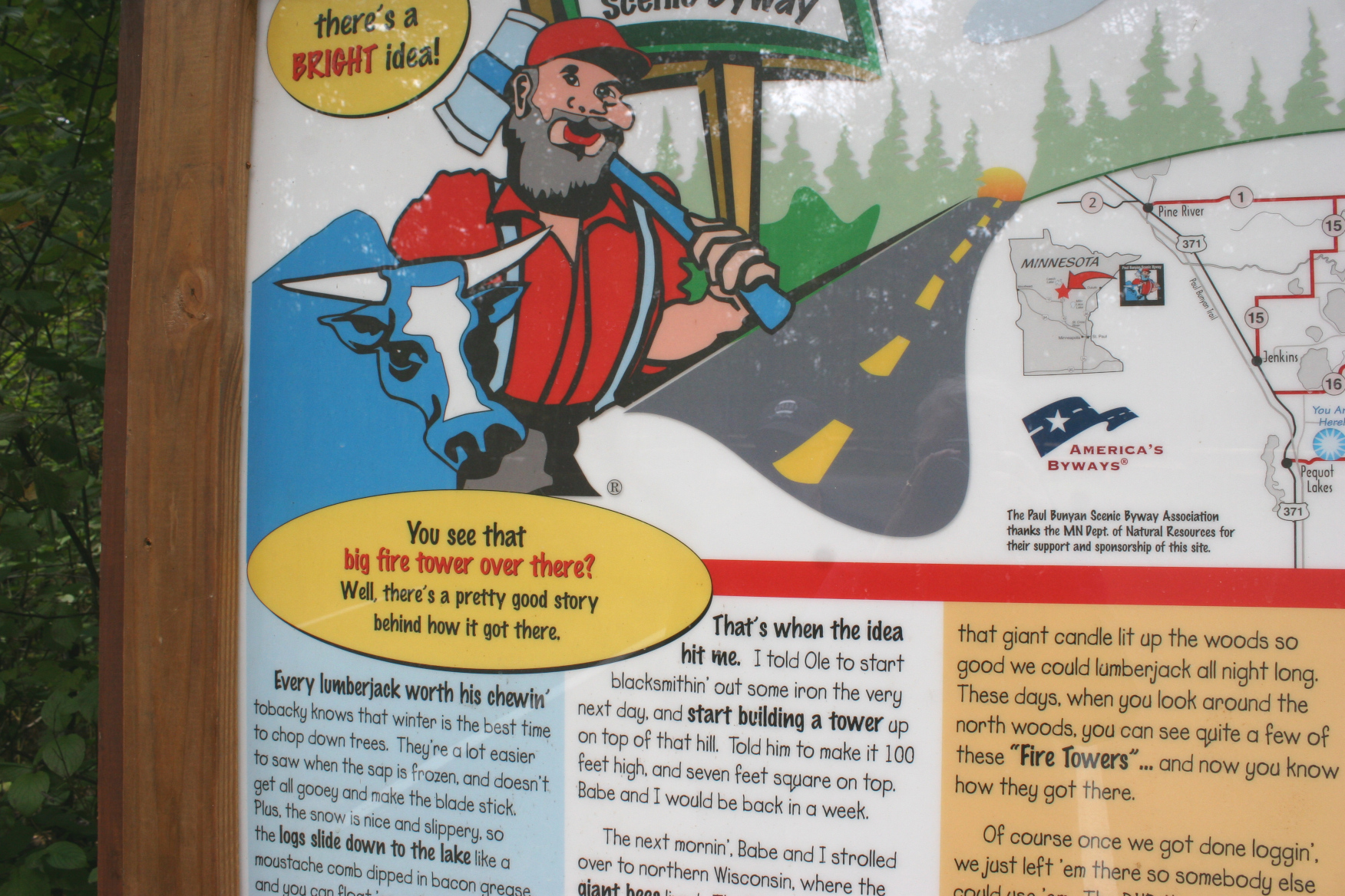
Lots to read here, including Paul Bunyan’s fire tower story. Minnesota Prairie Roots copyrighted photo September 2021.

We also read a bit of Paul Bunyan lore, a fun addition to the park located in the Paul Bunyan Scenic Byway area. This region of Minnesota is big on lumberjack stories about Paul and his sidekick, Babe the Blue Ox. The Pequot Lakes water tower is even shaped like Paul’s over-sized fishing bobber.

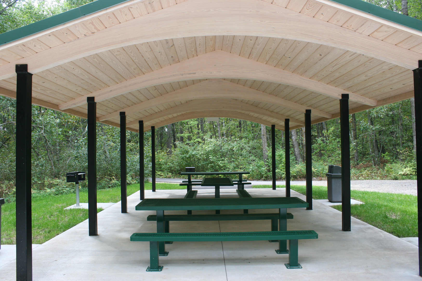
The pristine picnic shelter. Minnesota Prairie Roots copyrighted photo September 2021.
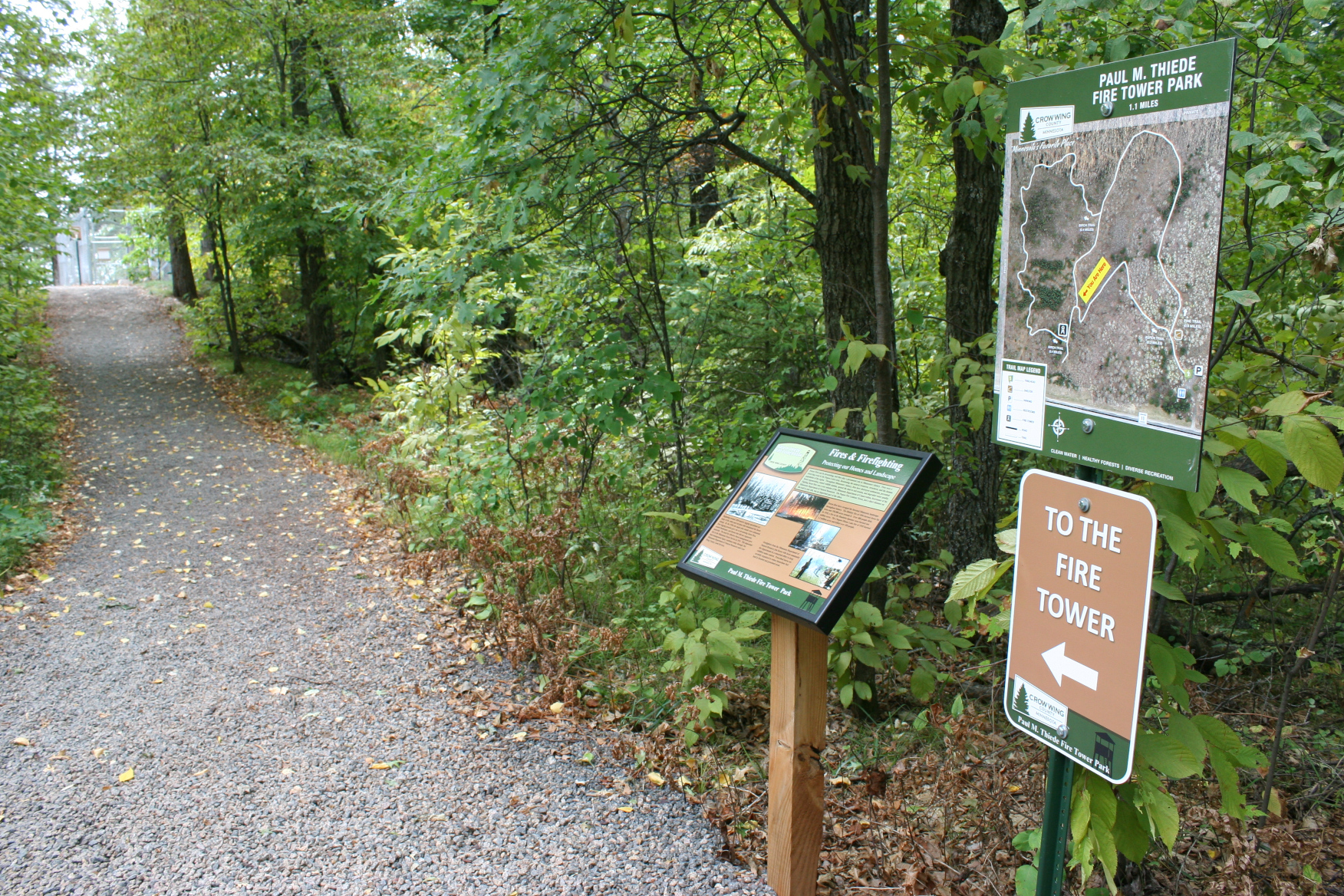
Signs point the way to the fire tower trail. Minnesota Prairie Roots copyrighted photo September 2021.
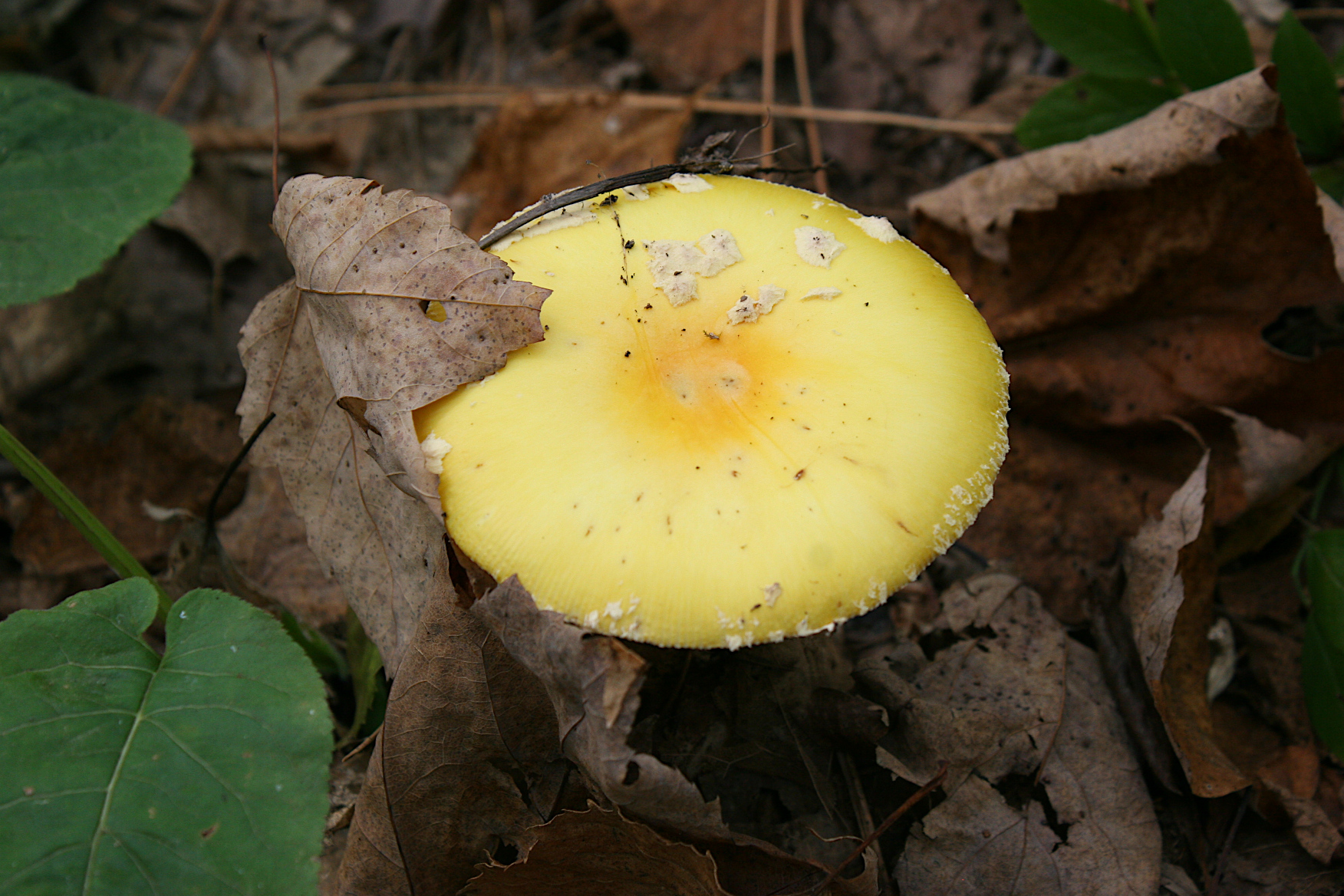
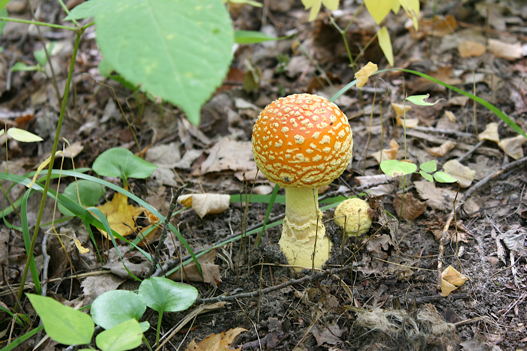
On the way to the tower, this large yellow mushroom temporarily distracted me. Minnesota Prairie Roots copyrighted photo September 2021.

Once we’d finished reading, and then admiring the beautiful new picnic shelter, we started off on the pea rock-covered trail through the woods and toward the tower. Up. Up. Up.

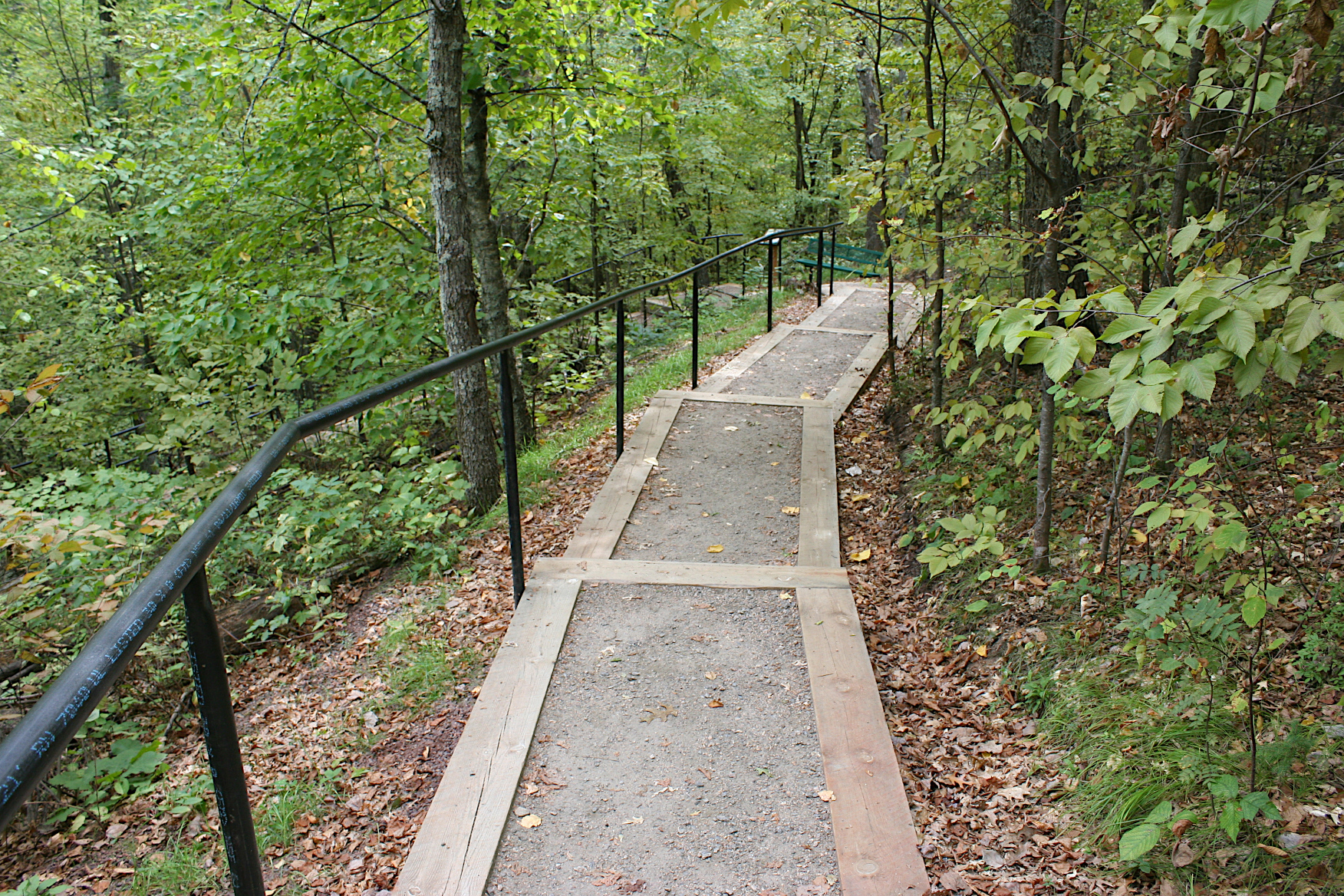
When the trail gets especially steep, steps aid in the climb. I took this photo on the descent. Minnesota Prairie Roots copyrighted photo September 2021.

After awhile, I began to tire, to wonder, how much farther? And just as I was about to declare myself done climbing steps, Randy assured me the tower was just around the bend. Yes.

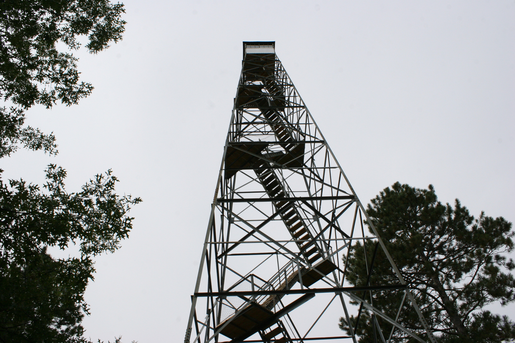
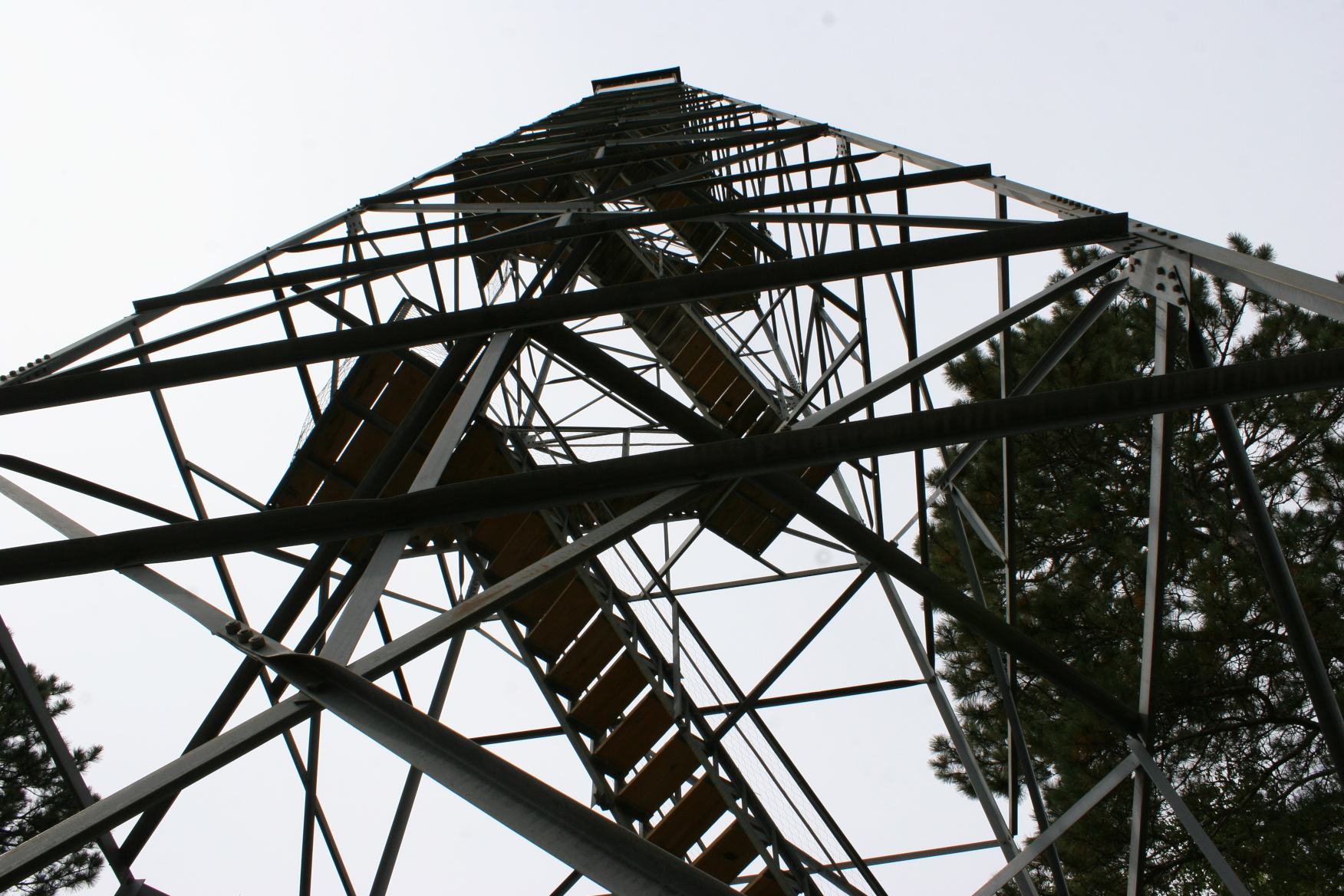
Looking up at the tower, all of which I couldn’t fit in a photo, I determined I was not climbing that high. Minnesota Prairie Roots copyrighted photo September 2021.

Once there, I stood at the base of the tower, reading the rules and warnings. I decided I best admire the ironwork from below. And I did. There’s a lot to be said for the 1930s workmanship of skilled craftsmen.

The underside of the tower shows layers of stairs. Minnesota Prairie Roots copyrighted photo September 2021.

Randy, though, started up the layered steps leading to a seven-foot square enclosed look-out space at the top of the tower. At that height, fire watchers could see for 20 miles.

If you look closely, you can see Randy with only a few more flights to reach the top. At this point, he decided not to go any farther. Minnesota Prairie Roots copyrighted photo September 2021.

As I watched, Randy climbed. Steady at first, but soon slowing, pausing to rest. “You don’t have to go all the way to the top,” I shouted from below. He continued, to just above treetop level, and then stopped. He had reached his comfort height level.

The tower is fenced at the base. Minnesota Prairie Roots copyrighted photo September 2021.

I can only imagine how spectacular the view this time of year, in this season of autumn when the woods fire with color. We visited in mid-September, when color was just beginning to tinge trees.

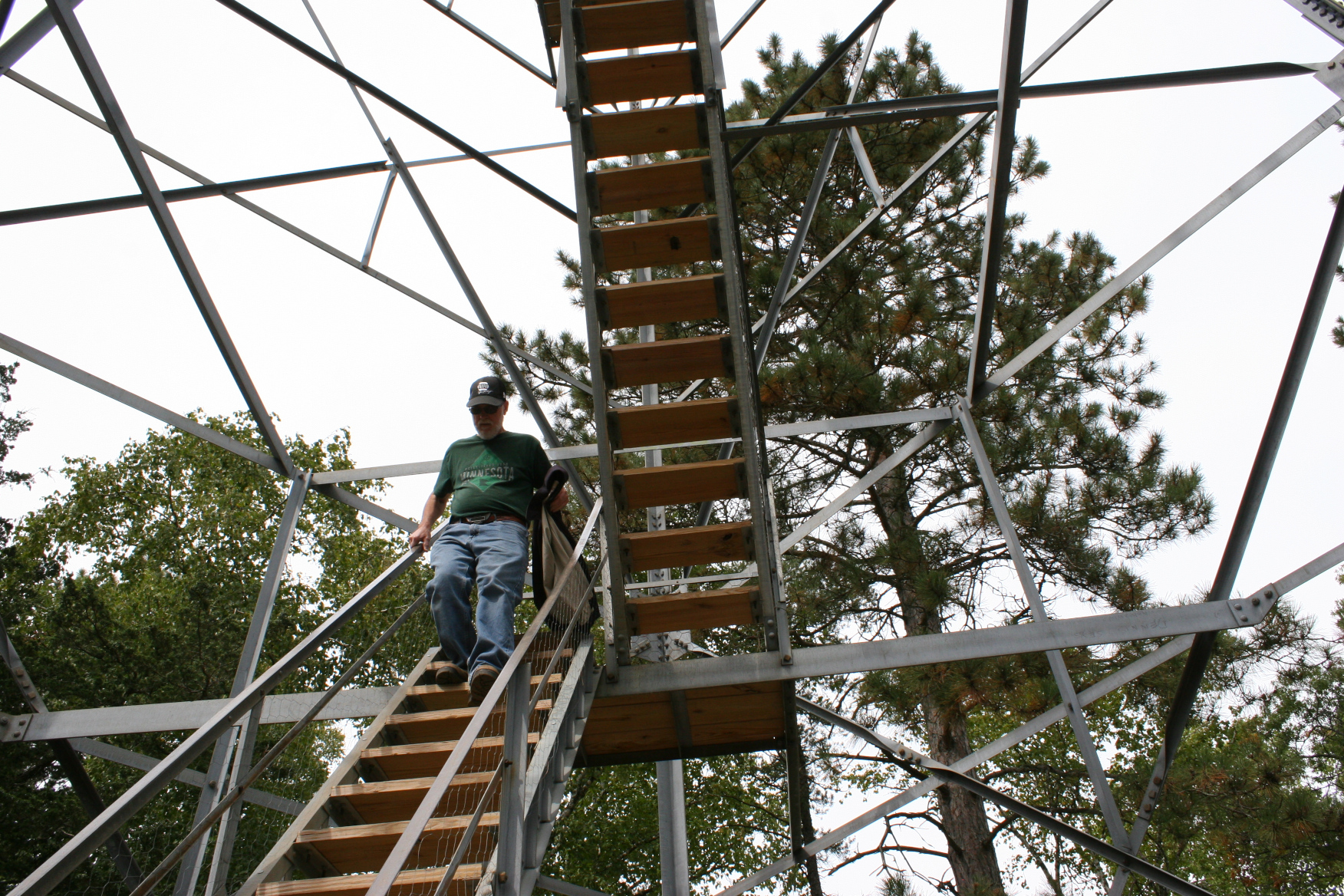
Randy exits the tower, several flights short of reaching the top. Minnesota Prairie Roots copyrighted photo September 2021.

Eventually, we began our retreat down the trail, much easier than ascending.

An incredibly vibrant mushroom thrives trailside. Minnesota Prairie Roots copyrighted photo September 2021.

Occasionally I stopped to photograph scenery, including species of orange and yellow mushrooms. Simply stunning fungi.

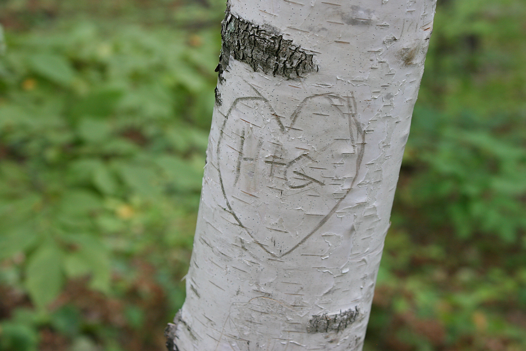
Sadly…a carving on a birch tree along the trail. Minnesota Prairie Roots copyrighted photo September 2021.

We also paused to visit with a retired couple on their way to the tower. They have a generational lake home in the area, like so many who vacation here. While we chatted, a young runner passed us. I admired her stamina and figured she’d face no physical challenges climbing the 100-foot tower.

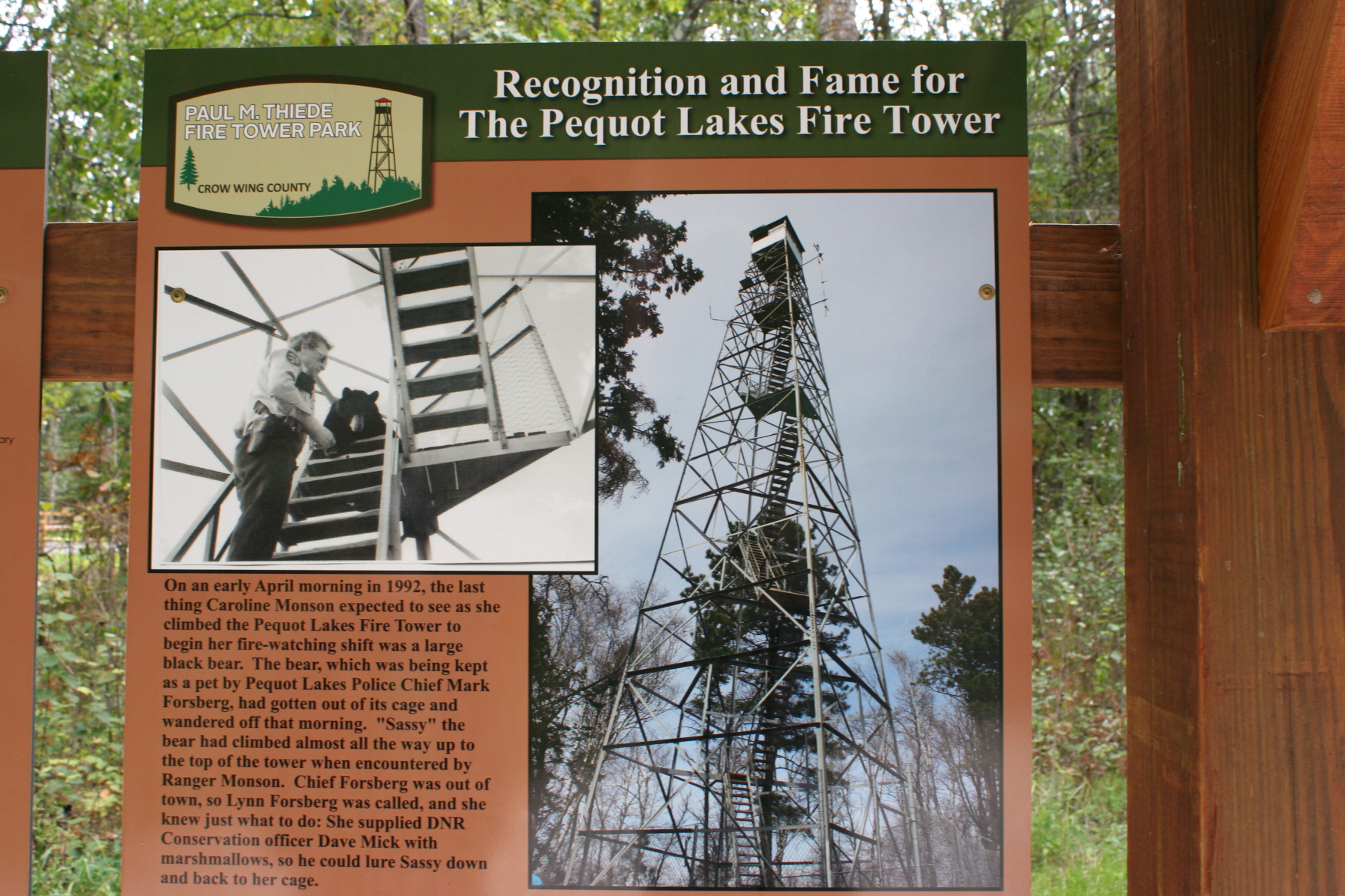
The story of Sassy the bear is included in the interpretative area. Minnesota Prairie Roots copyrighted photo September 2021.

Just like a domesticated black bear that once escaped and scampered up the tower. A ranger lured him down with a bag of marshmallows. That is not the stuff of Paul Bunyan lore, but of life in the Minnesota northwoods. This historic fire tower, which once provided a jungle gym for a bear and a place to scout for wildfires, now offers a unique spot to view the surrounding woods and lakes and towns. If you don’t fear heights or experience dizziness.

FYI: The Paul M. Thiede Fire Tower is open from dawn to dusk during the warm season, meaning not during Minnesota winters. Heed the rules. And be advised that getting to the tower is a work-out.

Right now should be a really good time to catch a spectacular view of the fall colors from the fire tower.

© Copyright 2021 Audrey Kletscher Helbling
 

As Canadian wildfires rage: “What’s mine is yours” May 4, 2016

Minnesota Prairie Roots file photo.

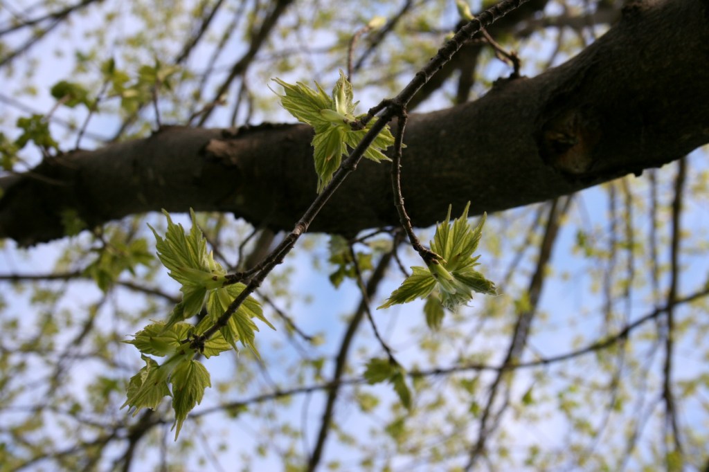
Minnesota Prairie Roots file photo of unfurling leaves in my Minnesota backyard.

IT’S BEEN A GLORIOUS MAY day here in southern Minnesota. Sunshine. Clear blue skies. Leaves unfurling in a landscape that is a lush and vivid green.

Tomorrow, though, we can expect “milky skies,” according to the National Weather Service Twin Cities Twitter page. Smoke from Canadian wildfires is moving east into Minnesota. It will be a visual reminder of what our neighbors to the northwest are enduring as wildfires rage.

With some 88,000 people evacuated from the Ft. McMurray area and 1,600 structures already destroyed, it would be easy to feel overwhelmed by the scope of the disaster. And those feelings would be warranted.

But while I was reading about the fires and evacuation today, I was moved to tears by the goodness of people. Scrolling through posts on the Fort McMurray Evacuee Open Source Help Facebook page, I read offer after offer of help:

We have a house in north Edmonton. What’s mine is yours. Plenty of clothes for a female child age 4-6. Toys for any age. Room to park a small trailer. Room for a tent, basement and air mattress ready. Food, shower anything you need please call or text… Can pick you up and help with small children

Is anyone stranded on HWY 63 that needs fuel or supplies? Please let me know!

It’s not much. But if anyone should be coming through spruce grove on their journey tonight, I would like to give a hot meal. And a place to relax and regroup your thoughts and plans.

The Church of South Edmonton is opening its doors to those displaced by the fire. They’ll offer snacks, activities for kids, a BBQ, pastoral counseling, internet access—simply a place to recharge and refocus. People can sign up online to host a family.

Offers of help are also coming from Slave Lake, which only five years ago suffered from similar devastating wildfires:

I have a spare room ready for anyone in need in Sherwood park! Wanting to pay it forward as I’m from Slave lake and lost my house so I would love to help someone! Txt me at…

LIVESTOCK
If there’s anybody from Ft McMurray in need, I have feed and water pen space available for free in Slave Lake. Can take 10-15 head of horses/cattle

And, yes, the offers for assistance extend beyond helping people. Canadians are also opening their farms and homes to house displaced pets and livestock.

We live by Rocky Mountain house On a farm We have room and free feed for your large or small livestock for as long as needed. Also room for your rv. And a spare room. And a holiday trailer that sleeps 7 for as long as you need. We can also come up and pick you or your animals up.

If you want your faith restored in people today, then I’d encourage you to read the Ft. McMurray Evacuee Open Source Help Facebook page. Now.

© Copyright 2016 Audrey Kletscher Helbling