Minnesota Prairie Roots

Writing and photography by Audrey Kletscher Helbling

Expecting severe weather in parts of Minnesota, maybe even “strong tornadoes” April 27, 2025

Surveying the destruction at Tracy Elementary School, which was destroyed by a June 13, 1968, F5 tornado. (Photo by The Tracy Headlight Herald and courtesy of Scott Thoma)

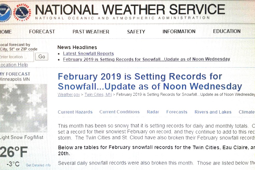
FOR DAYS NOW WE’VE HEARD the warnings and been advised to prepare for impending bad weather in parts of Minnesota and Wisconsin. Here’s the latest from the National Weather Service website as of early Sunday afternoon: Regardless of the risk level, an episode of dangerous weather is likely Monday, with all hazards possible…

The NWS breaks that weather threat down to include tornadoes (a few strong), large hail, damaging winds and frequent lightning. OK, then. I’m listening.

I live in southern Minnesota, which is under a “moderate” risk of severe storms. Now that word choice may not sound all that threatening until you consider that “moderate” ranks as number four on a scale of one to five. “High” risk, #5, tops the scale. Central and eastern Minnesota and western Wisconsin fall in this “moderate” risk area for severe weather.

Weather forecasters seem pretty confident in their predictions. So I have to go with what they’re saying and remain watchful and informed. And stay in contact with my friend Brad, a Minnesota native who lives in North Carolina and is retired from the NWS. He’s like my personal weather forecaster. (Thanks, Brad.)

Eric Lantz, 16, of Walnut Grove, shot this award-winning photo of the Tracy tornado as it was leaving town. He often took photos for the Walnut Grove Tribune, owned by his uncle, Everett Lantz. This image by Eric was awarded third place in the 1968 National Newspaper Association contest for best news photo. (Photo credit and copyrighted Eric Lantz)

I emailed Brad that “I really really really don’t like tornadoes,” not that anyone does. But I do have a bit of history with tornadoes stretching back to June 1968. On June 13, 1968, a violent F5 tornado with wind speeds of 261-318 mph devastated the small southwestern Minnesota town of Tracy, killed nine and injured 125. Days after that deadly twister, Dad, Mom, my siblings and I piled into the car for the 25-mile drive south of our family farm to view the destruction. The imprint of those scenes has stuck with me, which is likely the reason I respect and fear tornadoes.

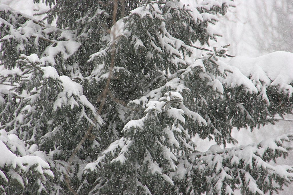
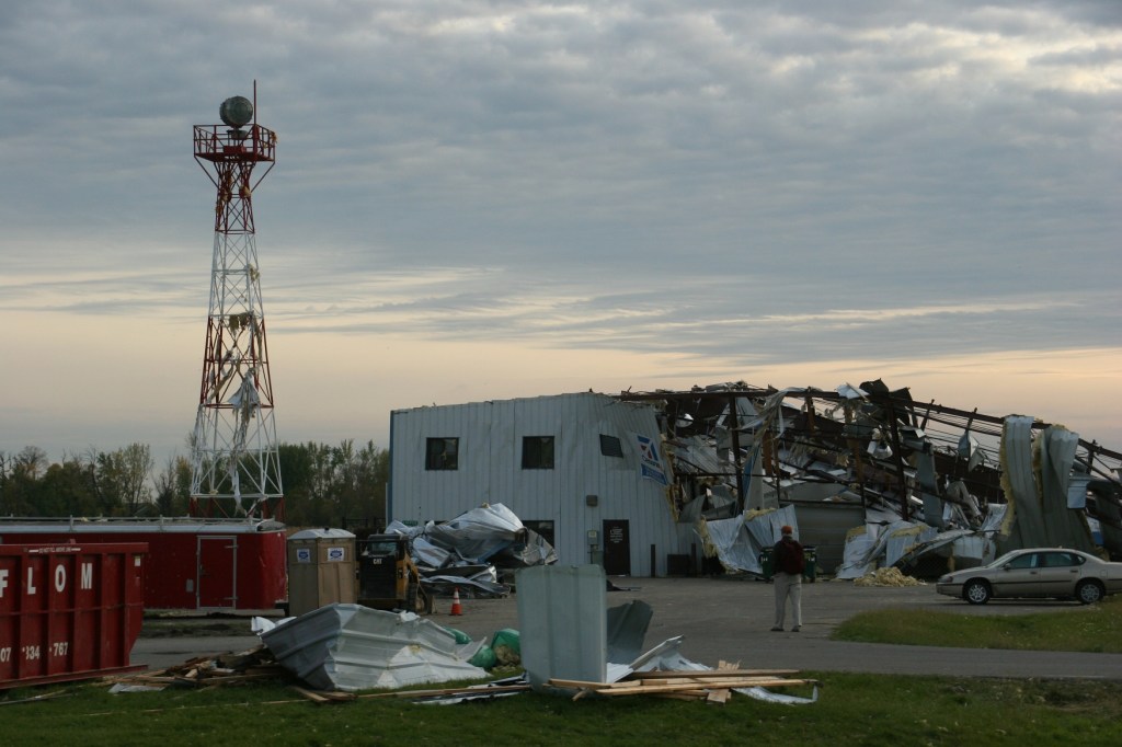
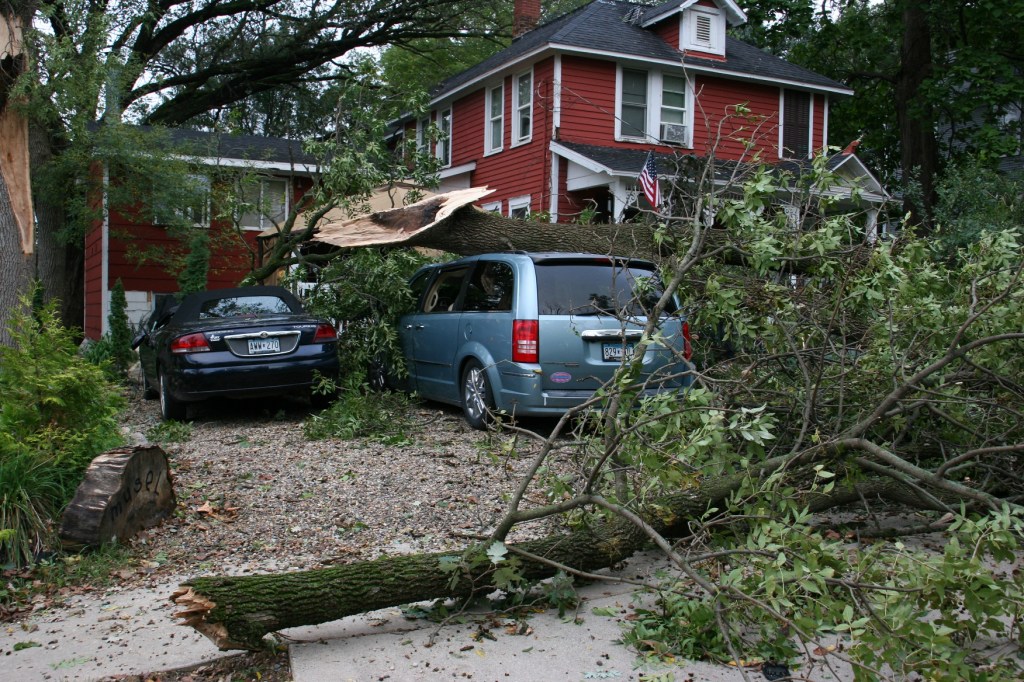
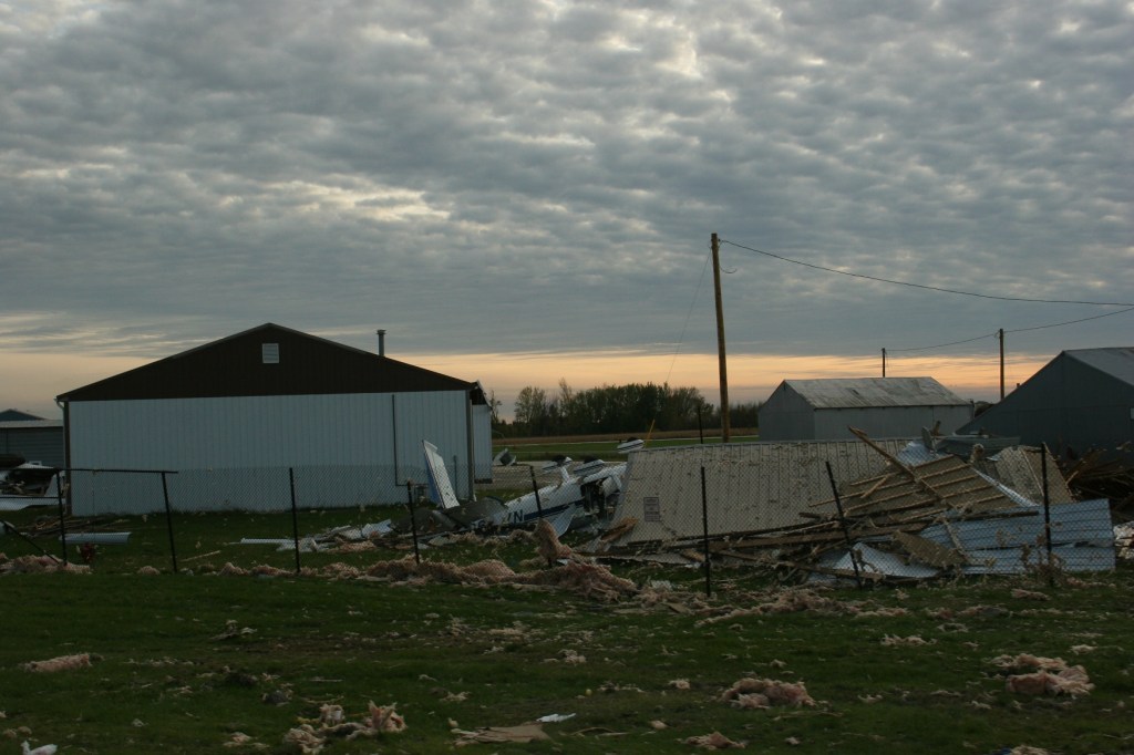
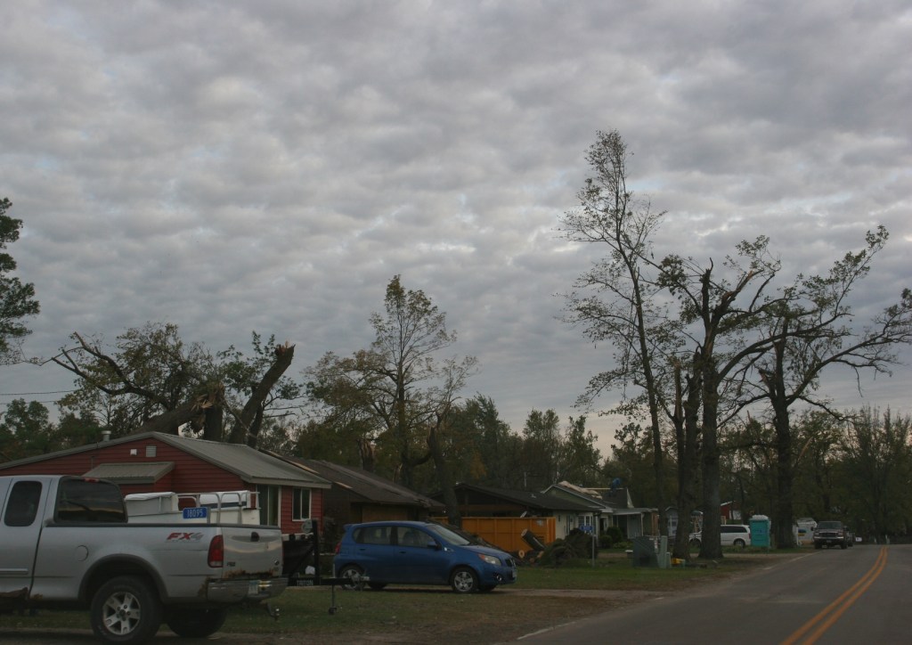
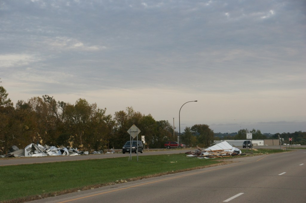
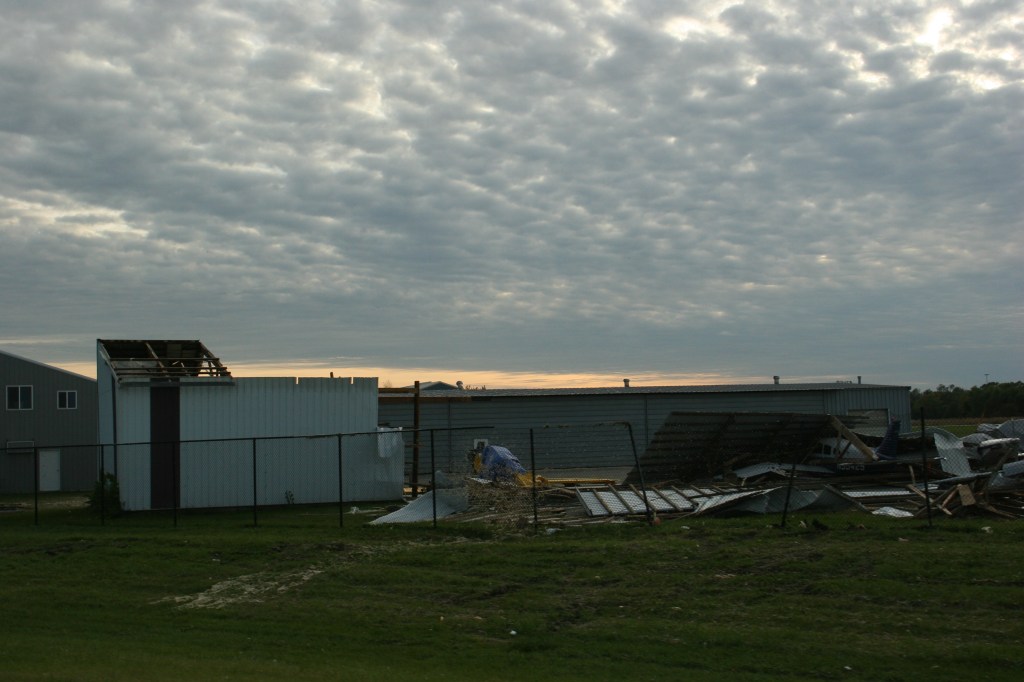
More recently, in September 2018, five tornadoes (the largest an EF2) swept through my county of Rice, including in Faribault. Randy and I sheltered in our basement as strong winds raged, ripping the electrical mast from our house and downing trees throughout our neighborhood and nearby. It was frightening to be huddled in the basement, to hear that roaring wind and then to be plunged into darkness. But damage to our property was minimal. And no one was killed or injured in the county. Today I can look out my office window or walk into my backyard to see visual reminders of that severe storm in what I call “tornado trees.”

Going back further, I recall seeing the destruction in St. Peter, 40 miles to the west of my community, after a tornado touched down there on March 29, 1998. A young boy died. A childhood friend lost his home. Prior to reaching St. Peter, the tornado devastated Comfrey in southwestern Minnesota.

In 1980, a tornado took down a silo, tossed a silage wagon, ripped the railing off the house and more on my childhood farm. That was literally too close to home. It was home. I was working as a newspaper reporter some 65 miles away and raced back to Vesta the next day to see the damage. While working as a reporter in Gaylord, I also reported on and photographed damage left by a tornado.

On July 7, 2011, downbursts during severe weather heavily-damaged my childhood church, St. John’s Lutheran, and caused other damage in my hometown. In neighboring Belview, an EF1 tornado touched down on that same date causing widespread destruction. My personal weather forecaster friend, Brad, grew up in Belview.

A residential street in Tracy, once covered in branches and debris, had to be plowed to allow vehicles to pass following a June 13, 1968, tornado. (Photo by The Tracy Headlight Herald and courtesy of Scott Thoma, Tracy native and author of “Out of the Blue,” a book about the Tracy tornado)

Yes, I have a history with severe storms and tornadoes. How about you?

Be alert, prepared and safe, everyone, especially my friends in Minnesota and Wisconsin.

© Copyright 2025 Audrey Kletscher Helbling


Waiting upon a predicted historic winter storm in Minnesota February 22, 2023

Blowing snow reduces visibility along Rice County Road 25/197th Street in January 2020. I expect similar or worse conditions in Rice County later today, overnight and into Thursday. (Minnesota Prairie Roots copyrighted file photo January 2020)

AS I WRITE THIS MID-MORNING Wednesday, the view outside my office window is one of a landscape layered in new snow, about five inches. The light snow of earlier has stopped.

All appears calm, until I look closer. I notice snow sweeping off my neighbor’s roof. I see, too, treetops swaying, a trio of exposed squirrel nests nestled among branches. Another neighbor’s political flags extend in the wind, bannering messages I’m weary of seeing long after the 2020 election has ended. Buffeting my front steps, dried hydrangea heads wave in the rhythm of the morning wind.

For days now, we’ve been lectured by weather forecasters and officials alike not to be lured into complacency. This lull in an anticipated historic winter storm here in Minnesota is expected. Southern Minnesota braces for storm’s second punch after overnight snow. That Minnesota Public Radio headline and similar headlines have played across media outlets for days.

I lean into believing the National Weather Service predictions about this multi-day event that could rank among our top five winter storms. It’s not only about the quantity of snow, possibly topping 21 inches, but also about the wind. As a prairie native, I understand how quickly winds of even 25 mph can create white-out blizzard conditions, making travel dangerous and impossible. Winds are expected in some places to top 50 mph. Our governor has already declared a peacetime emergency.

When my husband left for work Wednesday morning, I asked him to remain weather aware, reminding him that this storm is about the wind as much as the snow. He works as an automotive machinist in a rural location, typically a 35-minute commute. Unlike me, Randy leans into believing storm predictions are more hype than reality. Sometimes he’s right. Time will tell. Regardless, I inquired whether his phone was fully-charged and whether a sleeping bag was still in the van. It was and it was. And I asked him to text when he arrived at work and when he leaves later today. He did and I expect he will. Roads this morning were worse in sheltered areas, he reported.

By noon our winter storm warning transitions into a blizzard warning in effect for 24 hours. It’s not often my county of Rice, just south of the Twin Cities metro along Interstate 35, enters blizzard status. I expect this designation in southwestern Minnesota and other primarily open land area parts of the state, but not here.

Whatever happens, we’ve been warned by the National Weather Service, Twin Cities, on their Twitter page Wednesday: There seems to be some confusion this morning because the sun has come out. Does this mean all we got is a measly 3-5” and it’s over? Nope! As we’ve talked about for days, round 2 is on the way and it will pack a punch! Expect an ADDITIONAL 10-15” by tomorrow morning.

© Copyright 2023 Audrey Kletscher Helbling


Preparing for another major winter storm in Minnesota February 21, 2023

(Minnesota Prairie Roots copyrighted file photo 2018)

WHEN A MAJOR WINTER STORM is in the forecast for Minnesota, we Minnesotans listen intently. And then we stock up on eggs, milk and bread. Or so the joke goes. But, in reality, grocery stores do experience an uptick in business. Liquor stores, too. And for anyone who owns a snowblower—and that’s most of us—having enough gas to fuel snow removal is a must, not an option.

So here we are, poised to get massive quantities of snow over several days. Faribault is in the 17 to 22-inch snowfall range, according to the National Weather Service forecast on Monday. That bull’s eye target of snow stretches from western to eastern borders across a wide swatch of southern Minnesota from around Mankato in the south to St. Cloud in the north.

And then as if the large amounts of snow aren’t enough, winds are anticipated to rage, blowing around all that light, fluffy snow. The 40-45 mph winds gusting up to 50 mph will create white-out and blizzard conditions in many regions, especially on the prairie.

This looks to be a doozy of a winter storm that begins on Tuesday afternoon, ends on Thursday evening. Forecasters seem quite confident it will play out as predicted. I expect closures of schools, businesses and more. I expect snow gates (yes, there’s such a thing) to be pulled across interstates and other highways. There will be winter storm (our warning starts at 3 pm today) and blizzard warnings, travel advisories, “no travel recommended” and most likely stranded motorists who need rescuing.

Randy and I are prepared. I have a stack of library books to read. We have 2 ½ dozen eggs (thanks to a friend who has free-range chickens), enough milk and nearly a full loaf of bread. The snowblower gas tank is topped. And the mini fridge in the basement is stocked with craft beer. Yup, we’re ready…

© Copyright 2023 Audrey Kletscher Helbling


Dangerously cold in Minnesota, but also beautiful December 20, 2022

Once the grey skies broke, the snow-layered trees looked especially stunning against the cobalt sky. (Minnesota Prairie Roots copyrighted photo December 2022)

THE LANDSCAPE HERE IN MINNESOTA the past week has been undeniably beautiful—a winter wonderland. It’s absolutely stunning with snow layered upon trees and rooftops, creating scenes that could grace any Christmas card. I found myself many times just pausing at a window to admire the beauty of the outdoors.

This image shows snow falling in my backyard last week. (Minnesota Prairie Roots copyrighted photo December 2022)

But four consecutive days of snowfall also brought issues. The heavy snow snapped branches and power lines leaving many, especially in the Brainerd lakes area of central Minnesota, without power. Snow slicked roads, leading to crashes. And for all of us, no matter where we live in the state, all that snow meant snow removal.

The shovels we use to remove snow, all lined up against our house. (Minnesota Prairie Roots copyrighted file photo December 2021)

We have a snowblower, albeit massive and ancient, and three different types of shovels. The scoop shovel is good for tossing large quantities of snow, especially the rock-like chunks at the end of the driveway. The wide plastic shovel works well for pushing. And the wide metal shovel serves as an oversized ice scraper to expose bare concrete. I often shovel since I can’t manage the snowblower.

I zoomed in on this branch on a tree in my neighbor’s yard last week. (Minnesota Prairie Roots copyrighted photo December 2022)

Weather forecasters warned us to get the snow off sidewalks and driveways without delay. Why? Cold air has moved in. And it’s only going to get worse. The National Weather Service is warning of “life-threatening conditions possible Thursday and Friday with dangerously cold wind chills (into the minus 30s) and blizzard conditions from blowing snow.” So, yeah, not good. Our son is scheduled to fly in from Indiana on Thursday evening. Whether that happens remains to be seen. I don’t even want to consider the possibility of him not getting here for Christmas.

The snow boots I wear are warm, practical and fashionable. (Minnesota Prairie Roots copyrighted file photo October 2020)

When the NWS starts tossing out words like wind chill, frostbite and hypothermia, we Minnesotans recognize the need to stock winter survival kits in our vehicles, dress in layers, don our waterproof boots, wear mittens (not gloves) and more.

Snow layered every branch, every twig in this image taken last week. Beautiful. (Minnesota Prairie Roots copyrighted photo December 2022)

When lines of ice edge door thresholds in our house, I block the bottoms of exterior doors with rag rugs to seal cold air entry points. When cold ices windows on the second level, well, there’s not much I can do.

Already I feel the chill in our old house. I’ve added an extra blanket to our bed. In the morning, I pull my clothes from a cold closet to warm for awhile before getting dressed for the day.

I especially love the contrast of snow against blue sky. (Minnesota Prairie Roots copyrighted photo December 2022)

As I write, light snow falls. A notice on my computer screen warns of dropping temps. Highs later this week will not even reach above zero as “dangerously cold Arctic air” moves into Minnesota, just in time for Christmas.

© Copyright 2022 Audrey Kletscher Helbling


Latest snowstorm in Minnesota shatters February snowfall record February 21, 2019

My neighbor blows snow from his driveway on Wednesday.


HEY, MINNESOTA, we did it. Yesterday’s winter storm pushed us into the snowiest February ever. The current month’s snow total in the Twin Cities as of noon Wednesday was 30.4 inches. That’s a new record, according to the National Weather Service.


The NWS February snowfall totals for the Twin Cities posted mid-day Wednesday.


This shatters the February record snowfall of 26.5 inches set 57 years ago in 1962.


The forecast on a Twin Cities TV station Wednesday morning predicts more snow.


Snow was still falling Wednesday afternoon into evening, earlier in the day at a rate sometimes reaching two inches an hour. With eight days remaining in the month and forecasts for more snow in upcoming days, that record-shattering 30.4 inches will rise even higher.


Another neighbor shovels her driveway. The amount of snow on the ground, in piles, everywhere, is insane.


Passing by on my street, a white truck in a white landscape.


The City of Faribault did a great job clearing streets in my neighborhood on Wednesday.


Bravo, Minnesota.


I just want the snow to stop, But we still have to get through the rest of February and then March and April.


But now that we’ve claimed the snowiest February ever, can we be done with winter?


Winter beauty from my backyard.


THOUGHTS? I welcome positive comments about winter and snow and waiting for spring. Or I’ll accept congratulations/sympathy on behalf of my state for this new February snowfall record.


© Copyright 2019 Audrey Kletscher Helbling


Tornado count rises in southern Minnesota October 1, 2018

Ten days after an EF2 tornado hit the Faribault Airport, a man surveys the damage just before sunset.


MAKE THAT SIXTEEN. The National Weather Service updated from 10 to 16 the number of tornadoes which touched down in southern Minnesota and western Wisconsin on September 20.


A half block from my home trees fell onto two vehicles. Minnesota Prairie Roots file photo.


The unprecedented massive storm system hit my area hardest with five confirmed tornadoes in Rice County, the strongest an EF2 with wind speeds of 120 – 130 mph, according to the NWS report. That tornado damaged homes in Morristown and along Roberds Lake and destroyed the Faribault airport. Within the city of Faribault, apparent straight line winds felled hundreds of trees, including in my neighborhood, and also damaged houses and other structures. The tornadoes continued north and east of Faribault into Wisconsin causing additional damage.


The tornado at the Faribault Municipal Airport, Liz Wall Strohfus Field flipped airplanes and destroyed buildings.


The Weather Service states in its report that assessments continue and the final tornado count could change.


The single photo I shot along Roberds Lake Boulevard on Sunday evening, 10 days after the tornado. Damage to homes and loss of trees along this section of Roberds Lake is extensive.


Sunday evening, 10 days after the storm, Randy and I drove through the countryside, past the airport and along a short section of Roberds Lake Boulevard. Up until then, we chose to stay away as advised by local authorities. Gawkers early on hampered the work of emergency personnel, utility workers and clean-up crews. After seeing too many gawkers in our neighborhood (including the evening of the storm), I decided to wait until things calmed to view the destruction. No need to get in the way.


Debris landed on and along Minnesota State Highway 21 by the Faribault Airport. This is right off Interstate 35. I expect the scene was much worse right after the tornado. I shot this 10 days after the storm and shortly before sunset.


Ten days out, plenty of people are still working hard to remove trees, clear properties and repair storm-damaged buildings. Many roofs remain partially covered with tarps. I didn’t take many photos, except of the airport damage, and that as we drove past the airport. Mostly metal debris still lines road ditches and the median along Minnesota State Highway 21. I can only imagine how bad this area looked right after the tornado because it still looks bad.


Look closely and you will see aircraft under the debris.


Yet, in all of this we find reason to remain thankful. Not a single person was killed, which is remarkable given the 16 tornadoes and straight line winds. The NWS credits a Wireless Emergency Alert notification of the approaching tornadoes for saving lives. I agree. I got that alert on my cell phone. But I’d also seen an alert on TV and heard an alert on the local radio station to seek immediate shelter. I take these warnings seriously. There was a reason alerts sounded and emergency sirens blared, here in Faribault off and on for 40 minutes. They save lives. To ignore those warnings is a risk I will never take. Ever.

FYI: Click here to read the updated National Weather Service report released on Friday.

© Copyright 2018 Audrey Kletscher Helbling


Field fires aplenty in Minnesota’s Red Flag areas October 6, 2011

A farm site between Morgan and Redwood Falls in southwestern Minnesota, where field conditions are dry and the fire danger high.

DRY, WINDY CONDITIONS persist in much of Minnesota creating ideal conditions for fire.

Unless you’ve had your head buried inside, you understand the danger and the reason for the National Weather Service’s Red Flag Warning that covers central and southern Minnesota.

Today would not be the day to build a campfire, have a bonfire or toss a cigarette butt out the car window (like you should any day). Burning bans are in effect throughout the state.

If forecasters are correct, these weather conditions will continue for awhile.

That all said, I wondered if my nephew, a kindergarten teacher and Westbrook volunteer firefighter, has been battling any blazes in his region of southwestern Minnesota.

Adam checked in with me early this morning:

Fires—we have had quite a few around here. Westbrook has had two; Dovray, two; and Walnut Grove, for sure three, all in the past week. It’s very dry and with the wind, it doesn’t take much to create a big fire. Many of the calls are mutual aid—helping neighboring towns with fires, but that’s how we do things here. All of them have been combines and fields. I haven’t made it to many of them as I could not get out of school at the time. But I made it to one on Sunday.

A story in today’s The Cottonwood County Citizen about a county-wide burning ban confirms Adam’s summary:

These burning bans come in the wake of at least a half-dozen fires that occurred around the county, most of which involved the harvest. Extremely dry conditions, low humidity and high winds have increased the potential for major fires.

I found an article in last Thursday’s Jackson County Pilot headlined “Combine fire sparks massive field blaze.” The story went on to say that a combine fire, fueled by 40 mph winds, quickly spread into a field. Fire crews from numerous departments in southern Minnesota and northern Iowa were called to the scene.

The Faribault Daily News today reports a Monday afternoon fire in the Lonsdale-Montgomery area that burned five acres of hay, 30 acres of swamp and 30 – 50 acres of corn.

Another blaze, this one on Wednesday afternoon in a soybean field northwest of Luverne, is reported in The Rock County Star Herald. In that case, farmers disked strips of black dirt to help contain the fire.

It’s a dangerous situation out there right now, especially for farmers bringing in the harvest in those dry, dry fields.

IF YOU WOULD LIKE to report on fires in your area, submit a comment.

© Copyright 2011 Audrey Kletscher Helbling


What a Red Flag Warning means for Minnesota farmers October 4, 2011

Farmers are in the fields harvesting corn (pictured here) and soybeans under extremely dry conditions.

WHEN I HEARD about the National Weather Service’s “Red Flag Warning” for west central and south central Minnesota Monday evening, it was the first time I had heard that terminology.

What does it mean?

Here’s the definition, direct from the NWS:

A RED FLAG WARNING MEANS THAT CRITICAL FIRE WEATHER CONDITIONS ARE EITHER OCCURRING NOW…OR WILL SHORTLY. A COMBINATION OF STRONG WINDS…LOW RELATIVE HUMIDTY…AND WARM TEMPERATURES WILL CREATE EXPLOSIVE FIRE GROWTH POTENTIAL.

That’s a strongly-worded warning for those folks living in the communities and rural areas along and west of a line from Alexandria to Fairmont.

Farmers, especially, have to be worried about the fire danger given they are in the middle of harvesting corn and soybeans in tinder dry fields. Mix dry plant material, strong winds and the heat of a combine exhaust, for example, and you have the potential for a devastating fire.

Michael, a southwestern Minnesota farmer who blogs at Minnesota Farmer, writes two days ago about fires he spotted last Thursday while combining beans. Click here to read his October 2 post which explains how blazes start and the resulting, devastating financial impact on farmers.

It’s all too easy for those of us who live in town, even if we grew up on a farm, to forget about the dangers that come with harvest. And this year, the fire danger is particularly high.

The Red Flag Warning remains in effect until 7 p.m. Wednesday.

DO YOU LIVE in the Red Flag Warning area? If so, has there been an increase in the number of fires recently? Please submit a comment and share.

© Copyright 2011 Audrey Kletscher Helbling


Hot as “you know what” in Minnesota July 18, 2011

Air conditioners will be working overtime in Minnesota this week.

SO, MINNESOTANS, here’s the weather question of the day: “How hot is it outside?”

Although I’m of German heritage, I’d unequivocally state, “hotter than a Finish sauna.”

With a predicted dewpoint in the 70s (Sunday it reached an almost unheard of 81) and temperatures in the 90s today, the National Weather Service in Chanhassen has continued an extensive heat warning for central and southern Minnesota and west central Wisconsin through 9 p.m. Wednesday.

Heat indexes of more than 105 degrees (some media outlets are saying 110 – 117 degrees) are expected for several-hour stretches during the afternoon, creating “a dangerous situation in which heat illnesses are likely.” Ya think?

That means, folks, that we need to keep ourselves cool (preferably in an air conditioned building), drink plenty of fluids (and we’re not talking alcohol here) and stay out of the sun.

Don't increase your fluid intake via alcohol.

Honestly, when I stepped outside Sunday evening, I felt like I couldn’t breathe. You can guess how long I stayed outdoors. Long enough to turn around and walk back inside the house. I had been out earlier photographing the air conditioner you see above. I had a little trouble with the camera lens fogging over as soon as I stepped outdoors. The windows on our house also fogged, a phenomenon I have not previously seen except when I cook pasta. Weird stuff this weather.

All joking aside, this heat and humidity can be downright dangerous, especially for anyone working outdoors.

I know of some teens supposedly heading to the corn fields early this morning to detassel corn in the Stanton/Northfield area. Here’s my advice: Gulp water, by golly, then gulp some more. Slather on the sun screen, wear a cap and, if you’re at all feeling out of sorts, immediately tell your supervisor. Today would not be the day to tough it out. And, yes, I do know of what I write. As a teen I detasseled corn on days so hot it seemed as if the heavy air would suffocate me in the corn rows.

If you, or your teen, is starting a job this week as a corn detasseler, take extra precautions to avoid heat-related health issues. Also, don't quit. Every week in the cornfield won't be like this one and you' likely work only til noon.

Now, with those dire warnings out of the way, let’s talk about the words and phrases we Minnesotans use to describe this stretch of humid, hot weather. Let me pull out my Minnesota Thesaurus and thumb through the pages.

Here are some select synonyms for our current weather: steamy, muggy, scorching hot, sweltering, a real barn burner, so hot you could fry an egg on the pavement, like a sauna, “it’s not the heat, it’s the humidity”…

Whichever words you choose from that non-inclusive list, you might want to add, “It could be worse.” We Minnesotans like to tack that little phrase onto our statements lest, by not adding that qualifier, we leave ourselves open to worse circumstances/situations/weather. We do not want to tempt fate.

After all, come December, we could get socked with a raging blizzard that dumps two feet of snow on us followed by a week of temperatures plummeting to 20-below, and that’s without the windchill. We wouldn’t want to invite a Siberian winter by forgetting, this week, to say, “It could be worse.”

A snow pile divides traffic lanes along Fourth Street/Minnesota Highway 60 a block from Central Avenue in Faribault following a December 2010 snowstorm.

In summary, it’s best, really, not to overly-complain about the hellish, hot, scorching, stifling, steamy, sticky, sweltering, miserable, muggy, unbearable, oppressive heat and humidity. OK, then?

And, please, don’t be thinking, “Whatever, Audrey.”

IT’S YOUR TURN to speak up. How would you describe this weather we’re experiencing in Minnesota? How are you coping? Add your ending to this prhase: “It’s so hot in Minnesota that…”  Submit a comment and tell me whatever.

© Copyright 2011 Audrey Kletscher Helbling


Preparing for the floods, which haven’t arrived, yet, anyway March 25, 2011

Xcel Energy sandbagged its electrical substation near the Straight River in preparation for spring flooding. See the green, fenced enclosures next to the building. Last fall this substation flooded during a flash flood.

UNLESS THE NATIONAL WEATHER SERVICE changes its forecast, a flood warning that covers Rice County expires at 3:30 p.m. Friday.

That’s good news for Faribault, where residents and officials have been nervously watching the rising, and now receding, Cannon and Straight Rivers that run through town.

Six months ago, those rivers rushed over their banks during a September flash flood, threatening homes and businesses and actually flooding some. Sewage also backed up in to homes and the city’s wastewater treatment plant was compromised. Because of the sudden nature of that flood, my community was not fully prepared.

This spring, though, following a winter of heavy snowfall and then a quick snow melt, officials had emergency plans in place to deal with possible flooding. They had even recruited students to fill sandbags, stockpiled at a local park for residential use.

They were ready. Ready is good.

Better to be safe than sorry.

Here’s a look at some river and preparedness scenes I shot near the Cannon and Straight Rivers Wednesday evening.

If we don’t get another major storm—rain or snow— and the weather stays cold, slowing the snow melt, I think we should be OK here in Faribault, meaning no need to worry about flooding.

But then that can change on a dime, and I’ve heard predictions of another possible river crest next week.

And so we wait…prepared.

Student volunteers and others filled sandbags, available to residents who needed them. These were stockpiled at South Alexander Park by the Cannon River when I shot this image Wednesday evening.

River waters rise close to Faribault Foods. Last fall floodwaters reached as far as the overhead doors.

The Straight River encroaches on Faribault's Water Reclamation Plant, which now appears "safe" from floodwaters.

A sandbagged utility area along the Straight River by the viaduct and Teepee Tonka Park on Faribault's east side.

CLICK HERE to view images from last September’s flash flood in Faribault, comparing the situation then to today. River levels are much lower than six months ago.

© Copyright 2011 Audrey Kletscher Helbling