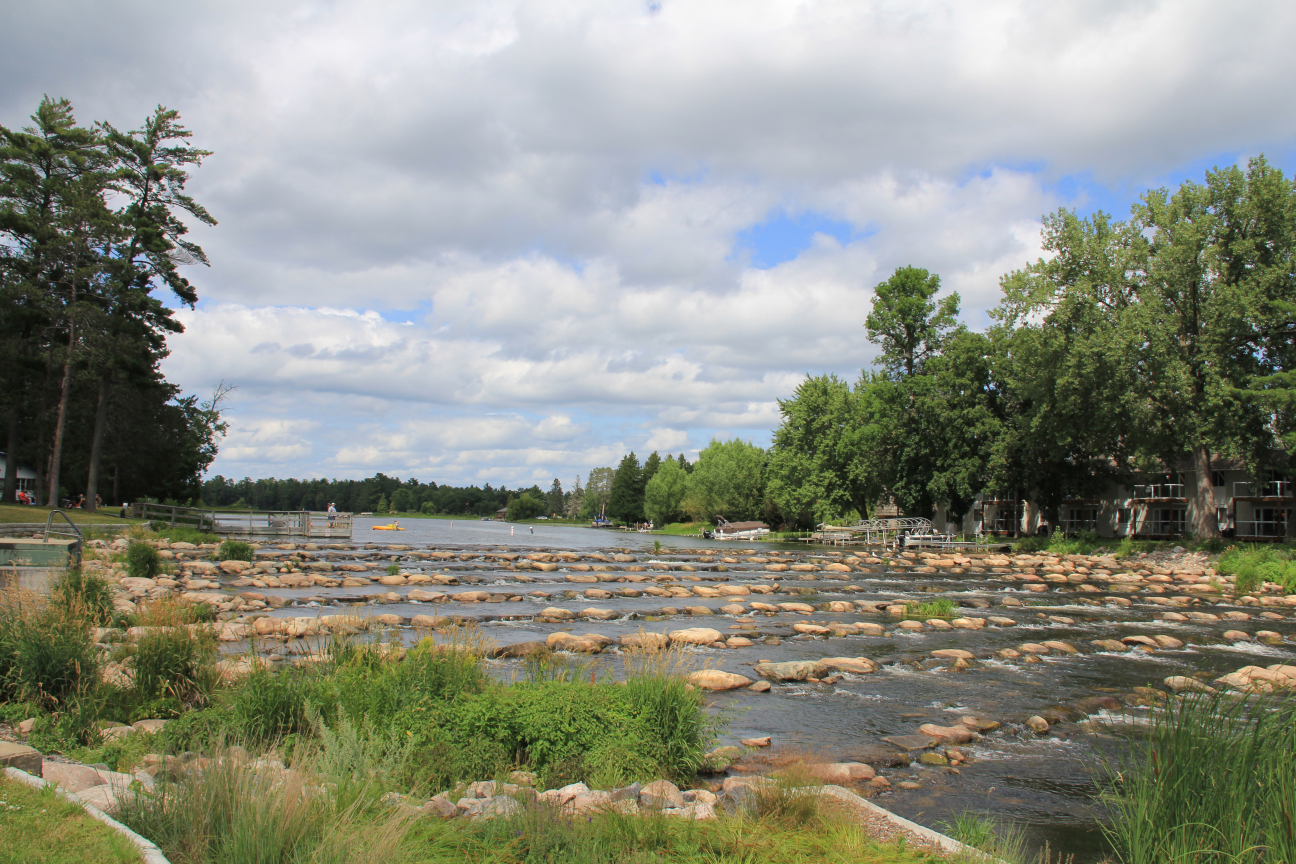
This rock riffle in Pine River replaced a traditional dam built in 1910 to hold back water flowing from Norway Lake into the Pine River. The old dam was designated as “high hazard,” thus in need of replacement. (Minnesota Prairie Roots copyrighted photo July 2024)
WIND AND WATER. Both prove soothing and calming elements of nature. Except when destructive.
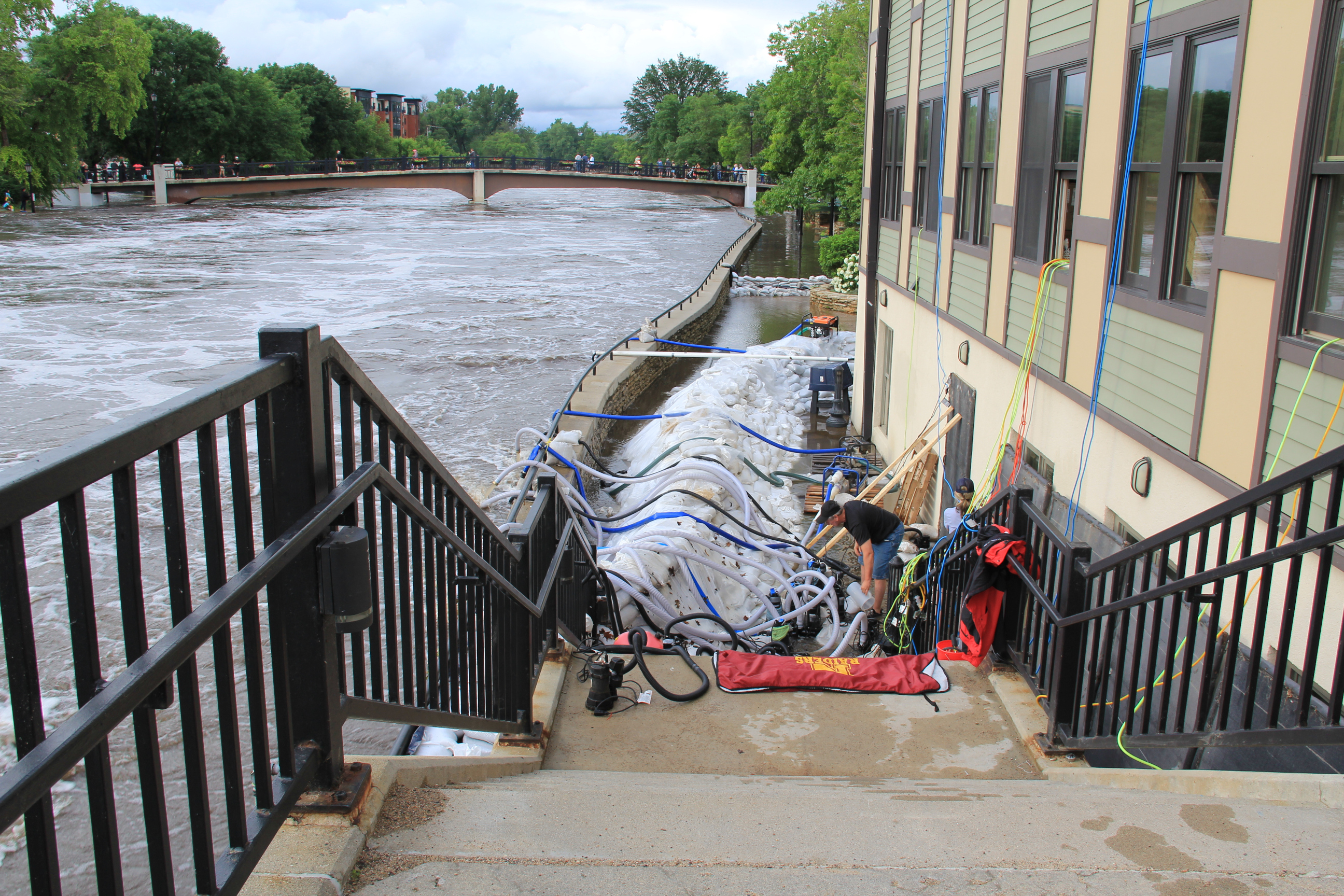
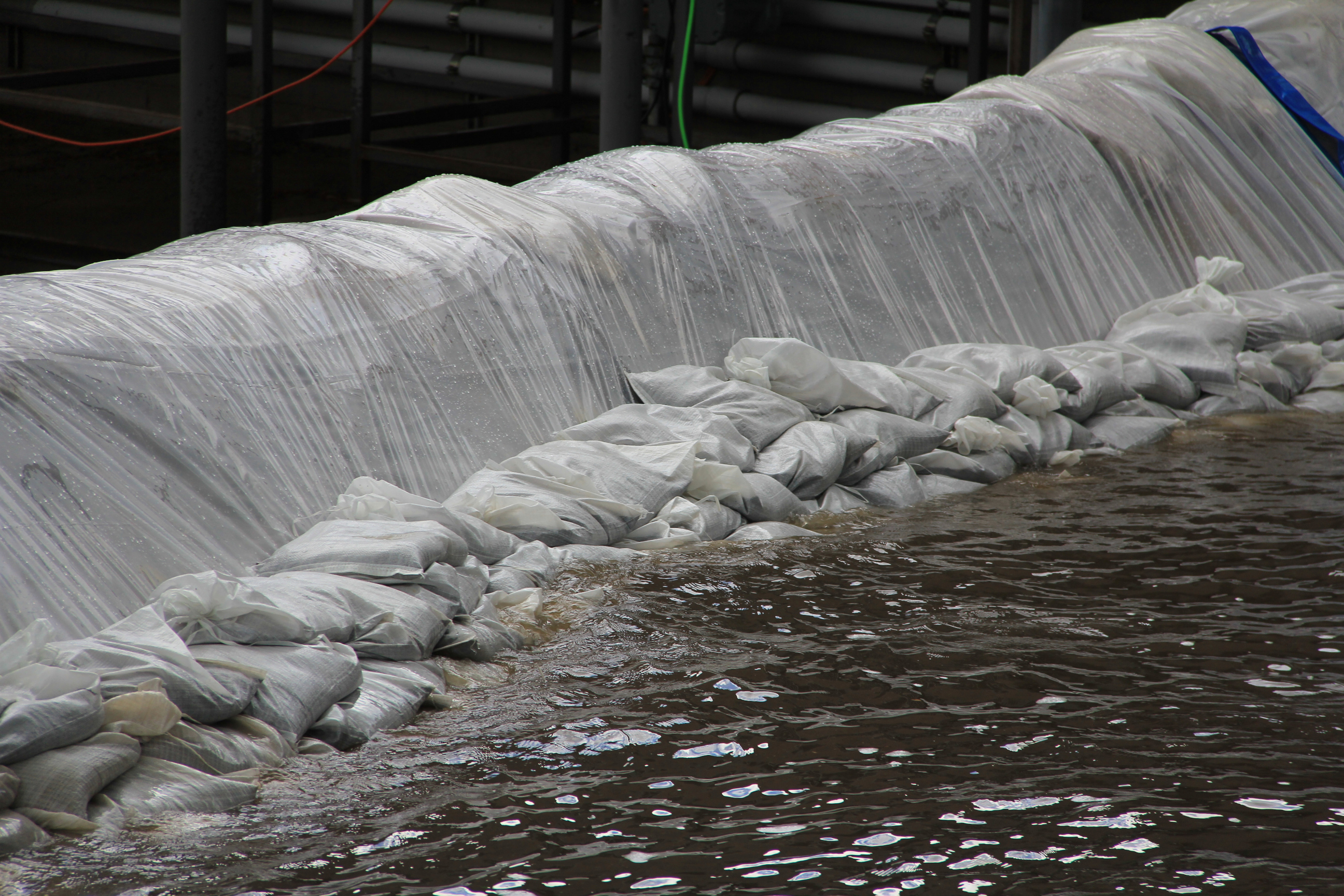
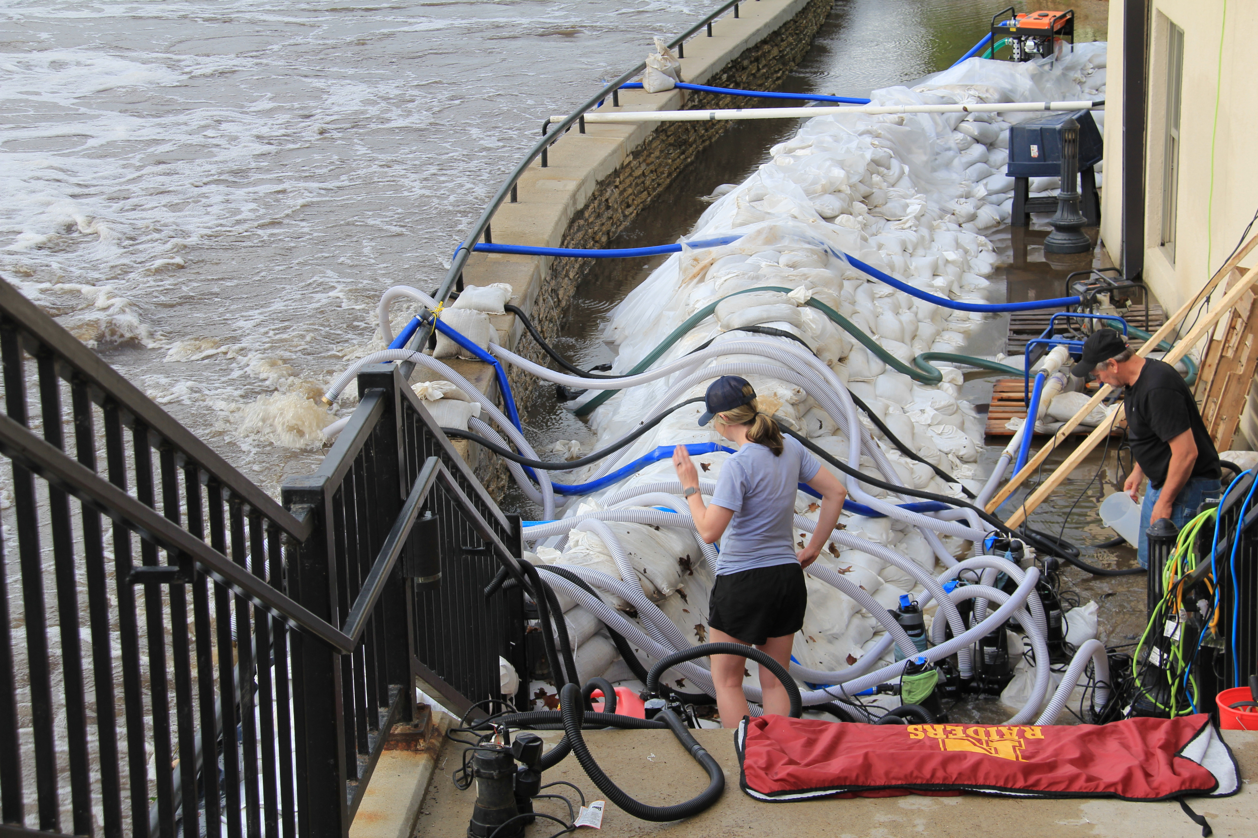
Sandbagging along the flooding Cannon River in downtown Northfield last June. The traditional dam in Northfield was not compromised, unlike in some Minnesota locations. (Minnesota Prairie Roots copyrighted file photo June 2024)
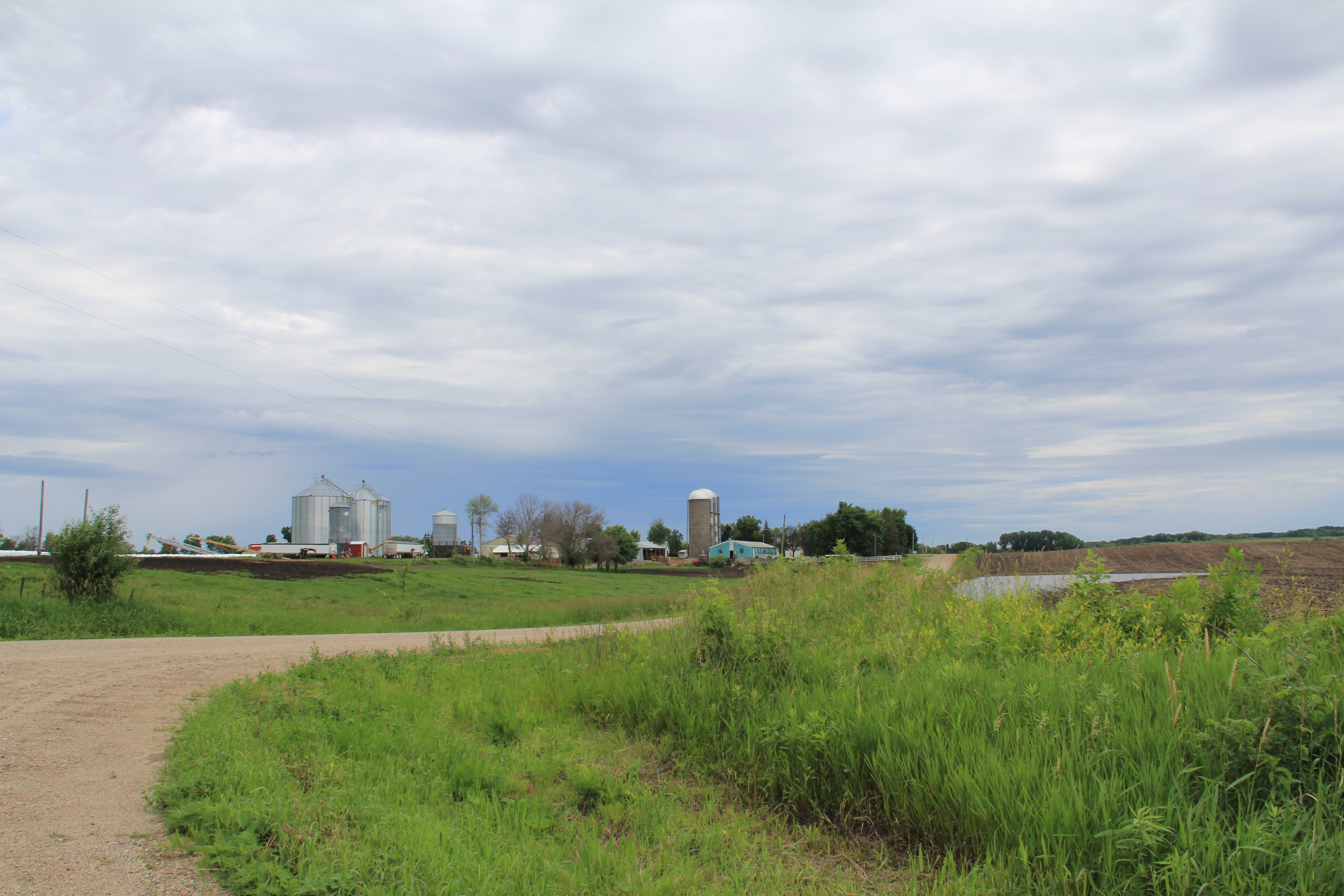
Last June, excessive rainfall led to devastating floods in parts of southern Minnesota, especially in Waterville, a 20-minute drive southwest of Faribault. Farther to the west in Rapidan, the Blue Earth River raged, causing a partial dam collapse and erosion of the land. That led to loss of a house and of the much beloved The Dam Store. In Northfield, 20 minutes from Faribault, the Cannon River flooded the Riverwalk and threatened riverside businesses. In Faribault, the Cannon and Straight Rivers spilled from their banks, flooding parks and several city streets. The powerful river also eroded the shoreline near the Faribault Mill Dam. Boulders were hauled in and placed beside the dam to contain the river and prevent additional erosion.
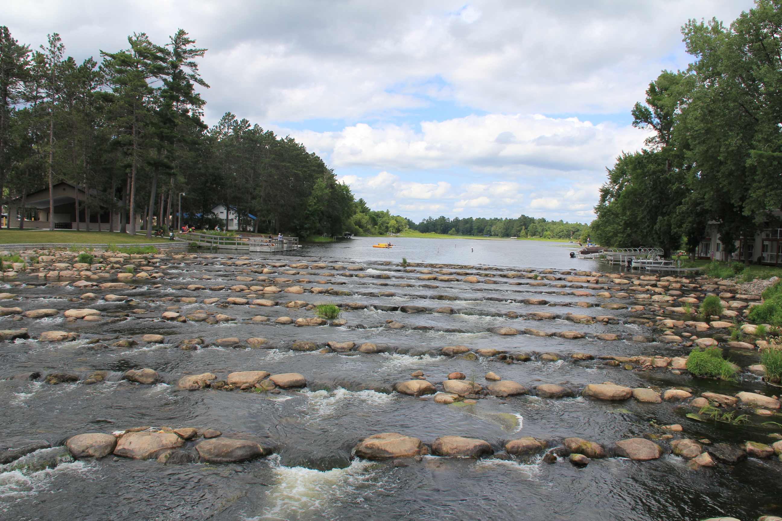
The Dam Park, with a pavilion, is to the left of the tree-edged Pine River in this photo, private homes to the right. (Minnesota Prairie Roots copyrighted photo July 2024)
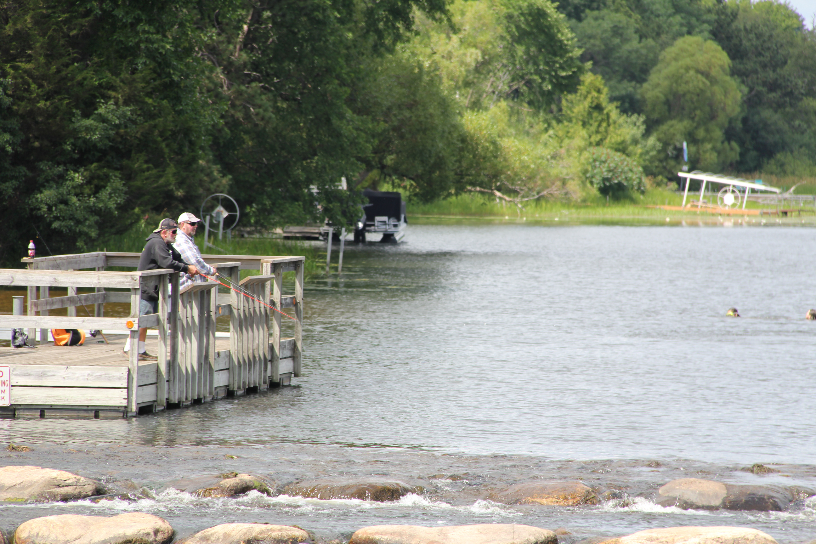
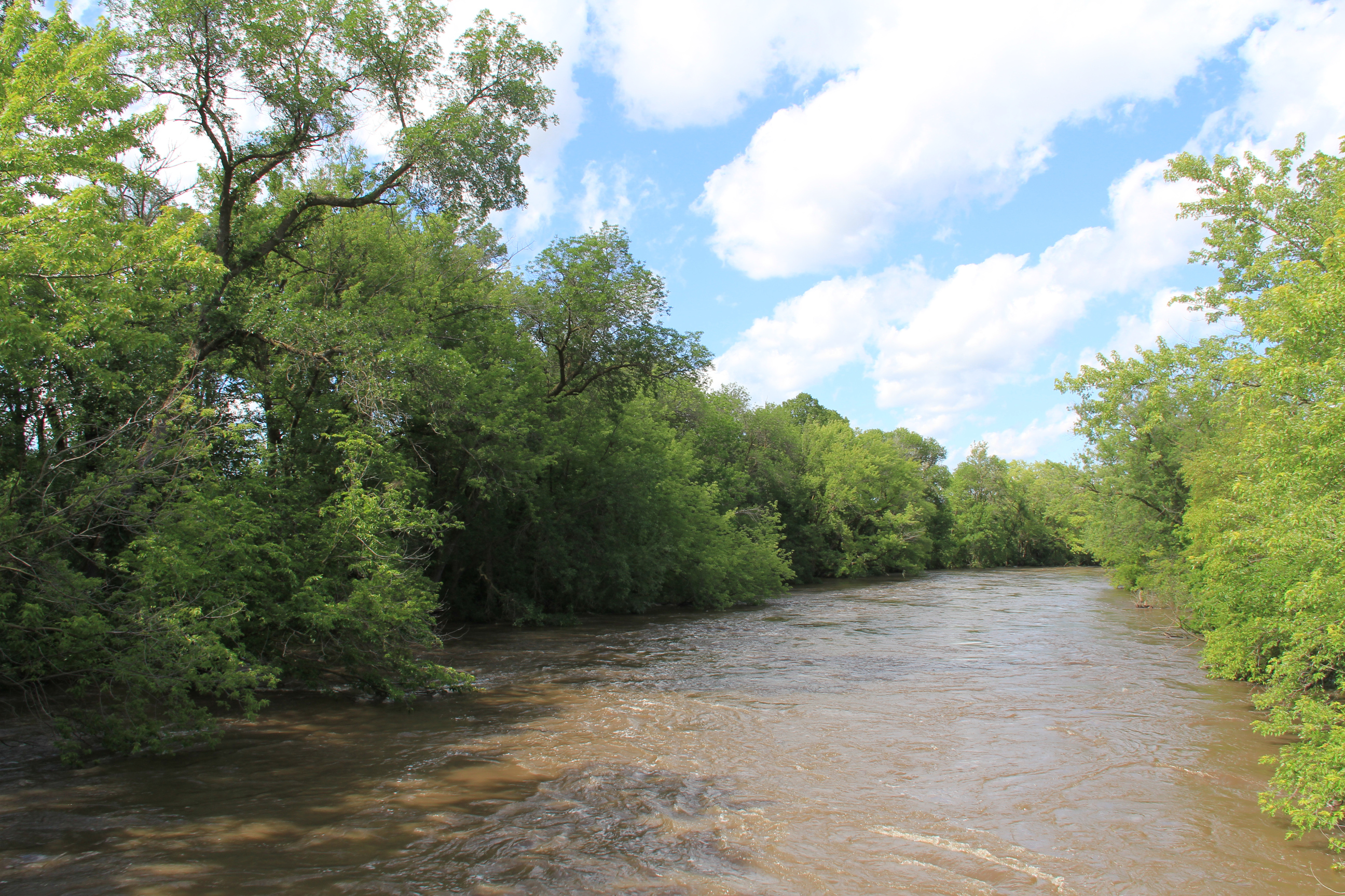
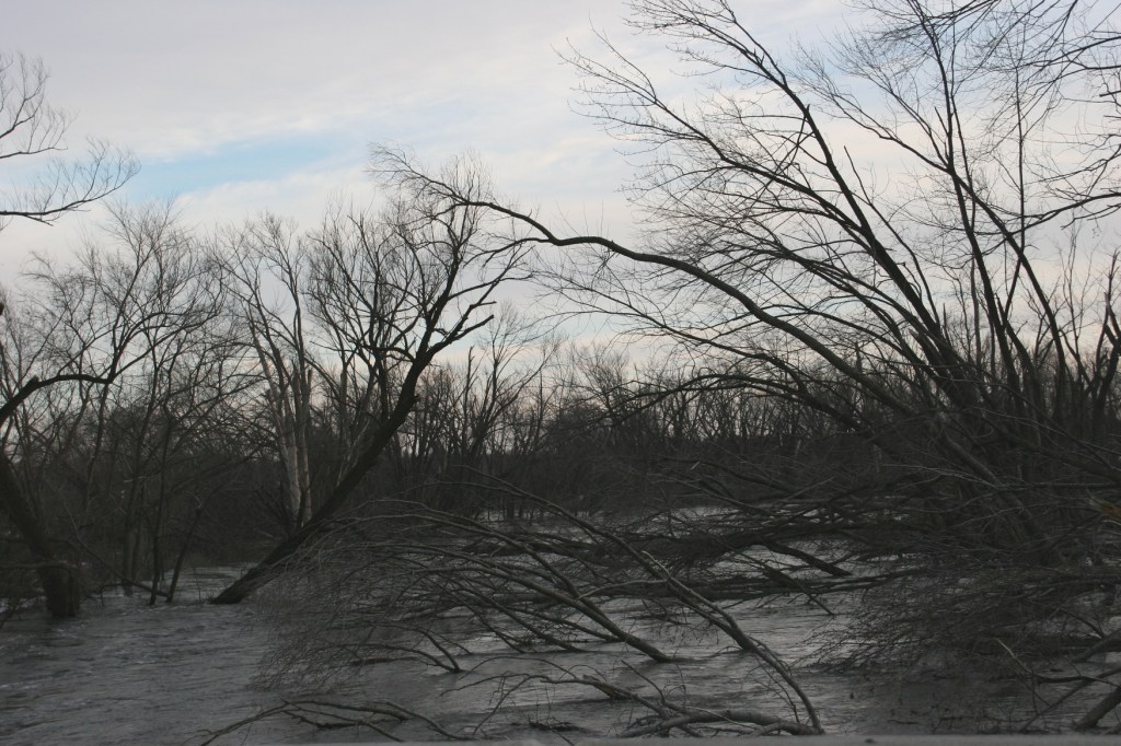
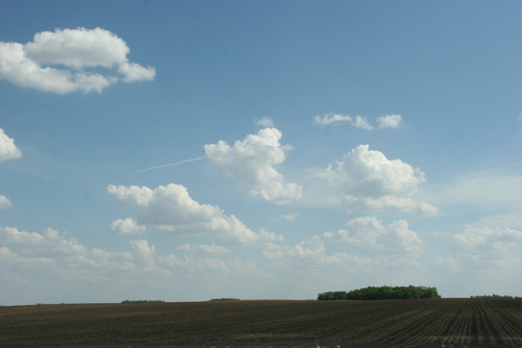
Now, many months later, Faribault city officials are considering options for the Faribault Mill Dam. And that got me thinking about Pine River. In this north central Minnesota community, a rock riffle/rock arch rapids replaces a 200-foot long by 13-foot high traditional dam built in 1910. The result is nothing short of stunning.
The concrete steps and platform remain from the original dam construction project. This image shows a view of the rock riffle looking downstream. (Minnesota Prairie Roots copyrighted photo July 2024)
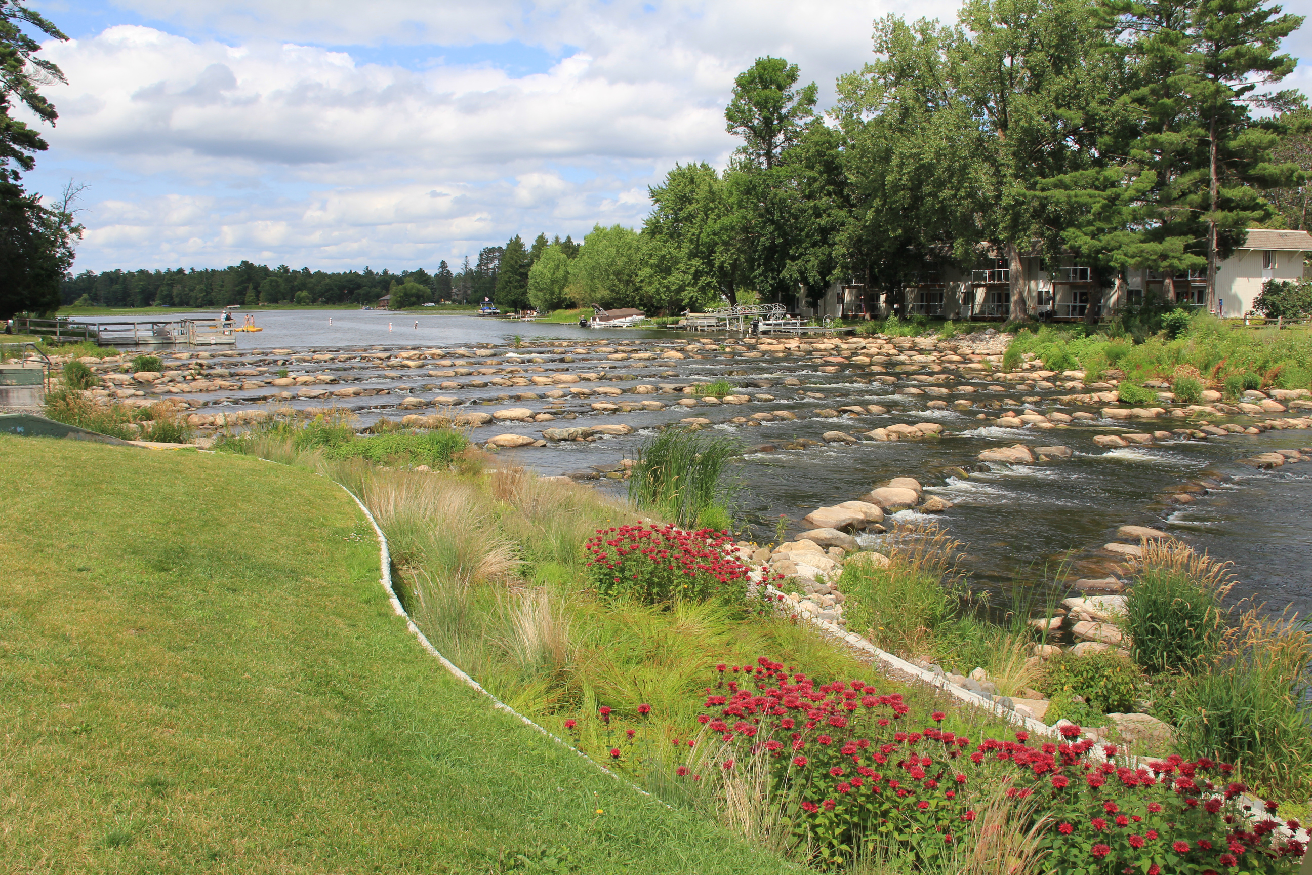
Let me explain. Smaller rip-rap rocks, larger rocks and boulders were placed in sloping rows across the Pine River to replace the dam. Water spills over the rocks as the rows descend for several hundred feet. Except for the precise placement of the rock rows, the rapids appear almost natural. And that is much more visually pleasing than a wall of concrete.
It’s mesmerizing to watch and listen to the river spill over the man-made rock riffle in Pine River. (Minnesota Prairie Roots copyrighted photo July 2024)
The sound, too, is pleasing. I have always loved the sound of water rushing over rocks. It’s calming, soothing, mesmerizing. As is watching the water pour over and around rocks.
The traditional dam proved a significant fish barrier. Installation of the rock riffle has improved fish habitat in the river, which feeds into the Whitefish Chain of Lakes in north central Minnesota. (Minnesota Prairie Roots copyrighted photo July 2024)
But this award-winning rock riffle dam in Pine River offers much more than a place to sit riverside and relax. It’s also a popular recreational area. During my mid-week July 2024 visit, anglers fished the river from a pier and from shore downstream. Swimmers jumped from floating platforms into the water above the rock riffle. There’s a sandy beach, too. And although I didn’t see any, kayakers can also navigate the rapids. And anyone can cross the river on the rocks, but at their own risk.
On a summer day, swimmers jump off a swimming platform above the rock riffle into the river. Dam Park includes a sandy beach. (Minnesota Prairie Roots copyrighted photo July 2024)
This revamped area, as I viewed it, draws people outside to the river. To recreate. To gather. To enjoy nature. There’s even a playground and a pavilion with a kitchen in Dam Park. What Pine River has created with this rock riffle is a community centerpiece that is beautiful in every way.
Plantings of flowers and grasses protect the river shoreline by the rock riffle. (Minnesota Prairie Roots copyrighted photo July 2024)
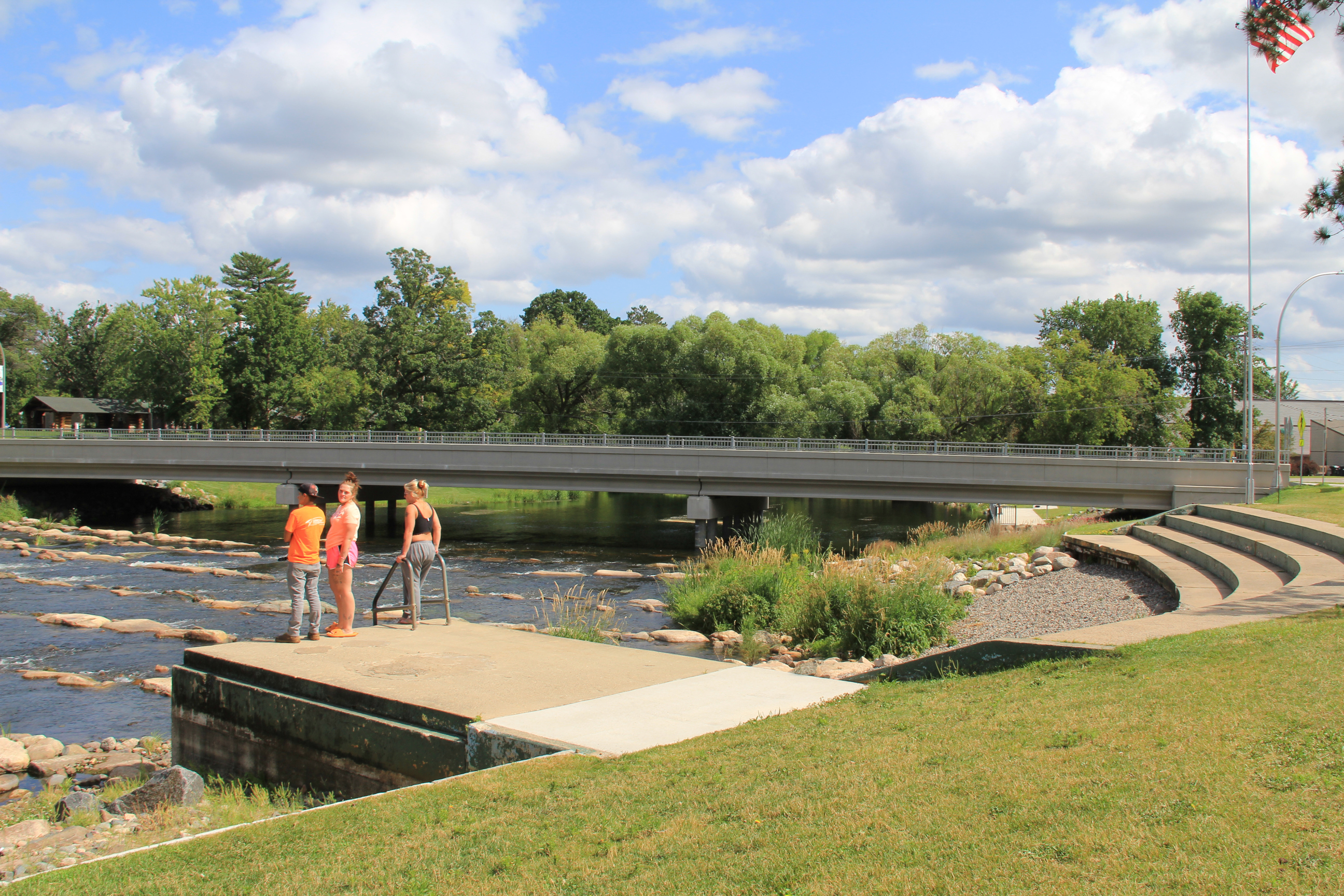
Now, whether this will work at the Faribault Mill Dam, I don’t know. I’m no engineer. But rock riffles have been placed in some 75 rivers and lakes across Minnesota. The one in Pine River is the first I’ve seen. I’d like local city officials to consider a rock arch rapids, maybe take a field trip to Pine River or elsewhere and see (and hear) just how inviting and lovely, calming, soothing and mesmerizing a rock riffle is compared to a traditional dam. See how this dam removal and rock riffle replacement in Pine River creates a recreational oasis, a beautiful gathering spot that grows community.
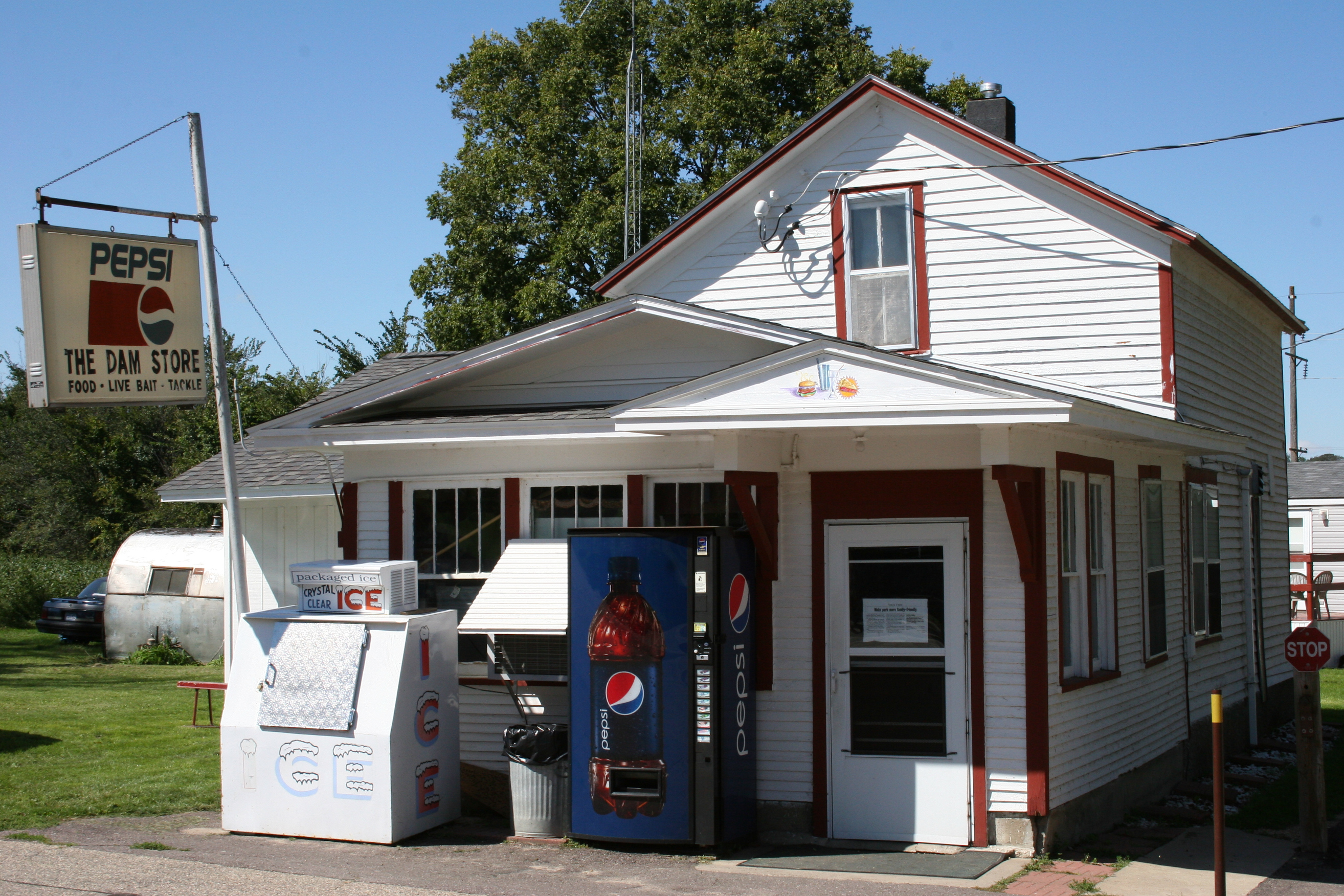
The Dam Store photographed in 2010. (Minnesota Prairie Roots copyrighted file photo 2010)
A FIXTURE NEAR THE RAPIDAN DAM since 1910, The Dam Store is no more. On Friday, crews demolished the historic eatery along the Blue Earth River in southern Minnesota.
Its collapse into the water seemed inevitable after the flooded river carved a path around the west side of the dam, eroding the land, taking down trees, buildings and an electrical substation. The Dam Store appeared next in line.
Officials considered their options, including consulting a professional about moving the store, according to media reports. When that was deemed unsafe, the decision was made to demolish the building. If the river claimed the store, that would add more debris to float downstream, creating additional hazards and safety risks.
Before demolition, the Hruska family, which has owned The Dam Store for some 50 years, and friends removed items from the long-time business. The store opened in 1910 to serve workers constructing the Rapidan Dam.
The loss of The Dam Store is a major loss not only to the Hruska family and locals, but also to the region and to Minnesota. It’s more than a place to grab a burger and a slice of homemade pie. It’s an icon, a destination, one of those genuine slice of Americana spots that stands out for its quaintness, friendliness, uniqueness and great food. Did I mention the pies?
The Hruska family has already stated this is not the end of The Dam Store. I believe them. For now, though, they have much to deal with emotionally and otherwise. The family home, near the store, fell into the river earlier this week. It’s a lot. But the community has rallied to support them financially via donations through GoFundMe and an account at MinnStar banks in Mankato and Lake Crystal. I expect the outpouring of support for this family to continue.
An egret flies over the Cannon River by the barely visible dam at North Alexander Park on Friday evening. (Minnesota Prairie Roots copyrighted photo June 21, 2024)
WILDLIFE SENSES, understands, picks up on nuances that we as humans often fail to notice in our heads-bent-to-our-smartphones, busy scheduled lives.
A blue heron perches on the edge of a tree along the Cannon River by the park-side dam. (Minnesota Prairie Roots copyrighted photo June 21, 2024)
The recent flooding is a prime example. I saw countless cellphones raised to record floodwaters and rising rivers. I carried my 35 mm Canon camera, drawn just like everyone else to document the historic natural event unfolding before me along the Cannon River in Faribault.
An egret and blue heron seem to be checking out the river as a red-winged blackbird sits among the grasses to the right. That’s the Faribault Mill in the background, railings for the park-side dam in the foreground. (Minnesota Prairie Roots copyrighted photo June 21, 2024)
But I also noticed the wildlife. They, too, were observing. Watching the water. And watching people invade their river habitat by the hundreds. I sensed how uncomfortable the egret, blue heron, ducks and red-winged blackbirds were amid all the human chaos. So many people and so much traffic.
Flying high above the flooded river. (Minnesota Prairie Roots copyrighted photo June 21, 2024)
I expect they longed for quiet. Peace. A respite from the attention. A return to normalcy. No more peering eyes. No more crowds gathering.
A bullhead partially emerges from shallow water on dam’s edge as it tries to swim up the floodwaters. (Minnesota Prairie Roots copyrighted photo June 21, 2024)
Another bullhead attempts to swim up river. (Minnesota Prairie Roots copyrighted photo June 2021)
And then there were the fish, primarily bullheads, but a few bass, attempting to swim up through water that was rushing down, spilling over the edges of the dam by North Alexander Park. The fish appeared determined to make it to the other side, to the quieter waters of the widened river. It seemed a losing cause to me. But who am I to discourage a stubborn bullhead? If anything, it was fascinating to watch.
A duck family swims in the shallow floodwaters next to the top of the dam. (Minnesota Prairie Roots copyrighted photo June 21, 2024)
Finally, I observed a mama duck and her brood aside the top of the dam. They began edging, descending toward the river. Foolish ducks, I thought, judging the mother mallard. And then I voiced my concern out loud, “Stop, you’ll drown!”
The ducks move toward the deep river. (Minnesota Prairie Roots copyrighted photo June 21, 2024)
I can only imagine the thoughts of that mother and her six ducklings. “Did that woman really say that, warn us to stay out of the water lest we drown?” If ducks could laugh, the seven of them would have chortled, chuckled, carried on and then shared what they’d heard me say. Quack. Quack. Quackity. Quack.
A mallard drake swims in the Cannon River, nowhere near the female duck and ducklings. (Minnesota Prairie Roots copyrighted photo June 21, 2024)
But it was my husband who spoke for them. “They’re ducks, Audrey,” Randy said. “They can swim.”
An egret stands watchful and tall, next to the water rushing, roiling over the dam. (Minnesota Prairie Roots copyrighted photo June 21, 2024)
Uh, yeah. He was right. But it was the mom in me emerging, the protective spirit that, in that moment, did not separate wildlife from human so focused was I on the dangers of the swollen, swift-moving river.
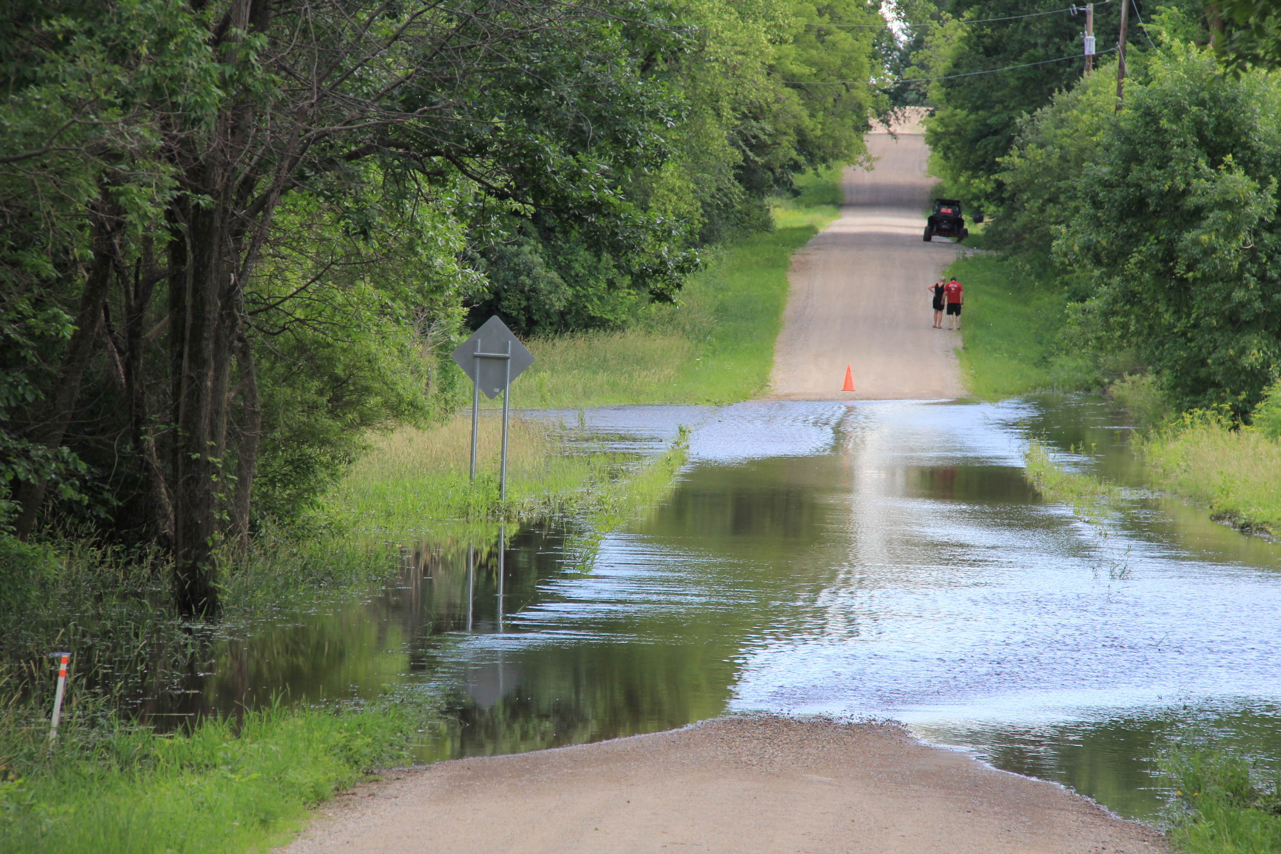
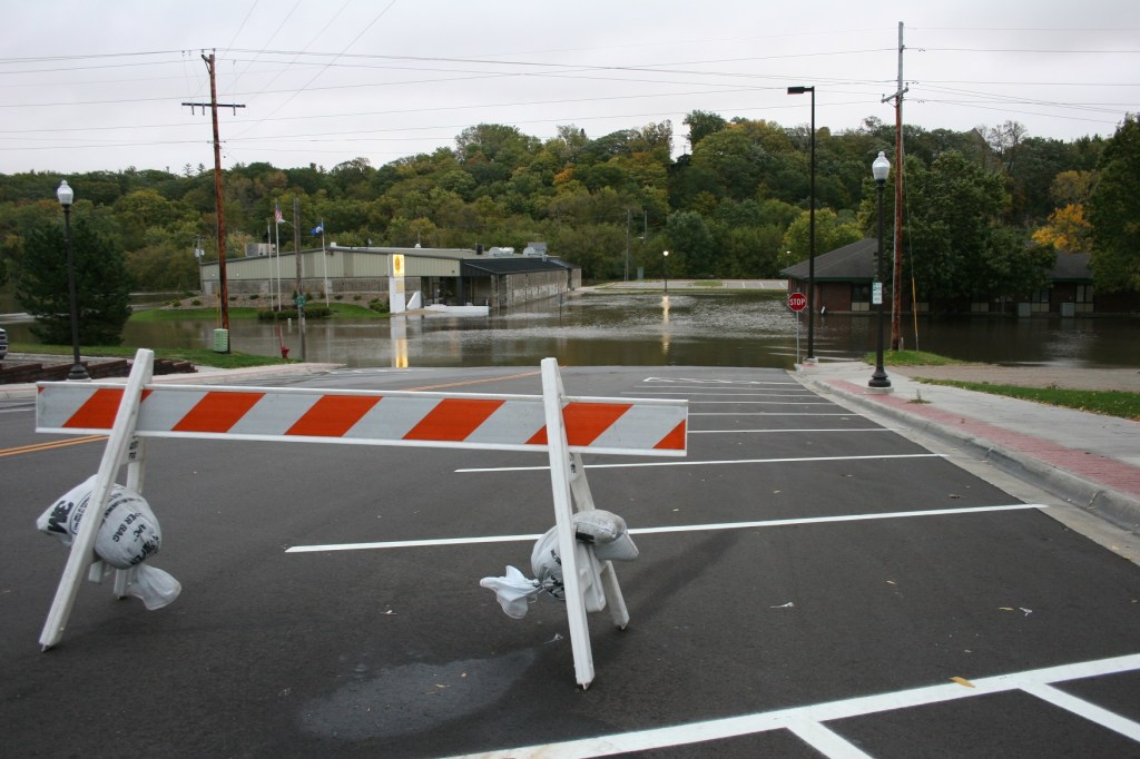
Roads are closed throughout the area due to flooding. Here a barricade blocks Dahle Avenue at its intersection with 220th Street East along the Straight River east of Faribault late Sunday afternoon. (Minnesota Prairie Roots copyrighted photo June 23, 2024)
A couple checks out flooded Dahle Avenue. (Minnesota Prairie Roots copyrighted photo June 23, 2024)
As inconvenient as these road closures may be, especially to locals, it’s nothing compared to the flooding of businesses, homes, campgrounds and more, especially in neighboring Waterville. The small town draws lake-lovers to summer cabins and campgrounds with tourism an important part of the local economy.
The muddy, fast-moving Straight River, photographed late Sunday afternoon from a bridge on 220th Street East, east of Faribault. (Minnesota Prairie Roots copyrighted photo June 23, 2024)
Other small towns, like Morristown and Warsaw, have also been impacted by the rising Cannon River. That water (and water from the Straight River) eventually ends up in Faribault and then Northfield and other places along the river and its watershed. In Faribault, public safety officials are keeping a close eye on the King Mill Dam, over which the Cannon flows. I’ve not seen that area, which is now barricaded to motor vehicle and foot traffic, and wisely so. The dam is a popular fishing spot. The road past the dam is also a busy traffic route, a connection to Minnesota State Highway 60.
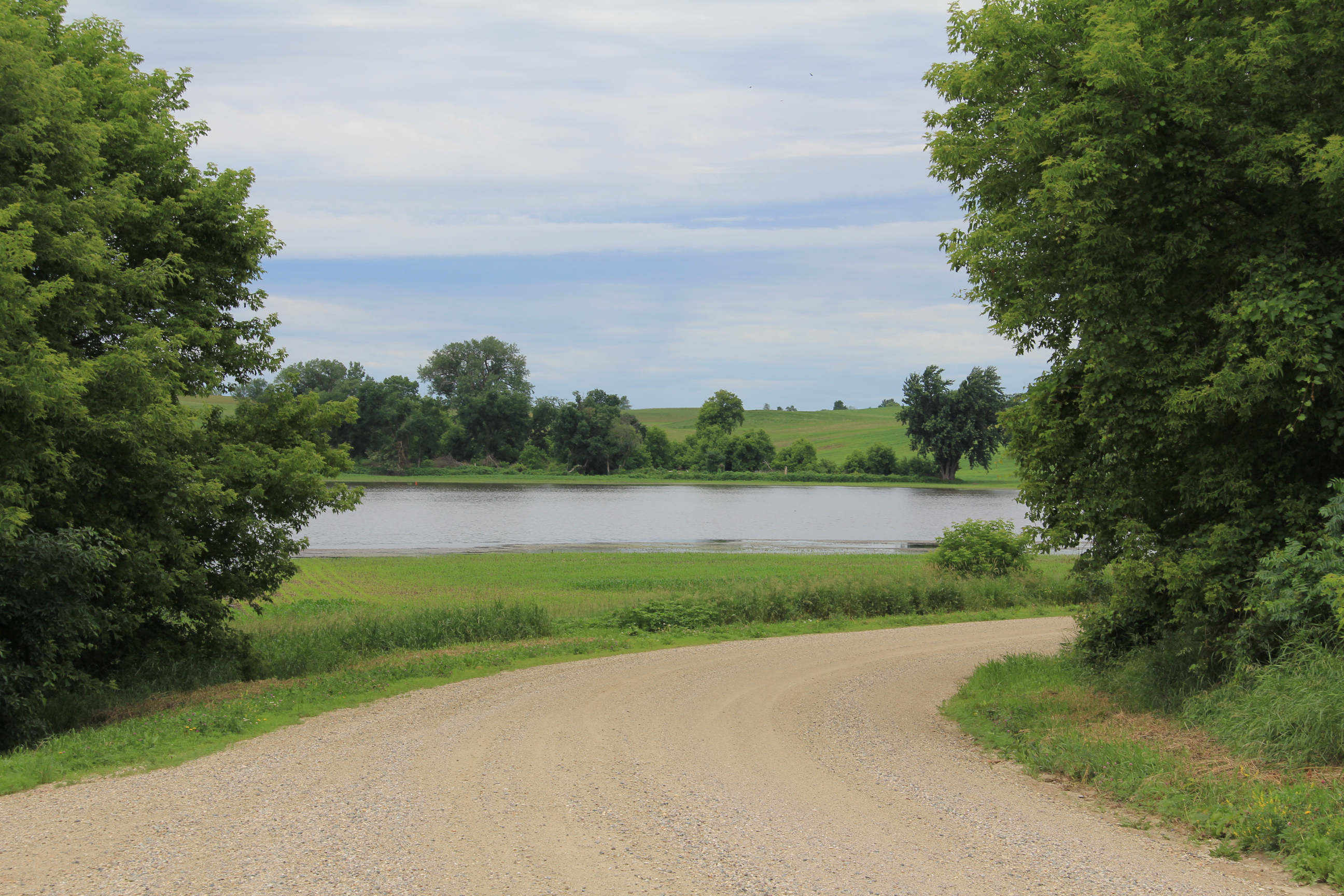
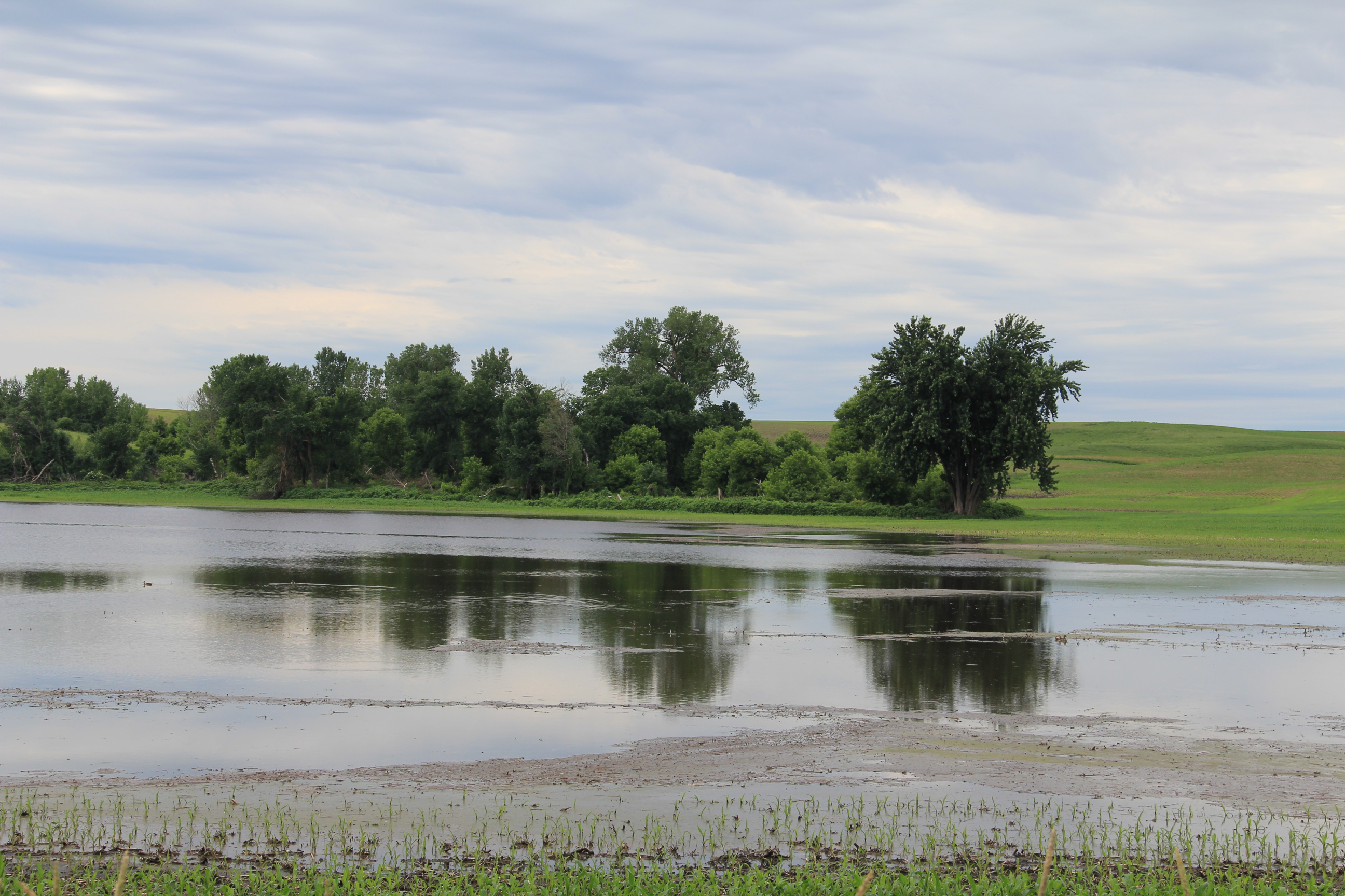
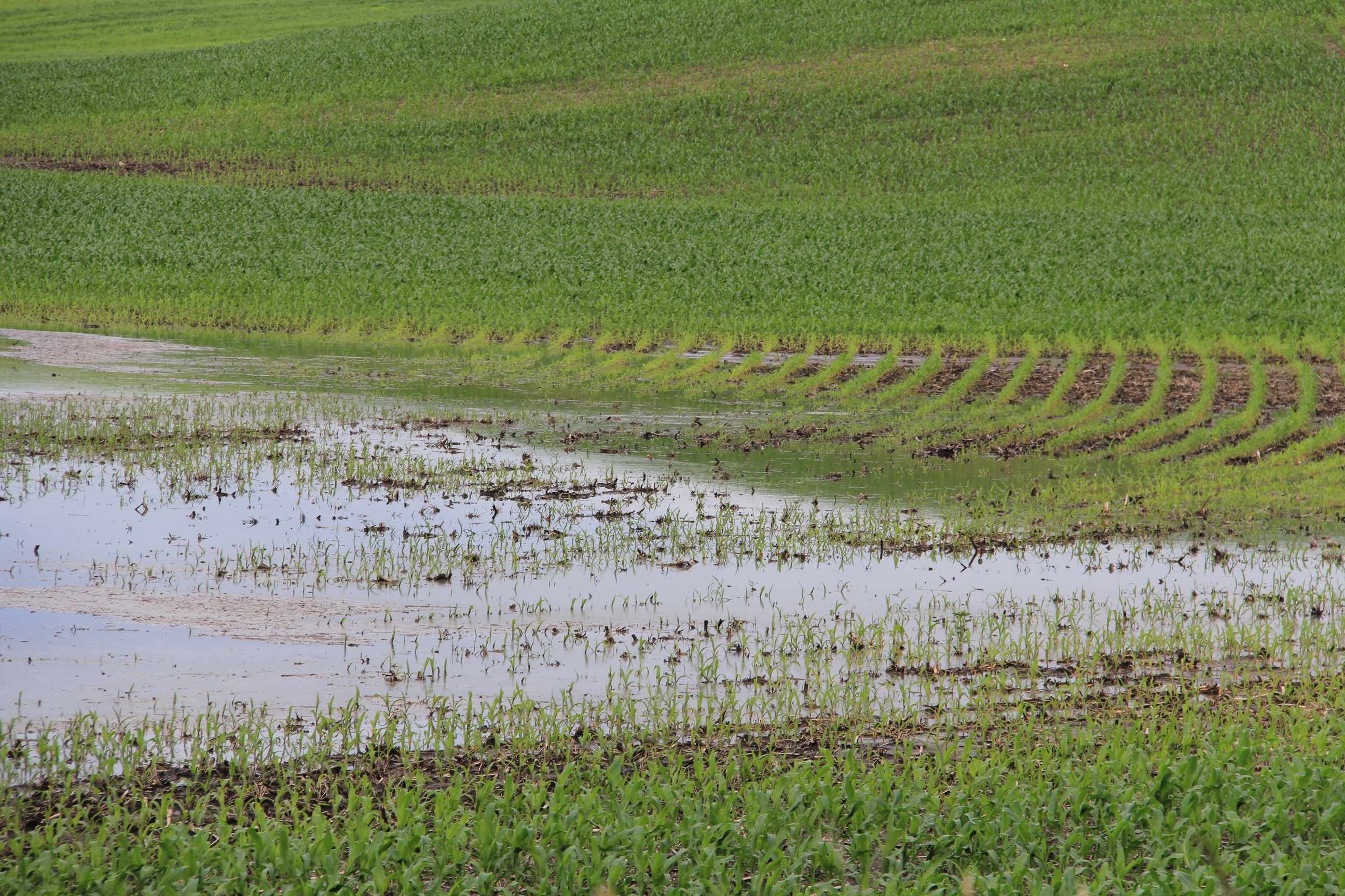
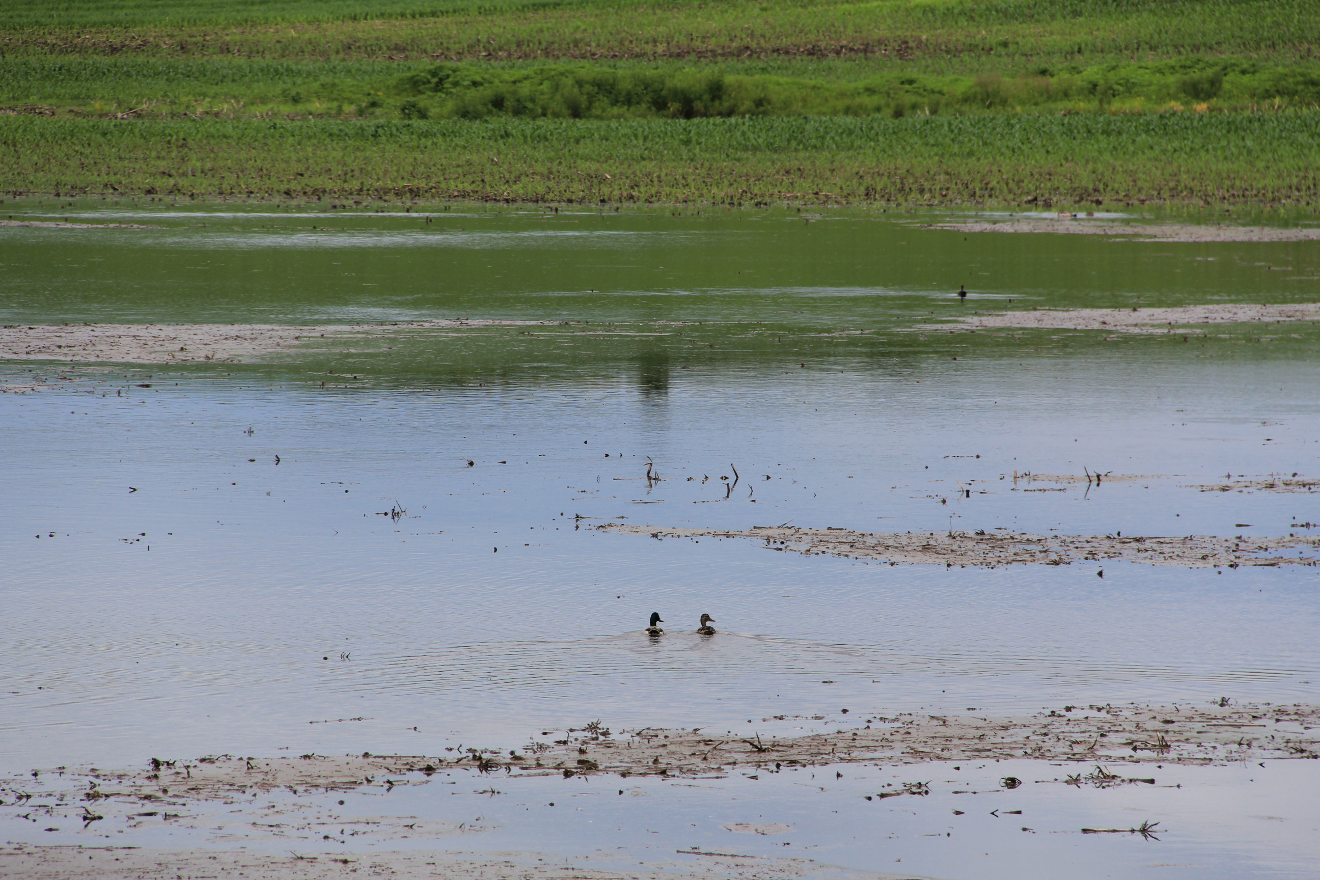
Rounding 195th Street West, a flooded cornfield, photographed northwest of Faribault late Friday morning. (Minnesota Prairie Roots copyrighted photo June 21, 2024)
Out in the countryside, too much rain has drowned corn and soybean crops, turning fields into lakes. I feel for the farmers, who depend on a good crop for their livelihood. It’s too late in Minnesota’s short growing season to replant. Crop insurance will cover some of their losses.
Excessive rain flooded this cornfield, transforming it from farmland to lake. Photographed late Friday morning along 195th Street West. (Minnesota Prairie Roots copyrighted photo June 21, 2024)
Rice County has a diverse topography of flat lands and rolling hills, plus differing soil types and drainage systems. Those, and rainfall amounts, affect whether a farm field floods. The entire county has experienced substantial rains. Just last Friday afternoon and into Saturday morning, we measured 3.1 inches of rain in our gauge. The day prior, 1.75 inches. Ten inches of rain fell here in eight days. Too much.
A flooded cornfield along 195th Street West, photographed Friday morning. (Minnesota Prairie Roots copyrighted photo June 21, 2024)
Ducks swim in the cornfield turned lake late Friday morning along 195th Street West. (Minnesota Prairie Roots copyrighted photo June 21, 2024)
Ask any farmer, and he/she can likely give you rainfall totals. I saw some of that rainwater on Friday morning while on a short drive along backroads northwest of Faribault. And that was before Friday’s three-inch rainfall.
A bit down the road, more flooding in the rolling terrain along Fairbanks Avenue northwest of Faribault, photographed late Friday morning. (Minnesota Prairie Roots copyrighted photo June 21, 2024)
On Sunday afternoon, most fields in the area I traveled were not flooded, but at least one township gravel road along the Straight River was flooded and barricaded. I expect if I expanded my tour, I’d see a whole lot more road closures and flooded fields. (Click here for a list of roadways that are closed in Rice County.)
Public officials are warning people to heed warning signs (like this one on Dahle Avenue) and stay out of flooded areas due to the dangers of swift-moving, high water. (Minnesota Prairie Roots copyrighted photo June 23, 2024)
In the all of this, there’s nothing we can do to control the weather. We can only prepare and then deal with whatever comes. Those, of course, are just words, not really helpful to anyone dealing with flooded fields, flooded roads, flooded homes, flooded businesses, flooded campers, flooded parks, flooded…
Friday evening the Cannon River was well above flood stage at the dam by the entrance to North Alexander Park. More rain overnight into Saturday raised the river level even higher. (Minnesota Prairie Roots copyrighted photo June 21, 2024)
NEARLY 10 INCHES OF RAIN fell in the past eight days at my Faribault home, half of that in the last three days. The significant rainfall not only in my community, but throughout southern Minnesota, has resulted in flooding as rivers swell and overflow their banks.
The same dam scene Saturday morning. (Minnesota Prairie Roots copyrighted photo June 22, 2024)
By Saturday morning, the Cannon encroached on even more land and the river rose higher under the Second Avenue bridge by the entrance to North Alexander Park. (Minnesota Prairie Roots copyrighted photo June 22, 2024)
This churning water at the dam shows the power of the river. (Minnesota Prairie Roots copyrighted photo June 21, 2024)
Minnesota Governor Tim Walz declared a peacetime emergency authorizing the National Guard to assist and support with emergency flood operations as needed. Faribault Mayor Kevin Voracek has declared a local emergency as my city deals with flooding. In nearby hard-hit Waterville, some residents have been evacuated. Mankato has also experienced significant flooding.
A police cruiser is parked Saturday morning under the historic viaduct near Teepee Tonka Park, an area prone to flooding. By Saturday evening, the Straight River had flooded even more of the park and surrounding land. (Minnesota Prairie Roots copyrighted photo June 22, 2024)
A chunk of south central Minnesota, including Faribault and other areas of Rice County, plus portions of Le Sueur, Steele and Waseca counties, remain in a flood warning until 10 a.m. Monday.
Teepee Tonka Park in Faribault, along the Straight River, was completely flooded Saturday morning. By evening, floodwaters crept onto the bridge. (Minnesota Prairie Roots copyrighted photo June 22, 2024)
Saturday morning the bridge at Teepee Tonka Park was open to pedestrians with a police officer stationed there. By evening, the bridge was cordoned off. (Minnesota Prairie Roots copyrighted photo June 22, 2024)
A Faribault police officer chats with the public and monitors the Straight River on the bridge into Teepee Tonka Park Saturday morning. (Minnesota Prairie Roots copyrighted photo June 22, 2024)
It’s a lot—this flooding of homes and businesses, city parks and railroad tracks, parking lots and roadways, cropland… A few blocks from my home, Xcel Energy crews are monitoring an electrical substation surrounded by water from the overflowing Straight River.
Floodwaters surround this warning sign by the Woolen Mill Dam. (Minnesota Prairie Roots copyrighted photo June 21, 2024)
A fire department truck stops on the Second Avenue bridge over the Cannon River on Friday evening as emergency personnel keep an eye on the rising river. (Minnesota Prairie Roots copyrighted photo June 21, 2024)
Police tape along the Cannon River by North Alexander Park is in place to keep people away from the roiling river. Friday evening the river nearly touched the bottom of the bridge. (Minnesota Prairie Roots copyrighted photo June 21, 2024)
I arrived home from church late this morning to automated messages from the 911 emergency system. One issued a cautionary warning from public safety officials to honor barricades by not walking or driving around them. Ignoring such signage in flooded areas will result in a citation from law enforcement.
Watching the swift-moving Cannon River from behind police tape Friday evening near the historic Faribault Mill. (Minnesota Prairie Roots copyrighted photo June 21, 2024)
Tree debris floats down the Cannon on Friday evening. (Minnesota Prairie Roots copyrighted photo June 21, 2024)
There’s a dam here, unseen as the Cannon River floods. (Minnesota Prairie Roots copyrighted photo June 21, 2024)
For the most part, I observed people being careful around floodwaters in Faribault while I was out on Friday evening and then again Saturday morning. The areas I accessed and photographed in that time frame have since been closed to the public, a smart move given the power of the river and the sheer volume of people checking things out. We are all naturally drawn to see for ourselves that which is unfolding in our backyard.
A car sits submerged in the parking lot of Two Rivers Health Center by Two Rivers Park on Saturday morning. (Minnesota Prairie Roots copyrighted file photo June 22, 2024)
Two rivers—the Cannon and the Straight—run through Faribault, converging at Two Rivers Park. Near that park, a car sat submerged Saturday morning in a parking lot. I’ve seen other vehicles sitting in floodwaters at the new riverside Straight River Apartments.
Along the Straight River on Third Avenue Northeast, floodwaters fill a backyard which, ironically, includes a boat. (Minnesota Prairie Roots copyrighted photo June 22, 2024)
Yet, as difficult as this flood event has been, it does not match the Faribault floods of 2010, 2014 and 2016, at least not from my recollection. Still, any flood is challenging.
Along the Straight River, a section of railroad tracks flooded. The Depot Bar & Grill patio is on the left. (Minnesota Prairie Roots copyrighted photo June 22, 2024)
For those affected, there’s clean-up and paperwork and unexpected expenses. Emergencies like this often bring out the best in people, as a community comes together. At the local government level, I expect emergency personnel have been working overtime. The Rice County Landfill, rural Dundas, opens at 7:30 a.m. Monday to begin accepting flood-contaminated materials.
Below the historic viaduct, the Straight River overflows its banks Saturday morning. By evening, it had risen even more. (Minnesota Prairie Roots copyrighted photo June 22, 2024)
I am fortunate. There’s no flooding in my home or yard. But I know others are struggling. I hope that in Sunday’s sunshine—finally, a day without rain—they feel a sense of hope. Floodwaters will recede. And life will, eventually, return to normal.
Walking along the Cannon River by the dam Friday evening, before the river flooded even more. (Minnesota Prairie Roots copyrighted photo June 21, 2024)
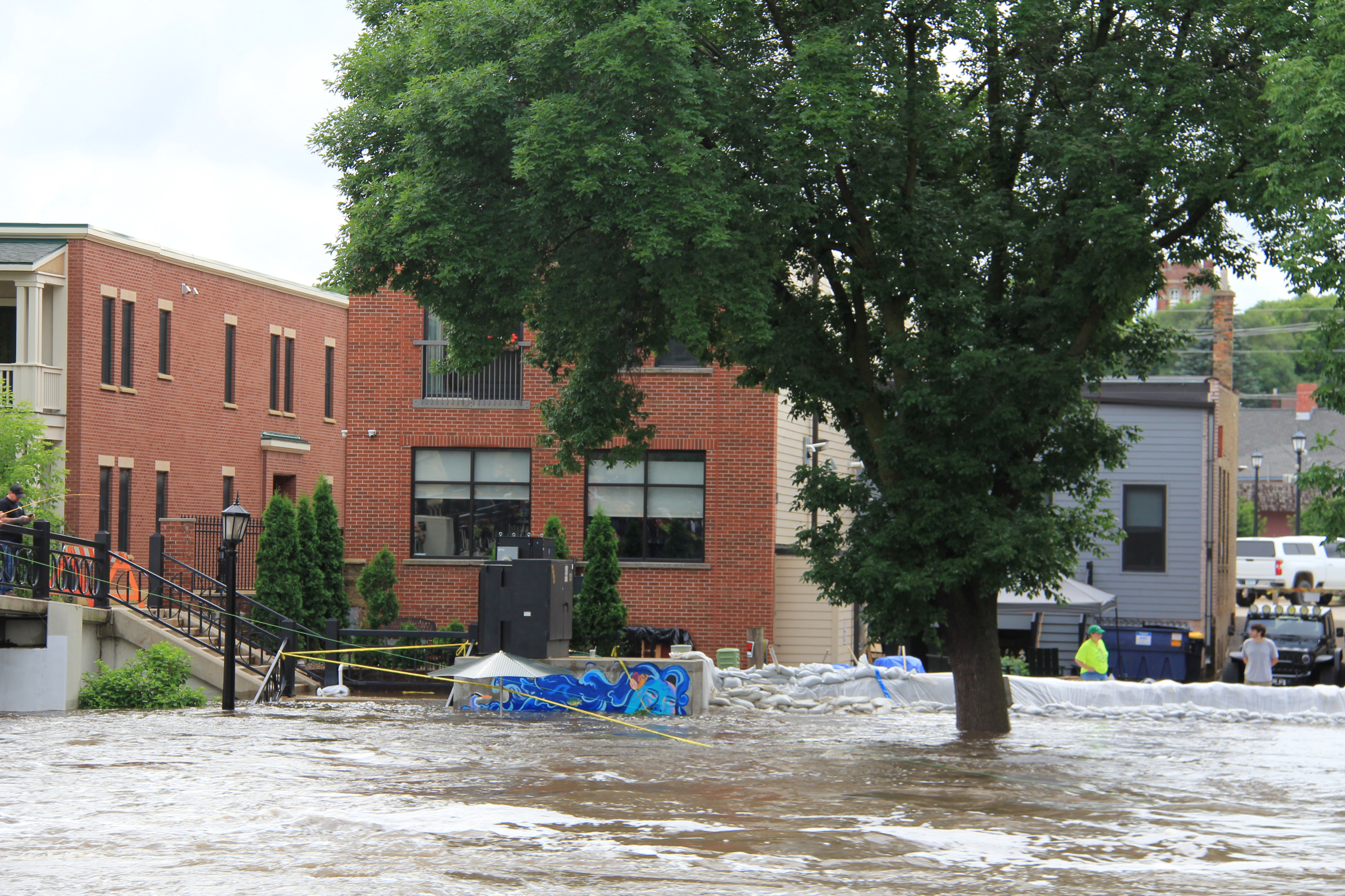
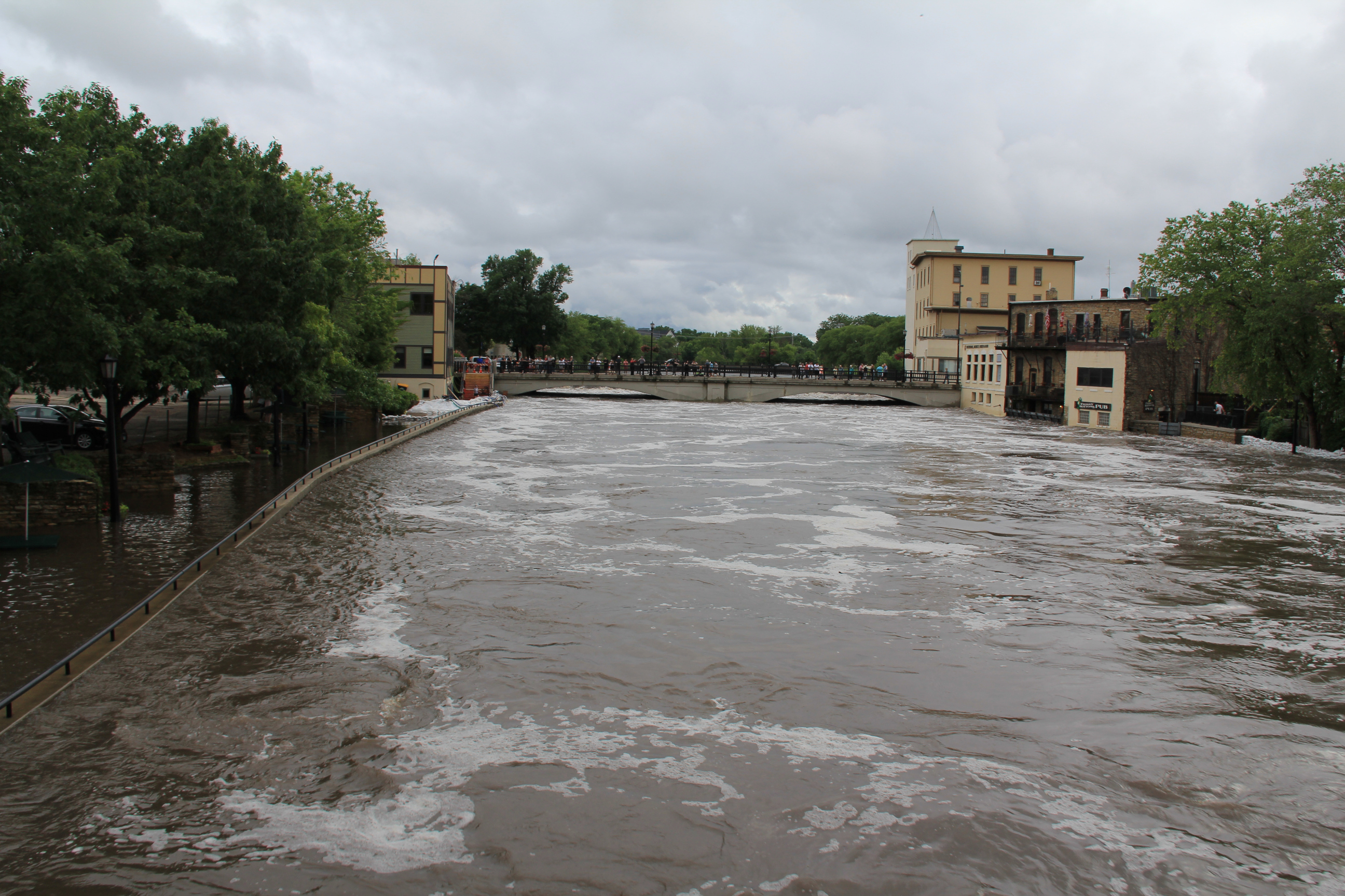
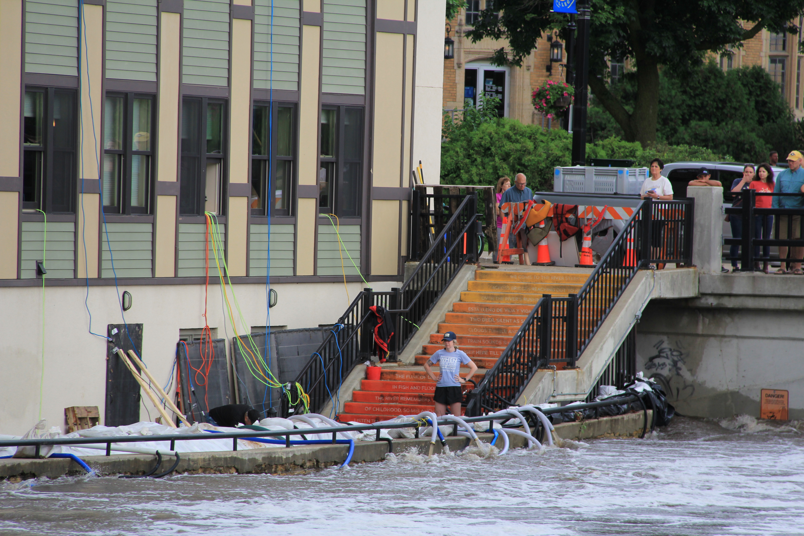
A crew works to protect the Carlson Capital Management building along the east bank of the Cannon River. This is by the “Poem Steps” leading to the Riverwalk, now flooded. (Minnesota Prairie Roots copyrighted photo June 22, 2024)
MANY AREAS OF SOUTHERN MINNESOTA, including my county of Rice, have been inundated with torrential rain during the past week. That’s led to flooding of rivers and property and to road closures. Like so many others, I’ve been out and about observing, taking photos.
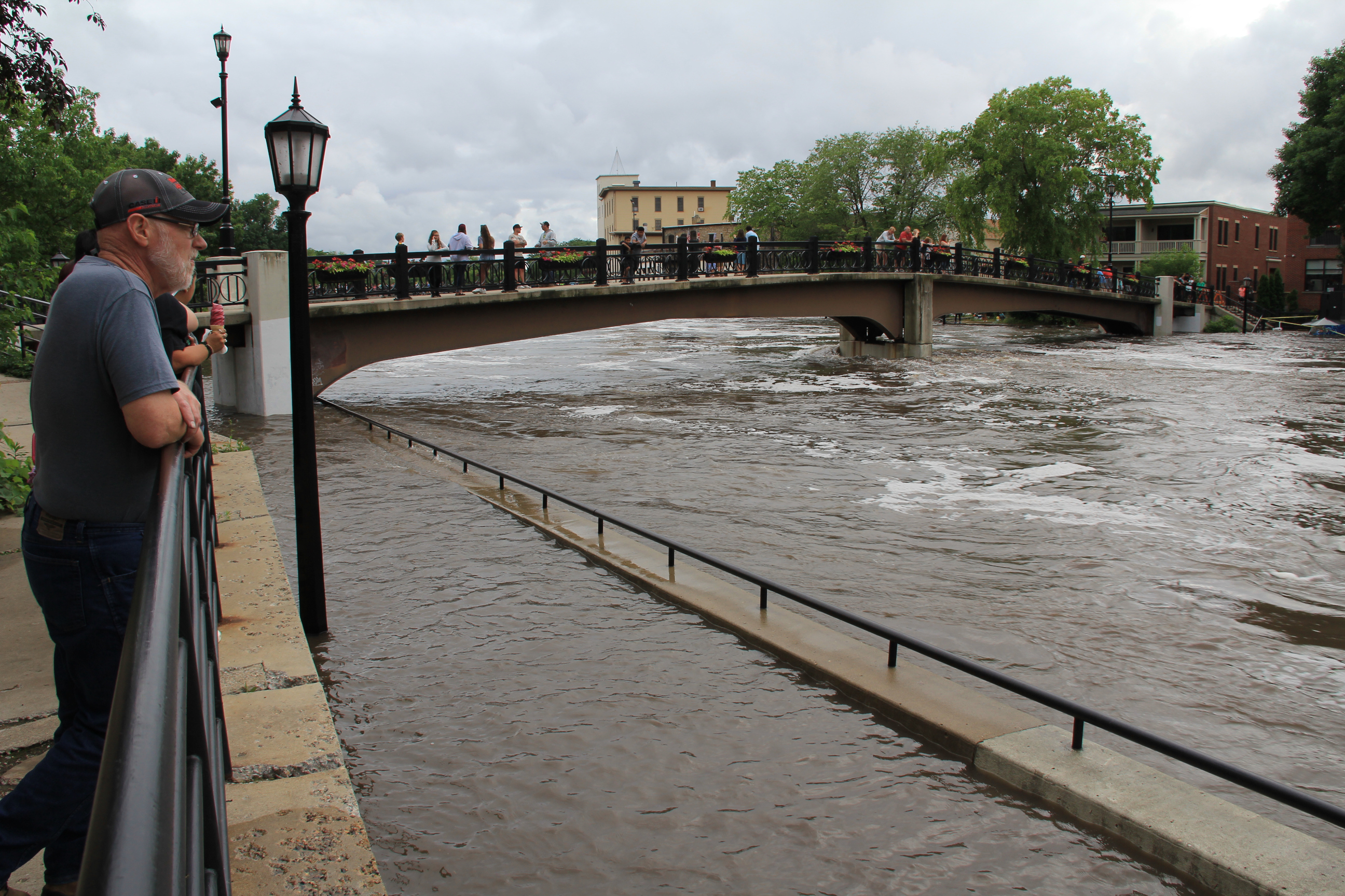
People gather on the pedestrian bridge and along a sidewalk above the Riverwalk to see flooding along the Cannon River. (Minnesota Prairie Roots copyrighted photo June 22, 2024)
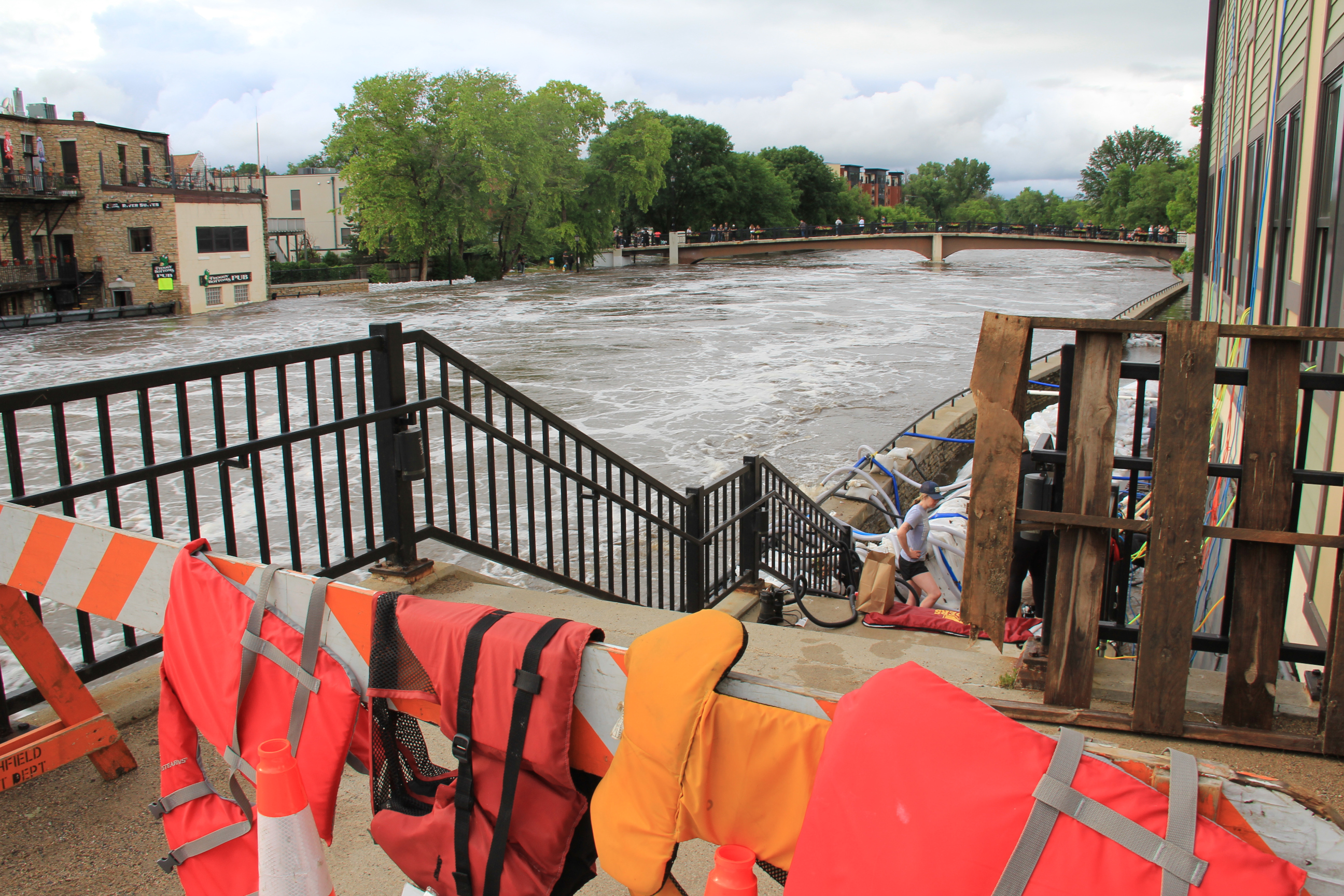
Saturday evening, on our way home from visiting family in Lakeville, Randy and I drove through Northfield and stopped to walk along the Cannon River. The river runs through the heart of this historic downtown, which features a waterside river walk.
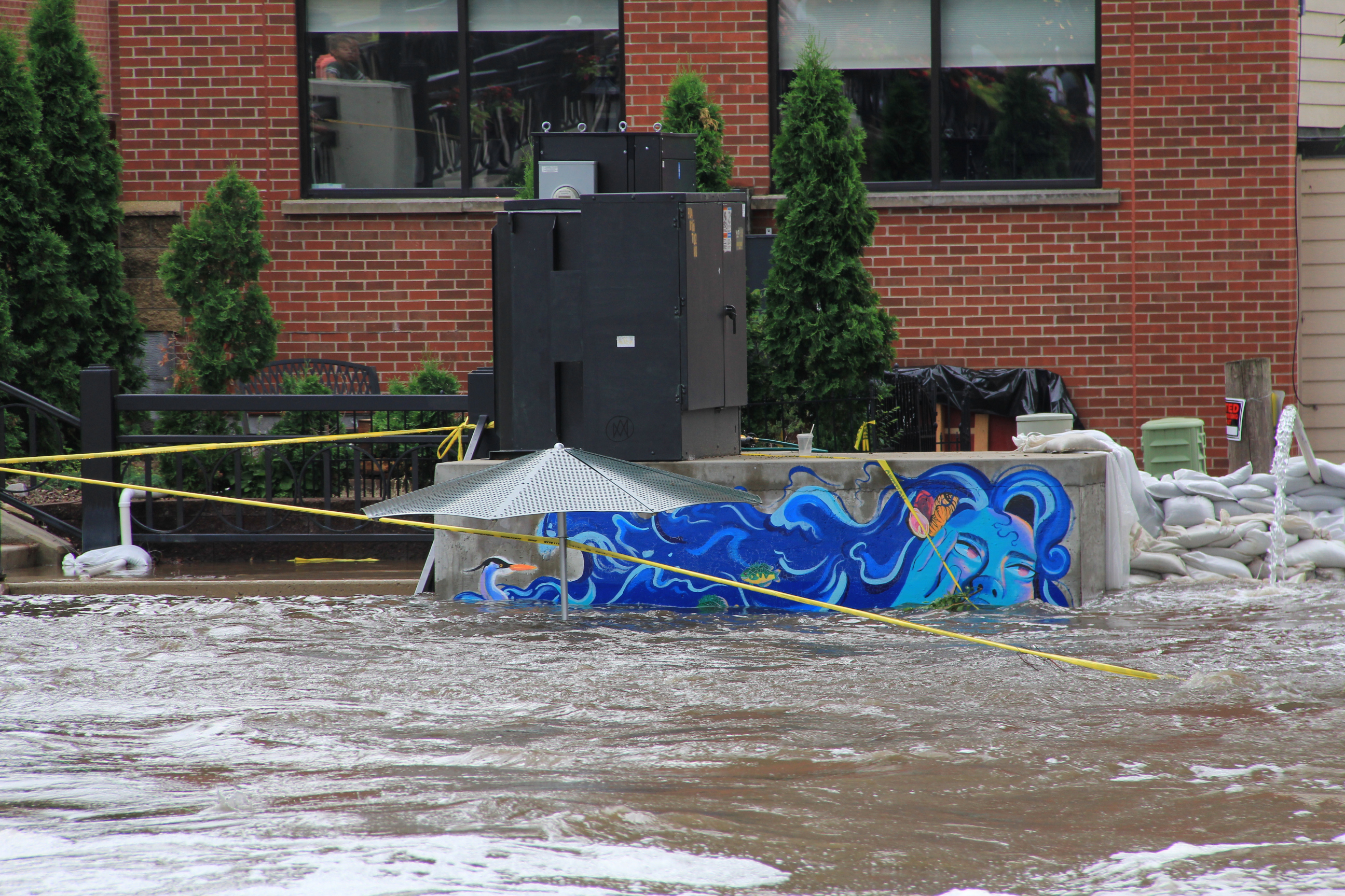
Flooding and sandbagging along the west bank of the Cannon near the Lady Cannon mural.
Sandbag wall on the west side of the river. (Minnesota Prairie Roots copyrighted photo June 22, 2024)
Lady Cannon is nearly swimming in the river. (Minnesota Prairie Roots copyrighted photo June 22, 2024)
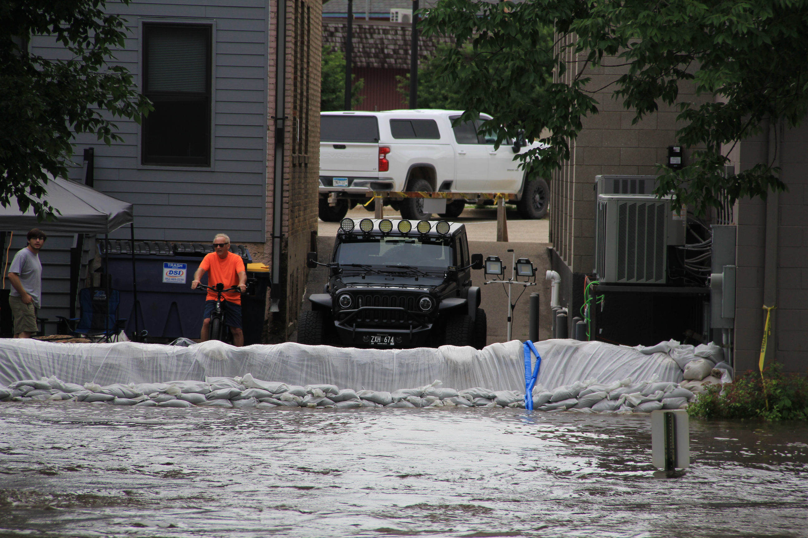
The Cannon has spilled over its banks, flooding the river walk and adjacent land and threatening buildings at water’s edge. Sandbags are in place. Pumping is underway.
People line the pedestrian bridge across the Cannon for a wide perspective of the river and the flooding. (Minnesota Prairie Roots copyrighted photo June 22, 2024)
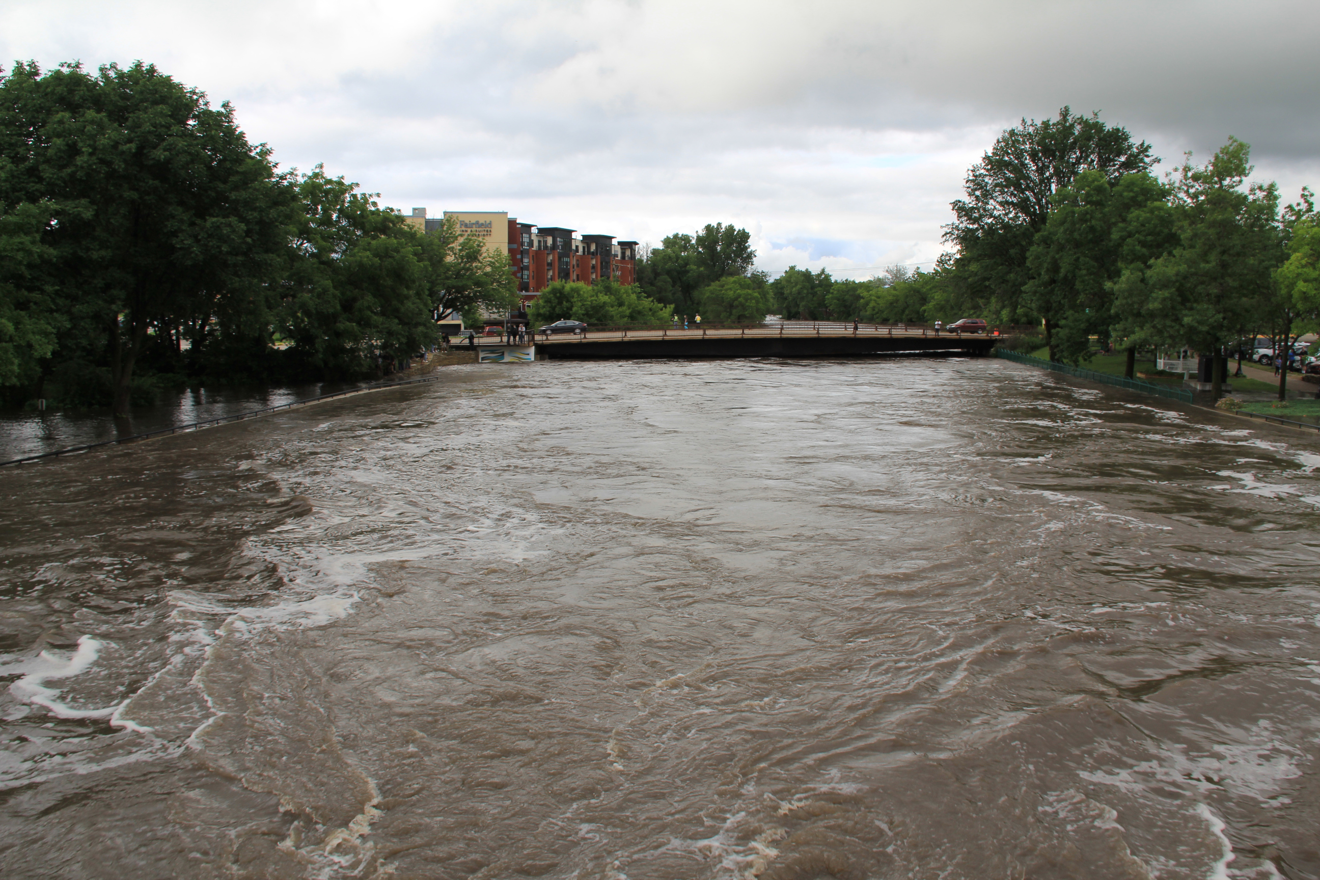
Looking north from the pedestrian bridge to the Second Street/State Highway 19 bridge. (Minnesota Prairie Roots copyrighted photo June 22, 2024)
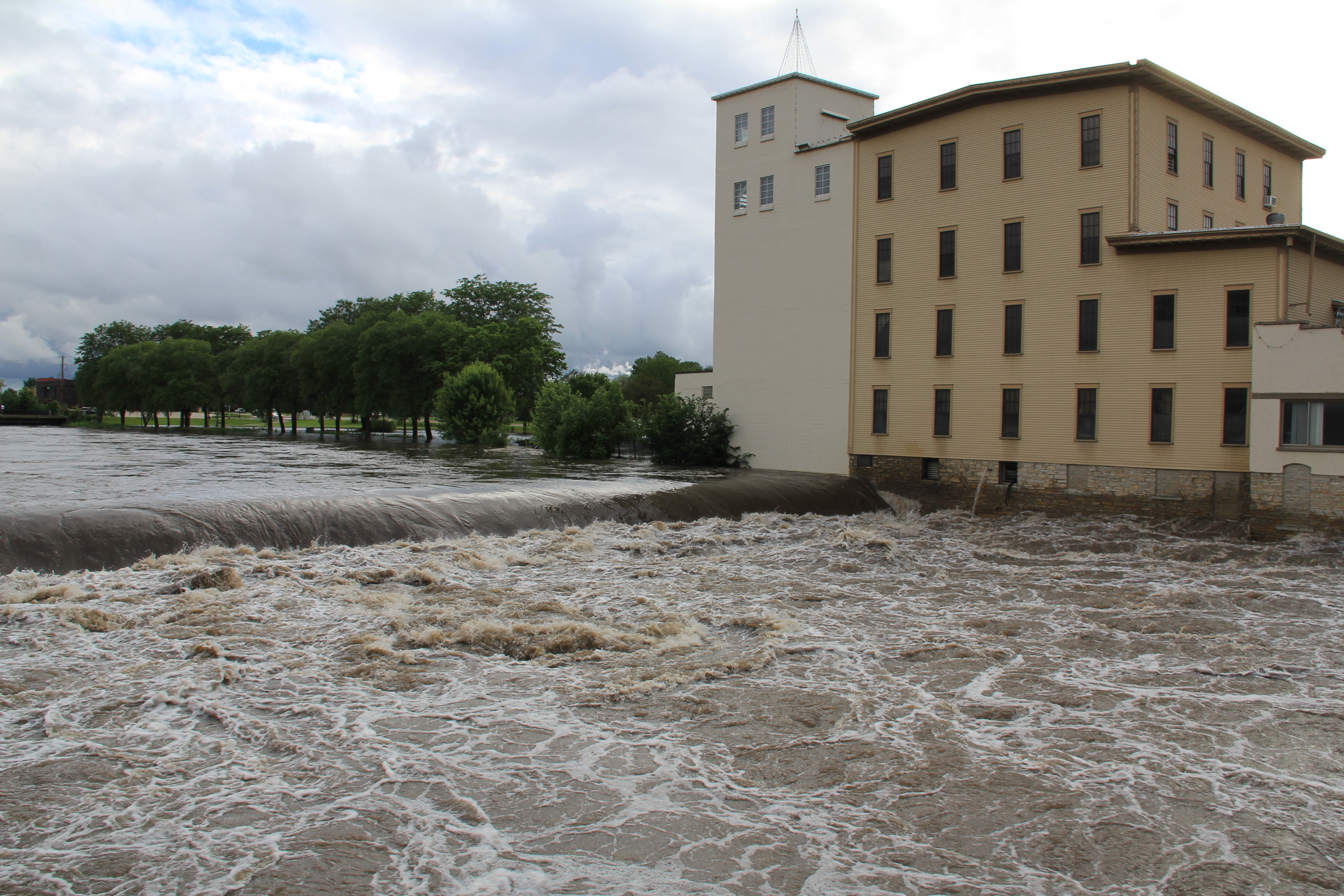
Looking south from the pedestrian bridge toward the Water Street bridge by the Ames Mill Dam. (Minnesota Prairie Roots copyrighted photo June 22, 2024)
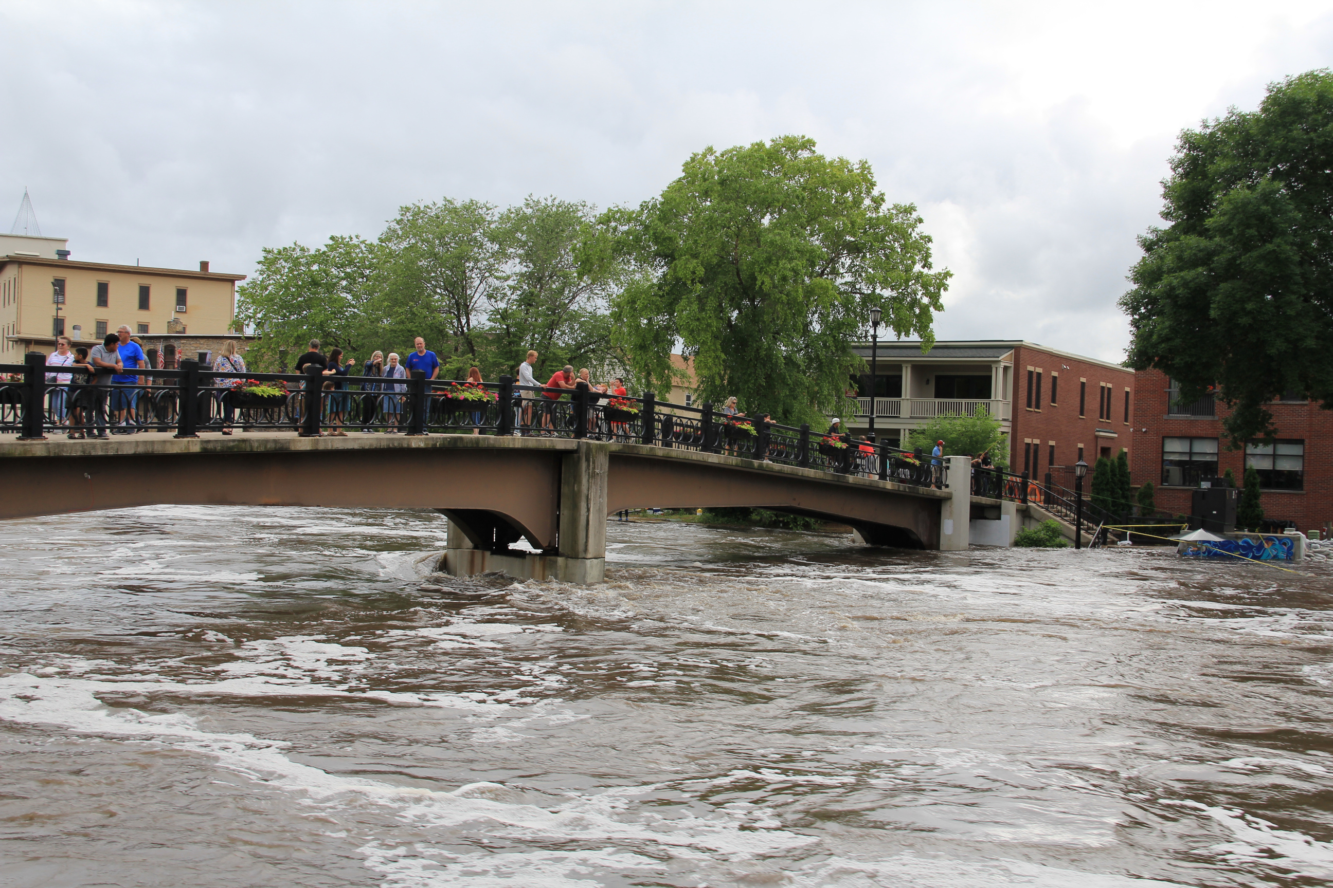
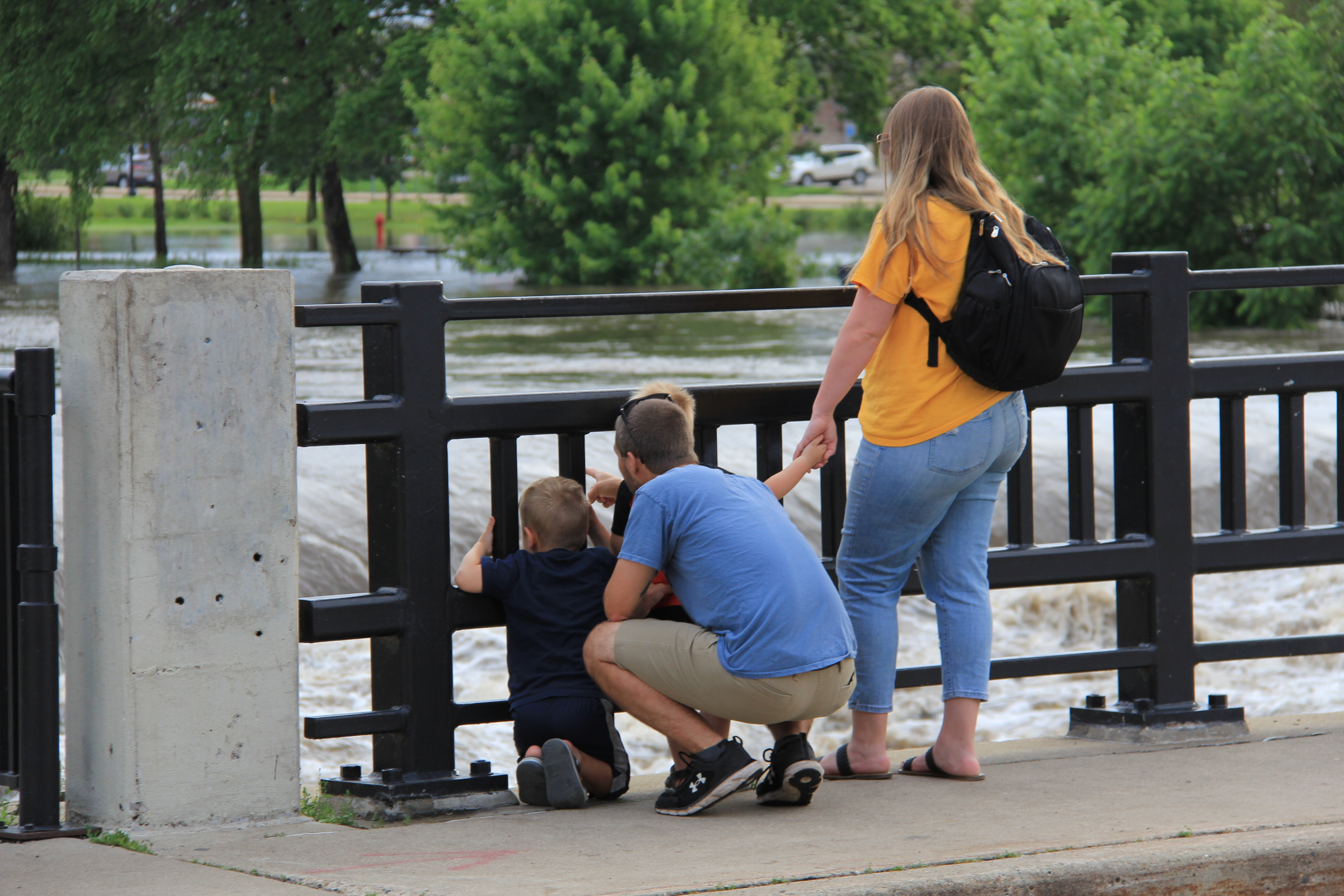
And people are coming to the river by the hundreds to view its raging power. A pedestrian bridge high above the water offers a unique perspective.
The dam is barely visible by the historic Ames Mill. (Minnesota Prairie Roots copyrighted photo June 22, 2024)
Among the many people viewing the river at the dam site. (Minnesota Prairie Roots copyrighted photo June 22, 2024)
And a bridge across the river by the historic Ames Mill provides a close-up view of the Cannon roaring over the dam.
Protecting Carlson Capital Management. (Minnesota Prairie Roots copyrighted photo June 22, 2024)
A maze of hoses channel water out of the Carlson building while sandbags protect it. (Minnesota Prairie Roots copyrighted photo June 2024)
Froggy Bottoms on the west bank floods whenever the river floods. A neon green poster on the building reads: “This Frog Swims Again.” (Minnesota Prairie Roots copyrighted photo June 22, 2024)
It is impressive, all of it. The nauseating movement of the water. The speed. The danger. The feeling of overwhelming respect and awe in the presence of such power.
Fitting words on the door of the Froggy Bottoms building. (Minnesota Prairie Roots copyrighted photo June 22, 2024)
This I felt as I took in the scene unfolding before me on a Saturday evening in Northfield.
A sandbag wall protects property along the west bank of the Cannon River. (Minnesota Prairie Roots copyrighted photo June 22, 2024)
A sandbagging station. (Minnesota Prairie Roots copyrighted photo June 22, 2024)
A line of sandbags protects property on the west bank of the Cannon. (Minnesota Prairie Roots copyrighted photo June 22, 2024)
Life jackets drape a barricade blocking access to the flooded east side Riverwalk. Below, workers work to protect the Carlson building from the river. (Minnesota Prairie Roots copyrighted photo June 22, 2024)
NOTE: Check back tomorrow for flood photos from Faribault.
I shot this scene of the rising Cannon River near the iconic Faribault Woolen Mill shortly before sunset Monday.
WITH TWO RIVERS RUNNING through Faribault, a flooding concern always exists. We’ve had property-damaging floods here in the past. And now, with spring snow melt well underway, we’re all on alert.
The Faribault Woolen Mill dam is barely visible in this photo.
A close-up of the dam.
Likewise, a second dam by the entrance to North Alexander Park and the Rice County Fairgounds is also almost invisible.
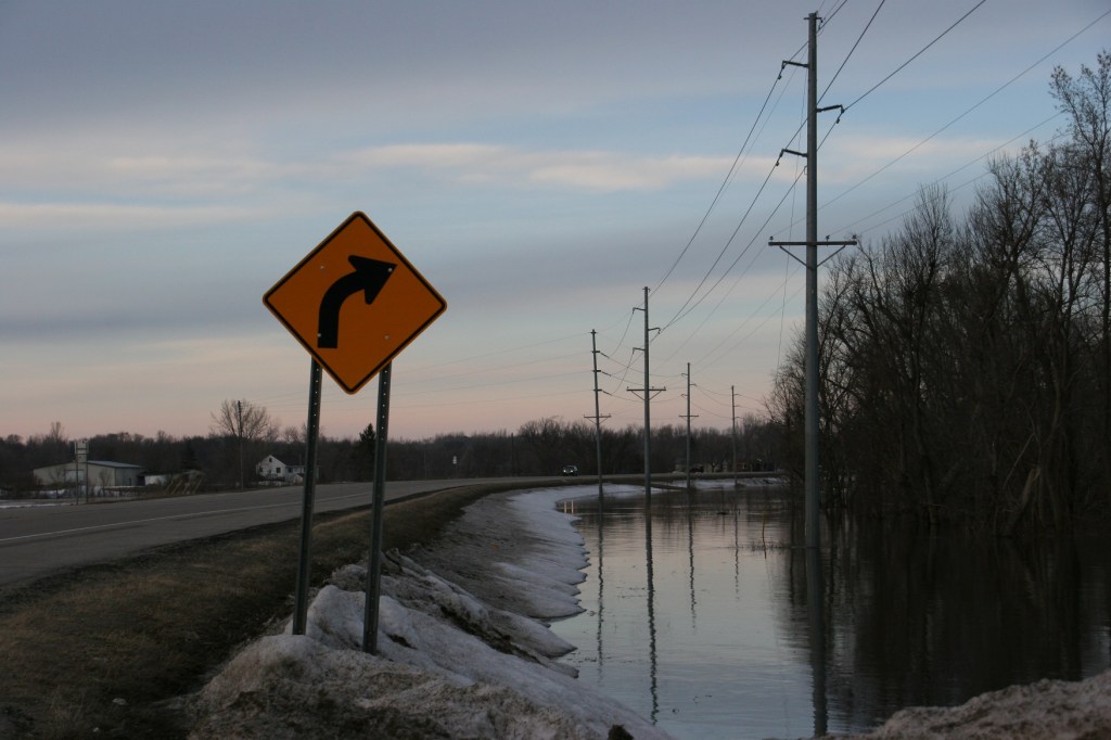
Although the Cannon and Straight Rivers are high and have spilled from their banks in some areas, they aren’t threatening. Yet. Who knows what this week’s expected 50 to near 60-degree temps will bring?
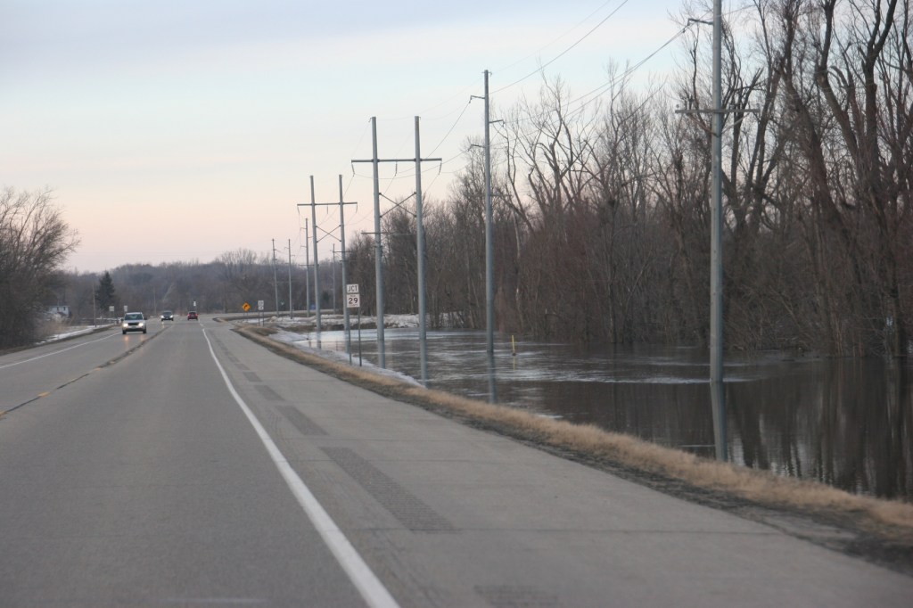
The overflowing Cannon River edges Minnesota State Highway 3 at its intersection with Rice County Road 29 just north of Faribault.
Trees felled by a September 2018 tornado clog the rising Cannon River as seen in this view from the Rice County Road 29 bridge.
The Cannon River spills out of its banks at the intersection of Minnesota State Highway 3 and Rice County Road 29 on Monday evening. This is the main connecting highway between Faribault and Northfield.
I feel for the folks in Nebraska with the devastating floods there. I feel for the folks in the Fargo-Moorhead area now preparing for likely flooding. I feel for the folks in Jordan, Minnesota, some of whom already had to evacuate homes. I feel for the river communities of Northfield, Hastings, Stillwater, Red Wing, New Ulm… The list is lengthy of Minnesota cities that could face serious flooding. Some, including Northfield along the Cannon River and just to the north of Faribault, are in a flood warning issued by the National Weather Service. My home county of Redwood, through which the Redwood River runs, is also included in this warning for specific rivers (the Redwood, Cottonwood, Minnesota and Cannon rivers) in Minnesota.
While the snow pack has diminished significantly, snow remains to melt. I shot this photo west of Dundas around sunset Monday along Rice County Road 1.
For now, in Faribault, the issue is primarily flooded basements. I’ve talked to friends who’ve never had water in their basements. Until this year. We’re not talking just water seepage either. We’re also talking backed up septic systems. We’ve had minor issues in our house, too.
Water floods a low lying area along Interstate 35 somewhere between the south metro and Faribault. Photo taken late Saturday afternoon.
But we’ll get through this. We always do.
TELL ME: Have you experienced any flooding or water-related issues in your community or home? Or are you prepping for such a possibility?
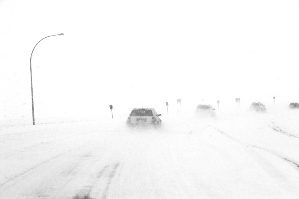
I took this photo several years ago on the Minnesota Highway 19 curve just north of Vesta, my southwestern Minnesota hometown. White-out conditions can happen quickly in that wind-swept part of the state. Minnesota Prairie Roots file photo.
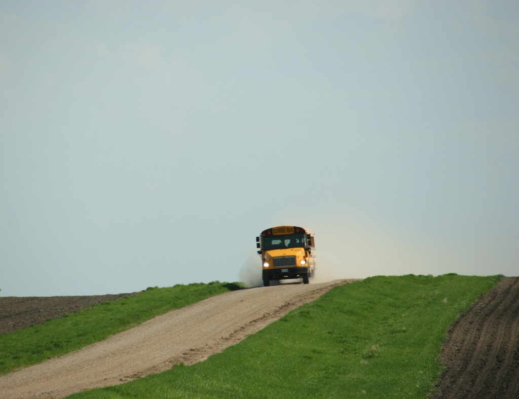
SOME 50 YEARS AGO, getting to school each day during the winter months proved difficult. It was a particularly snowy winter with strong prairie winds drifting snow across and blocking many roadways. I lived a mile from Vesta on a crop and dairy farm. But I lived some 20 miles from the junior high school I attended in Redwood Falls.
In that late 1960s winter to remember, buses stopped driving into the country to pick up students. That pretty much covered everyone from the Vesta area. Nearly all of us lived on farms.
A bus I photographed near Morgan, Minnesota, in May 2018. Minnesota Prairie Roots file photo 2018.
If we could get into the cafe in Vesta, we could board a bus that would then travel Minnesota State Highway 19 to our school in Redwood. But getting there took effort and determination. My oldest brother and I climbed onto the John Deere tractor driven by Dad for the ride into town. And just to clarify, that tractor did not have a cab, only a canvas shield of sorts around the seat. And even though girls were banned from wearing pants at school, I slipped a pair of pants on underneath my dress.
I don’t recall additional details of those tractor rides. But I do recall the bus ride to Redwood along a state highway with snowbanks towering well above the bus. Single lanes cut into rock-hard drifts.
And then I recall the reactions of some teachers when all of us Vesta kids arrived two hours late. They were angry and told us so. Really? You try hopping on a tractor in the cold of winter to get to town to catch a bus and then ride another half hour to school. Be thankful we made it to class.
Kids now days certainly don’t face those challenges. And, if they did, they’d be tucked inside a heated tractor cab. More likely a pick-up truck. But Minnesota prairie kids still face canceled rural routes. “Buses on plowed roads only” is not uncommon during the winter in parts of Minnesota. And just yesterday, I read on the KLGR radio website out of Redwood Falls that buses in at least three schools—Lakeview, Echo Charter and, surprisingly, Redwood—would travel on paved roads only.
Muddy gravel roads and flooding can also become a problem as winter transitions toward spring. And right now Minnesota is experiencing plenty of flooding of roadways and streets.
The Faribault American Legion and Heritage Place businesses, a block from downtown, are surrounded by flood waters in September 2010. Minnesota Prairie Roots file photo 2010.
And more. In Faribault, the city issued this statement on its Facebook page:
SANDBAGS: The City of Faribault will be providing to city residents sand and bags if, and when, flooding occurs. If sandbags are needed now because of a localized flooding event (like backyard flooding into a door in a walkout basement, for example) contact the Faribault Fire Department at 507-334-8773.
A broad view of Wabasso’s Main Street. Minnesota Prairie Roots file photo.
In the small town of Wabasso (where I attended high school) in my home county of Redwood, the city issued this statement on its Facebook page:
The city of Wabasso recommends turning your sump pump discharge outside. This means either into your yard, the street, or on top of the snow.
The water flowing through the sanitary sewer has been elevated since this afternoon.
When the sewer is overloaded, there is a risk that residents will have sewage back up into their homes.
Please turn your sump pumps to the surface as soon as you are able.
This winter of too much snow and now a too quick snow melt with too much rain is challenging all of us. But eventually conditions will improve. And we can look back and remember the difficult winter of 2019. Like I remember that late 1960s winter of riding the John Deere tractor to catch the school bus.
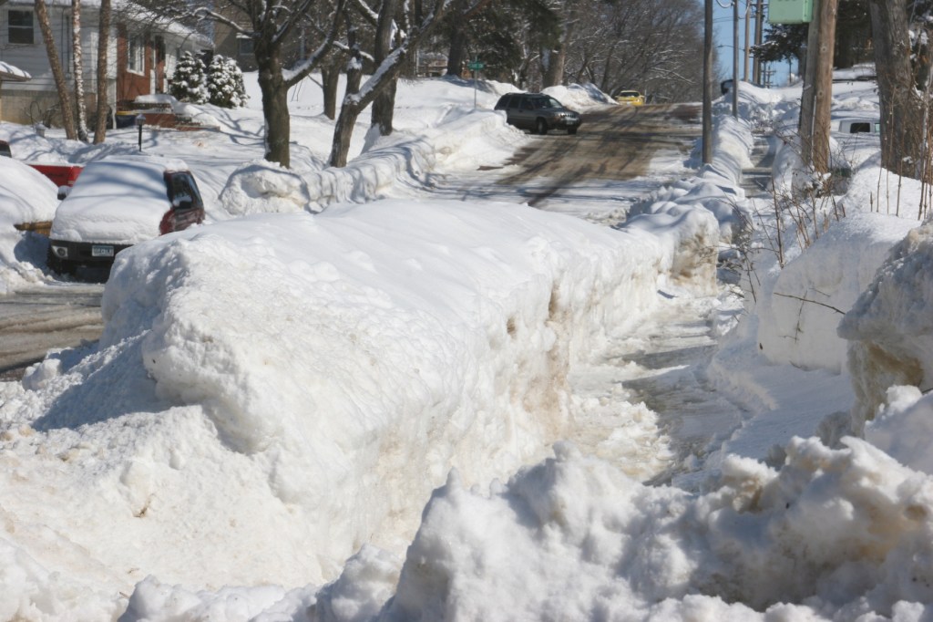
A snow-socked neighborhood in Faribault, photographed on Sunday.
AS IF THIS WINTER of excessive snow hasn’t taxed us enough, now Minnesota is dealing with potential flooding. A flood warning is in effect until 8 a.m. Wednesday for my county of Rice, Goodhue County and several counties in Wisconsin. The National Weather Service has also issued a flood watch in other parts of Minnesota.
Expected temps in the 40s, even 50s, coupled with rainfall of several inches and a resulting fast snow melt, set us up for flooding. All of that water must go somewhere.
With the ground still frozen, that water won’t soak into the earth. Where will it go? In cities and small towns, the water should typically run into storm drains. But many are clogged by snow and ice, meaning the water will end up ponding on and flooding streets. And, yes, city crews have been working to open storm drains. But it’s a time-consuming and difficult task.
Many Minnesota riverside communities (like Stillwater and Hastings) have plans in place to sandbag. The Cannon and Straight Rivers run through Faribault. We’ve experienced flooding in the past. Will those rivers flood again? I don’t know.
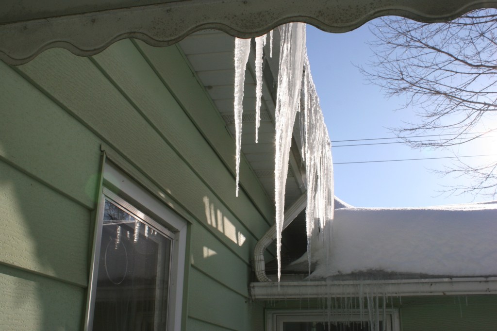
Randy shovels snow from a portion of our house roof during a particularly past snowy winter. Minnesota Prairie Roots file photo.
Homeowners dealing with massive amounts of snow on their roofs and ice dams (and that includes us) face water leakage issues. Randy has been on our roof thrice this winter to remove snow, including Tuesday afternoon. He worked for hours in the rain to shovel snow, chip at ice dams and run hot water over snowy and icy areas on the roof. The ladder slipped once, with him on it. He rode it down to a lower roof level without falling. Yes, I cajoled/pleaded/begged him not to attempt another climb onto the steep, icy roof. Once he melted the icy section with hot water, he was back up a more stabilized ladder.
Ice dams on our house. This is a common problem, especially on older homes like ours. Minnesota Prairie Roots file photo February 2019.
Water is leaking under shingles and inside homes. Water is seeping into basements. That likely will get worse. I hope the water prevention system we installed in our basement several years ago continues to work.
This winter is truly challenging all of us. Mentally. Physically. And now in our pocketbooks. I know we’re not alone. Other areas of the country are experiencing similar catastrophic weather. If it wasn’t for the flooding and other water-related issues, I’d embrace the current warm temps.
We are in this together. We’ll get through this. We always do. We just need to get safely through these next several days.
Just six weeks ago, spring planting was underway in this same area of rural Minnesota. Minnesota Prairie Roots file photo May 2018.
DURING MY LAST TRIP to southwestern Minnesota in mid May, farmers worked the land. Tilling. Planting crops. Rushing to get seeds into the soil after a late spring start.
Now, some six weeks later, acres and acres of that same cropland lie under water, corn and soybean fields flooded by torrential rains. Flash floods that turned farm land into lakes early last week.
On our route west of Redwood Falls then north to Belview then later east of Belview along county roads back to Redwood, Randy and I observed lots of standing water. Massive lakes where crops should now thrive. It was disheartening to see the efforts and hopes of so many farmers gone. Flash, just like that. Weather is always the gamble of farming. I would never have the mental fortitude to farm. I admire those who do.
As we drove, I noted the wash of debris along shoulders, evidence that floodwaters overtook the county road. We drove a narrow ribbon of asphalt, water edging both sides of the roadway. Orange cones and orange flags flagged danger. An orange snow fence blocked a gravel road.
I understood that, days after the flash flood, we had not seen the worst of this devastating storm. But it was enough for me to gauge the significant loss to the farmers of my native Redwood County.
#
NOTE: My apologies for the lack of flood images. But I am under strict orders from my ortho surgeon not to use my left hand as I recover from surgery on my broken left wrist. “Use it,” he said, “and you will be back in the OR.” I’ll listen, thank you.


Recent Comments